Description
These maps work on Windows, Android, iPhone/iPad and Mac devices providing they have the appropriate App/Software installed.
The licence conditions permit you to use the map on up to five devices (computers, laptops, phones, tablets etc) for personal use. Business licences are available on request.
Shortly after making payment you will receive the download link on screen and by email. Please check your junk mail folders if the email doesn’t appear promptly as your spam filter may have mistaken the download link for spam.
The download link will be valid for 6 months. You may use the link in the email to download any (of all) of the monthly updates issued during that time to ensure you have the latest version of the map. You can update your map at a discounted price after that.
Please use the free examples to see how good my maps are and check you can conquer the download and installation process before ordering.
Route

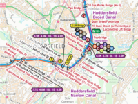
Each map covers the route shown in orange, including:-
- Llangollen Canal
- Whitchurch Branch
- Prees Branch
- Ellesmere Branch
- Trevor Branch
- Montgomery Canal
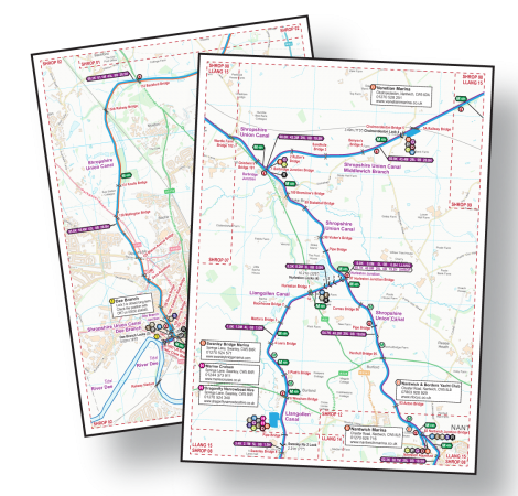
Acrobat (pdf)
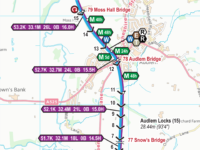
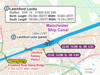
Example pages from my range of maps.
You must have Acrobat Reader (or equivalent) App/Software installed to use my maps in Acrobat (pdf) Format.
Acrobat (pdf) Format maps are split into A4 pages. They can viewed a page at a time on screen, or printed on your own printer. They are designed to be printed A4 size and, if your eyesight is good enough, they can be printed A5. They can be printed A3 if you need a larger print size.
You can read more about using my maps in Acrobat (pdf) Format.
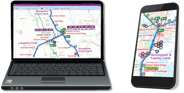
Memory-Map (qct)
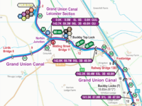
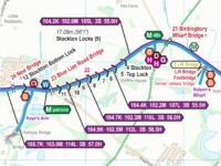
Examples from my range of maps.
You must have the Memory-Map App/Software installed to use my maps in Memory-Map (qct) Format. That App/Software must have the Classic Map Compatibility licence enabled and you will have to pay Memory-Map (the company) for that.
Please use the free examples to check Memory-Map’s pricing (after using their initial free trial period) and ensure you can conquer Memory-Map’s tricky installation process (which is especially difficult on Apple products) before ordering.
The maps will track in real time on GPS enabled devices so you know exactly where you are. You can save tracks, routes and waypoints with the Memory-Map software.
You can scroll around the whole map and zoom in and out as required.
You can read more about using my maps in Memory-Map (qct) Format.
Support
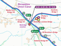
You can download the key separately if required. It is included as the last page on every Acrobat (pdf) map and shown at intervals on the Memory-Map (qct) Maps.
You can read more about using my maps on each type of device. These pages are intended to provide general information only and may not be up to date for the latest versions of the App/Software. You will need to follow the instructions from the supplier of the App/Software you are using and seek help from them if you are having problems with their App/Software.
Please note that I only supply the map and I will offer help in the unlikely event of any problems with my map. If you are having problems using an App/Software then you must seek help from the supplier of that App/Software. Please use my free maps to check you can conquer the download and installation process (which is particularly tricky on Apple devices) before purchasing any of my maps.


 Save 10% buying a
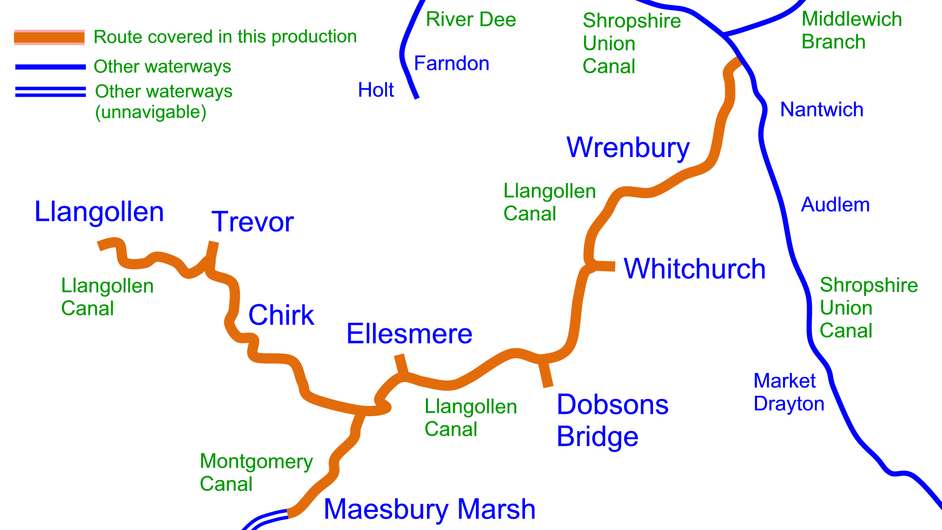


 RSS Blog Feed
Chris Jago (verified owner) –
Many thanks to Paul.
As newbies about to use the Llangollen Canal for a week this summer (hire all booked) it was wonderful to find this site and be able to download the maps and key – really clear and helpful and very easy to do! Looks like it should extremely good value to boot!
Peter (verified owner) –
We’ve had a half dozen holidays on narrowboats, and each time an essential purchase is a map from waterwayroutes. Whether it is marking down locations of pubs, or identifying where to moor or refill with fresh water, couldn’t be without one of these. Got this one for 2022 and looking forward to somewhere else in ‘23.
Natalie (verified owner) –
Exactly what I’ve been looking for! Looking forward to our canal boat holiday now
Innes Duncan (verified owner) –
Excellent map. Bargain price. I may have missed an update; the Trevor Branch is closed at Bridge 29W, so no mooring or turning possible (so nowhere to lie down after crossing the Pontcysyllte Aqueduct!). However managed to reverse successfully between all the day-hire boats
Paul –
I’m sorry you were inconvenienced by the short-term closure. As explained in my maps and on my website, short-term closures aren’t shown on my maps as they often come and go faster faster then my monthly updates and it’s impracticable to show them.
Each navigation authority publishes these on their websites and you should always check them for stoppages, daily during your cruise if you can, as some can be at very short notice. The Canal & River Trust Stoppages are shown at https://canalrivertrust.org.uk/notices and the list can be filtered to show just the canal you are interested in.
Thank you for your interest in my maps.
David Bird (verified owner) –
Fantastic map.The detail is terrific.
We are going on our first Canal Cruise in a few weeks time and this map has helped enormously in planning where to moor up and what to expect on the route.Far better than the guide books we have purchased and an absolute bargain at this price.
Easy and pleasant seller to deal with I could not recomend this Company more highly