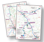
All the Waterway Routes Cruising Maps are available in Acrobat (pdf) format, as well as in Memory-Map (qct) format.
The Acrobat (pdf) maps are split into pages, with overlaps between each page.
Advantages of the Acrobat (pdf) Format
- The format is well known and supported
- The software and apps are free and often installed already
- The maps are split into A4 pages
- The maps are easy to print A4 or A5
- The maps are easy to view on screen (a page at a time)
Disadvantages of Acrobat (pdf) Format
- There is no GPS tracking on smartphones
- Requires lots of scrolling on small screens (like phones)
- There are lots of pages to search and turn through (more than 1,000 pages for England & Wales Maps)
Which devices will the maps work on?
The maps work on almost any computer, phone or tablet which will open Acrobat (pdf) files, including:
How can I check if the maps work on my device?
Download one of the free maps from my website and try that. If the free map works then the paid for ones will work the same way. You can try these free maps:
Please note
I produce the maps. I don’t produce the software or apps to use them, but I explain where to get those from.


Dear Waterway Routes Cruising Maps, Would love to get a Llangollen canal map, but when I uploaded the Droitwich canal sample PDF maps, I found zooming in using Adobe Acrobat X (on a Win7 Pro) laptop makes the text illegible (too low of resolution). Surely I’m missing something? Any suggestions? I will try the QCT format another time, but wanted to check in on this first. Thanks in advance.
Brett: I’m puzzled by your comment. I’ve just downloaded a copy of the Droitwich Canals Map to check it works and I can zoom in to show incredible detail. Are you sure you are looking at the map pages and not trying to zoom in on the low resolution index page? Paul.
How do I download the Wey & Arun canal
Patrick: Look in the categories menu at the top right and expand the “MAPS” tab for an alphabetical listing of all the waterway maps. Wey & Arun is near the end of that list. Paul.