End of the Nutbrook Canal
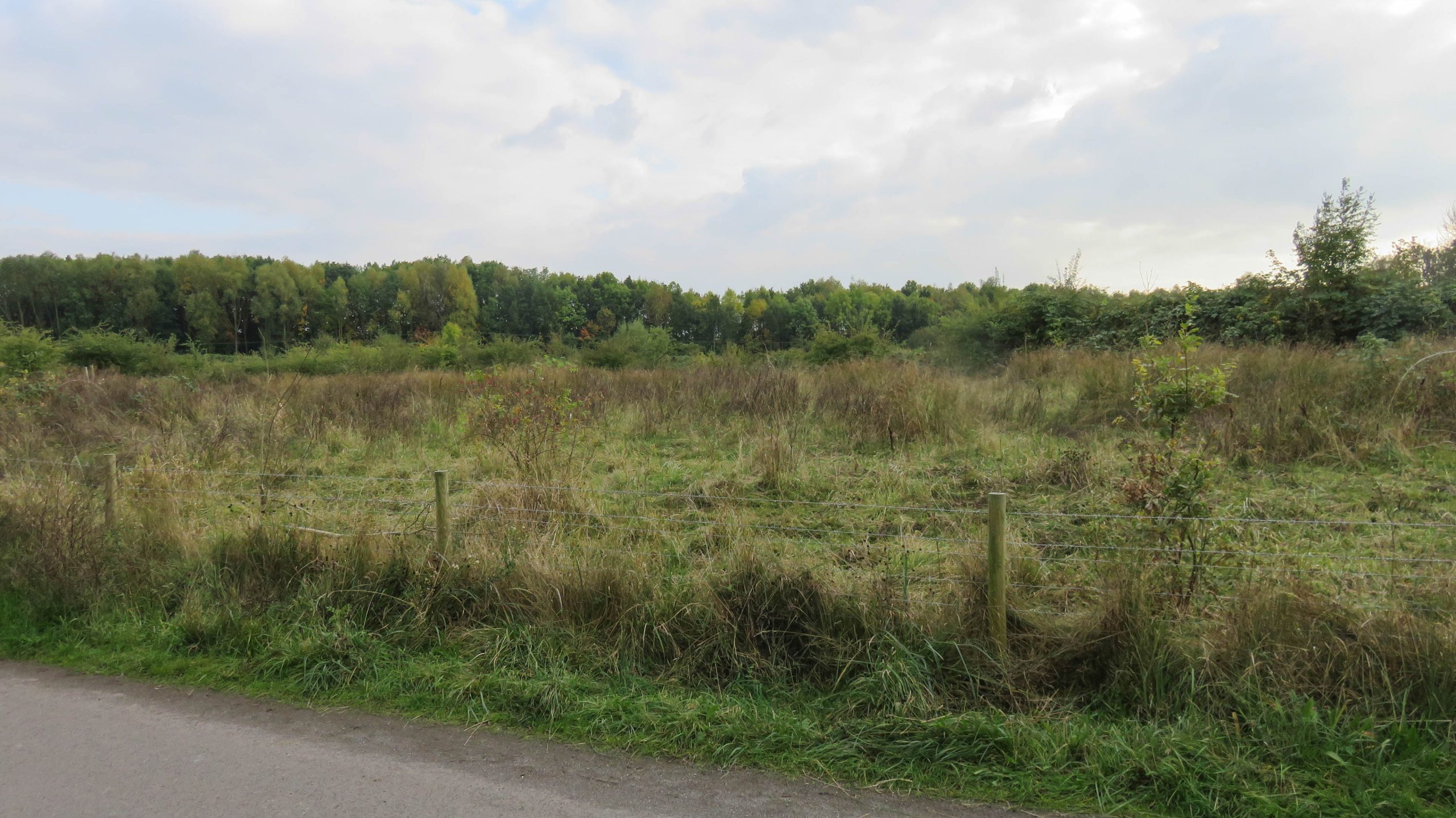
< JUMP TO Nutbrook Canal Next > < Erewash Canal Jn Erewash Canal Jn > The Nutbrook Canal comes towards the camera and finished somewhere in the middle of the photo, in the middle of nowhere...
![]()
Maps and DVDs for the Waterways of Britain
by Paul · Published 21/11/16 · Last modified 17/11/19
< JUMP TO Nutbrook Canal Next > < Erewash Canal Jn Erewash Canal Jn > The Nutbrook Canal comes towards the camera and finished somewhere in the middle of the photo, in the middle of nowhere...
by Paul · Published 21/11/16 · Last modified 17/11/19
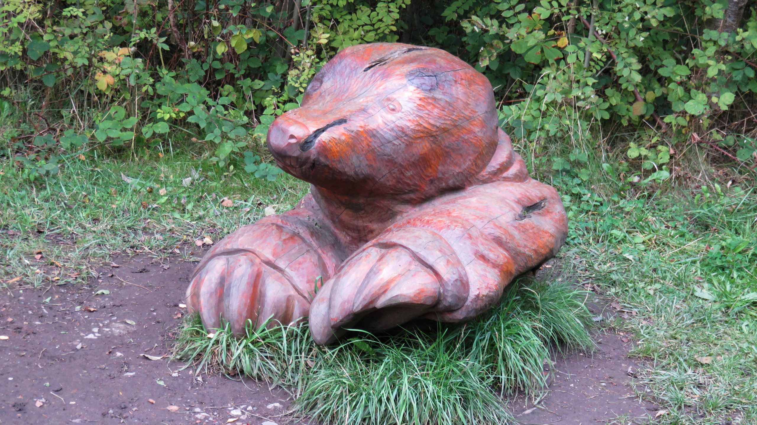
< Next Nutbrook Canal Next > < End of Navigation Erewash Canal Jn > Look out as you walk along the Nutbrook Canal – some of the wildlife is larger than life. Waterway and Kilometerage NUT...

by Paul · Published 21/11/16 · Last modified 17/11/19
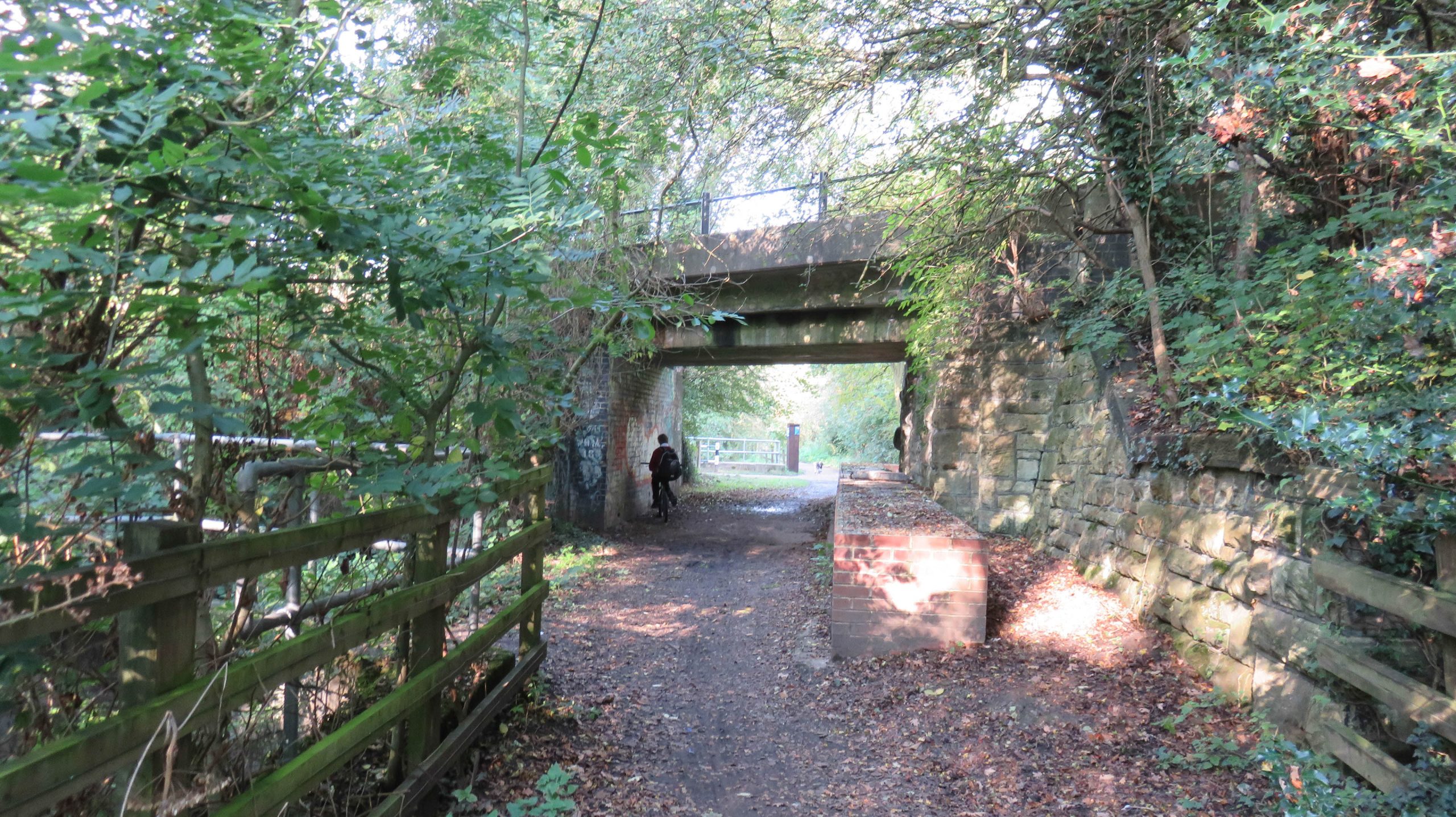
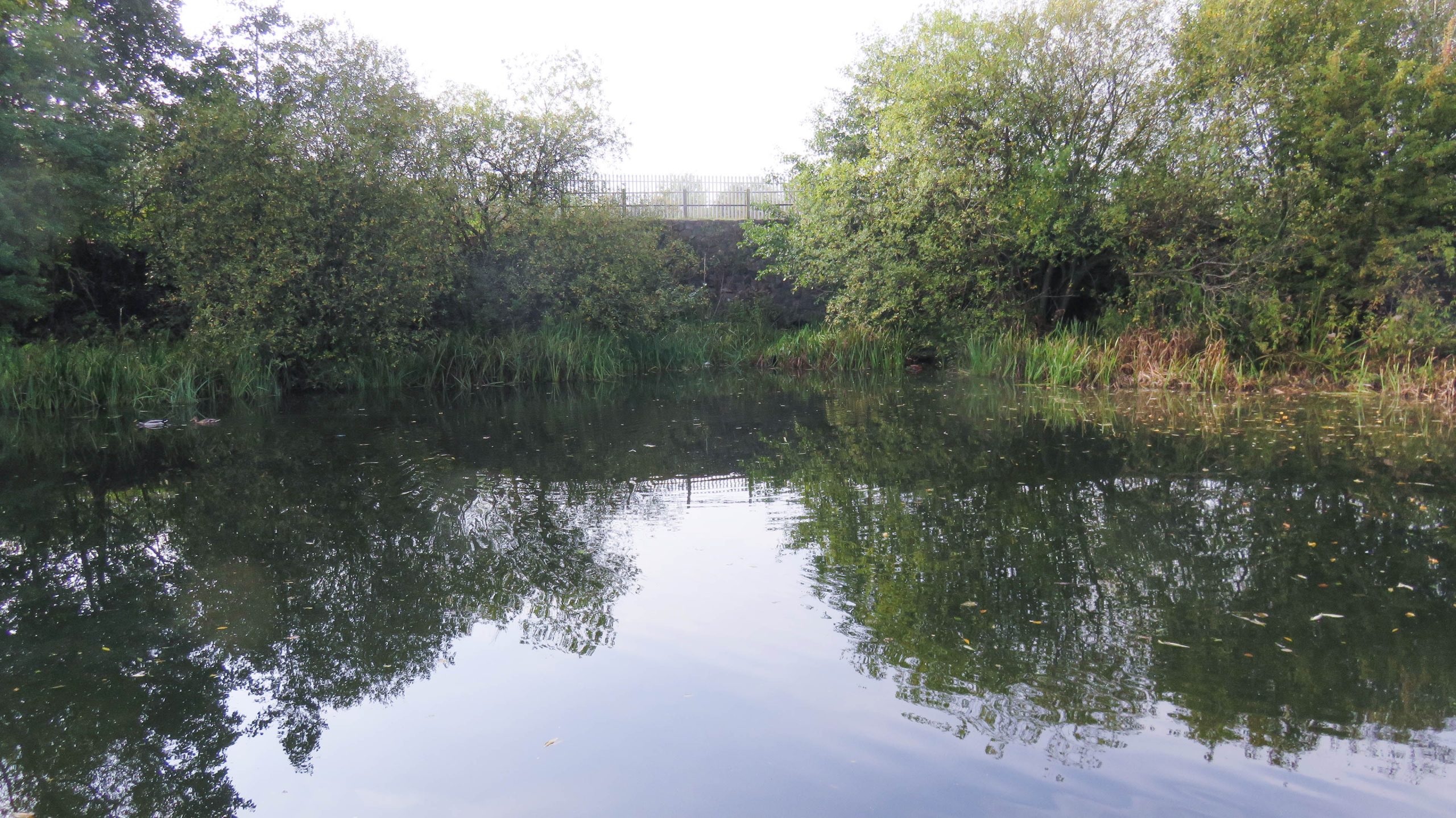
< Next Nutbrook Canal Next > < End of Navigation Erewash Canal Jn > The railway has gone, as well as the Nutbrook Canal, but the bridge is still there. Waterway and Kilometerage NUT 05.255.01 OS...

by Paul · Published 21/11/16 · Last modified 14/12/19
< Next Nutbrook Canal Next > < End of Navigation Erewash Canal Jn > The channel of the Nutbrook Canal looks ready for navigation once the water starts, around 300m before Stanton Bridge. Waterway...
by Paul · Published 21/11/16 · Last modified 17/11/19
< Next Nutbrook Canal Next > < End of Navigation Erewash Canal Jn > The cycle route now closely follows the towpath from Straws Lock 7, past Peewit Lock 8, and Limekiln Lock 9, to Mapperley...
by Paul · Published 21/11/16 · Last modified 17/11/19
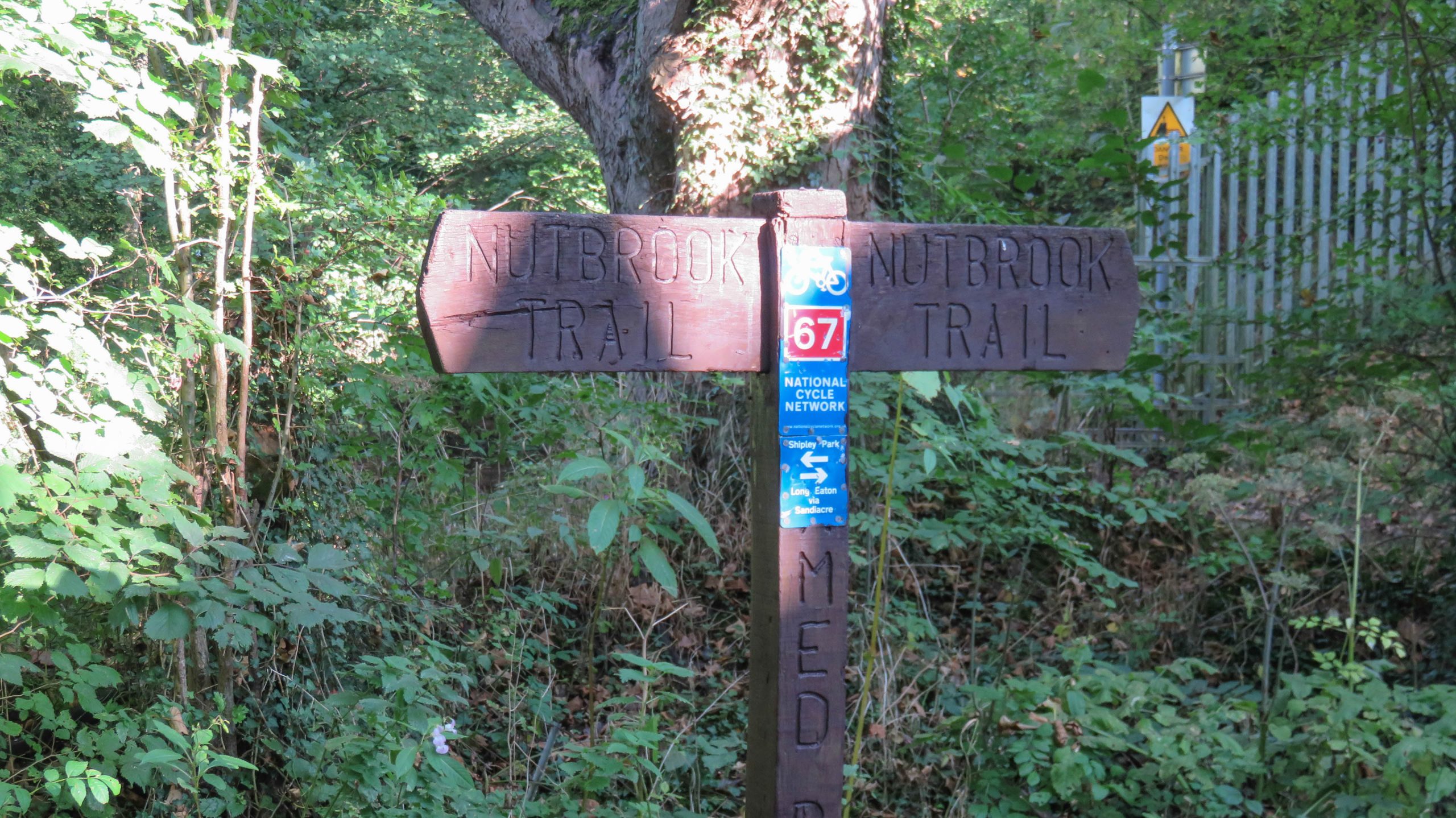
< Next Nutbrook Canal Next > < End of Navigation Erewash Canal Jn > Near Straws Lock 7, just beyond this bridge, the Nutbrook Trail, cycle route 67, joins the towpath. It’s a great walking or cycling...

by Paul · Published 21/11/16 · Last modified 17/11/19
< Next Nutbrook Canal Next > < End of Navigation Erewash Canal Jn > The towpath of the Nutbrook Canal is still walkable for much of the length of the canal, but the channel, to the...
by Paul · Published 21/11/16 · Last modified 17/11/19
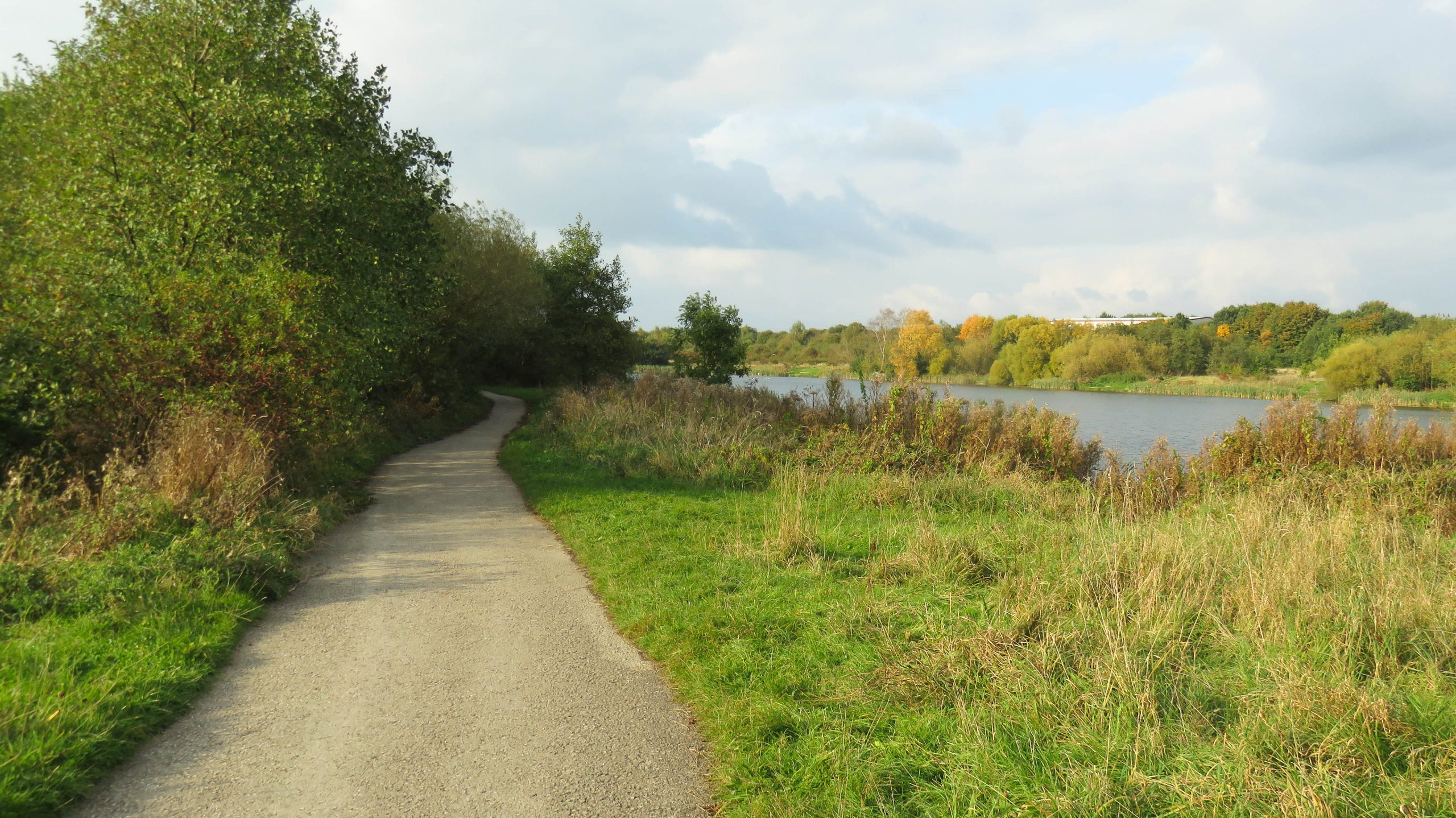
< Next Nutbrook Canal Next > < End of Navigation Erewash Canal Jn > Running close to the Nutbrook Canal in places, the Nutbrook Trail is part of National Cycle Route 67. Waterway and Kilometerage NUT...
by Paul · Published 21/11/16 · Last modified 17/11/19
< Next Nutbrook Canal Next > < End of Navigation Erewash Canal Jn > The stonework for Birches Lock 4 is still there, but deteriorating as these trees continue to grow in the recess which once...

by Paul · Published 21/11/16 · Last modified 17/11/19
< Next Nutbrook Canal Next > < End of Navigation Erewash Canal Jn > It’s a long time since there was any water and boats along the channel to the left of the towpath which is...
by Paul · Published 21/11/16 · Last modified 17/11/19
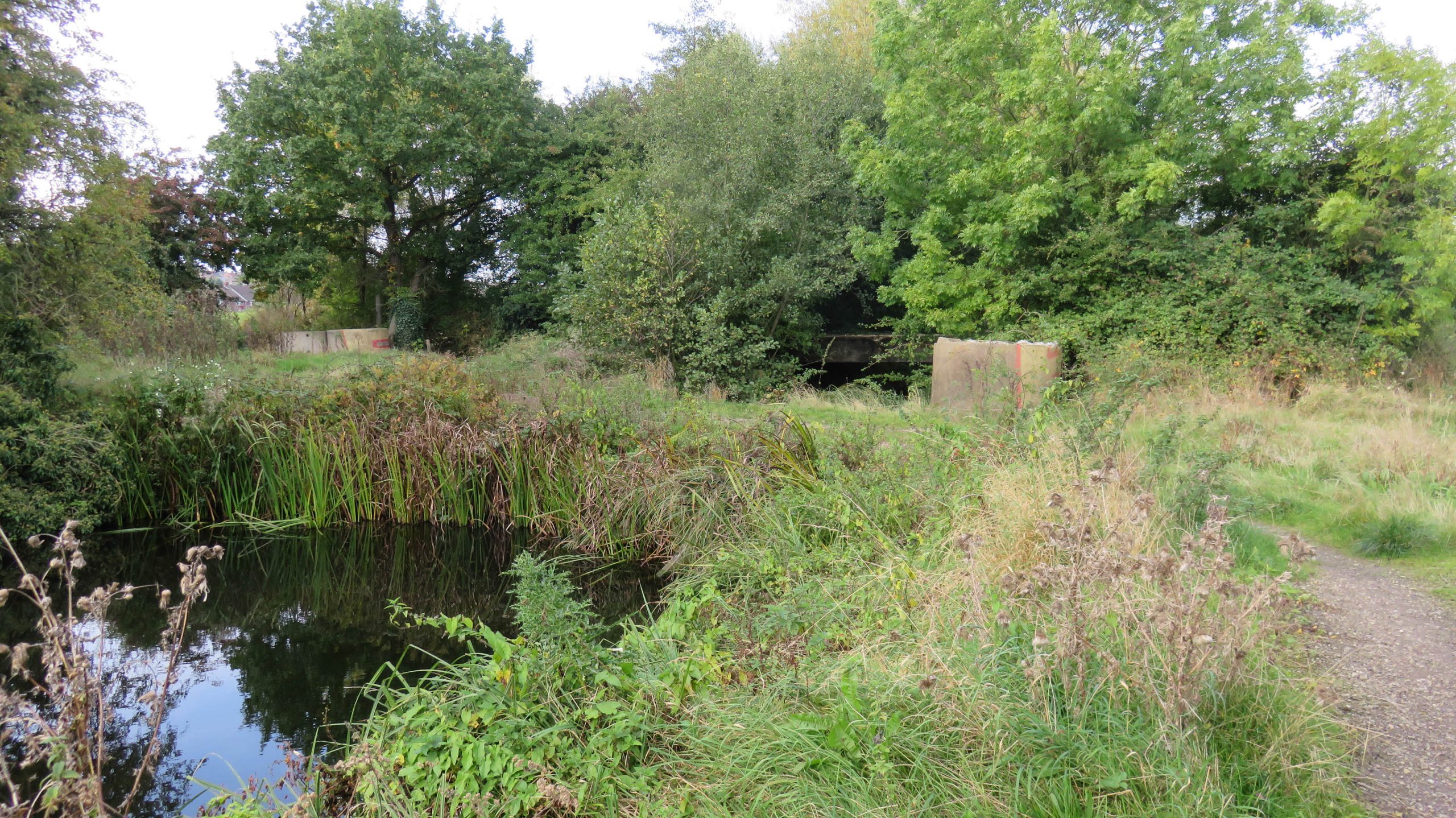
< Next Nutbrook Canal Next > < End of Navigation Erewash Canal Jn > The Nutbrook Canal is in water for around 400m above Old Furnace Lock 3. Then it’s block by a causeway adjacent to...
by Paul · Published 21/11/16 · Last modified 09/12/19
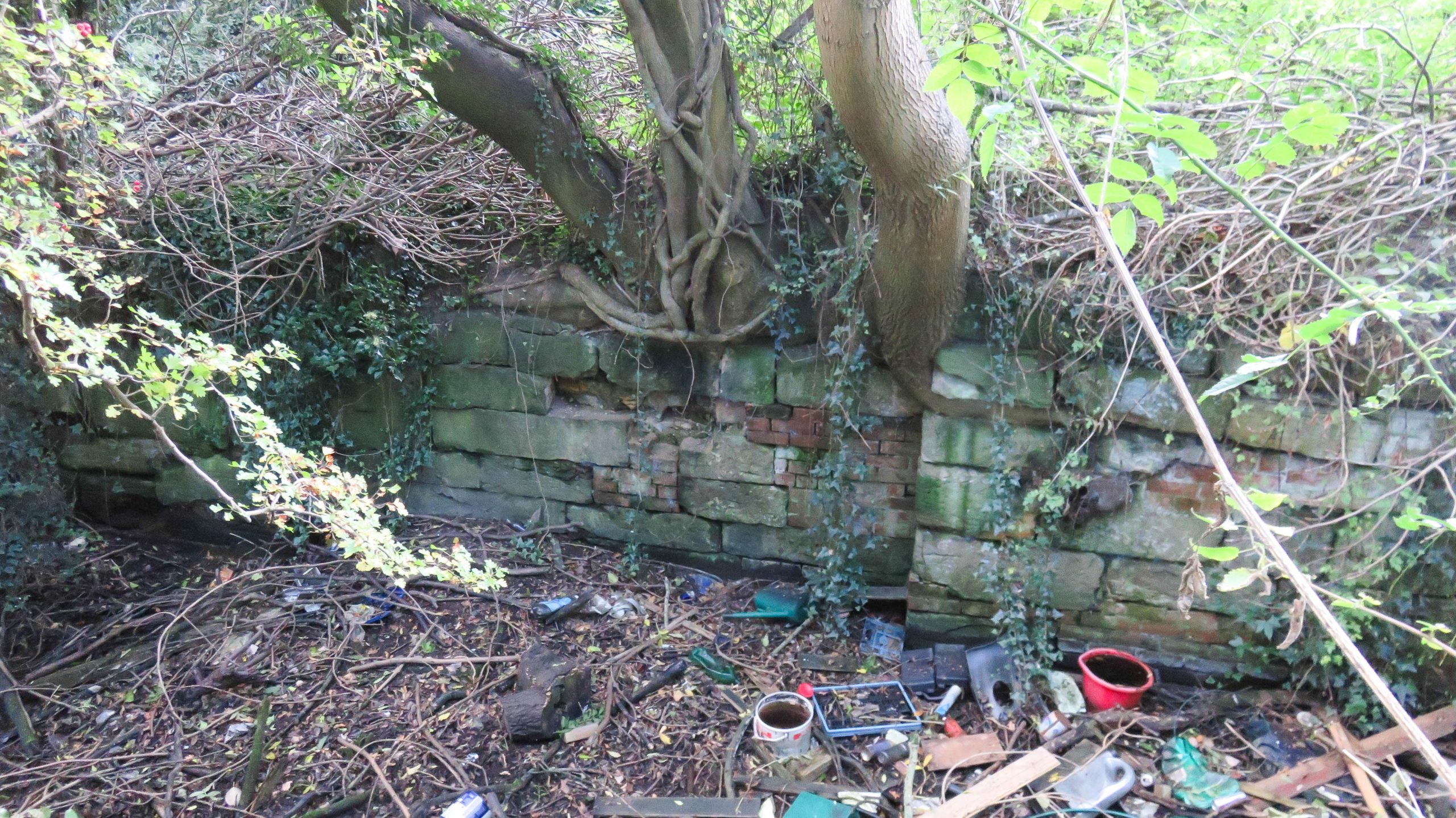
< Next Nutbrook Canal Next > < End of Navigation Erewash Canal Jn > The stonework of Old Furnace Lock 3 is still there, with a weir in place of the top gates to maintain the...
by Paul · Published 21/11/16 · Last modified 09/12/19
< Next Nutbrook Canal Next > < End of Navigation Erewash Canal Jn > The stonework below the bottom gates of Old Furnace Lock 3 is till visible, but there are no gates and the entrance...
by Paul · Published 21/11/16 · Last modified 17/11/19
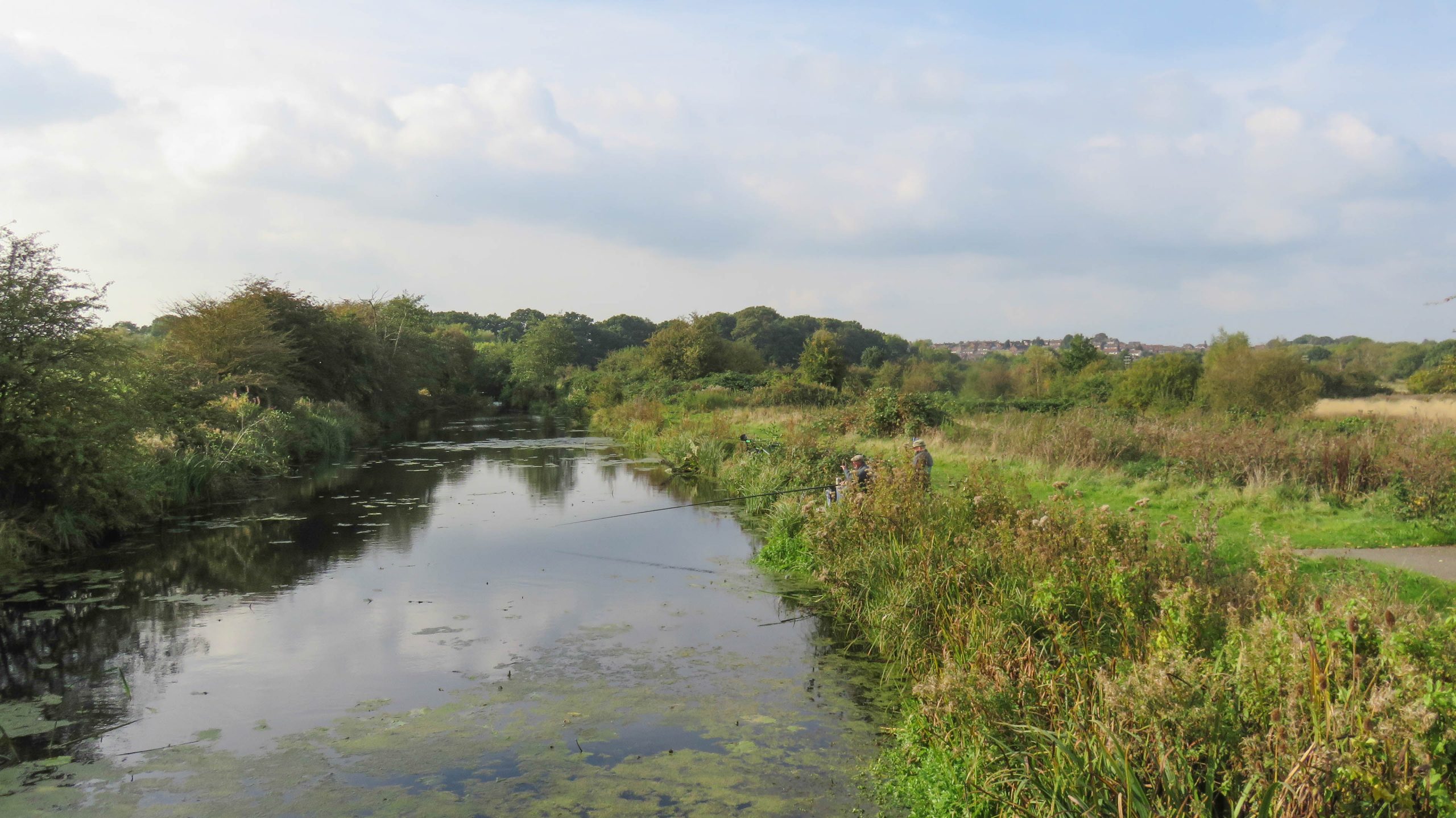
< Next Nutbrook Canal Next > < End of Navigation Erewash Canal Jn > Looking North West along the Nutbrook Canal from Stanton Bridge. It’s many years since a boat last passed along here, but there...
by Paul · Published 21/11/16 · Last modified 17/11/19
< Next Nutbrook Canal JUMP TO > < End of Navigation End of Navigation > Standing on the towpath of the Erewash Canal, looking into the start of the Nutbrook Canal, with Trent Junction to the...
 England & Wales Waterway Map for Download
England & Wales Waterway Map for Download
England & Wales Waterway Map for Download
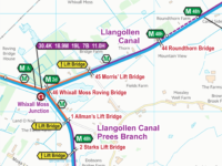 Llangollen Canal Map for Download
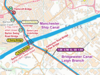 Bridgewater Canal Map for Download
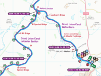 East Midlands (Leicester) Ring Map for Download
 RSS Blog Feed
Recent Comments