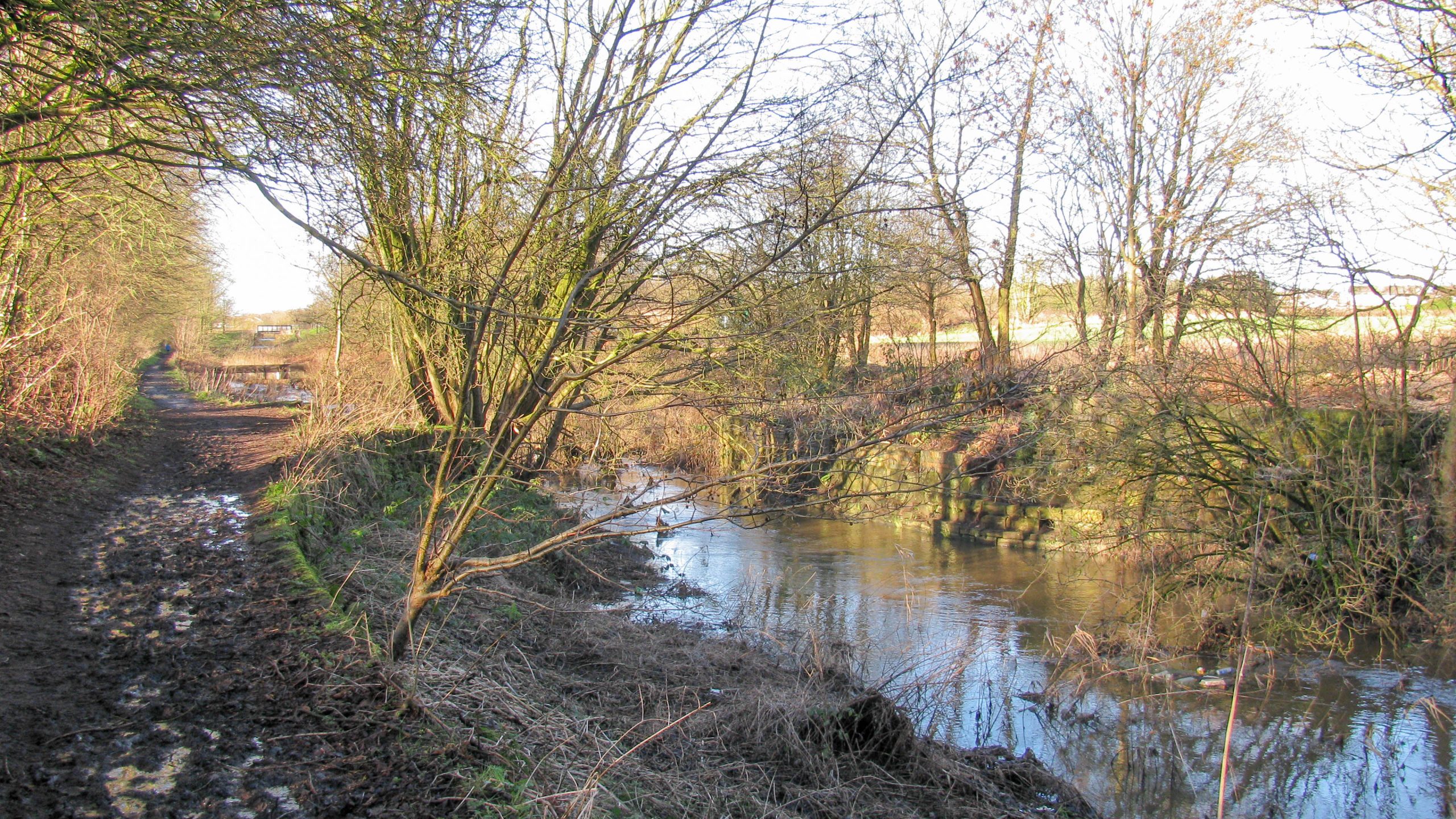
Former Swing Bridge
< Next St Helens Canal Next > < Old Double Locks Jn Earlestown > The stonework marks the position of a former swing bridge. Waterway and Kilometerage HELENS 20.820 OS Grid Reference SJ 53896 96051 Date...
![]()
Maps and DVDs for the Waterways of Britain
< Next St Helens Canal Next > < Old Double Locks Jn Earlestown > The stonework marks the position of a former swing bridge. Waterway and Kilometerage HELENS 20.820 OS Grid Reference SJ 53896 96051 Date...
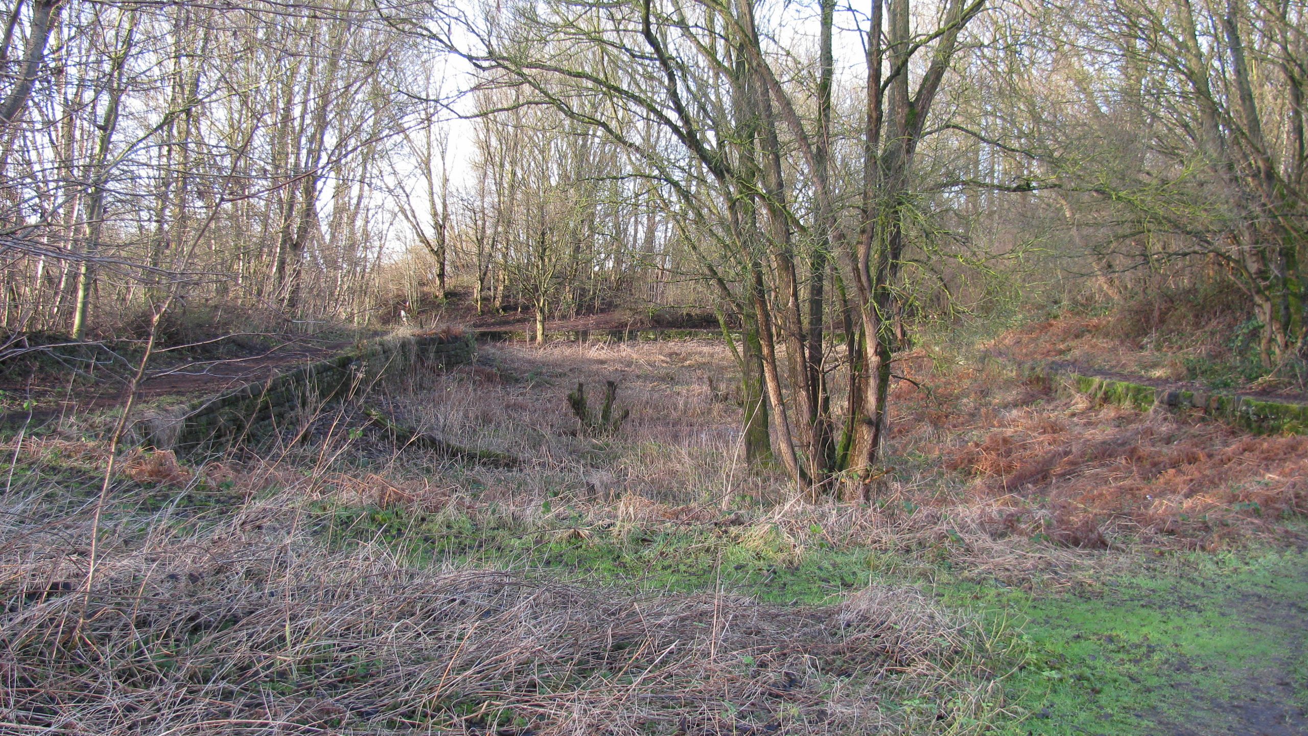
< Next St Helens Canal Next > < Old Double Locks Jn Earlestown > Broad Oak Basin would once have been busy with boats being loaded and unloaded. Waterway and Kilometerage HELENS 20.550 OS Grid Reference...

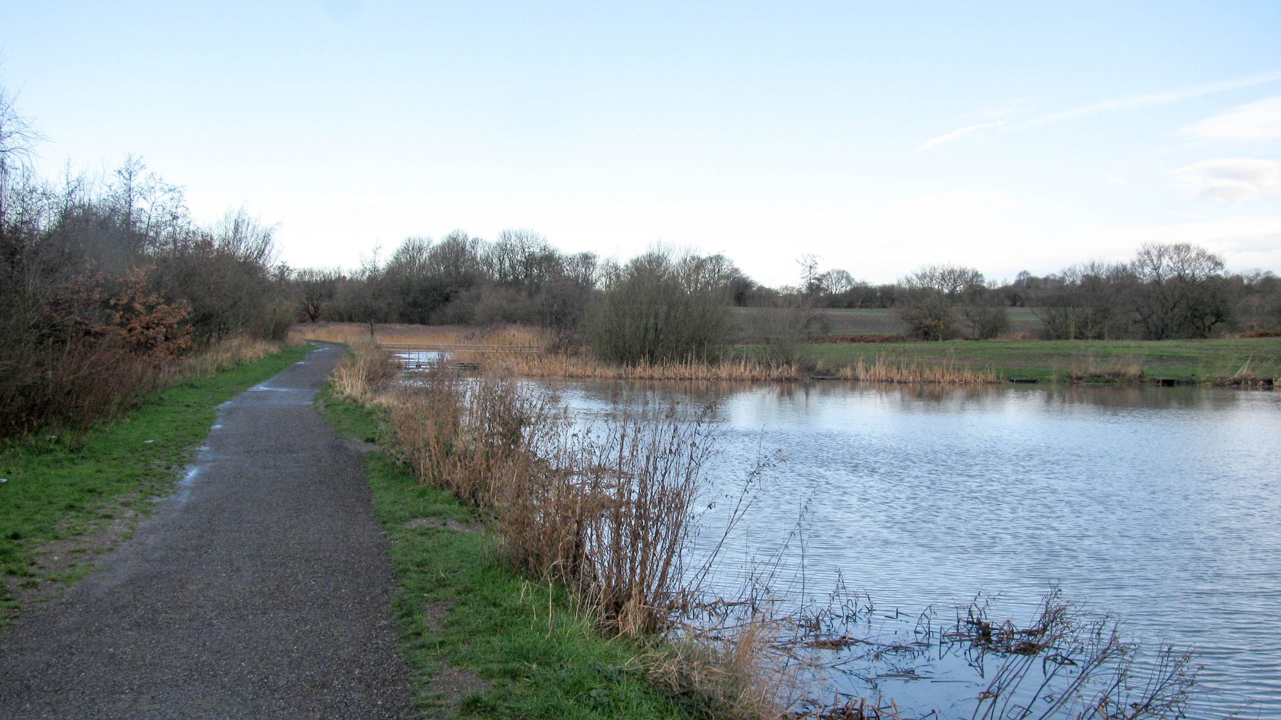
< Next St Helens Canal Next > < Old Double Locks Jn Earlestown > Local water courses flow along the channel of the canal before joining the Sankey Brook. The water level can overtop the banks...
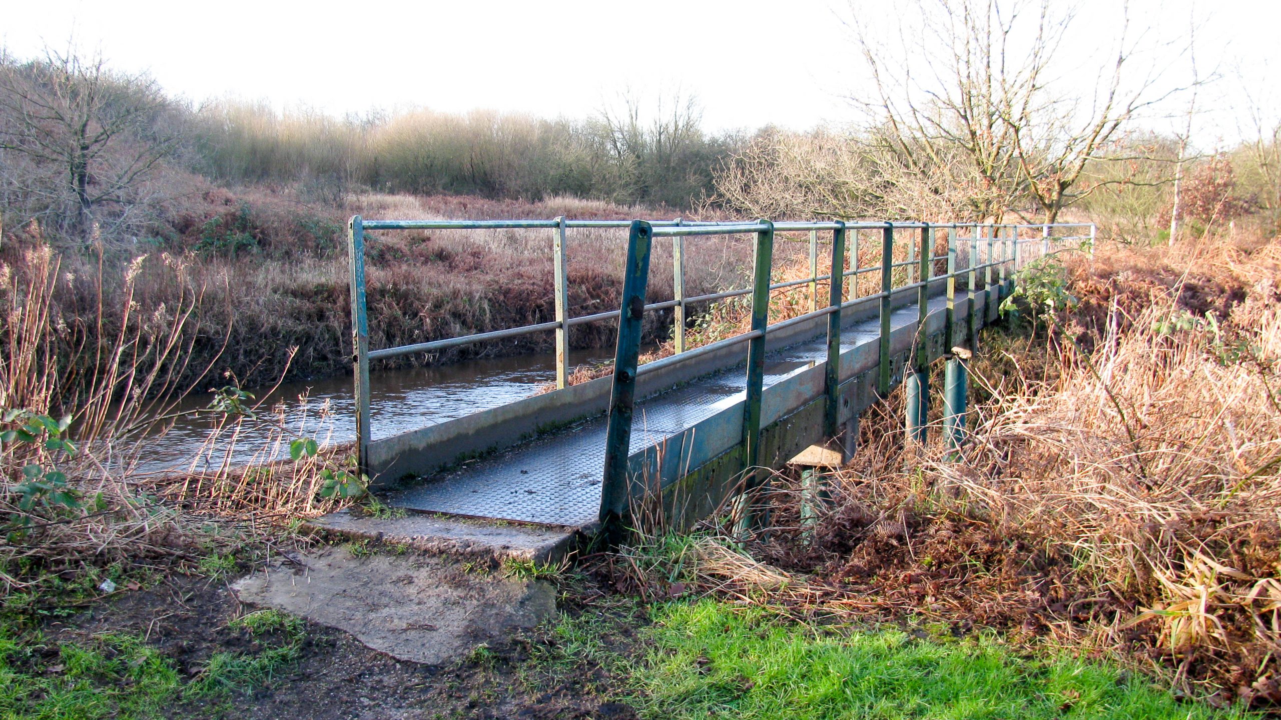
< Next St Helens Canal Next > < Old Double Locks Jn Earlestown > A new footbridge carries the towpath over a channel taking the flow from a local watercourse using part of the canal until...
< Next St Helens Canal Next > < Old Double Locks Jn Earlestown > It’s difficult to identify the course of the canal in places. Sometimes the Sankey Brook has been diverted to flow along the...
< Next St Helens Canal Next > < Old Double Locks Jn Earlestown > There is very little height difference between the canal, to the right of the footpath, and the Sankey Brook, to the left....
< Next St Helens Canal Next > < Old Double Locks Jn Earlestown > Penkford Bridge crosses the canal with limited headroom. The arches to the left carry the towpath over the flow to the weir...
< Next St Helens Canal Next > < Old Double Locks Jn Earlestown > Part of Newton Common Lock is visible, with the far end under the road which was once a swing bridge. Note the...
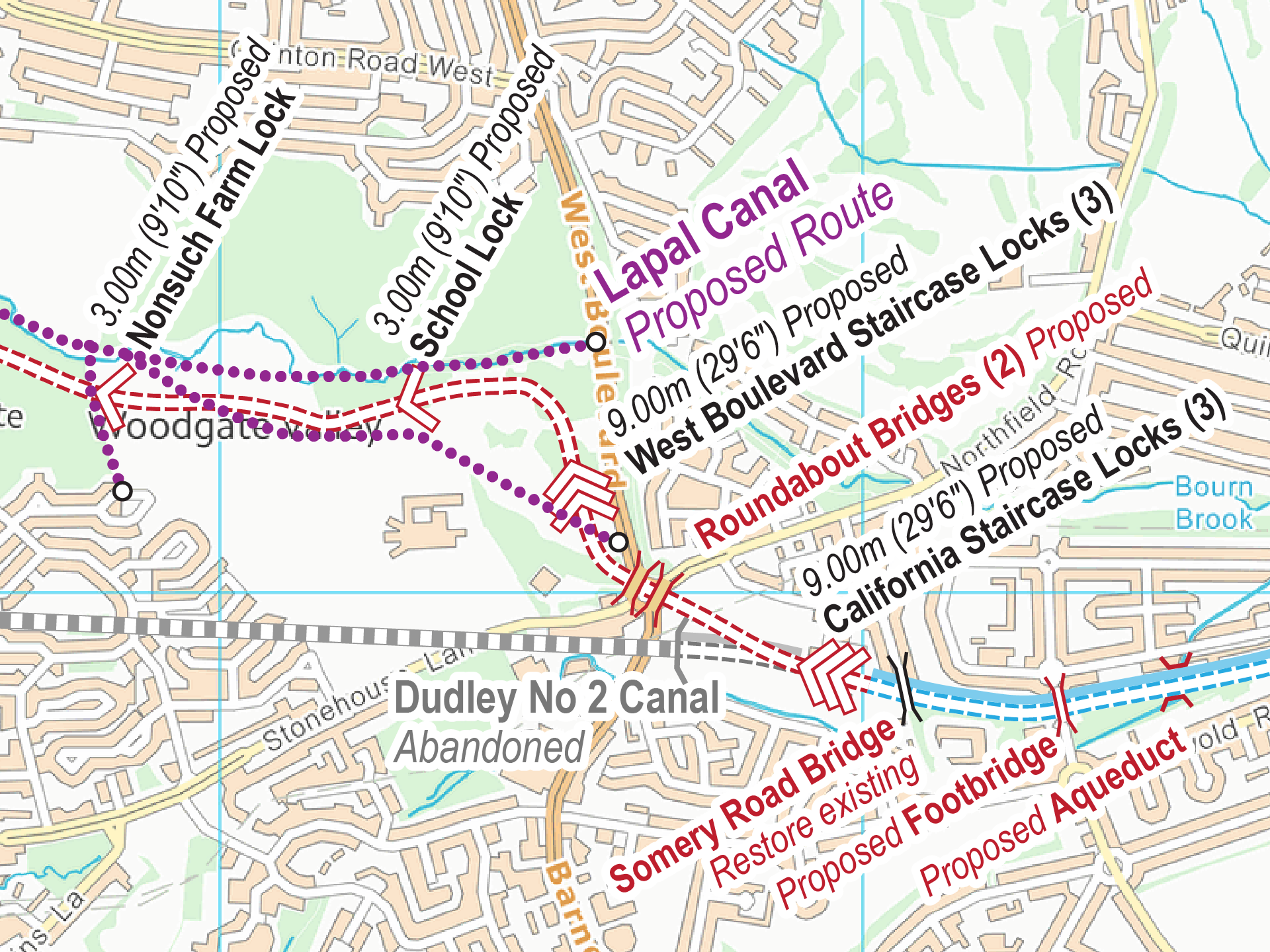
The Lapal Canal is the name now associated with the restoration of the Dudley No 2 Canal using an alternative route in places. History The Dudley No 2 Canal once ran from Parkhead Junction...
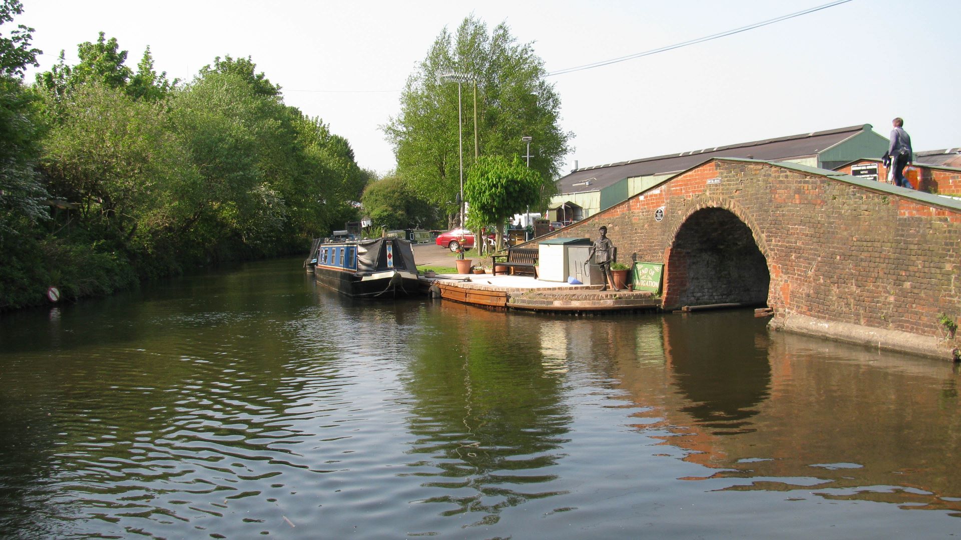
< JUMP TO Dudley No 2 Canal Next > < Selly Oak Selly Oak > The entrance to Hawne Basin, under the bridge, marks the normal limit of navigation on the Dudley No 2 Canal. Straight ahead the...
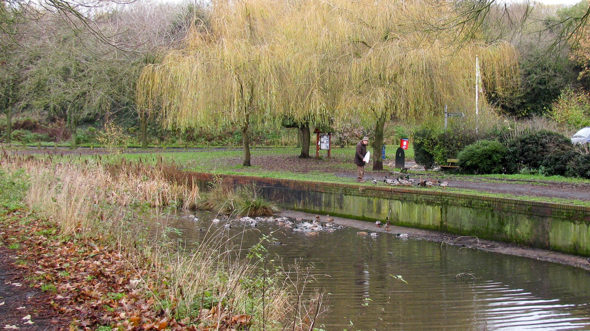
< Next Lapal Canal Next > < Hawne Basin Selly Oak > The local wildlife have trained the locals to feed them where the Lapal Canal is in water where it uses the former Dudley No 2 Canal’s...
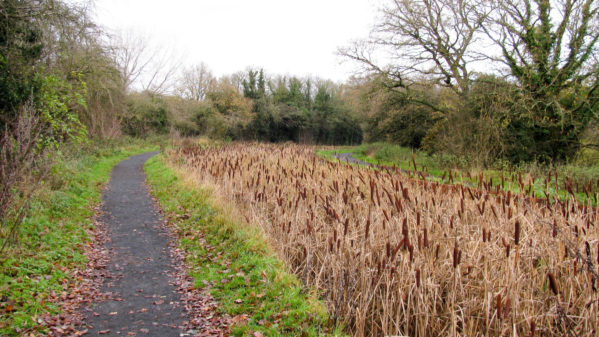
< Next Lapal Canal Next > < Hawne Basin Selly Oak > Towpaths along both sides of the Lapal Canal, now using the route of the former Dudley No 2 Canal, make a popular circular walking route for...
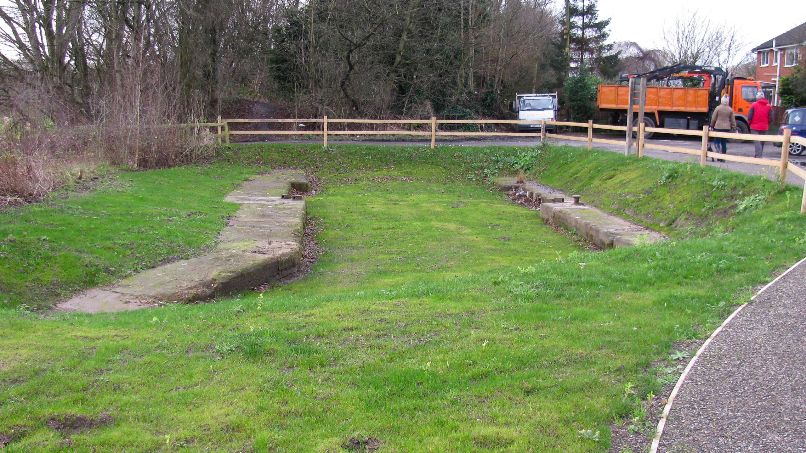
< Next Lapal Canal Next > < Hawne Basin Selly Oak > The narrows of a former stopgate are still present, just waiting for narrowboats to squeeze through the gap. Waterway and Kilometerage LAPAL 08.180 OS Grid Reference...
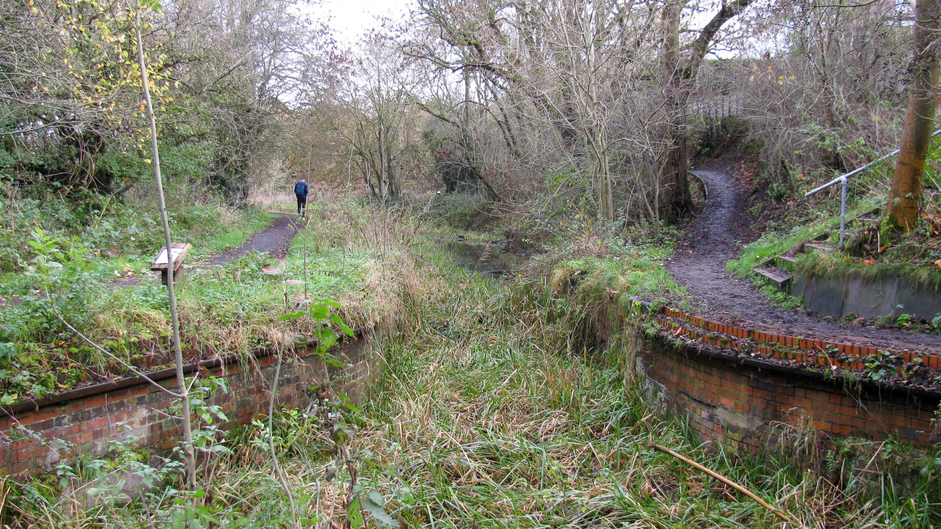
< Next Lapal Canal Next > < Hawne Basin Selly Oak > The route of the Lapal Canal, now using the route of the former Dudley No 2 Canal is easily identified. Waterway and Kilometerage LAPAL 08.000 OS...
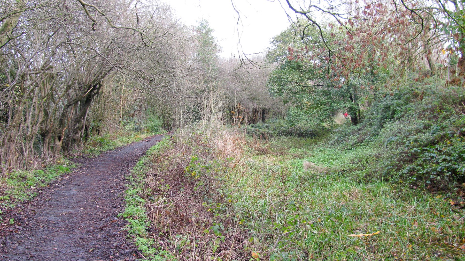
< Next Lapal Canal Next > < Hawne Basin Selly Oak > The towpath and route of the Lapal Canal can be followed as it passes between the houses. Waterway and Kilometerage LAPAL 07.775 OS Grid Reference SO...
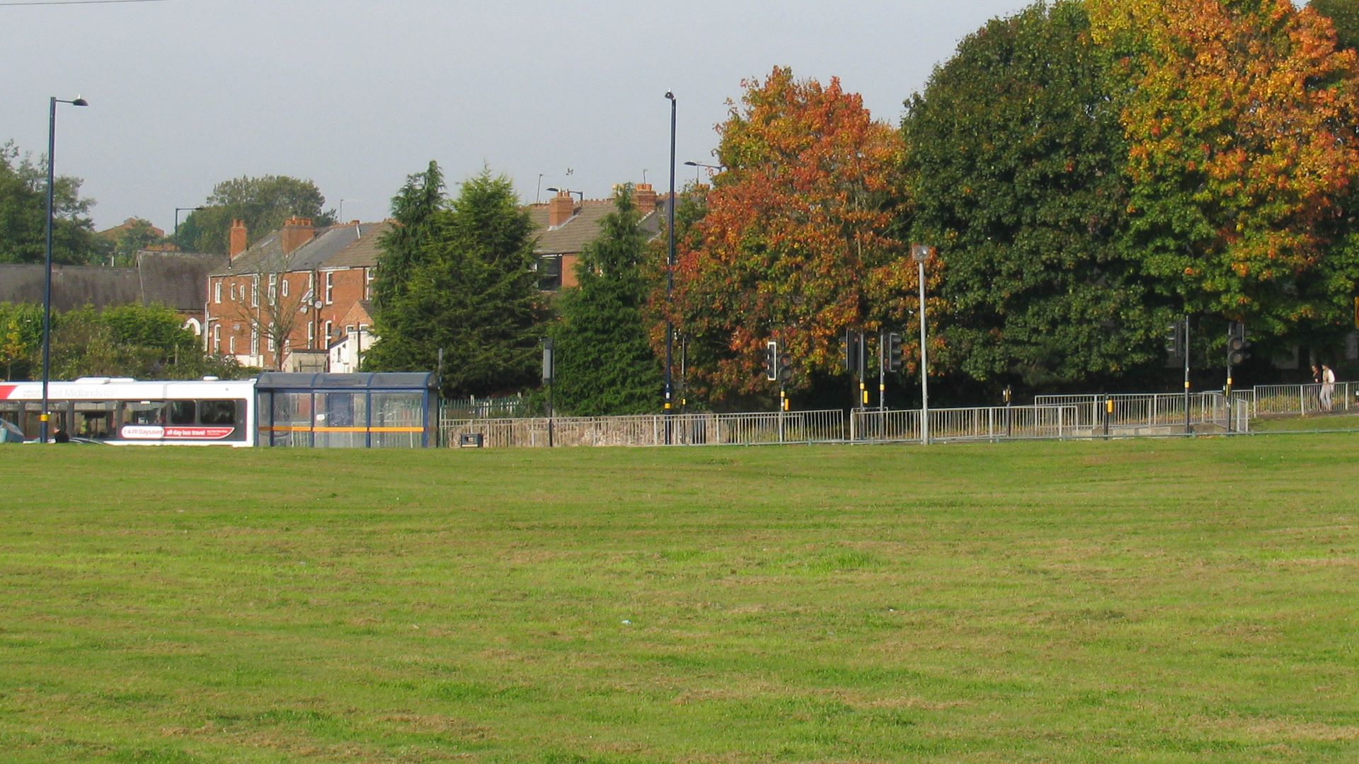
< Next Lapal Canal Next > < Hawne Basin Selly Oak > The photo is taken alongside the bus stop in the next photo (towards Selly Oak) where the footpath follows the route of the Dudley No 2 Canal,...
< Next Lapal Canal Next > < Hawne Basin Selly Oak > The original route of the Lapal Canal, as the Dudley No 2 Canal crossed here at road level, passing just to the right of the bus...
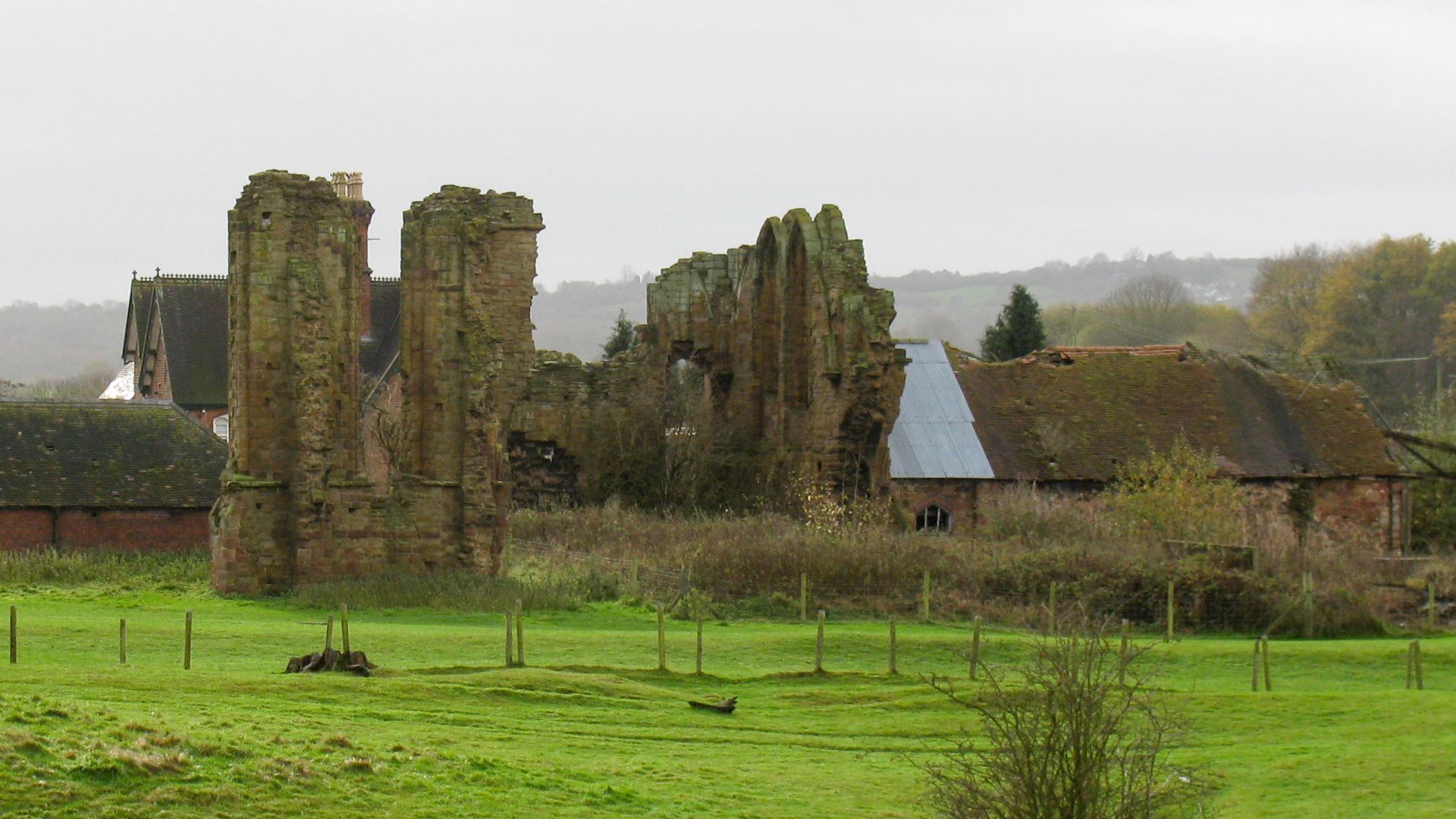
< Next Lapal Canal Next > < Hawne Basin Selly Oak > The Lapal Canal will pass close to the ruins of Halesowen Abbey, established in 1218. This is the nearest anyone can get to the abbey as...
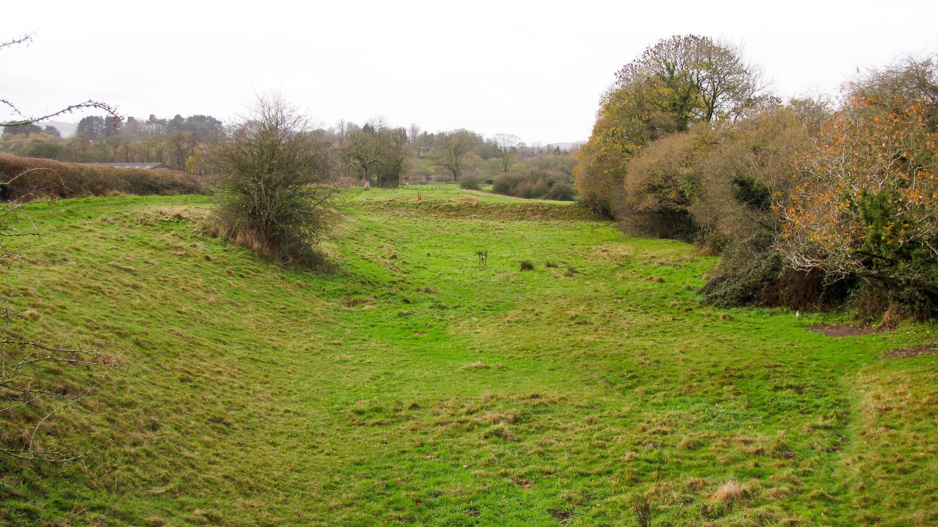
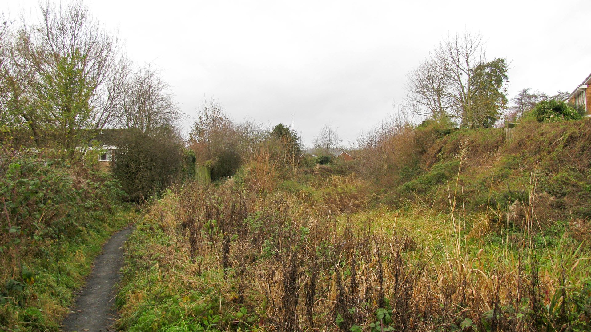
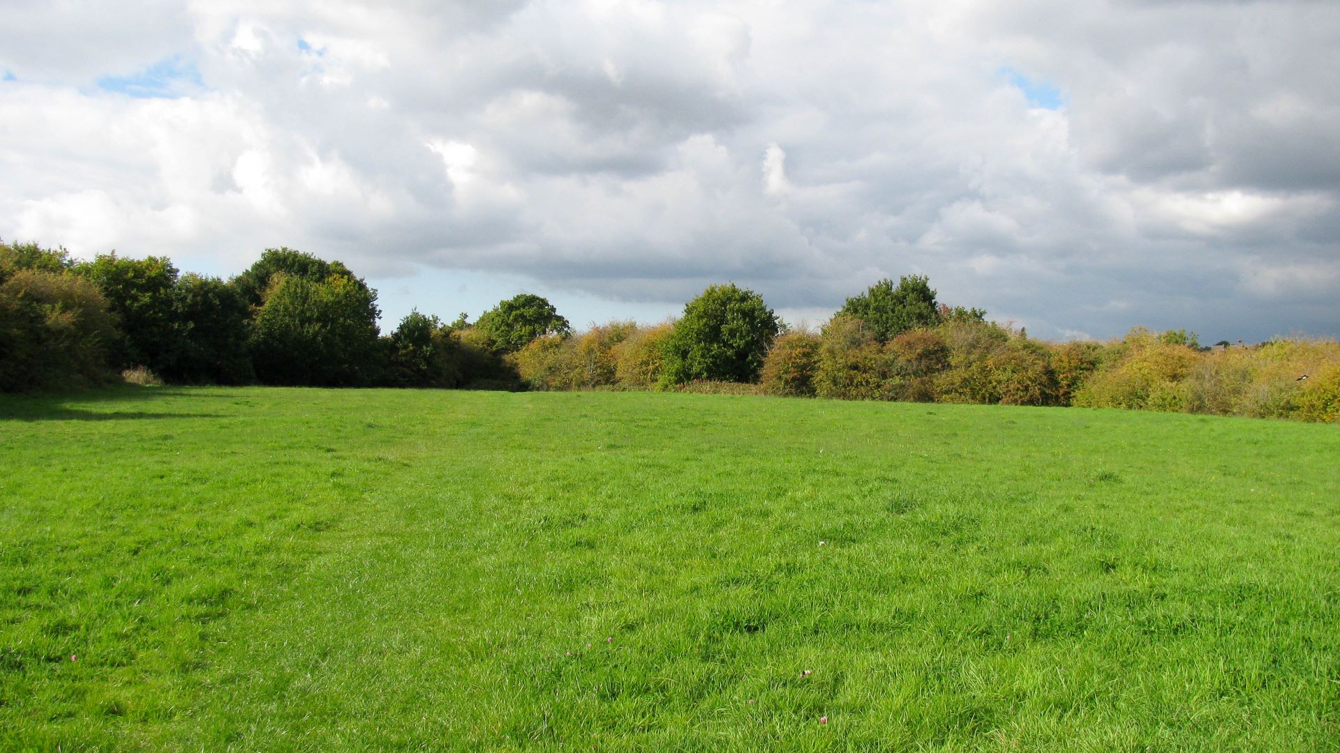
< Next Lapal Canal Next > < Hawne Basin Selly Oak > Looking along the original alignment of the Lapal Canal. The proposed route over the top of the hill will descend to the same level near the...
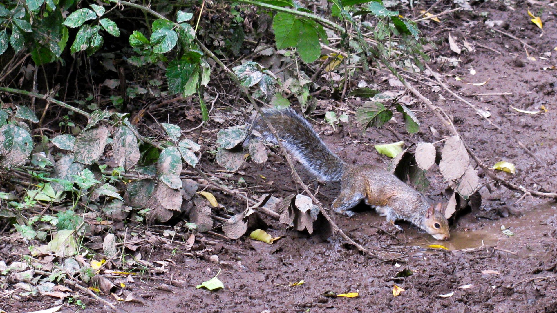
< Next Lapal Canal Next > < Hawne Basin Selly Oak > This squirrel hardly took any notice of me as I walked past – the wildlife seems used to humans walking past and probably won’t mind us...
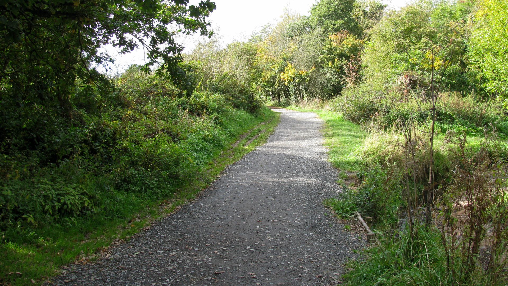
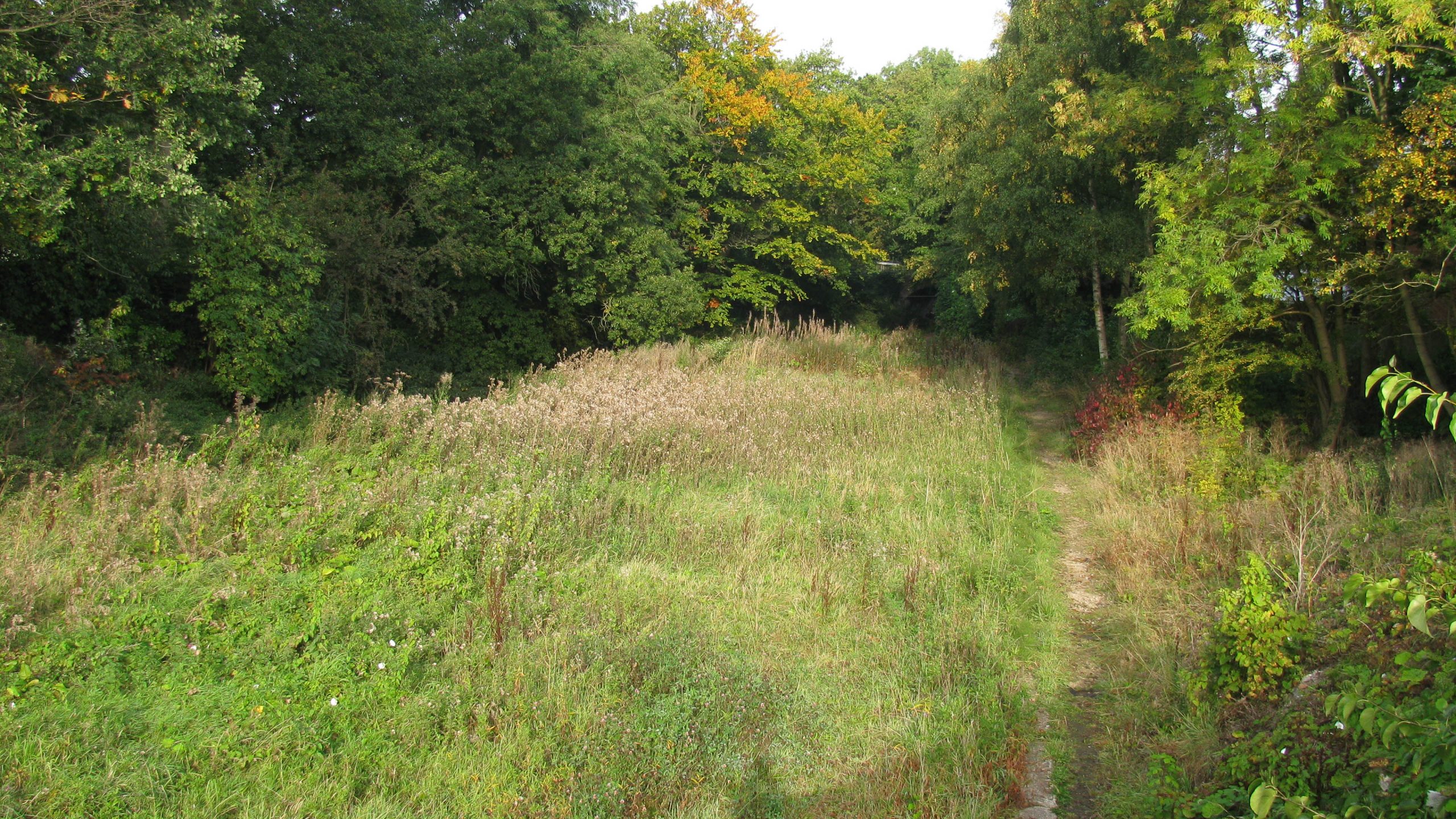
< Next Lapal Canal Next > < Hawne Basin Selly Oak > The gentle slope of the path following the general line of the Lapal Canal over the top of the hill indicates the likely position of one...
< Next Lapal Canal Next > < Hawne Basin Selly Oak > The Lapal Canal will continue to climb through several more single locks as the hillside gradually rises towards the summit. A footpath follows the general line of...
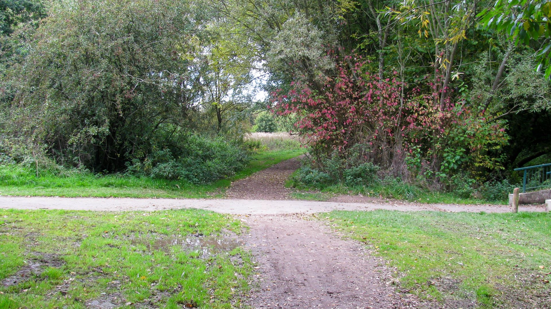
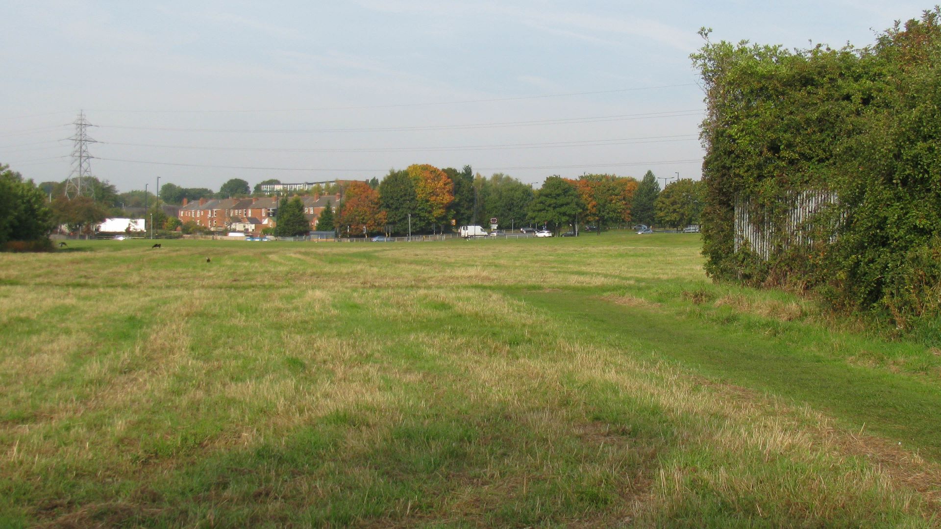
< Next Lapal Canal Next > < Hawne Basin Selly Oak > Around 250m beyond the previous photo, after passing under the roads the canal is very quickly back into open countryside. The Lapal Canal will climb through...
< Next Lapal Canal Next > < Hawne Basin Selly Oak > We are close to the mouth of Lapal Tunnel which would have been much lower than current ground level so the canal can pass under the...
< Next Lapal Canal Next > < Hawne Basin Selly Oak > We’re standing on the line of the canal. As the land rises ahead the canal would have entered a gradually deepening cutting and, about three quarters of...
< Next Lapal Canal Next > < Hawne Basin Selly Oak > Somery Road Bridge is still standing and this is where walkers have to leave the canal route for a short while. Beyond this bridge (to the...
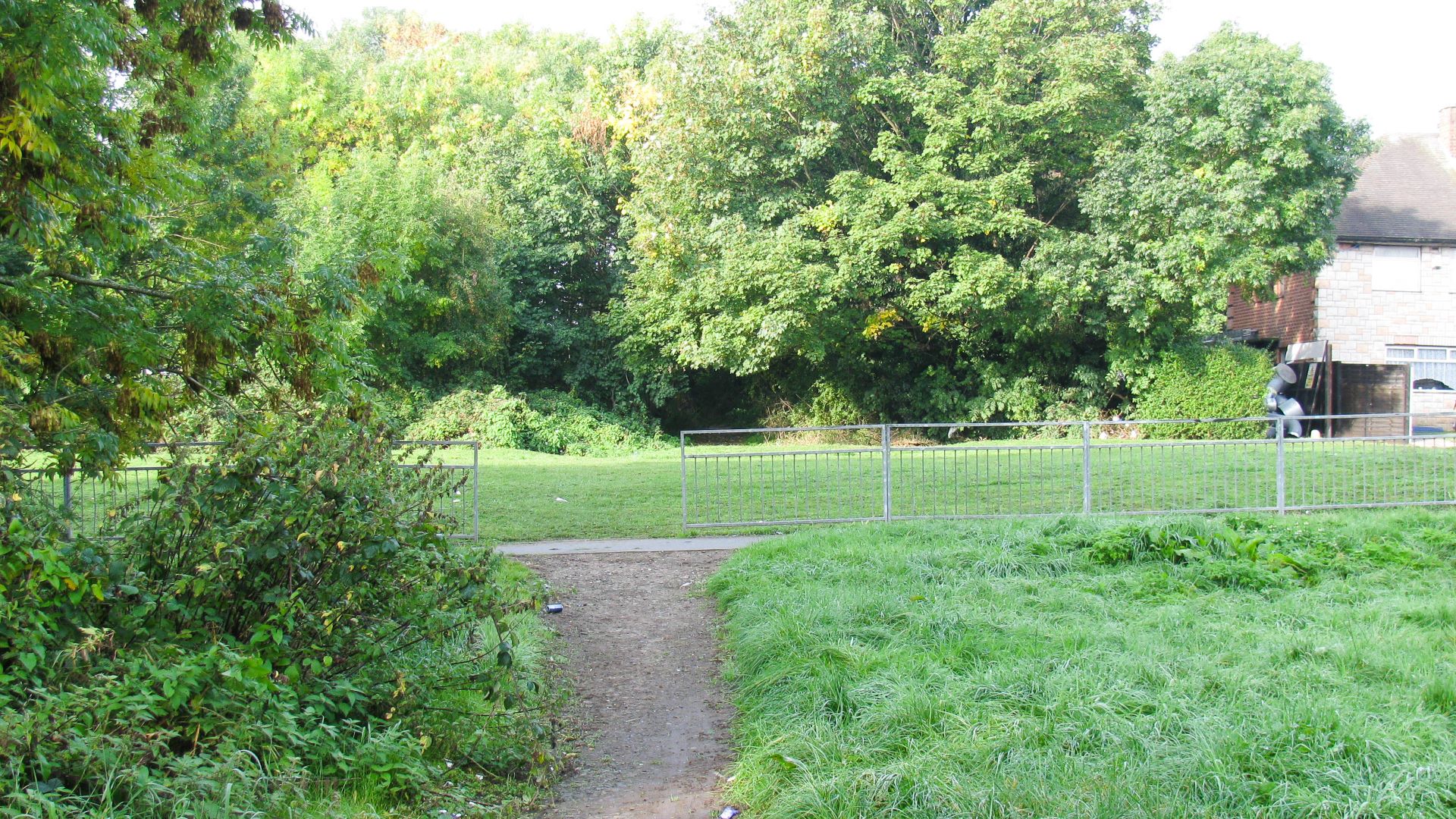
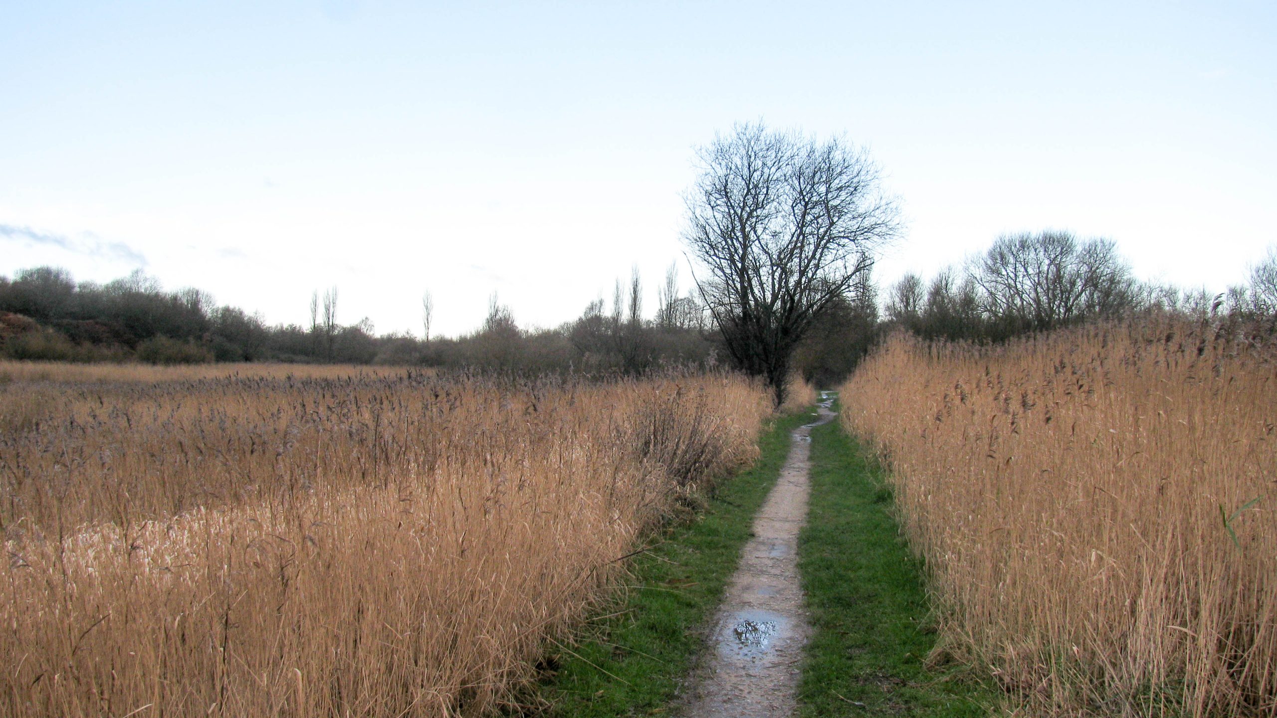
< Next Lapal Canal Next > < Hawne Basin Selly Oak > Just imagine the canal heading straight ahead. A footpath crosses from left to right and a new footbridge will maintain that walking route. Waterway and Kilometerage...
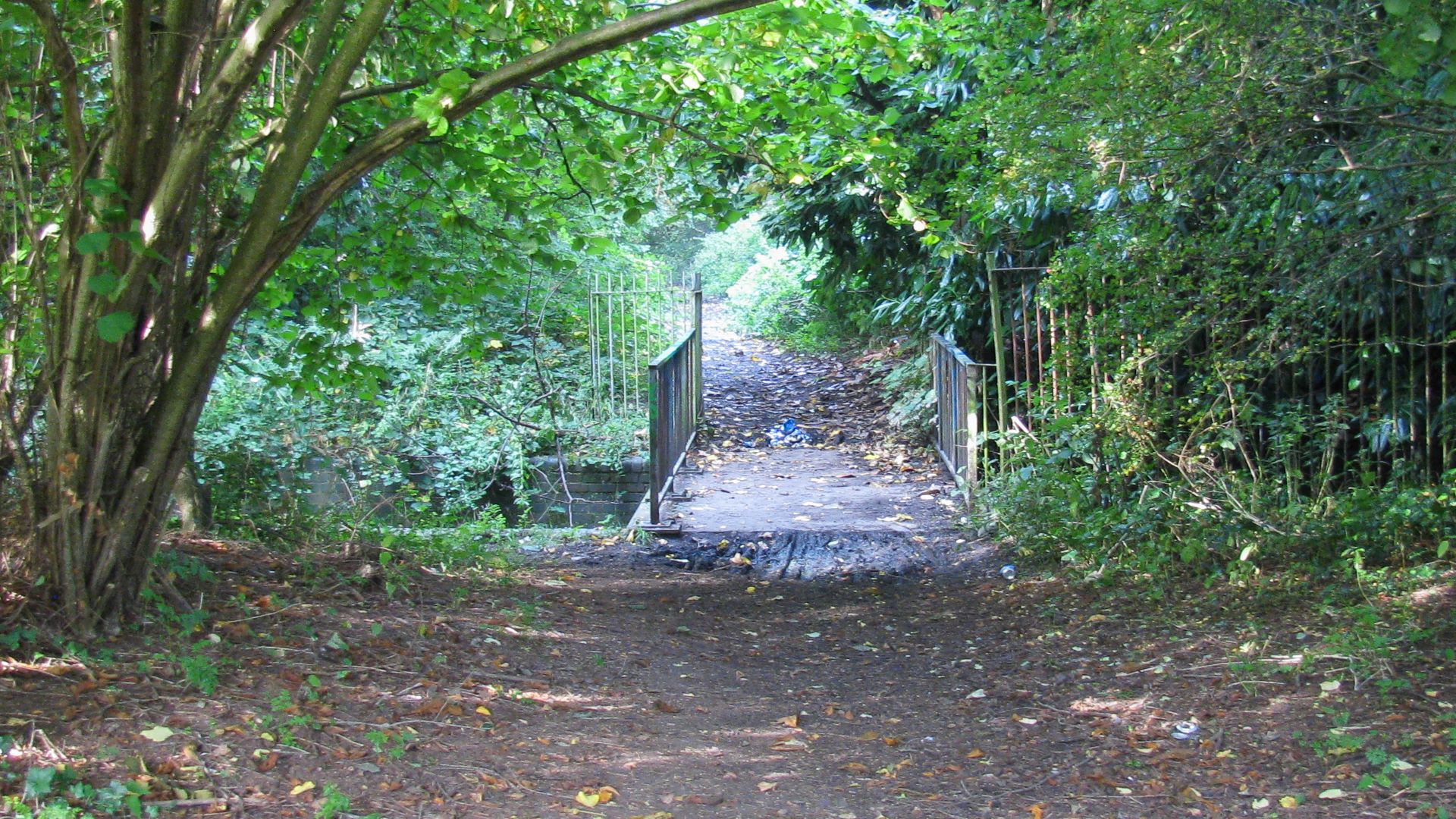
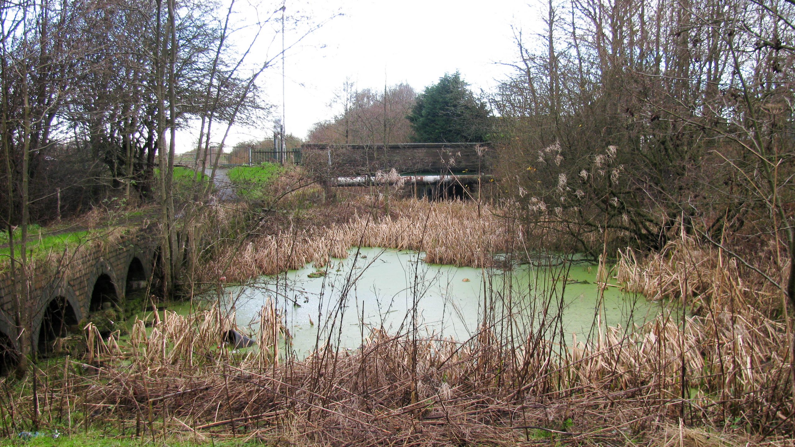
< Next Lapal Canal Next > < Hawne Basin Selly Oak > The footbridge over the stream is in place of a former aqueduct. Restoration of the canal will require replacement of the aqueduct. Waterway and Kilometerage LAPAL...
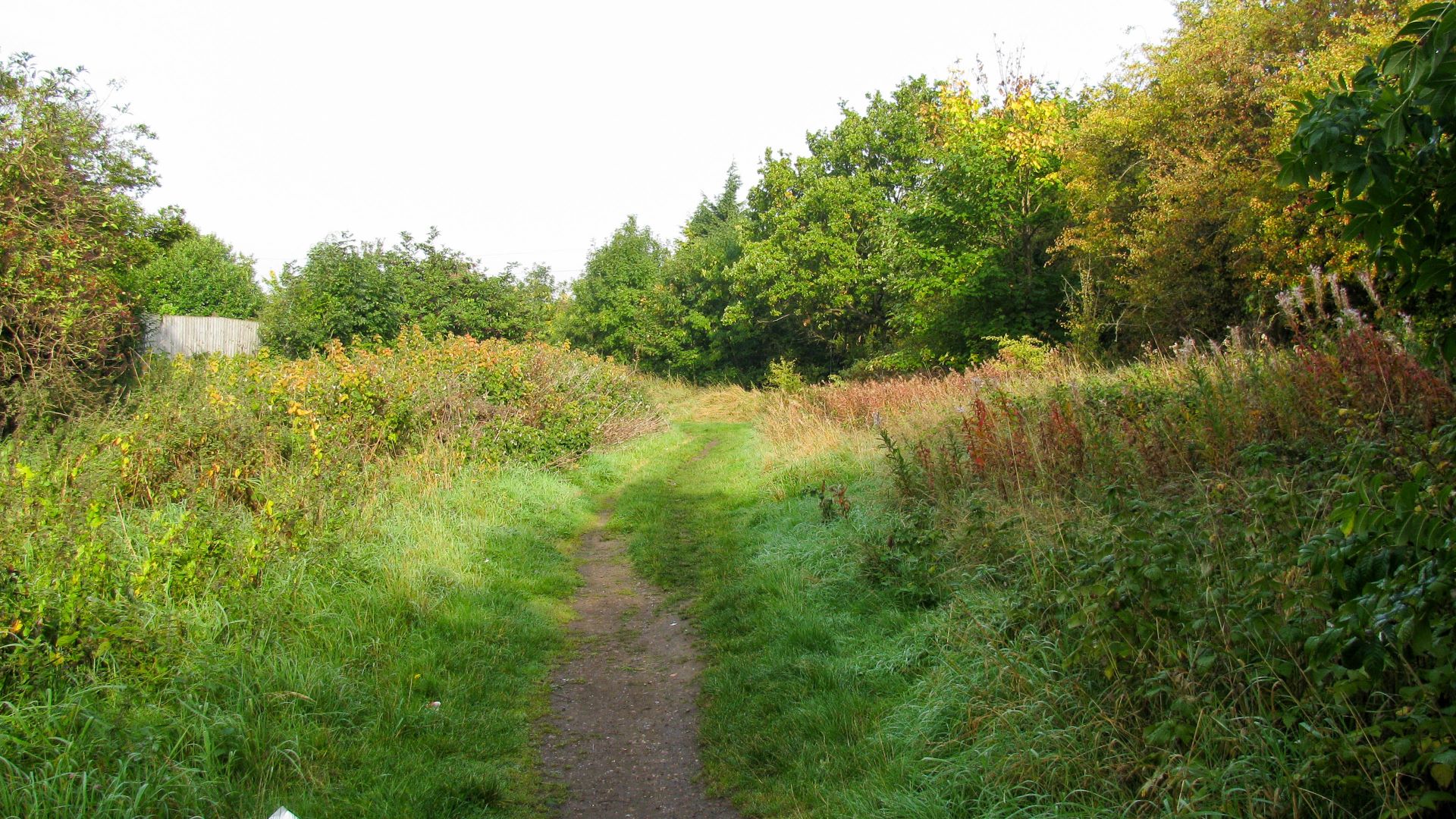
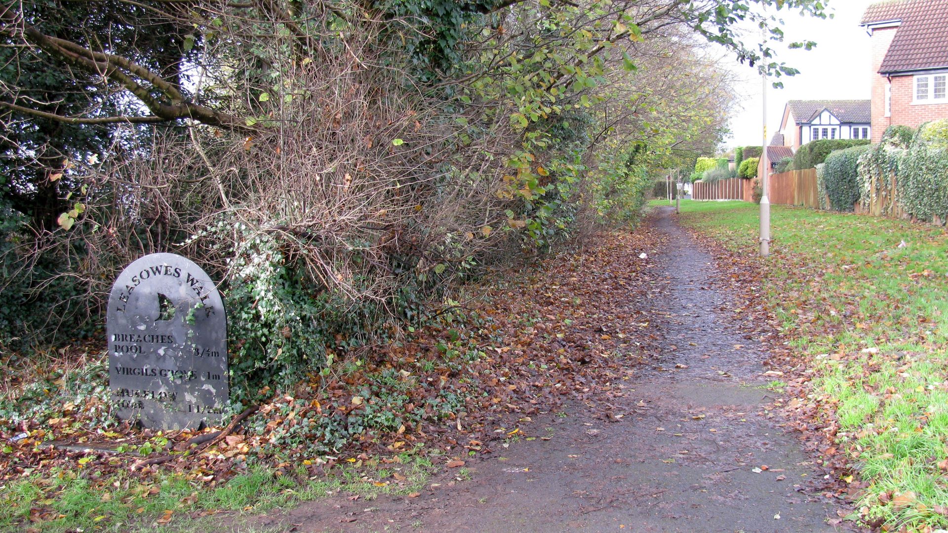
< Next Lapal Canal Next > < Hawne Basin Selly Oak > The footpath continues along the line of the Lapal Canal. Waterway and Kilometerage LAPAL 01.425 OS Grid Reference SP 03024 82889 Date and Time 150929 094652...
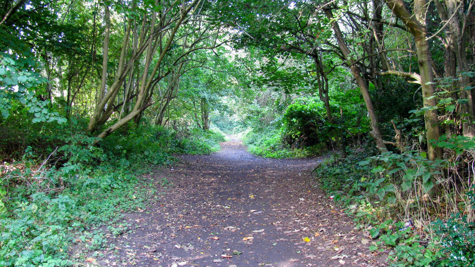
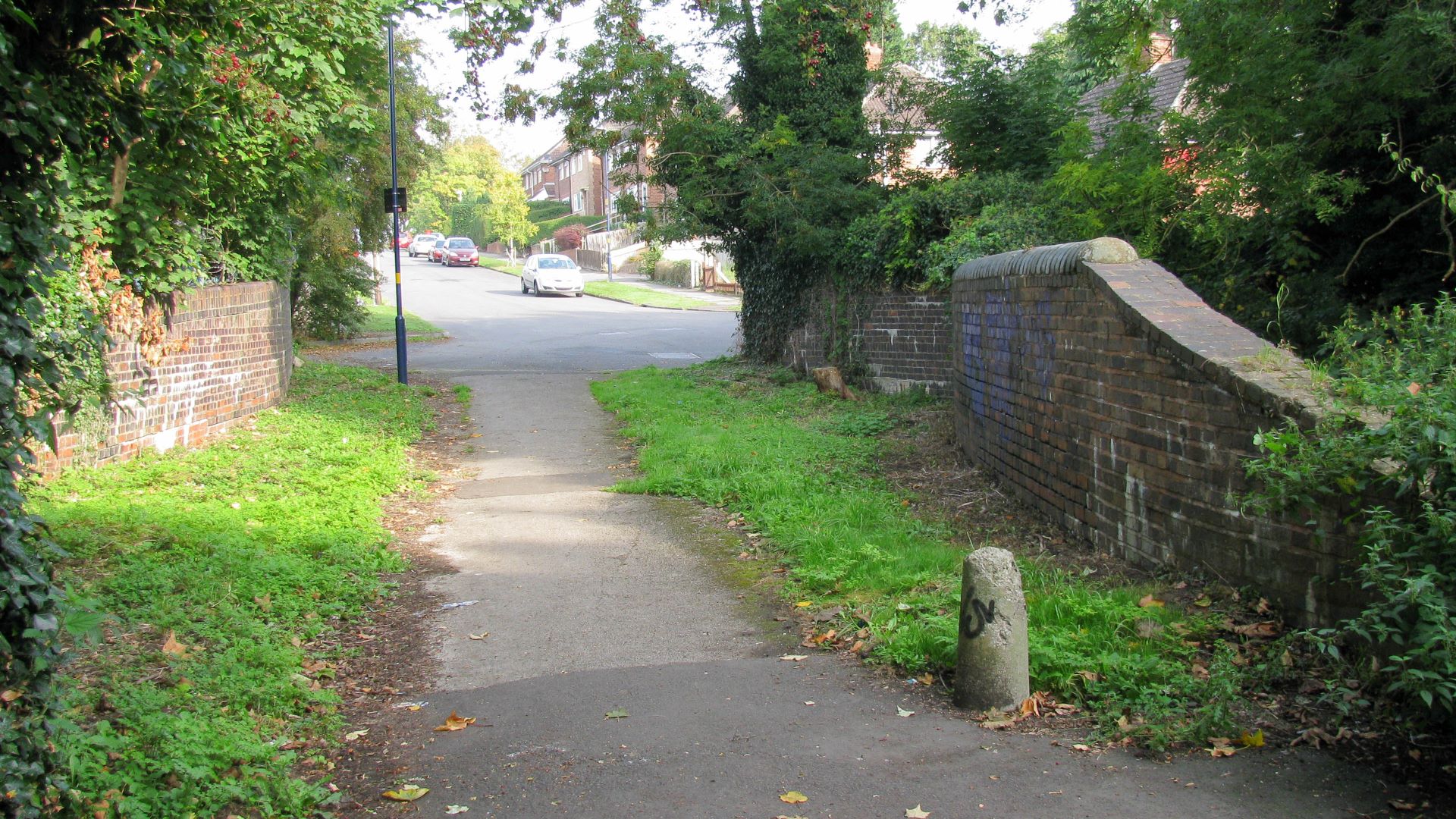
< Next Lapal Canal Next > < Hawne Basin Selly Oak > There’s a good footpath along the line of the Lapal Canal where it’s easy to forget there are houses close to each side of the route....
< Next Lapal Canal Next > < Hawne Basin Selly Oak > The channel still holds water in places after Weoley Park Bridge where it passes close to the houses. Waterway and Kilometerage LAPAL 00.530 OS Grid Reference...
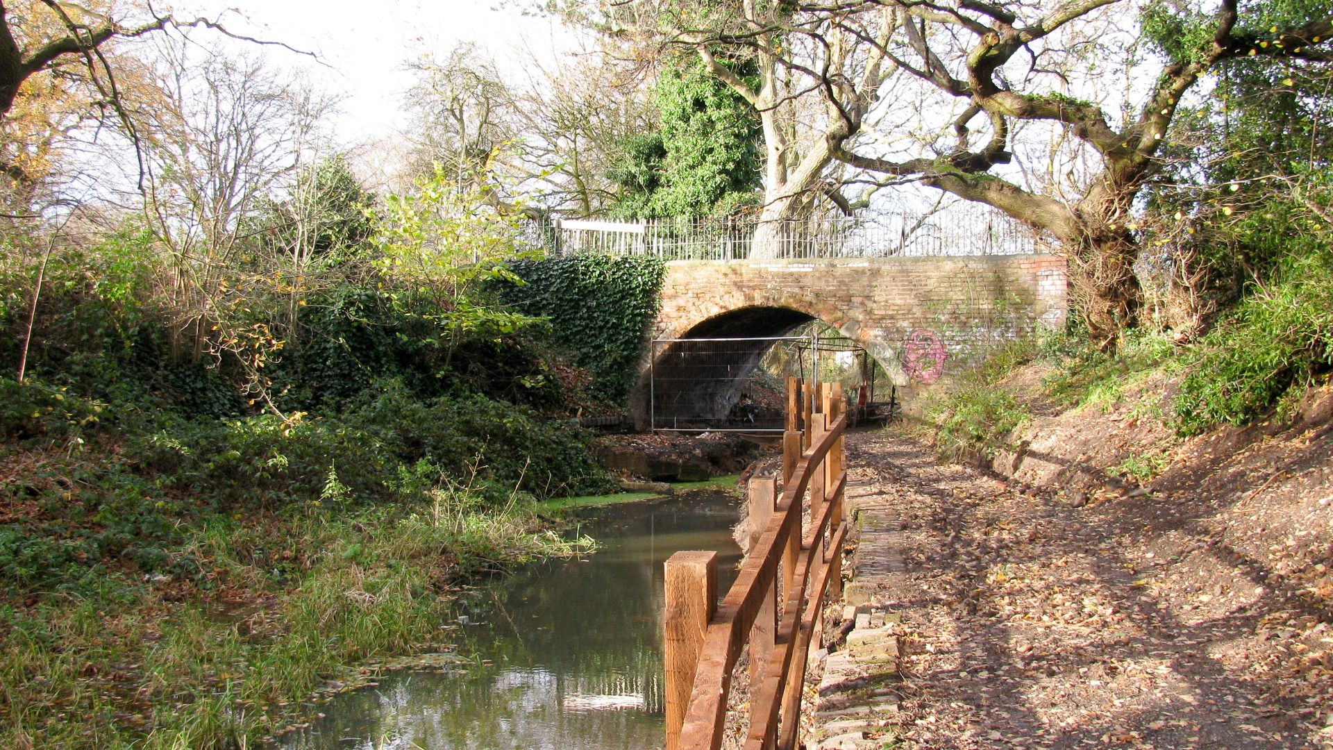
< Next Lapal Canal Next > < Hawne Basin Selly Oak > Weoley Park Bridge is the first traditional bridge still standing at the Selly Oak end of the Lapal Canal. Waterway and Kilometerage LAPAL 00.470.02 OS Grid...
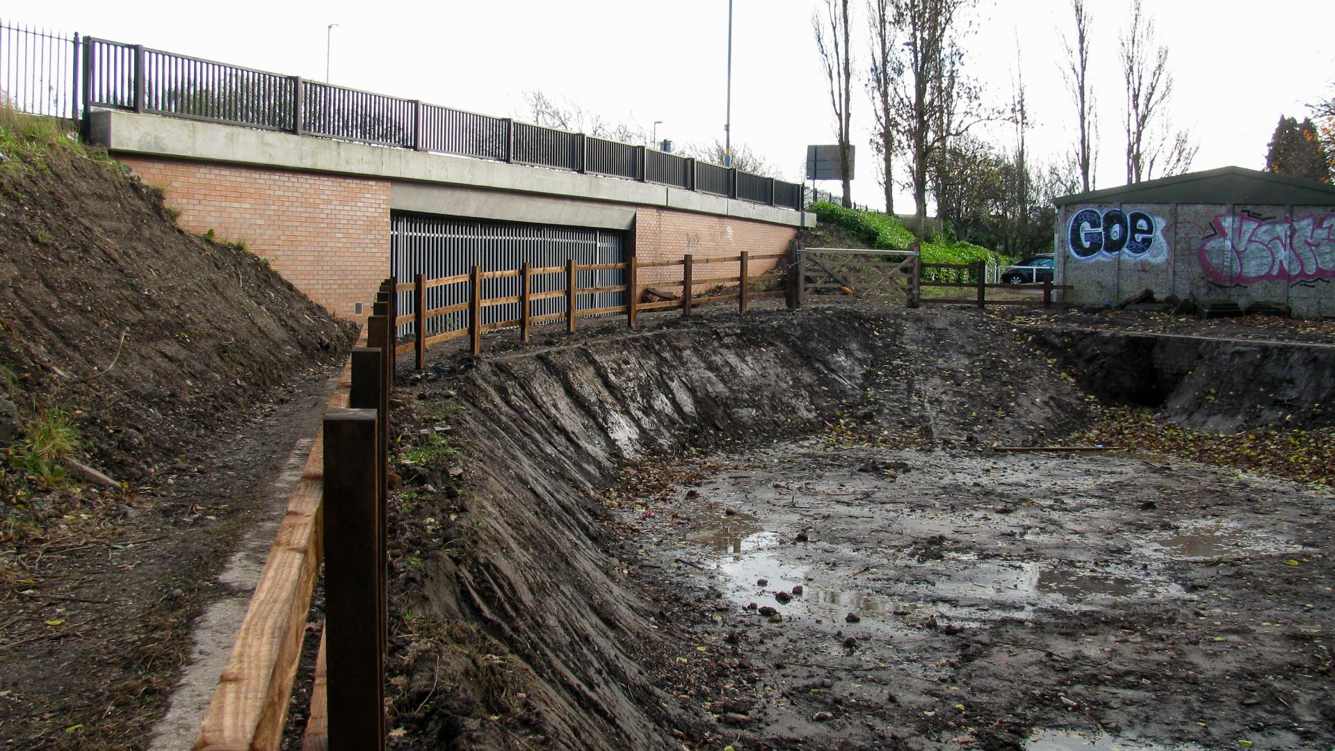
< Next Lapal Canal Next > < Hawne Basin Selly Oak > The modern Harborne Lane Bridge was constructed with navigation clearances and a channel in anticipation of restoration of the Lapal Canal. The recent excavations have created...
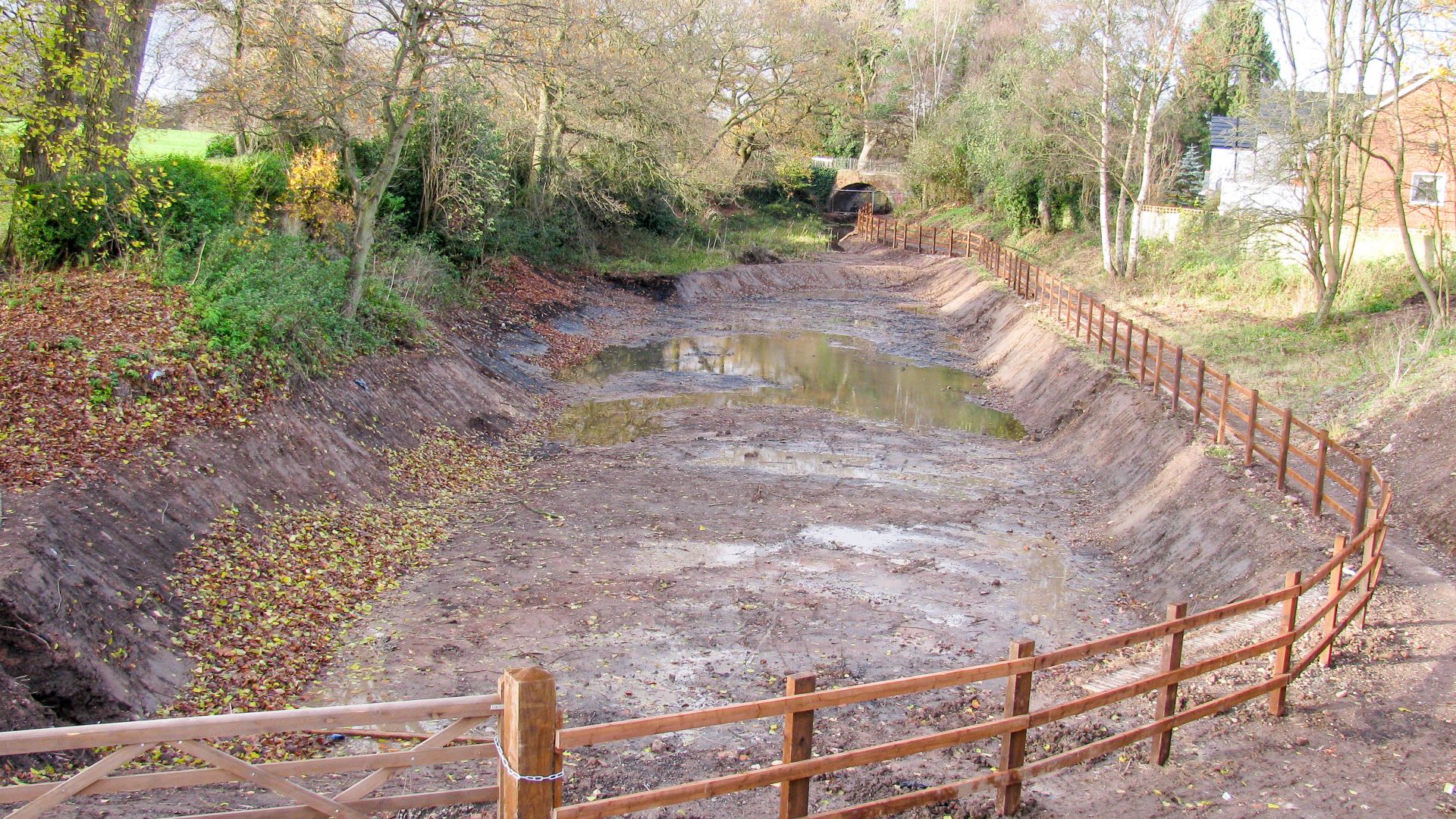
< Next Lapal Canal Next > < Hawne Basin Selly Oak > A section of the Lapal Canal has been dug out and its starting to collect water after rain. The next photo (towards Selly Oak) shows a...
< Next Lapal Canal Next > < Hawne Basin Selly Oak > Looking down from a modern road bridge the line of the Lapal Canal can be seen, with the towpath still used as a footpath. The next...
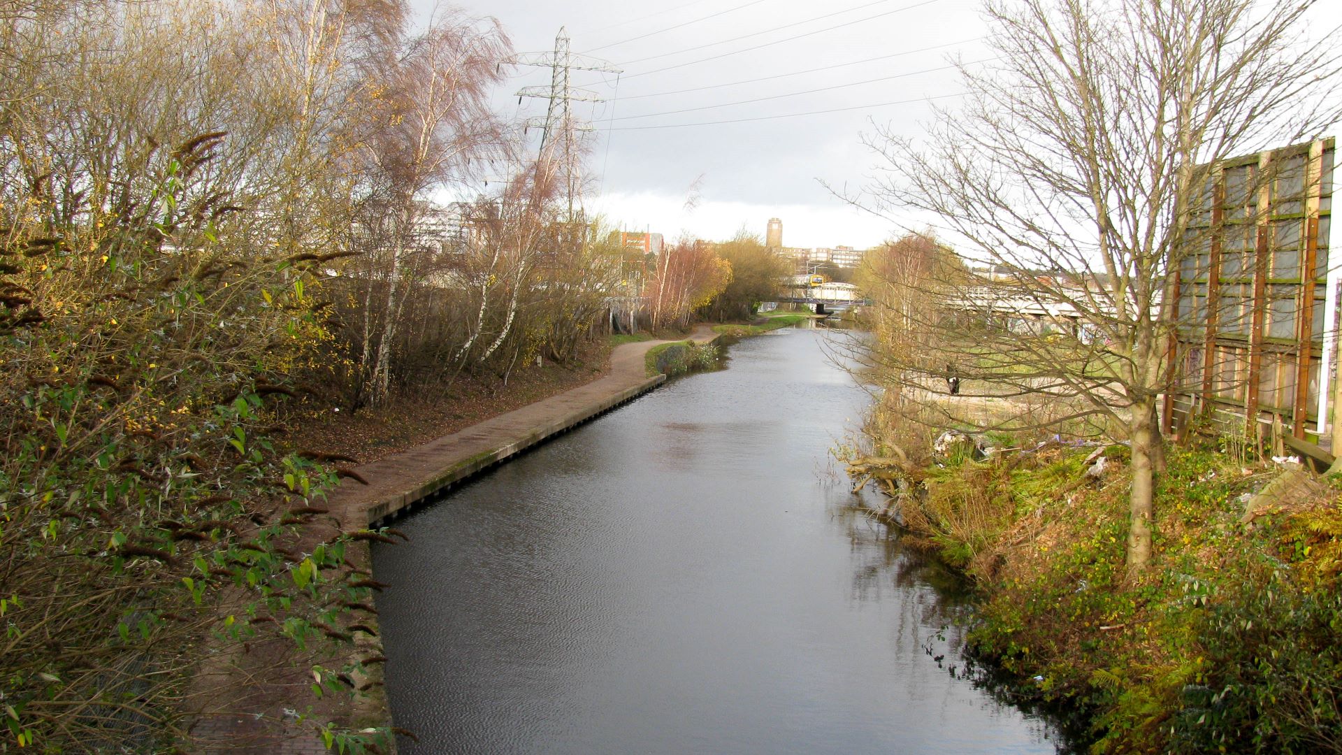
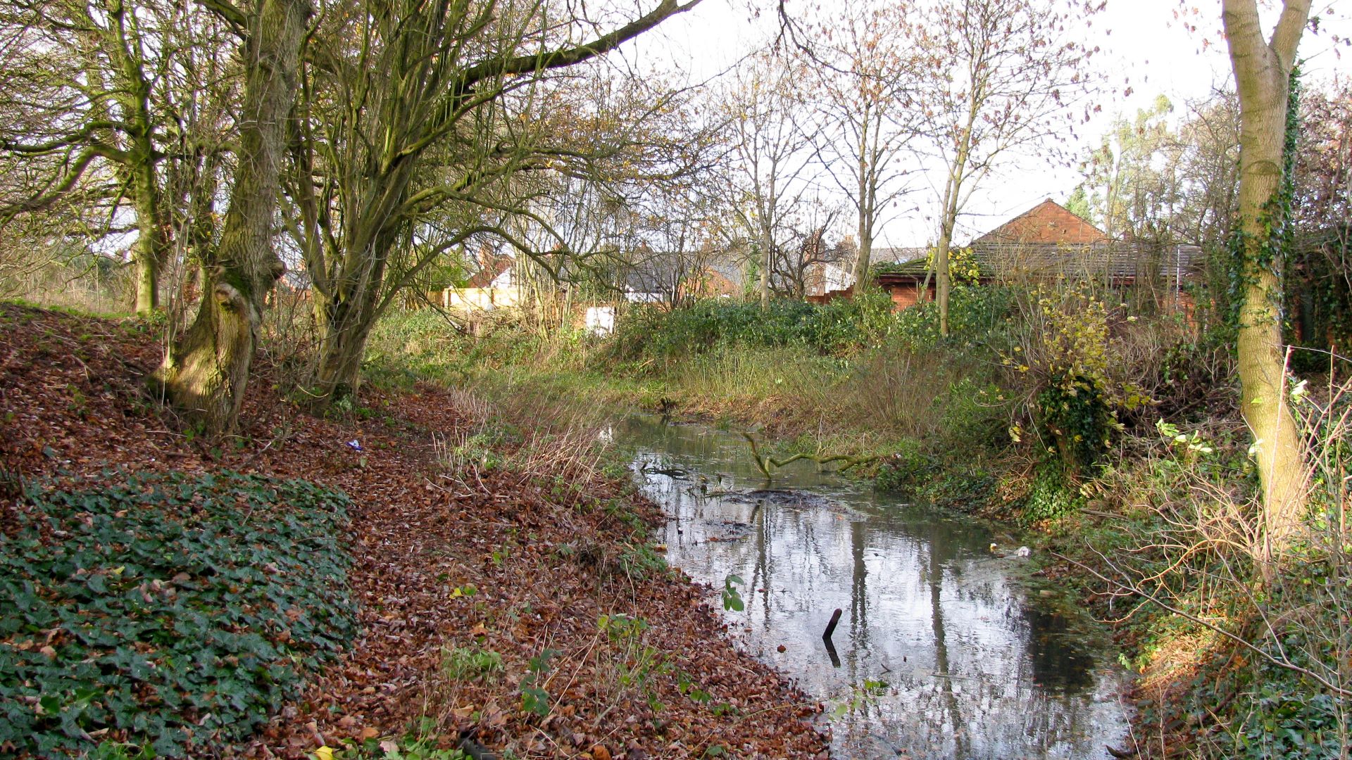
< Next Lapal Canal Next > < Hawne Basin Selly Oak > Looking north, along the Worcester & Birmingham Canal towards Birmingham from Bristol Road Bridge 80. The Dudley No 2 Canal once came in from the left,...
< Next Lapal Canal JUMP TO> < Hawne Basin Hawne Basin > The Dudley No 2 Canal once came through the building site to meet the Worcester & Birmingham Canal near the centre of the photo. The...
< Next St Helens Canal Next > < Old Double Locks Jn Warrington > The recent path follows the line of the canal under the Railway Viaduct, known locally as Nine Arches, which carries the Chat Moss Line from...
< Next St Helens Canal Next > < Earlestown Warrington > Bradley Lock, looking uphill, although the ground level suggests otherwise. The level of the land and the towpath above the lock are at the same level as that...
< Next St Helens Canal Next > < Earlestown Warrington > Bradley Lock has interesting holes in the stonework. I expect someone knows what they were for. Waterway and Kilometerage HELENS 16.680.01 OS Grid Reference SJ 57338 94433 Date and Time...
< Next St Helens Canal Next > < Earlestown Warrington > Bradley Lock, viewed from below, showing a small rise in canal level. Waterway and Kilometerage HELENS 16.625 OS Grid Reference SJ 57399 94406 Date and Time 151229 140637...
< Next St Helens Canal Next > < Earlestown Warrington > Below Bradley Lock another swing bridge has already been restored, waiting for boats to pass through. Waterway and Kilometerage HELENS 16.350 OS Grid Reference SJ 57672 94408 Date...
< Next St Helens Canal Next > < Earlestown Warrington > Approaching Hey Lock from below. Waterway and Kilometerage HELENS 15.400 OS Grid Reference SJ 58233 93729 Date and Time 151229 135918 Copyright © Paul Balmer
< Next St Helens Canal Next > < Earlestown Warrington > A cycle and walking path follows the line of the canal for most of the length, including the approach to Earlestown. Waterway and Kilometerage HELENS 14.905 OS Grid...
< Next St Helens Canal Next > < Earlestown Warrington > The West Coast Railway Line runs parallel to the canal for 2½ km (1½ miles) to the north of Warrington Bank Quay station and the gates of Winwick Lock...
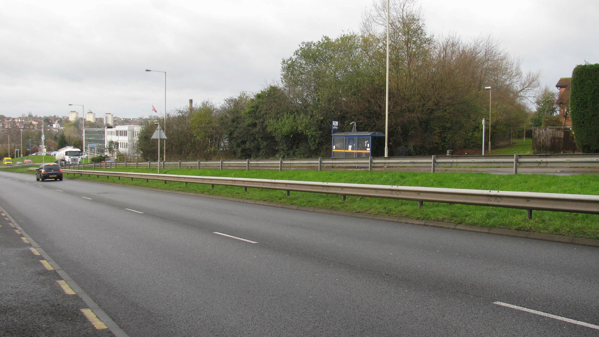
< Next St Helens Canal Next > < Earlestown Warrington > The grass marks the line of the canal which heads straight for the embankment of the modern M62 motorway. There’s certainly enough height difference to construct a bridge...
< Next St Helens Canal Next > < Earlestown Warrington > Looking into the dry dock from the lift bridge. Boats would have been maintained in here, after the water had been let out through sluices, into the Sankey...
< Next St Helens Canal Next > < Earlestown Warrington > The hand rails on the left are for a Lift Bridge which crosses the entrance to the dry dock. There’s no lifting mechanism, just a hinge at the...
< Next St Helens Canal Next > < Earlestown Warrington > The outline of Hulme Lock is clearly visible. We’re looking northwards, that’s uphill, yet the land level beyond the lock is lower than the lock. Subsidence from coal...
< Next St Helens Canal Next > < Earlestown Warrington > The channel is kept dredged and clear of vegetation where it’s shared with the Sankey Brook to allow flood water to pass through, on its way to the...
< Next St Helens Canal Next > < Earlestown Warrington > Starting about 550m north of Bewsey Lock, and for almost 1km (1/2 mile), the Sankey Brook has been diverted to run along the St Helens Canal. Don’t let the name...
< Next St Helens Canal Next > < Earlestown Warrington > The structure of Bewsey Lock is still there, waiting to be restored, with the gate recesses clearly visible in the stonework. The channel to the north is still...
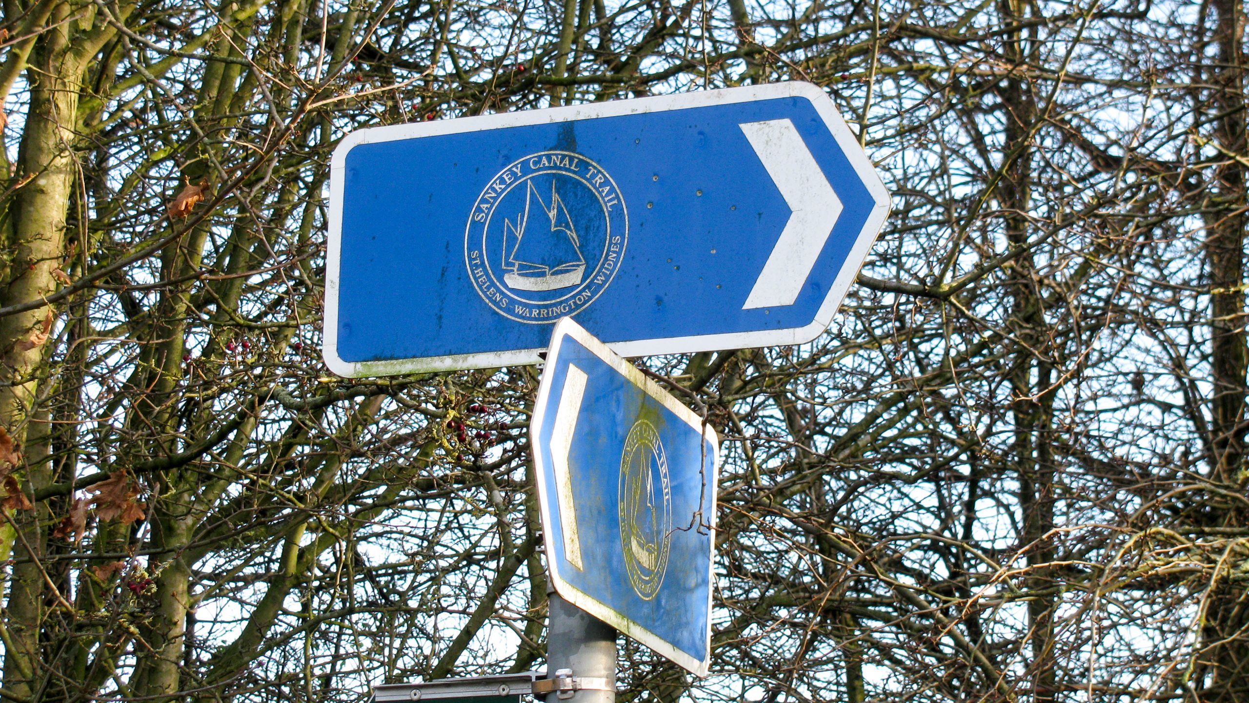
< Next St Helens Canal Next > < Earlestown Warrington > Free Maps of the St Helens (Sankey) Canal. The Sankey Canal Trail crosses the swing bridge at Bewsey Lock and generally follows the canal, although not as close...
< Next St Helens Canal Next > < Earlestown Warrington > A modern swing bridge replaces the former swing bridge across Bewsey Lock. This is ready to swing once the vegetation is cleared and the lock is restored. It...
< Next St Helens Canal Next > < Earlestown Warrington > An interpretation board at Bewsey Lock provides lots of information about the lock, the swing bridge across it, and the surrounding area. Waterway and Kilometerage HELENS 10.630.01 OS...
< Next St Helens Canal Next > < Earlestown Warrington > The walls and basic structure of Bewsey Lock are still there, ready for restoration. Like all the locks on the St Helens Canal, this is a broad lock...
< Next St Helens Canal Next > < Earlestown Warrington > The narrow road bridge (nearest the camera) was a swing bridge but is now fixed. A modern footbridge (with the white railings) is also fixed and both prevent navigation...
< Next St Helens Canal Next > < Earlestown Warrington > Viewed from the foot of the Sankey (Seven Arches) Railway Viaduct the canal looks ready for boats. Waterway and Kilometerage HELENS 09.930 OS Grid Reference SJ 58994 89036...
< Next St Helens Canal Next > < Warrington Widnes > Another footbridge already high enough for navigation, above a channel looking ready for navigation. Waterway and Kilometerage HELENS 09.565.02 OS Grid Reference SJ 59058 88663 Date and Time 151229...
< Next St Helens Canal Next > < Warrington Widnes > The Sankey Valley Park, with lots of amenities, follows the line of the St Helens Canal and the adjacent Sankey Brook. Waterway and Kilometerage HELENS 09.565.01 OS...
< Next St Helens Canal Next > < Warrington Widnes > North of Sankey Way there are sections of canal which look ready for navigation. Waterway and Kilometerage HELENS 09.095.02 OS Grid Reference SJ 58976 88214 Date and...
< Next St Helens Canal Next > < Warrington Widnes > Sankey Way will require raising to create navigation clearances. Waterway and Kilometerage HELENS 09.095.01 OS Grid Reference SJ 58976 88214 Date and Time 151229 124941 Copyright ©...
< Next St Helens Canal Next > < Warrington Widnes > Sankey Way crosses the canal just above water level in the centre of this photo. Fortunately there seems to be space to raise the road to create navigation...
< Next St Helens Canal Next > < Warrington Widnes > Looking down from the footbridge it’s not hard to imagine a little dredging taking place to clear the channel for navigation. Waterway and Kilometerage HELENS 08.730.02 OS...
< Next St Helens Canal Next > < Warrington Widnes > Continuing beyond the two fixed rail and road bridges the next bridge is a footbridge with navigation clearance across a channel that looks ready for boats already. Although...
< Next St Helens Canal Next > < Warrington Widnes > Liverpool Road Bridge, around 100m from the fixed railway bridge, is another fixed bridge which will require considerable money and ingenuity to find an acceptable solution to make...
< Next St Helens Canal Next > < Warrington Widnes > Parallel to the fixed railway bridge is a swing footbridge that was restored some time ago and, although it looks like it could do with a lick...
< Next St Helens Canal Next > < Warrington Widnes > Now fixed too low for navigation the former swing railway bridge will be one of the more difficult problems to tackle during restoration of the canal. This is...
< Next St Helens Canal Next > < Warrington Widnes > Several long lengths of the St Helens Canal have fencing between the towpath and the canal with red signs saying “No Angling” and warning of the unstable...
< Next St Helens Canal Next > < Warrington Widnes > Marsh Swing Bridge is another which no longer swings. There’s also a pipe running across the canal at bridge deck level, just to the right of the bridge...
< Next St Helens Canal Next > < Warrington Widnes > Modern housing approaches the north side of the canal, but is separated by the railway which still runs parallel to the canal. The towpath is great for...
< Next St Helens Canal Next > < Warrington Widnes > Penketh Swing Bridge is another bridge now fixed across the canal. Waterway and Kilometerage HELENS 06.370 OS Grid Reference SJ 56801 86987 Date and Time 151229 121044 Copyright...
< Next St Helens Canal Next > < Warrington Widnes > The second swing bridge after Fiddler’s Ferry Lock is now fixed. Restoration of the canal will require it to swing again. Waterway and Kilometerage HELENS 05.830 OS Grid...
< Next St Helens Canal Next > < Warrington Widnes > Lots of moored boats on the open section of the St Helens Canal. Waterway and Kilometerage HELENS 05.650 OS Grid Reference SJ 56196 86610 Date and Time 151229...
< Next St Helens Canal Next > < Warrington Widnes > The first swing bridge to the east of Fiddler’s Ferry Lock is still operational and divides the open section of the St Helens Canal into two parts. Waterway...
< Next St Helens Canal Next > < Warrington Widnes > The River Mersey, looking upstream at Fiddler’s Ferry Lock, where it’s starting to look more like a river than a tidal estuary. Waterway and Kilometerage HELENS 05.515.04 OS...
< Next St Helens Canal Next > < Warrington Widnes > Fiddler’s Ferry Lock links the 600m open section of canal to the tidal River Mersey. The first stage of restoration of the St Helens Canal proposes to...
< Next St Helens Canal Next > < Warrington Widnes > Looking East along the St Helens Canal the swing bridge on the right carries the towpath across Fiddler’s Ferry Lock which grants access to the tidal River...
< Next St Helens Canal Next > < Warrington Widnes > A 660m section of canal is open next to Fiddler’s Ferry Lock, running east from Marsh House Swing Bridge. Waterway and Kilometerage HELENS 05.355.02 OS Grid Reference SJ...
< Next St Helens Canal Next > < Warrington Widnes > Looking west from the fixed Marsh House Swing Bridge shows the channel is completely filled with reeds,but practical to restore. Waterway and Kilometerage HELENS 05.355.01 OS Grid Reference...
< Next St Helens Canal Next > < Warrington Widnes > Marsh House Swing Bridge is now a fixed structure where the road crosses the adjacent railway at a level crossing. The bridge forms the current limit of...
< Next St Helens Canal Next > < Warrington Widnes > A modern bridge strides across the canal and the adjacent railway, replacing an old swing bridge and level crossing just to the east. Waterway and Kilometerage HELENS 03.855...
< Next St Helens Canal Next > < Warrington Widnes > A local watercourse, once passed under the canal at an aqueduct and now crosses in an open channel. The pipe across the channel maintains the water flow between...
< Next St Helens Canal Next > < Warrington Widnes > The handrail across the canal marks the location of a missing aqueduct where a local watercourse once passed under the canal and now cuts across the canal in...
< Next St Helens Canal Next > < Warrington Widnes > A cormorant finds the redundant signal post a handy perching place to look down on the canal and across the adjacent River Mersey. Waterway and Kilometerage HELENS 02.625.02...
< Next St Helens Canal Next > < Warrington Widnes > Looking west, along the tidal River Mersey, from one of the viewpoints along the St Helens Canal the crane and low level causeway in the foreground are...
< Next St Helens Canal Next > < Warrington Widnes > The St Helens Canal runs close to the tidal River Mersey for the first 8 km (5 miles). Looking to the west we can see the three cranes starting to...
< Next St Helens Canal Next > < Earlestown Widnes > Known as the “Seven Arches” there are seven arches plus one flat span across the canal. There are suggestions that the flat span once lifted to allow masted...
< Next St Helens Canal Next > < Warrington Widnes > Fiddler’s Ferry Power station sits near the canal. A freight only railway line runs parallel to the canal and is used to bring coal to the power station. A...
< Next St Helens Canal Next > < Warrington Widnes > The towpath changes sides at Carter House Swing Bridge which has recently been replaced and seems to be in full working order, just waiting for boats to pass....
< Next St Helens Canal Next > < Warrington Widnes > The entrance lock is in full working order and available for use when the tide is in. A well used footpath runs across the top gate. The...
< Next St Helens Canal Next > < Warrington Widnes > Looking towards the River Mersey from the entrance lock to the St Helens Canal when the tide is out. Waterway and Kilometerage HELENS 00.045.02 OS Grid Reference SJ...
< Next St Helens Canal Next > < Warrington Widnes > The entrance lock to the St Helens Canal from the tidal River Mersey is only useable near high tide. There were once a pair of locks here and...
< Next St Helens Canal JUMP TO > < Warrington Earlestown > The entrance to the St Helens Canal in Widnes is from the tidal River Mersey and only useable near high tide. Waterway and Kilometerage HELENS 00.000.00 OS Grid Reference...
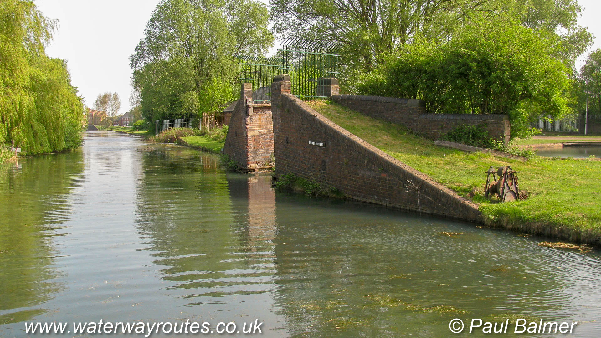
Select one of these starting points then keep clicking on the “Next” link to progress along the Bradley Arm.
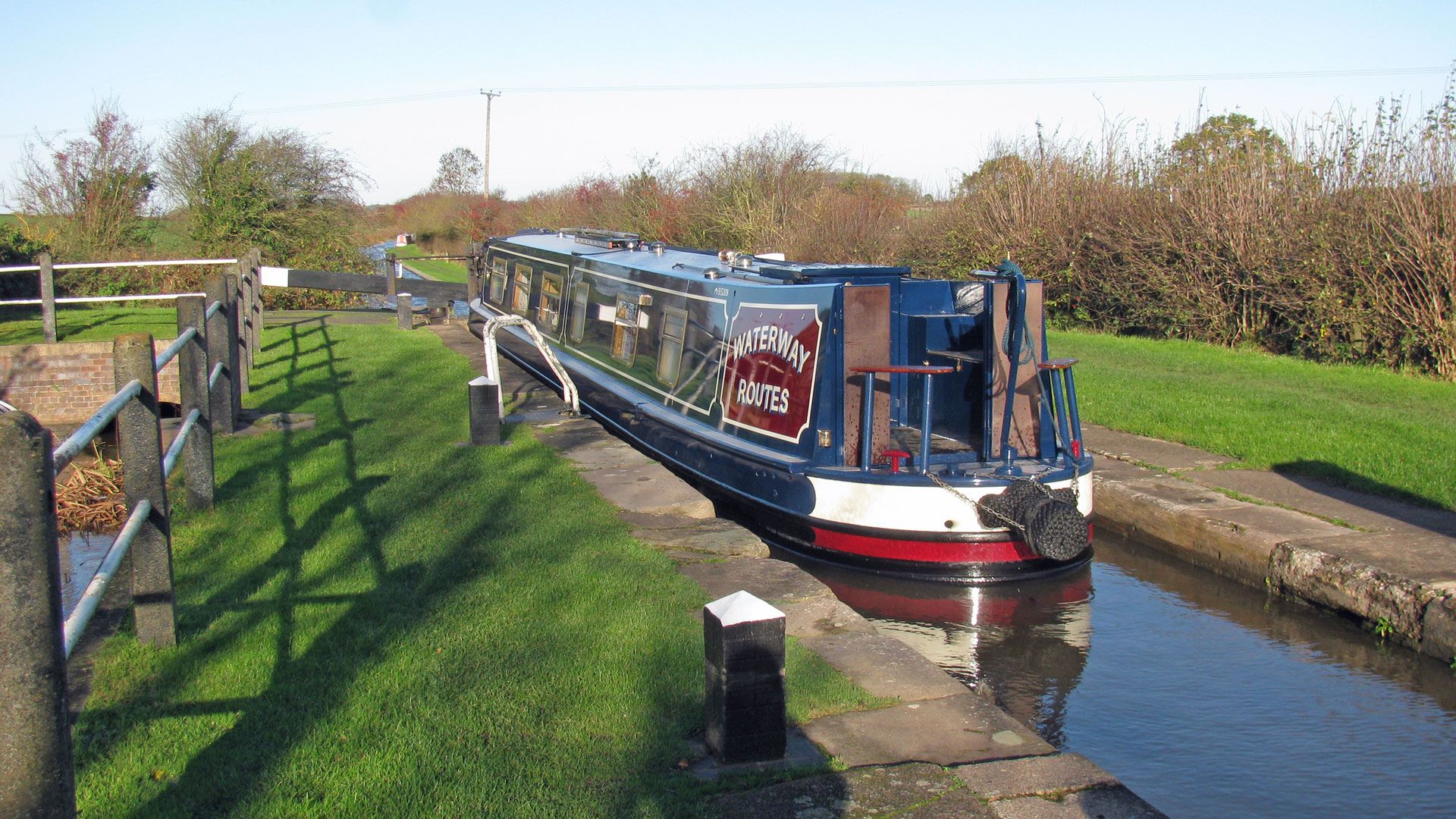
We’re heading home with our repainted Waterway Routes Narrowboat. The sunshine looks nice but it was bitterly cold. There was a sprinkling of snow on the boat this morning and it took until nearly lunchtime...
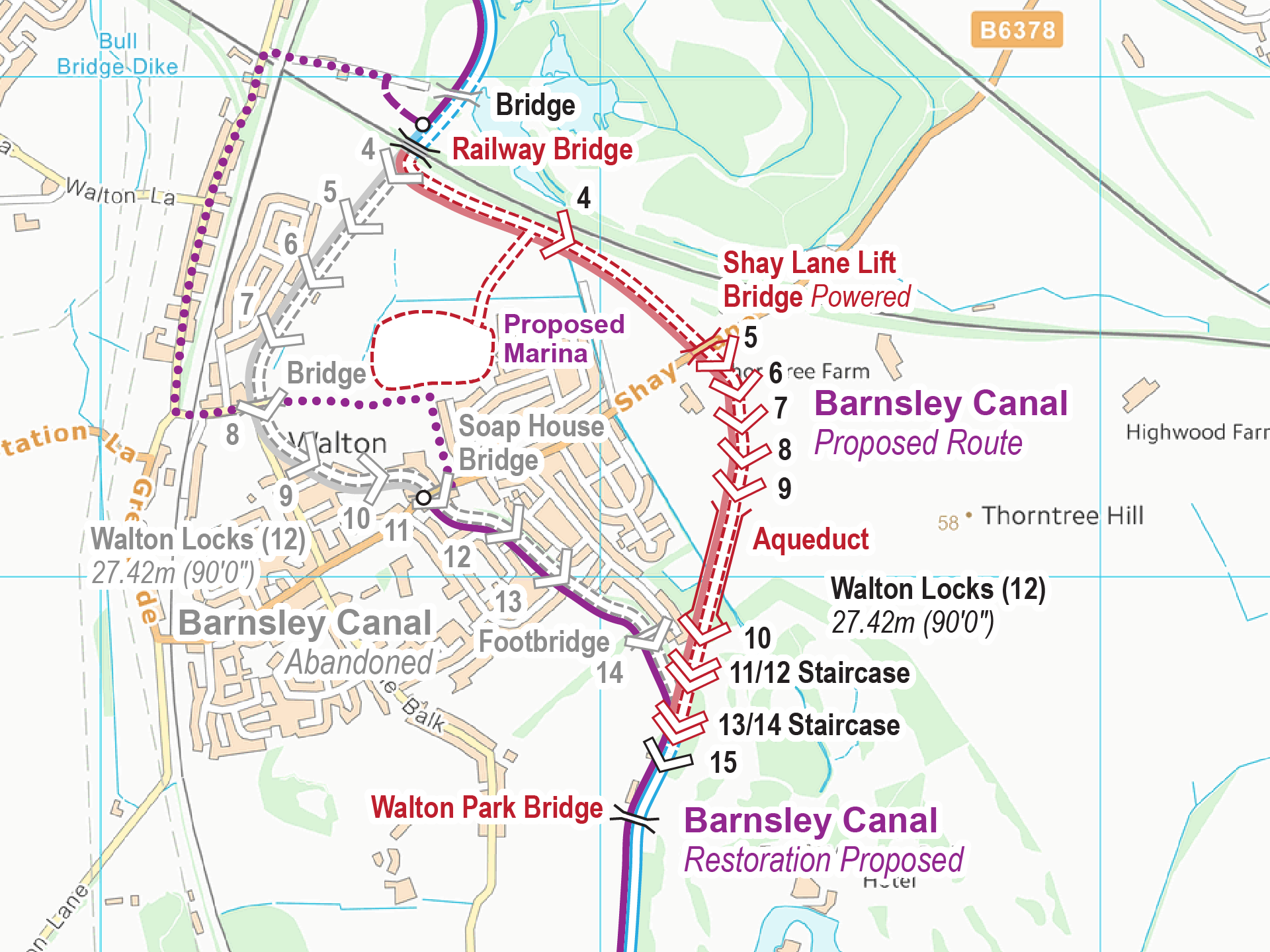
The Barnsley and Dearne & Dove Canals are derelict, with plans for restoration. Together they will form a through route between the Aire & Calder Navigation and the Sheffield and South Yorkshire Navigation. There are...
 England & Wales Waterway Map for Download
by John DiDonato
England & Wales Waterway Map for Download
by John Charnock
England & Wales Waterway Map for Download
by John DiDonato
England & Wales Waterway Map for Download
by John Charnock
 Llangollen Canal Map for Download
by Mike Moreau
Llangollen Canal Map for Download
by Mike Moreau
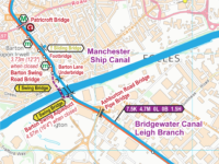 Bridgewater Canal Map for Download
by PAUL DUNNING
Bridgewater Canal Map for Download
by PAUL DUNNING
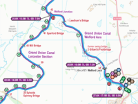 East Midlands (Leicester) Ring Map for Download
by John Howells
East Midlands (Leicester) Ring Map for Download
by John Howells
 RSS Blog Feed
Recent Comments