Map Updates – Spring 2026
I am pleased to say the Spring 2026 updates for my maps are are now available.
Quarterly map updates mean you not only start with an up to date map but you can keep them up to date too.
All of my maps have updated Ordnance Survey (OS) background maps this quarter.
In addition, those maps with significant waterway updates this quarter include:-
Whole Country Map
Rings
- Black Country Ring Map
- East Midlands Ring Map
- Four Counties Ring Map
- Mid Worcestershire Ring Map
- South Pennine Ring Map
Waterways
- Aire & Calder and Calder & Hebble Navigations Map
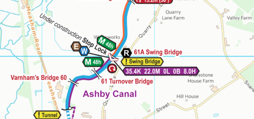
- Ashby Canal Map
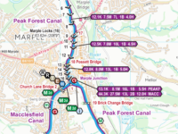
- Ashton and Peak Forest Canals Map
- Birmingham Canal Navigations (BCN) Map
- Bridgewater Canal Map
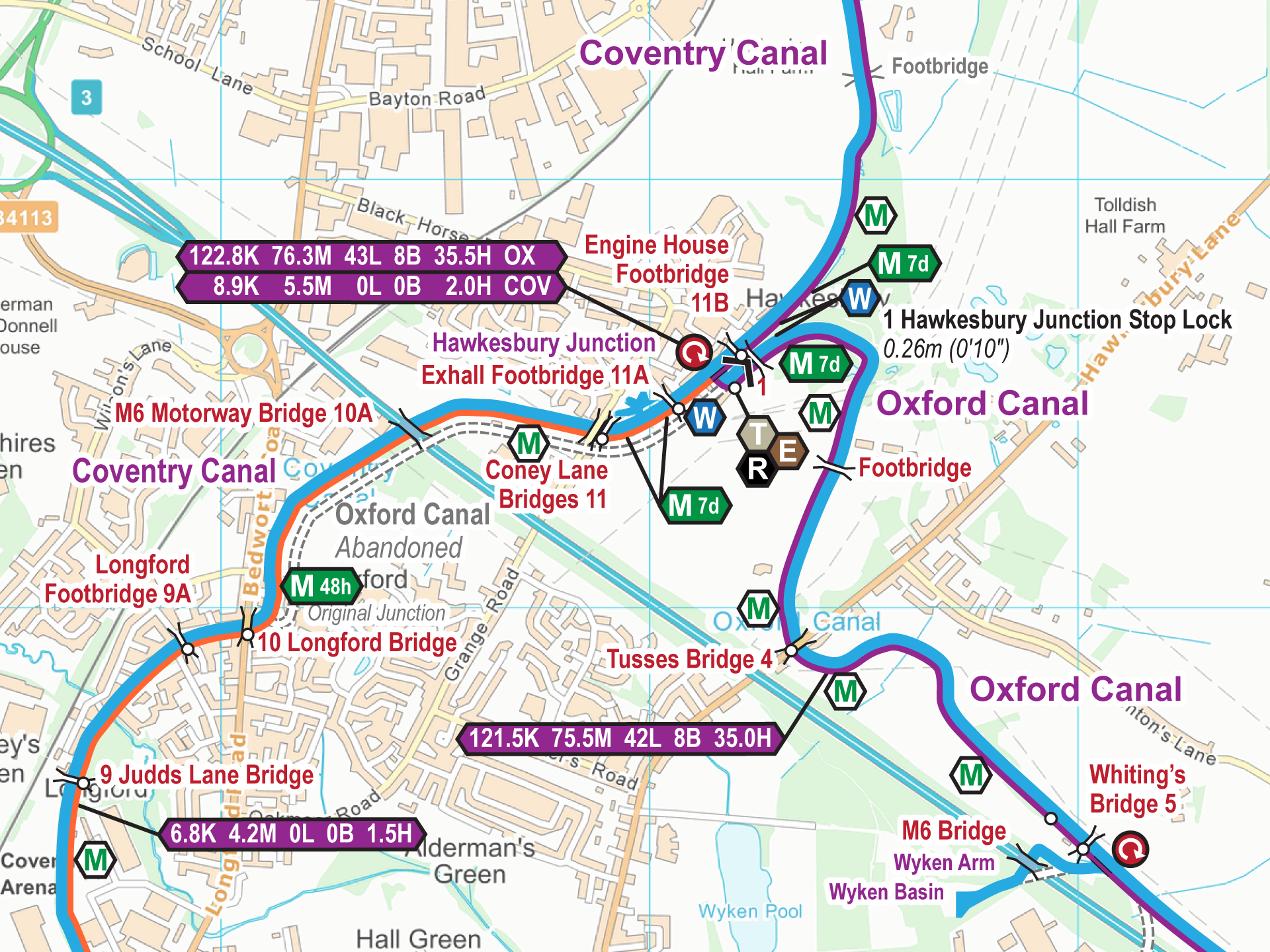
- Coventry Canal Map
- Droitwich Canals Map – FREE
- Grand Union Canal (All) Map
- Grand Union Canal (Leicester Section) Map
- Grand Union Canal (North) Map
- Grand Union Canal (South) Map
- Herefordshire & Gloucestershire Canal Map – FREE
- Huddersfield Canal Map
- Kennet & Avon Canal Map
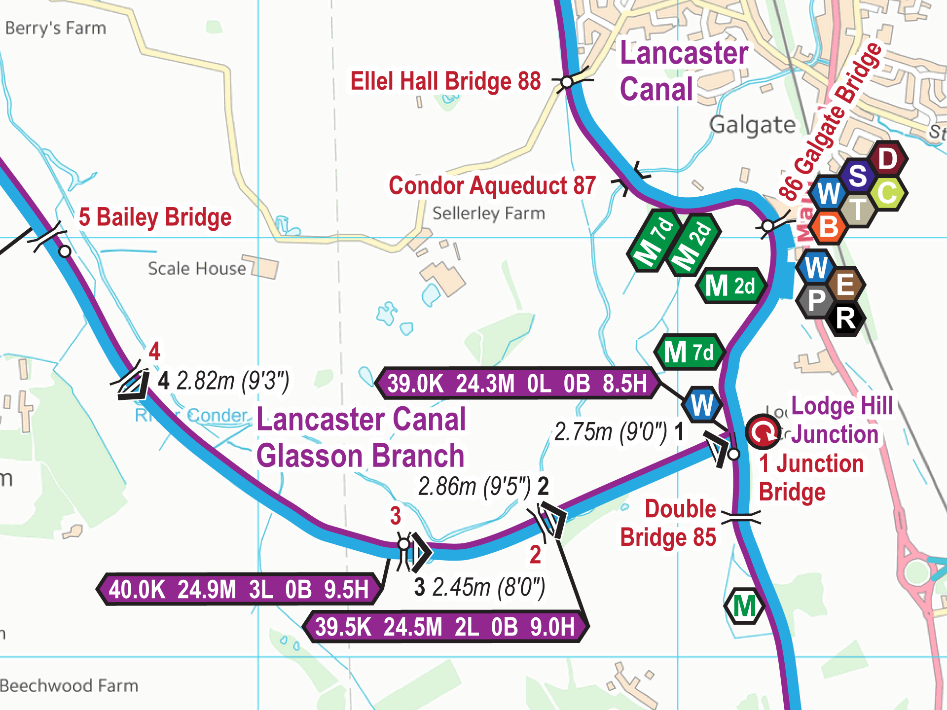
- Lancaster Canal Map
- Lee & Stort Navigations Map
- Leeds & Liverpool Canal Map
- Llangollen Canal Map
- Macclesfield Canal Map
- Oxford Canal Map
- Pocklington Canal Map – FREE
- River Avon Canal Map – FREE
- River Great Ouse Map
- River Ouse and Tributaries Map
- River Severn and Gloucester & Sharpness Canal Map
- River Thames (All) Map
- River Thames (Lower) Map
- Rochdale Canal Map
- Sheffield & South Yorkshire Navigations Map
- Shropshire Union Canal Map
- Staffs & Worcester Canal Map
- Stratford upon Avon Canal Map
- Trent & Mersey Canal Map
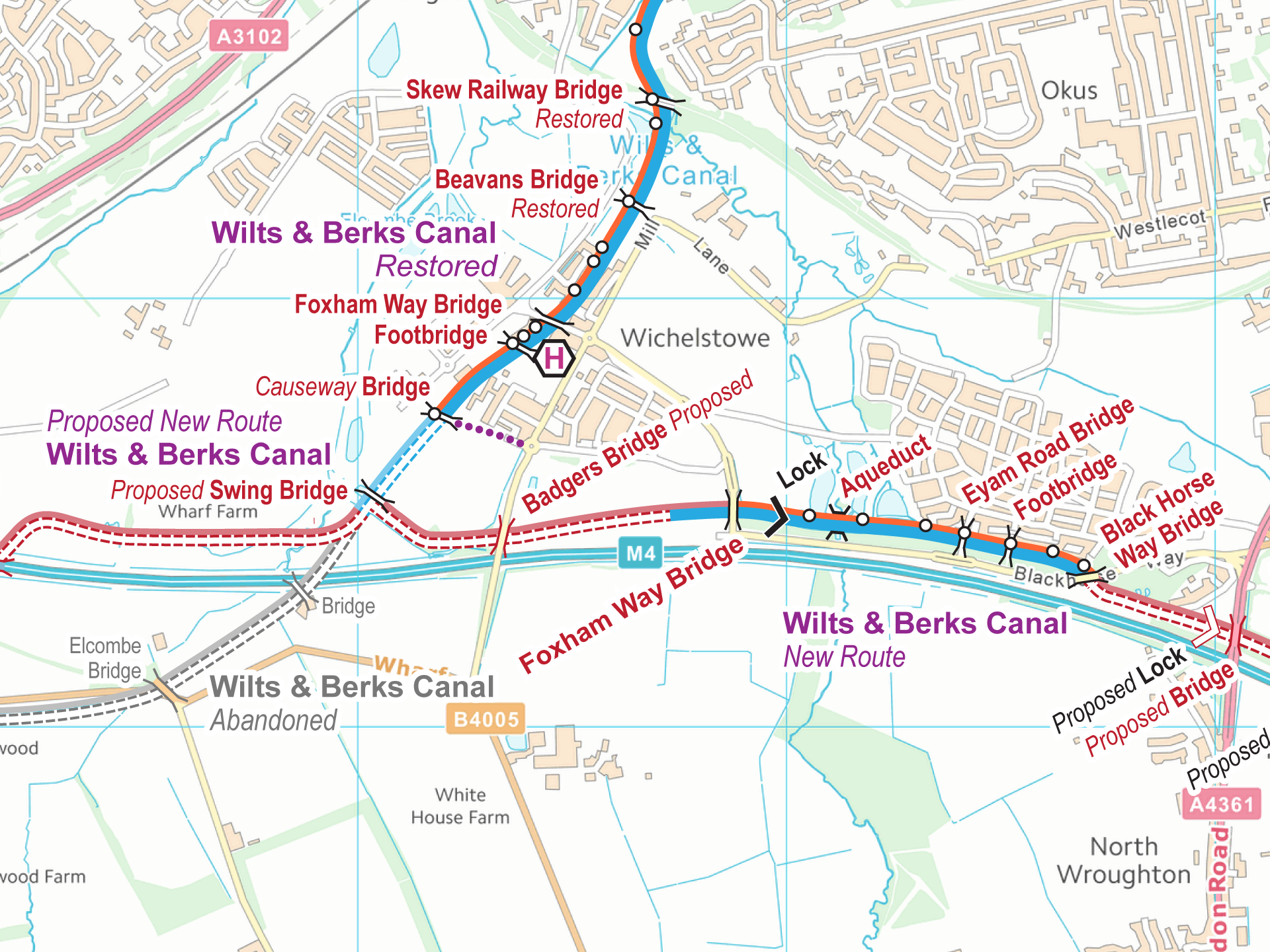
- Wilts & Berks Canal Map – FREE
- Worcester & Birmingham Canal Map
 RSS Blog Feed
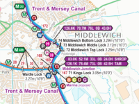

Recent Comments