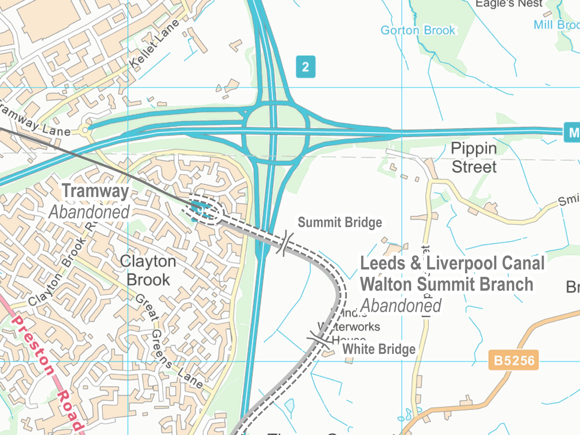
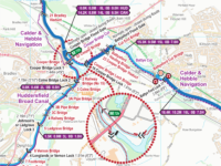
Walton Summit Branch Maps
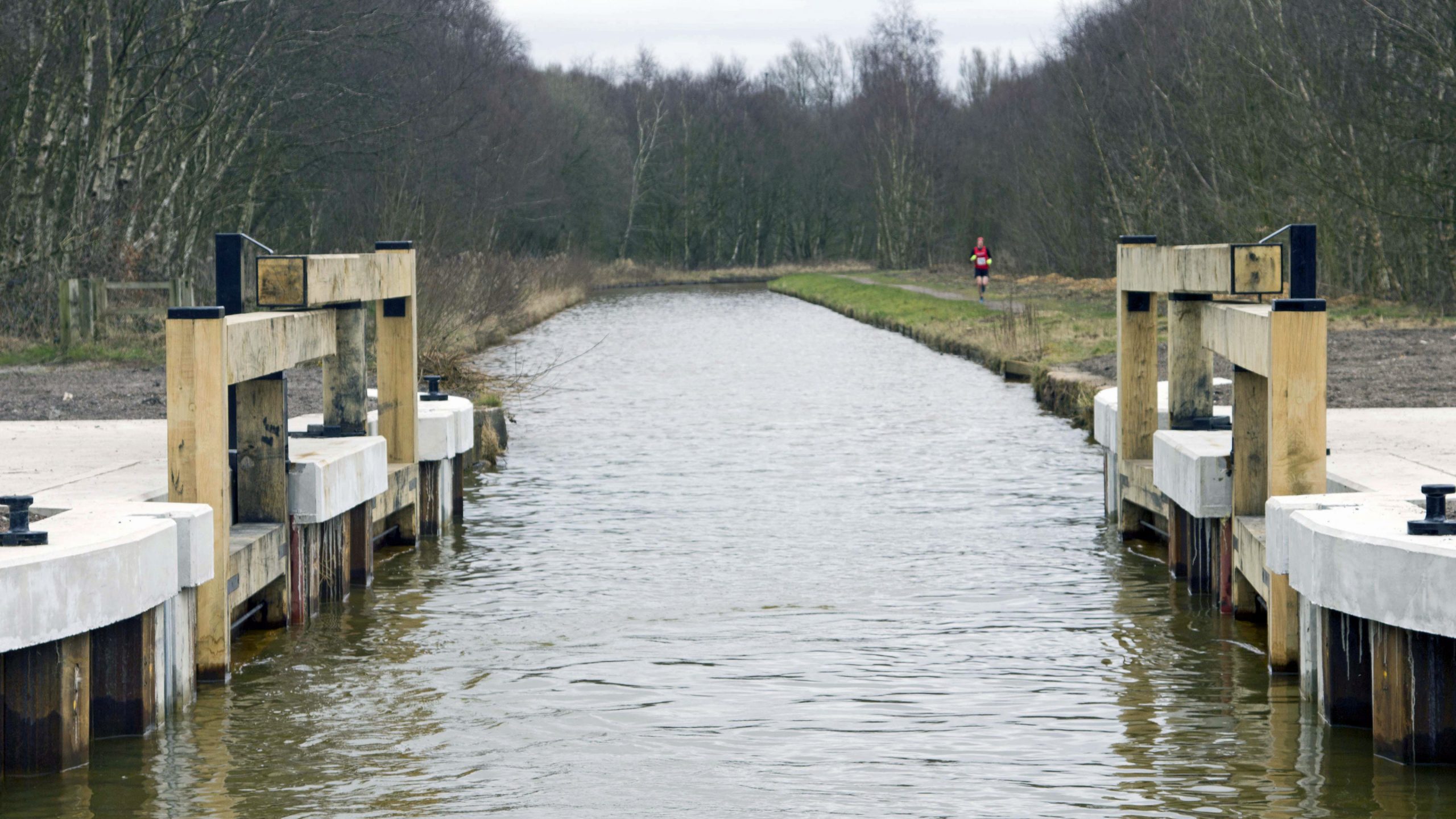
Ths south end of the Lancaster Canal was once linked to what we now call the Leeds & Liverpool Canal at the foot of Johnson’s Hillock Locks. The link was by means of a tramway, at the northern end, and a canal at the southern end. Both have been abandoned, with just the short stub end of the branch remaining at Johnson’s Hillock.
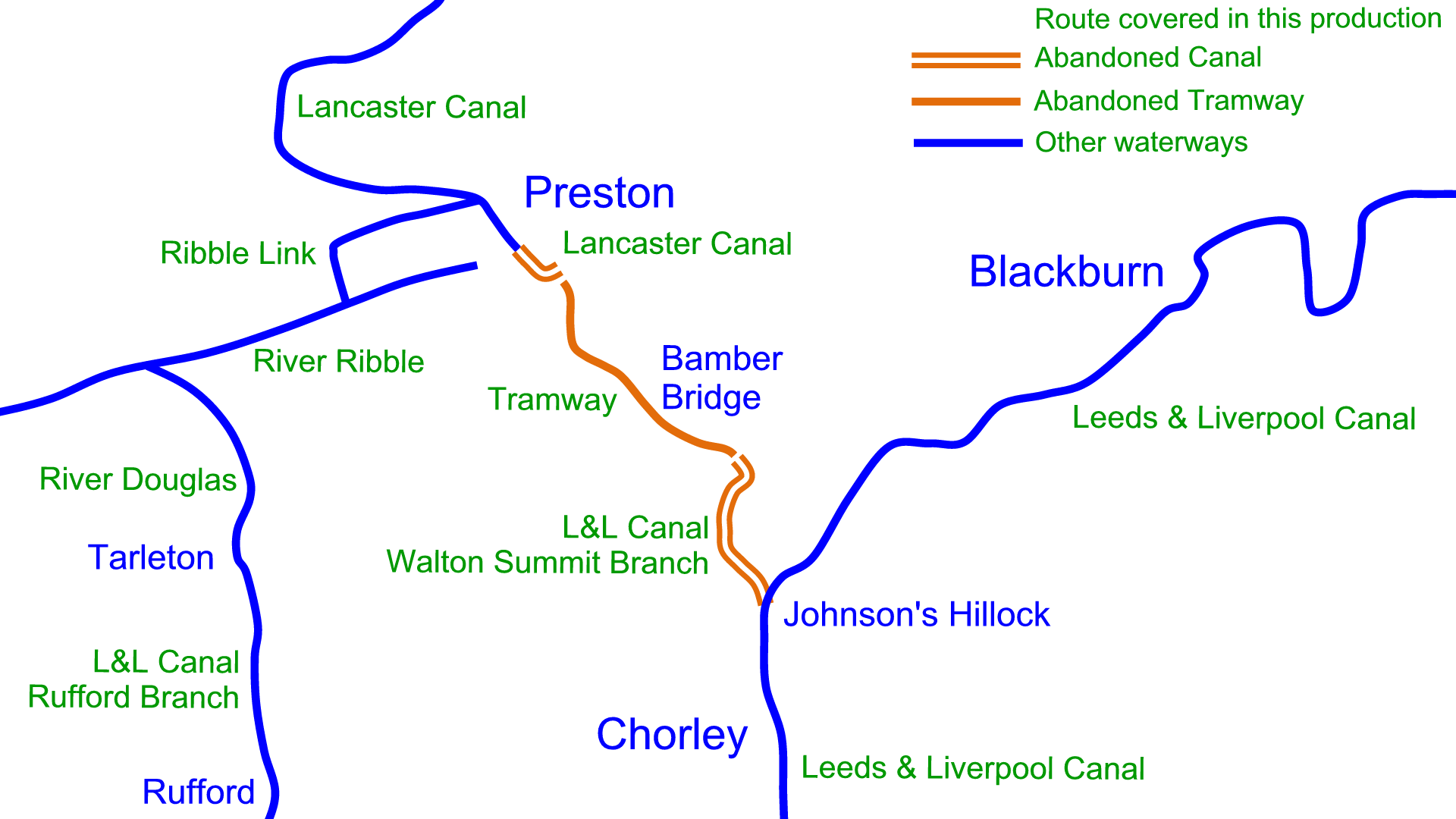
I’ve produced another of my free maps showing the route, although I had trouble deciding what to call it and eventually settled on referring to it as the Walton Summit Branch of the Leeds & Liverpool Canal as that’s the name shown on Old Ordnance Survey Maps.
As with all of ny extensive range of maps for restoration projects and abandoned canals the Walton Summit Branch Maps are free to download. All maps are available in Acrobat (pdf) format and Memory‑Map (qct) format.
Visit the Walton Summit Branch Maps page for further information and the free download links.
 RSS Blog Feed
Iain
Being a local, i was always fascinated at the canal system and the way in which they grew to serve an expanding UK.
My Late father was also, last week i walked the Lancaster canal from Bilsborough to Garstang and was looking at the history and to my surprise, whilst there is a a Ribble link from the Southern end via the Rufford link and the conversion of the River Astland to a canal i never knew of the Western to Preston route. i have lived in area since 1968 and ridden and walked past this once overgrown area so many times, never putting one and two together, My Dad did write a Pamphlet in his later life and walked the route on the Tramway road and still parts are still called Tramway as nearer Preston is so called Tramway road. Really interesting area
Interesting where the link is was a bottling plant called Whittle Springs and there is a restaurant now called the Malt House
http://breweryhistory.com/wiki/index.php?title=Whittle_Springs_Brewery_Ltd
Iain: I’ve not heard of Martin Zero. Paul
Many thanks for the info on this section of canal. My wife and I walked the section of Leeds / Liverpool canal today (20 Oct 2020) from Top Lock at Wheelton to the Botany Bay building and we were intrigued by this “side canal” which was unknown to us. We had wondered if it had served a local old industrial estate and we did not realise that it was the southern end of the Lancaster canal until reading the above data.
Was the tram line built especially to connect the two canals? And why not connect them by extending the two canals? If you have any info on either of these questions we would be grateful if you can share it.
Many thanks, and regards.
Iain: The tramway was built as a temporary solution to link the two sections of the Lancaster Canal. Despite this being a busy section of the “canal” the cost of building a very substantial aqueduct to carry the canal over the River Ribble was never justified and, like many temporary solutions, it became permanent.
There’s more information in the Wikipedia Article Paul
Thanks Paul
All very interesting info and history my wife and I were unaware of. We mentioned it to my brother-in-law who then told us of someone called Martin Zero who does some canal research around the old Manchester waterways and who has some videos on YouTube. This is a link to a fascination one. Do you know the guy?
Regards
Iain
https:ilovemanchester.com/rochdale-canal-viral-video-youtube