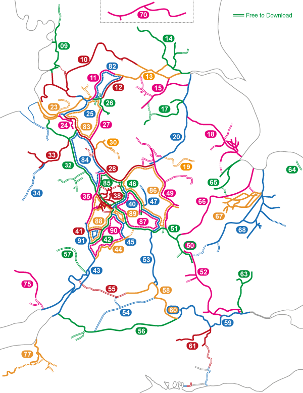
I produce maps for all the waterways coloured on this map. Click on a number to see details of the map.
![]()
Maps and DVDs for the Waterways of Britain
I produce maps for all the waterways coloured on this map. Click on a number to see details of the map.
 England & Wales Waterway Map for Download
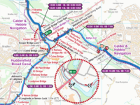
 Cheshire Ring Map for Download
England & Wales Waterway Map for Download
England & Wales Waterway Map for Download
Cheshire Ring Map for Download
England & Wales Waterway Map for Download
England & Wales Waterway Map for Download
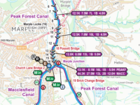
 South Pennine Ring Map for Download
 RSS Blog Feed
Hello Paul.
I’m going to be hiring a boat from Middlewich to Wigan. So that’s probably maps 83 and 11.
It looks like all of map 25 is included in 83 is that correct?
Just want to make sure all my planned route is covered.
Regards, Ian
If you click on the numbers on my map of maps it will take you to the individual map pages with enlargements of the routes covered so you can check exactly what they cover.
The Cheshire Ring Map (83) includes all of the Bridgewater Canal Map (25) and will cover your route from Middlewich as far as Leigh. The last little section of your route from Leigh to Wigan is covered in the Leeds & Liverpool Canal Map (10).