Description
These maps work on Windows, Android, iPhone/iPad and Mac devices providing they have the appropriate App/Software installed.
The licence conditions permit you to use the map on up to five devices (computers, laptops, phones, tablets etc) for personal use. Business licences are available on request.
Shortly after making payment you will receive the download link on screen and by email. Please check your junk mail folders if the email doesn’t appear promptly as your spam filter may have mistaken the download link for spam.
The download link will be valid for 6 months. You may use the link in the email to download any (of all) of the quarterly updates issued during that time to ensure you have the latest version of the map. You can update your map at a discounted price after that.
Please use the free examples to see how good my maps are and check you can conquer the download and installation process before ordering.
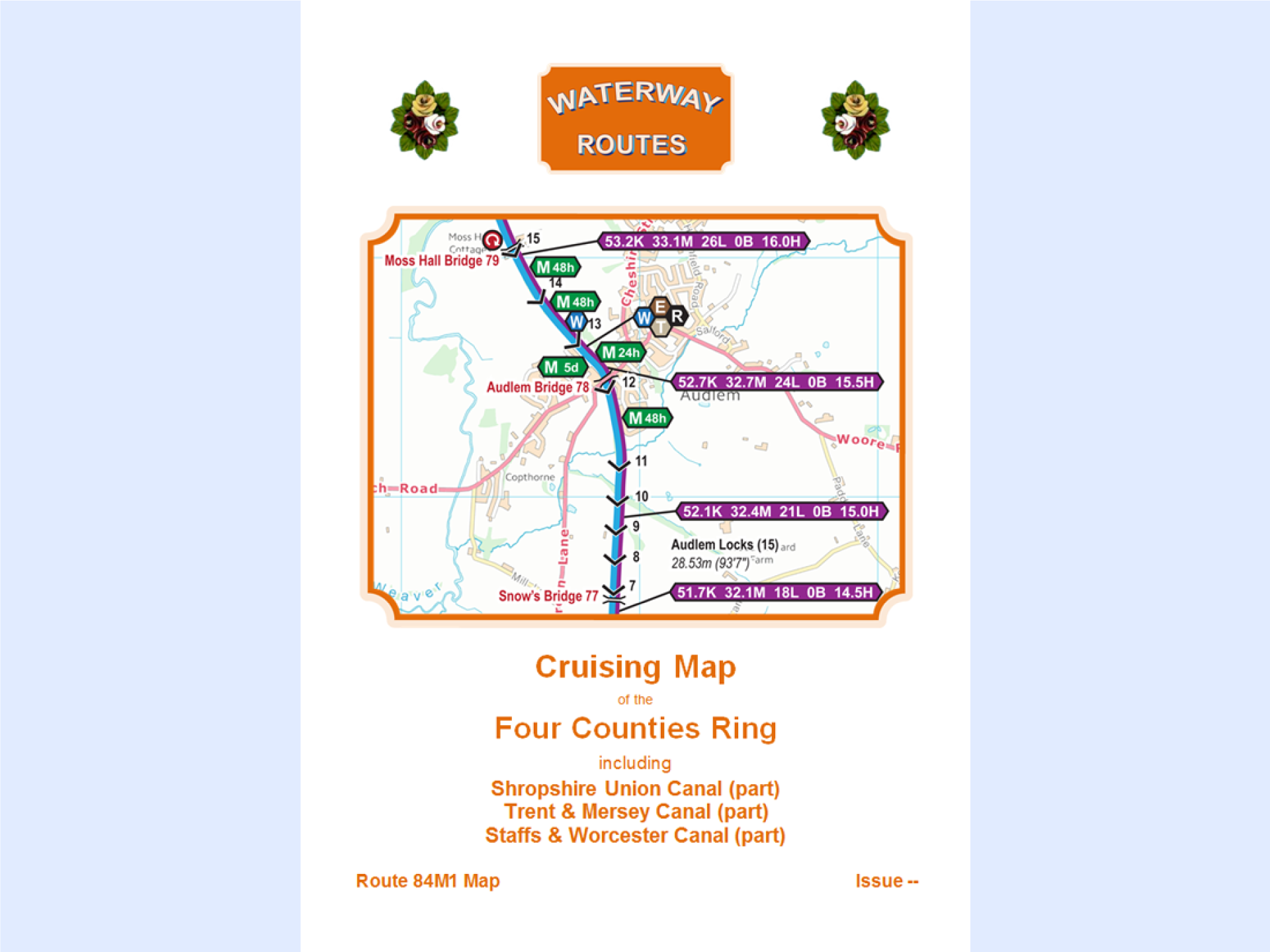
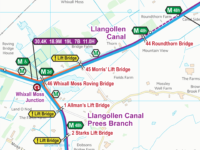
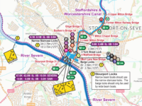
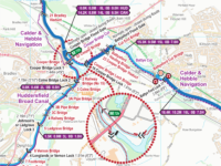
Route
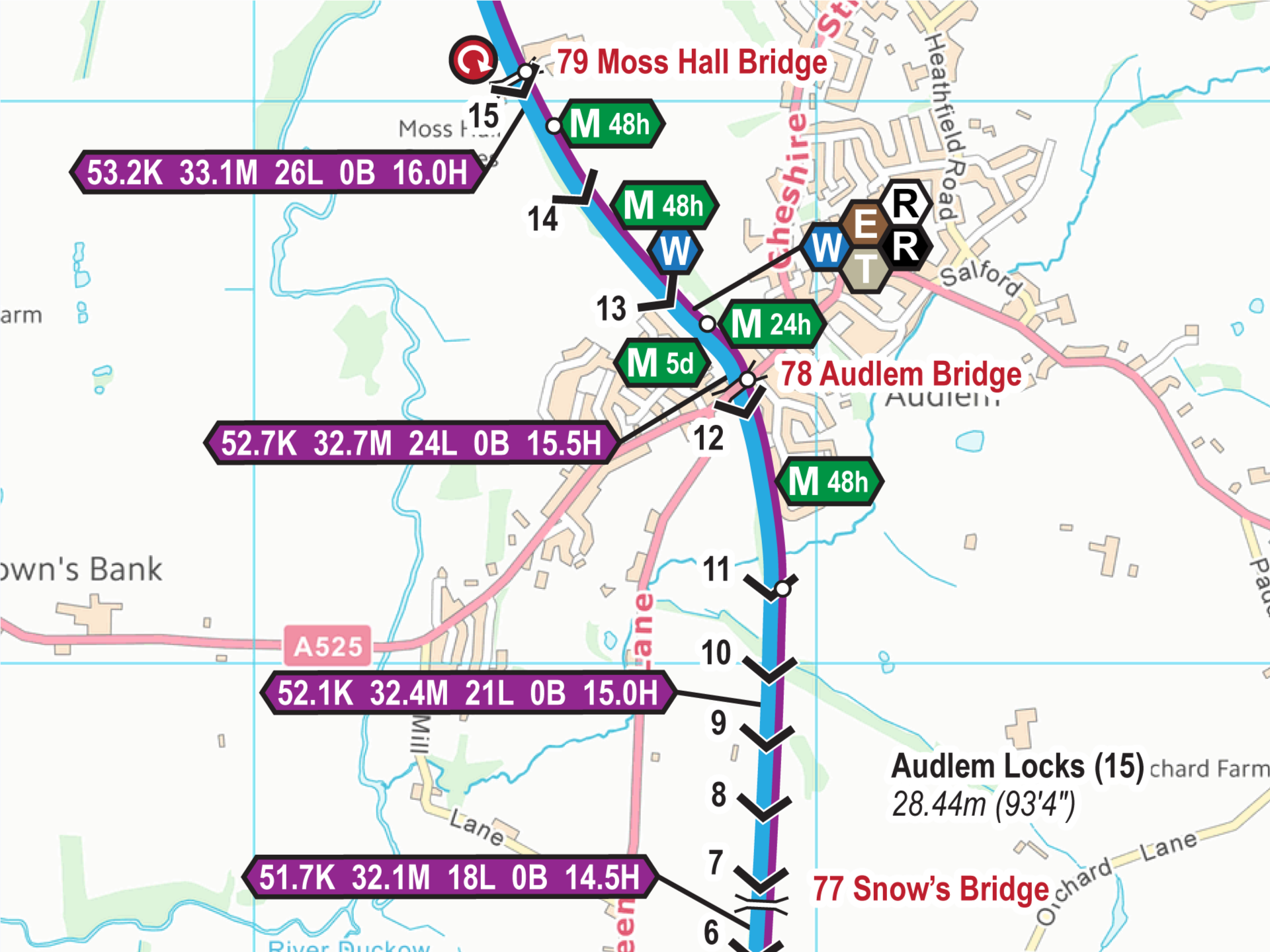
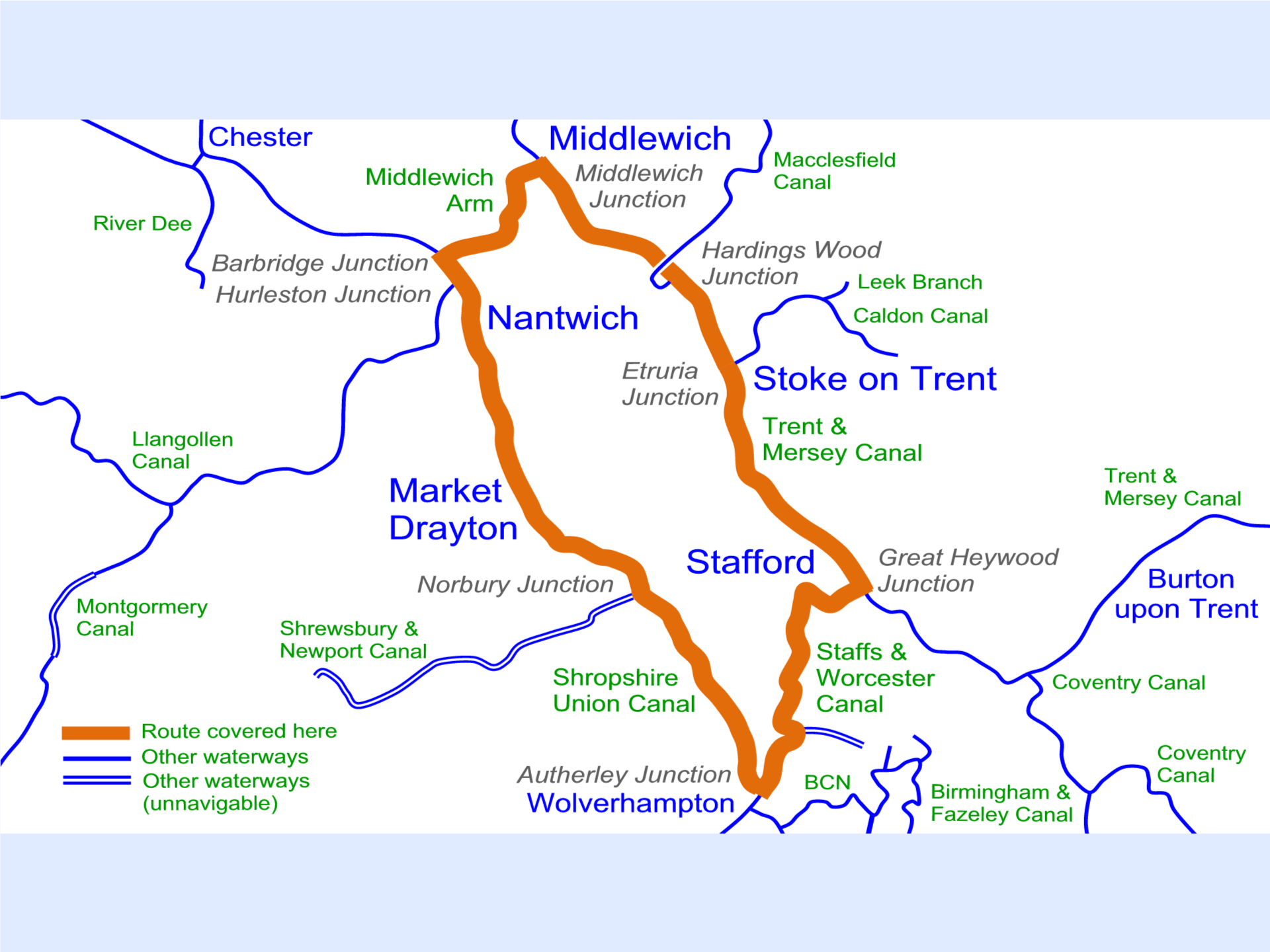
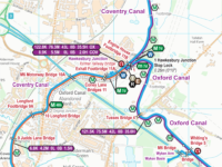
Each map covers the route shown in orange, including:-
- Shropshire Union Canal (Barbridge Junction to Autherley Junction
- Staffs & Worcester Canal (Autherley Junction to Great Haywood Junction)
- Trent & Mersey Canal (Great Haywood Junction to Middlewich Junction)
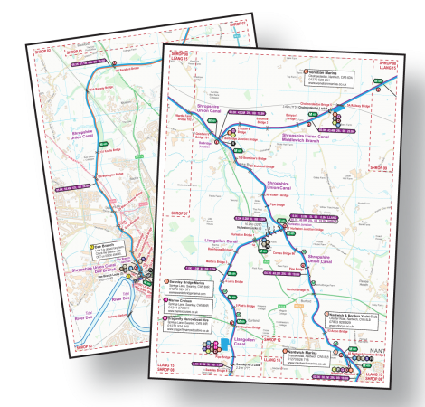
Acrobat (pdf)

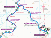
Example pages from my range of maps.
You must have Acrobat Reader (or equivalent) App/Software installed to use my maps in Acrobat (pdf) Format.
Acrobat (pdf) Format maps are split into A4 pages. They can viewed a page at a time on screen, or printed on your own printer. They are designed to be printed A4 size and, if your eyesight is good enough, they can be printed A5. They can be printed A3 if you need a larger print size.
You can read more about using my maps in Acrobat (pdf) Format.
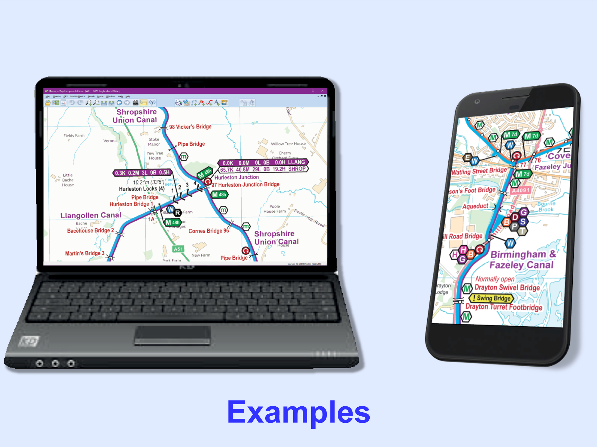
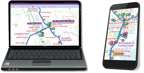
Memory-Map (qct)
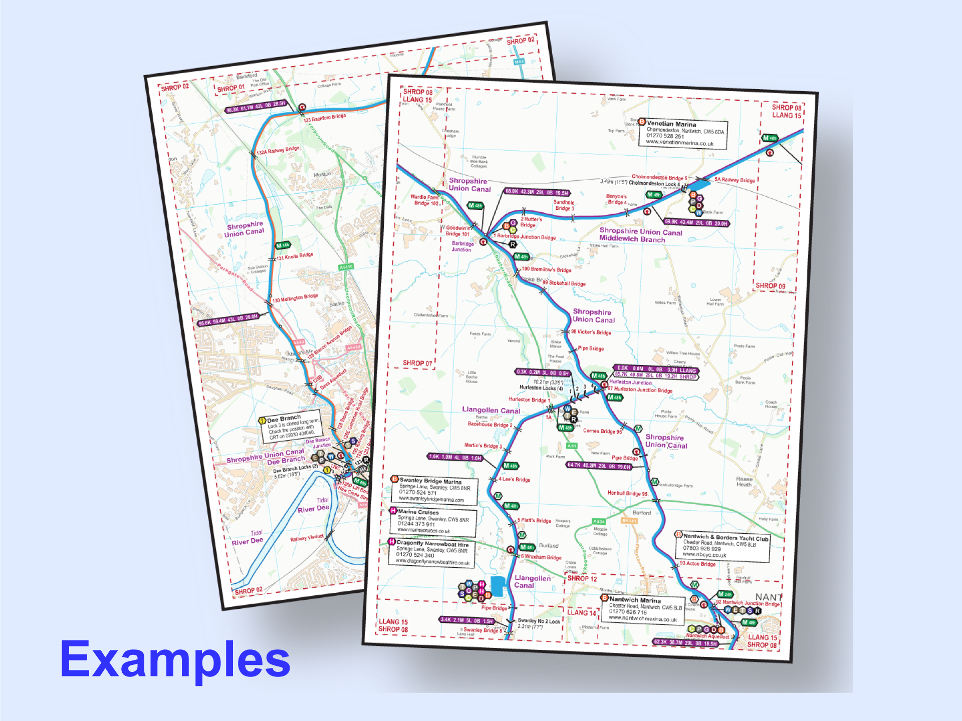
Examples from my range of maps.
You must have the Memory-Map App/Software installed to use my maps in Memory-Map (qct) Format. That App/Software must have the Classic Map Compatibility licence enabled and you will have to pay Memory-Map (the company) for that.
Please use the free examples to check Memory-Map’s pricing (after using their initial free trial period) and ensure you can conquer Memory-Map’s tricky installation process (which is especially difficult on Apple products) before ordering.
The maps will track in real time on GPS enabled devices so you know exactly where you are. You can save tracks, routes and waypoints with the Memory-Map software.
You can scroll around the whole map and zoom in and out as required.
You can read more about using my maps in Memory-Map (qct) Format.
Support
You can download the key separately if required. It is included as the last page on every Acrobat (pdf) map and shown at intervals on the Memory-Map (qct) Maps.
You can read more about using my maps on each type of device. These pages are intended to provide general information only and may not be up to date for the latest versions of the App/Software. You will need to follow the instructions from the supplier of the App/Software you are using and seek help from them if you are having problems with their App/Software.
Please note that I only supply the map and I will offer help in the unlikely event of any problems with my map. If you are having problems using an App/Software then you must seek help from the supplier of that App/Software. Please use my free maps to check you can conquer the download and installation process (which is particularly tricky on Apple devices) before purchasing any of my maps.
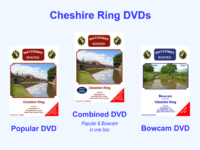
 Save 10% buying a
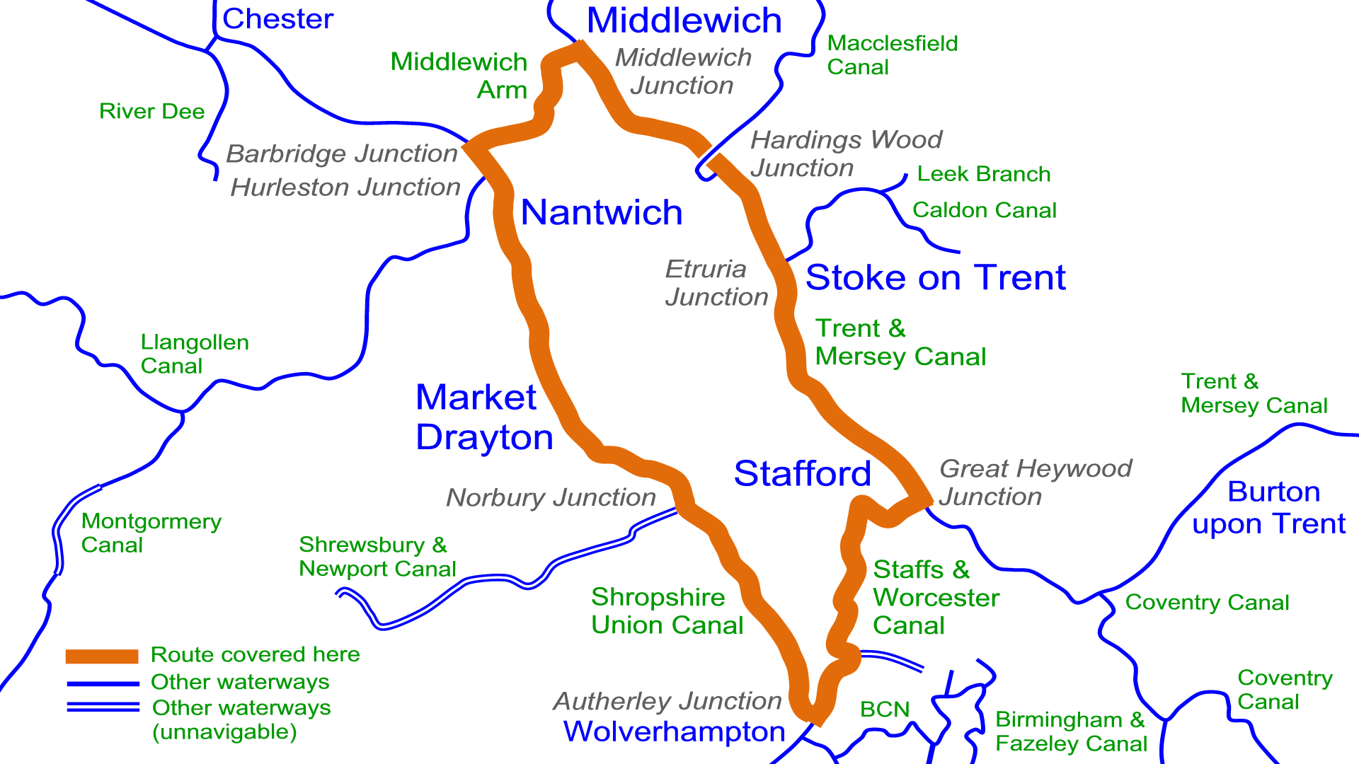


 RSS Blog Feed
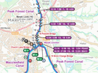
Mike House (verified owner) –
Used these excellent maps for our trip round the Four Counties Ring starting from Swanley Bridge Marina. I like all the clear detail, the ditance markers. I print them A4 2-sided, laminate them, and put them in a ring binder. (The prints are in the order of the the route I am taking and as I finish a sheet I put it at the back so the current map is always at the front) Much clearer maps than Nicholson and Pearson and I believe constantly ket up to date.
Paul –
Thank you for your lovely comment.
Yes, the maps are updated monthly, issued around the middle of each month, to make them the most up to date maps available.
You might like to try the Memory-Map (qct) version next time which runs on a smart phone with GPS tracking so you know exactly where you are or on your computer to plan your route on a larger screen with no pages to turn and no need to encapsulate anything.
Jeremy C –
With the individual pages I can just print those I want and not the whole ring.