River Avon (Proposed Higher Avon) Maps
Free Maps These are my free maps covering the Higher Avon (Proposed). Download these free maps (from the links at the end) to see how good my maps are, and to check you can...
![]()
Maps and DVDs for the Waterways of Britain
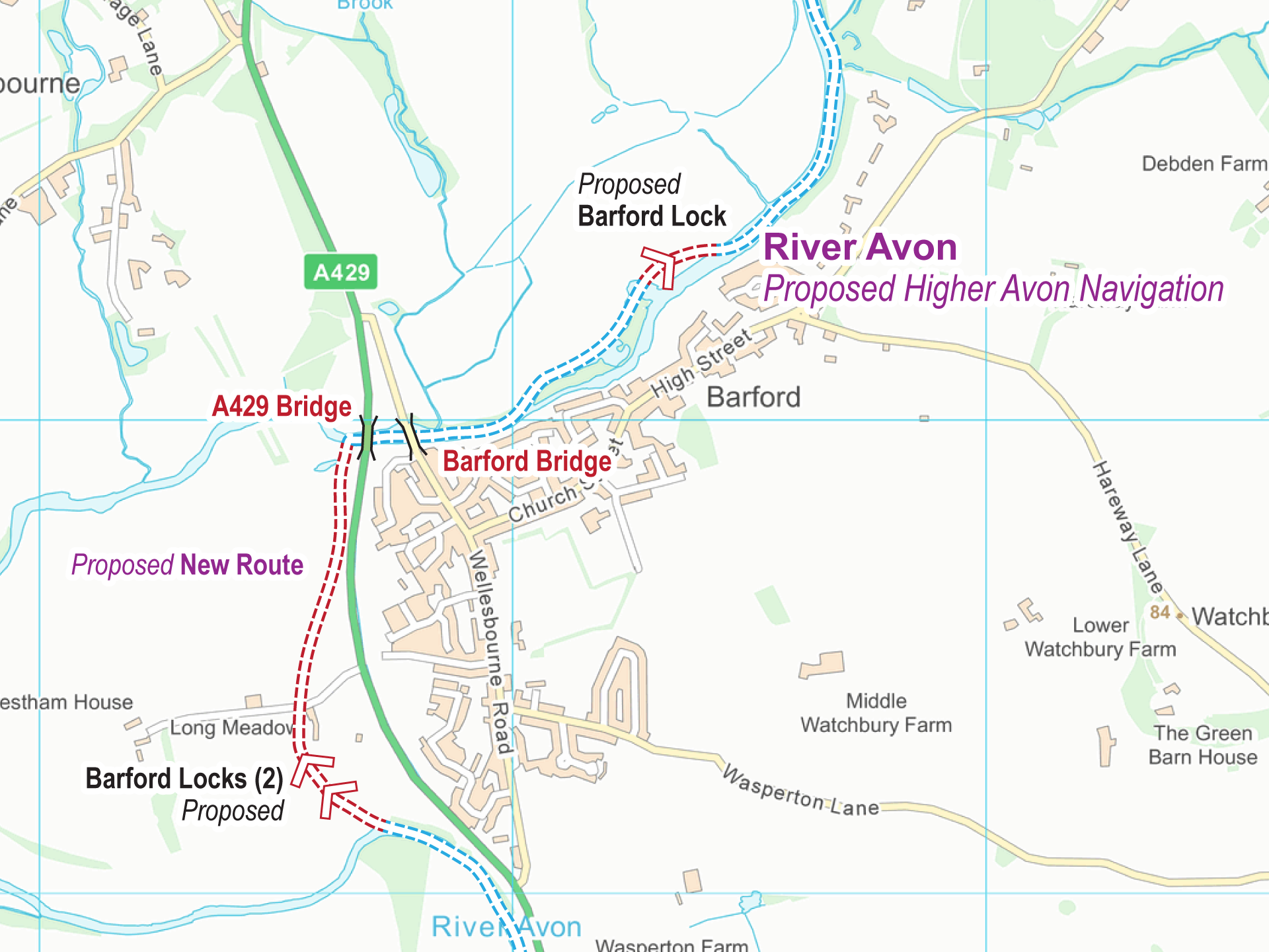
Free Maps These are my free maps covering the Higher Avon (Proposed). Download these free maps (from the links at the end) to see how good my maps are, and to check you can...
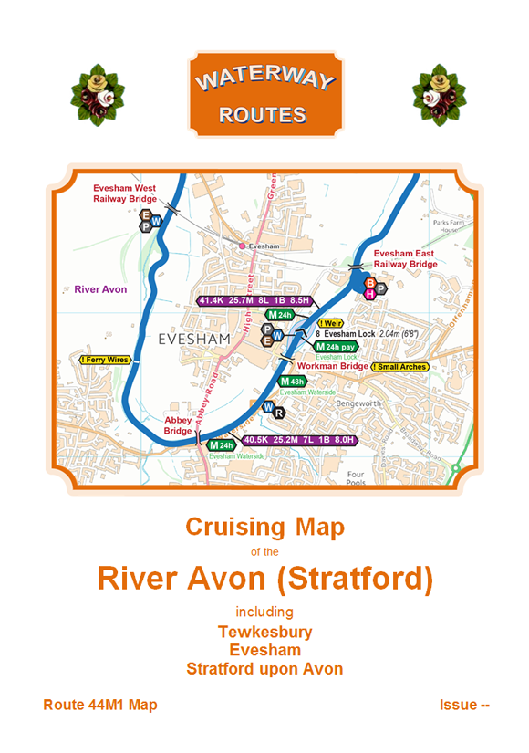
Download maps of the River Avon (Stratford). The most up to date and clearest maps of the River Avon (Stratford) are available for download. View on your computer, laptop, smart phone, or tablet, or...
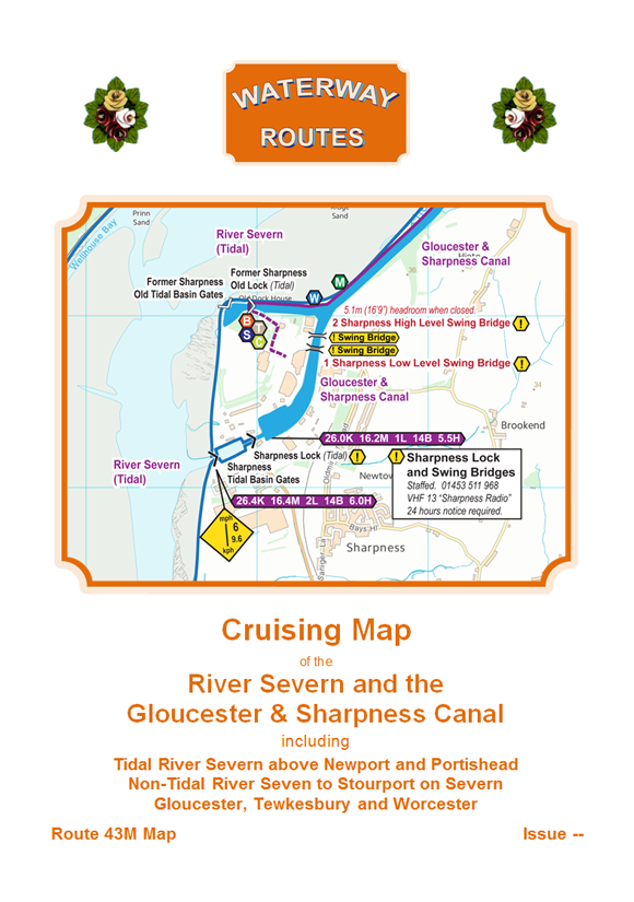
Download maps of the River Severn and Gloucester & Sharpness Canal. The most up to date and clearest maps of the River Severn and Gloucester & Sharpness Canal are available for download. View on...
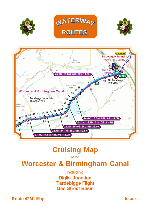
Download maps of the Worcester & Birmingham Canal. The most up to date and clearest maps of the Worcester & Birmingham Canal are available for download. View on your computer, laptop, smart phone, or...
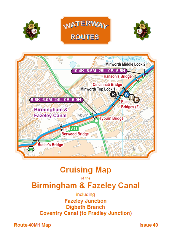
Download maps of the Birmingham & Fazeley Canal. The most up to date and clearest maps of the Birmingham & Fazeley Canal are available for download. View on your computer, laptop, smart phone, or...
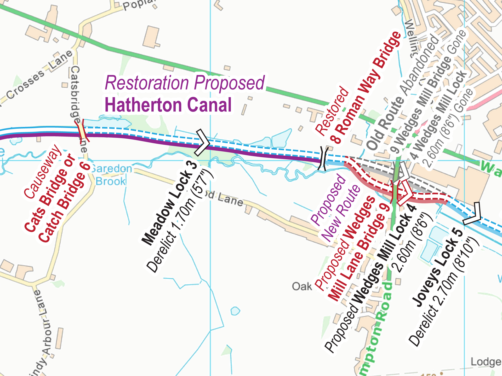
Free Maps These are my free maps covering the Hatherton Canal. Download these free maps (from the links at the end) to see how good my maps are, and to check you can install...
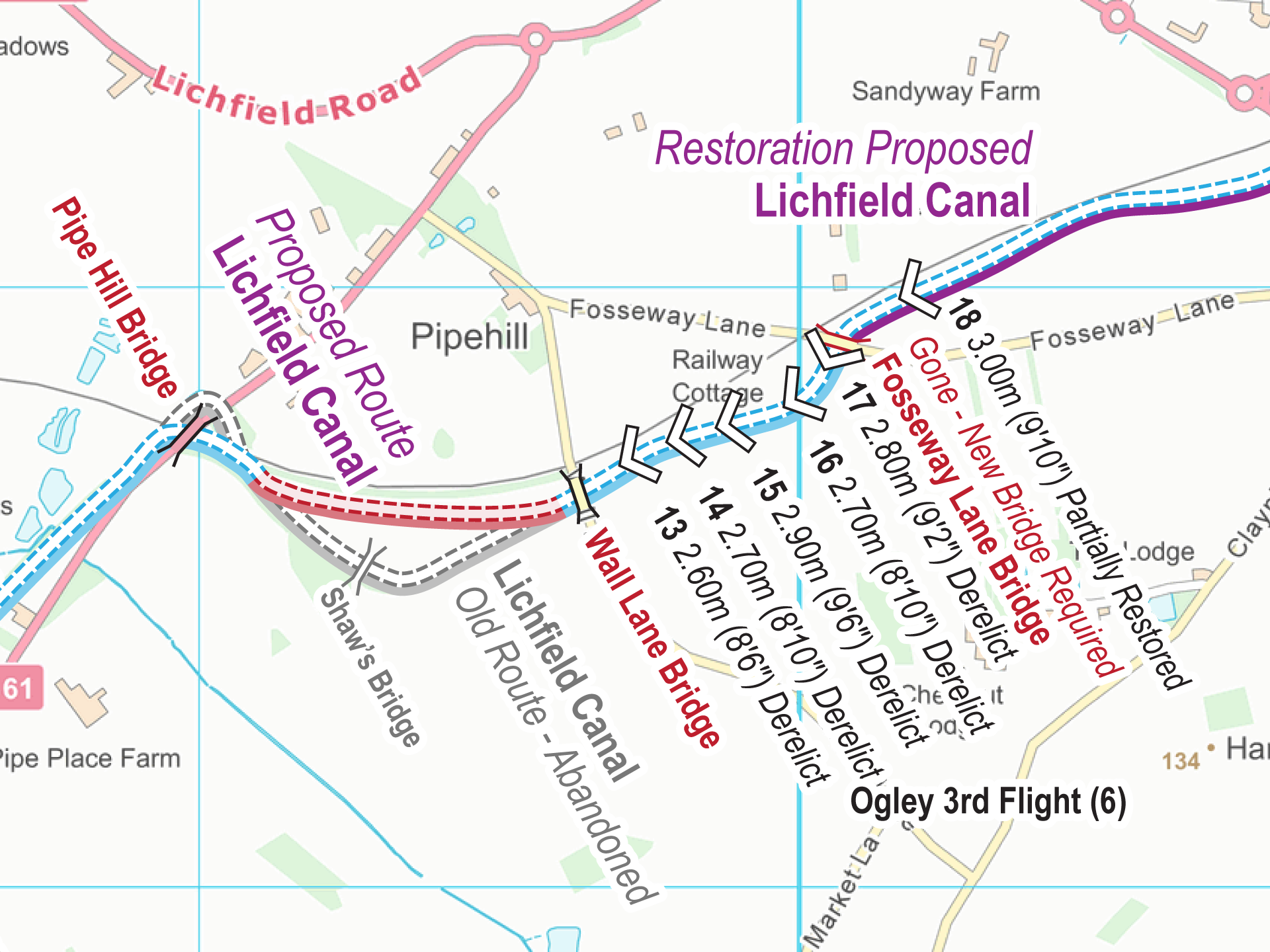
Free Maps These are my free maps covering the Lichfield Canal. Download these free maps (from the links at the end) to see how good my maps are, and to check you can install...
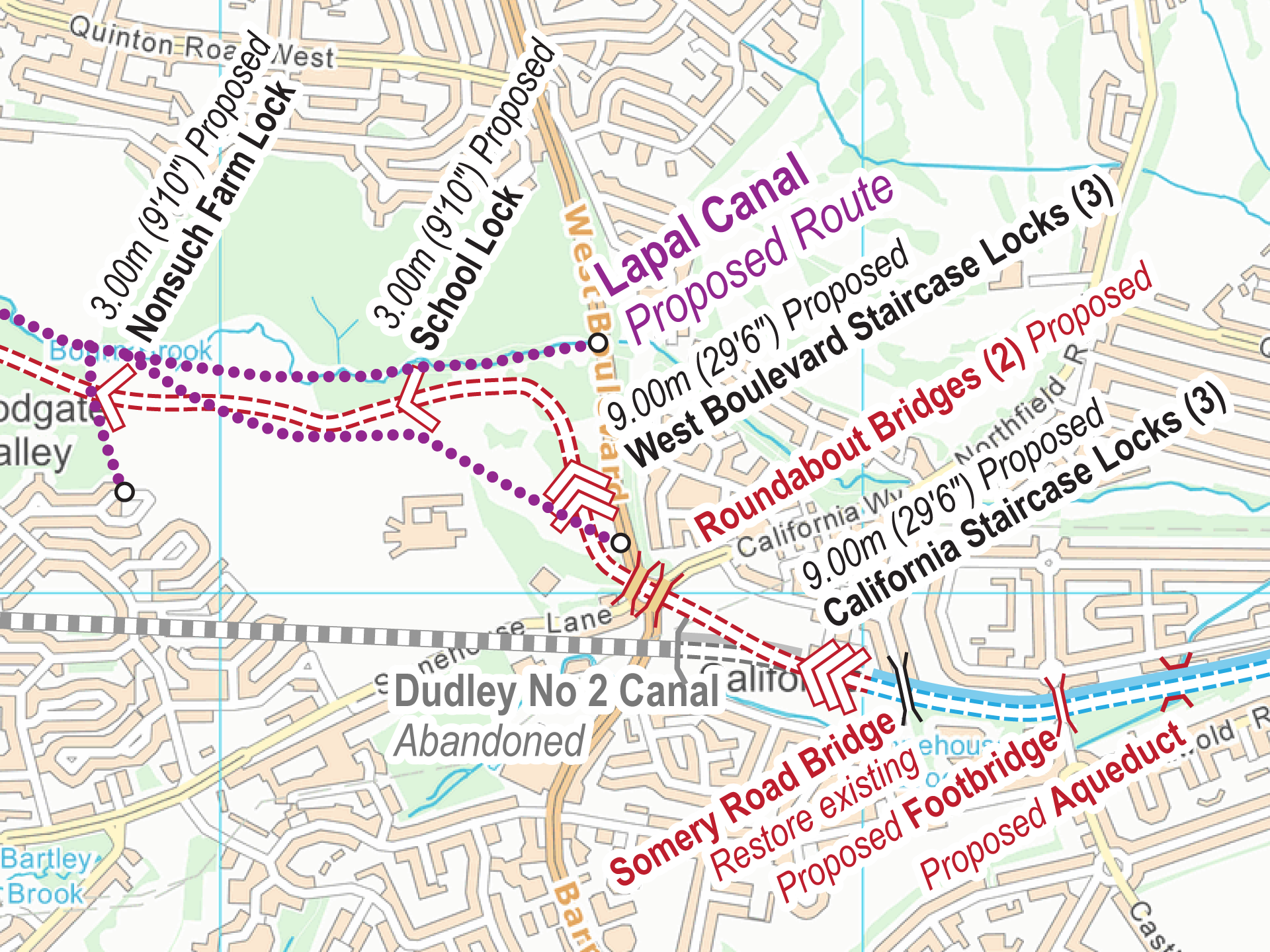
Free Maps These are my free maps covering the Lapal Canal. Download these free maps (from the links at the end) to see how good my maps are, and to check you can install...
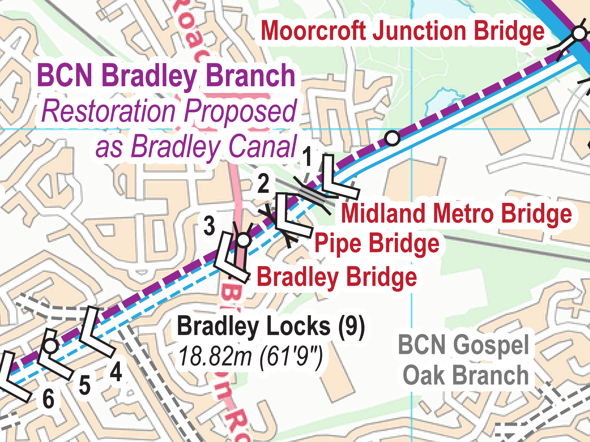
Free Maps These are my free maps covering the Bradley Canal. Download these free maps (from the links at the end) to see how good my maps are, and to check you can install...
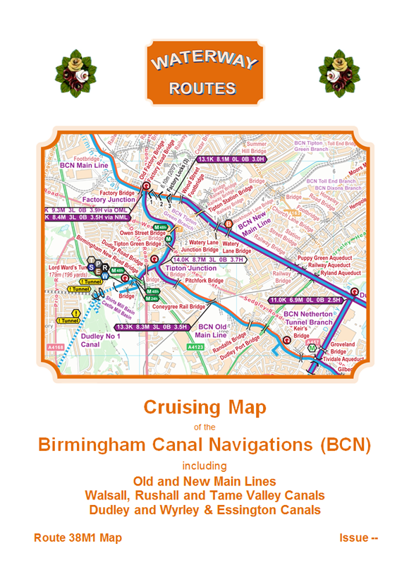
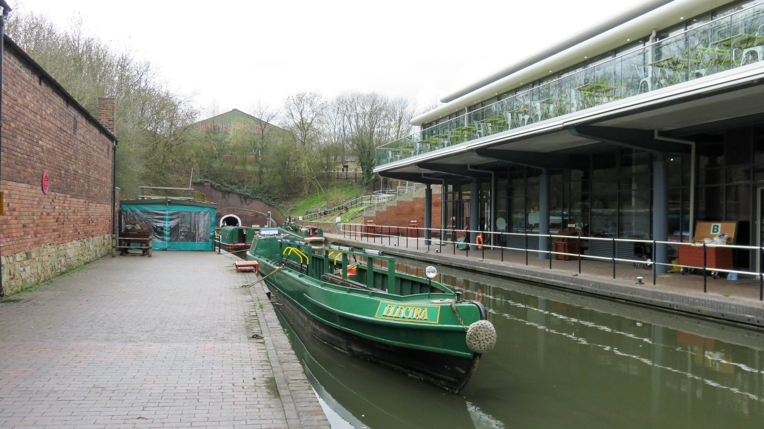
Download maps of the Birmingham Canal Navigations (BCN). The most up to date and clearest maps of the Birmingham Canal Navigations (BCN) are available for download. View on your computer, laptop, smart phone, or...
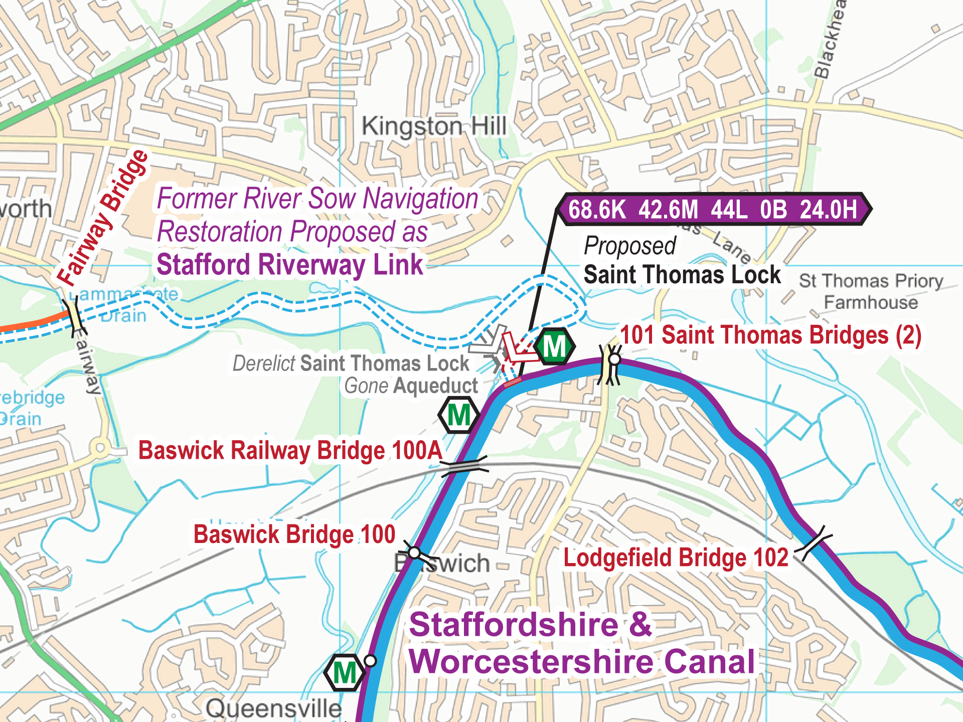
Free Maps These are my free maps covering the Stafford Riverway Link. Download these free maps (from the links at the end) to see how good my maps are, and to check you can...
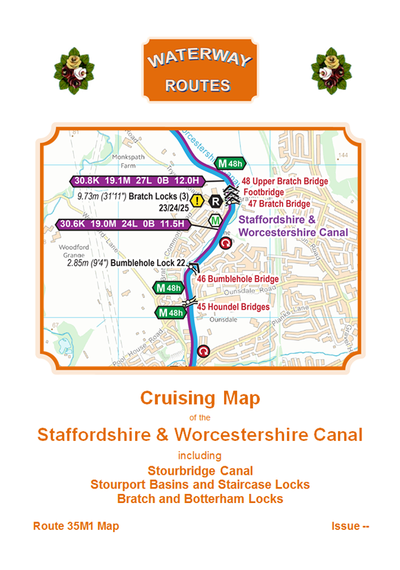
Download maps of the Staffs & Worcester Canal. The most up to date and clearest maps of the Staffs & Worcester Canal are available for download. View on your computer, laptop, smart phone, or...
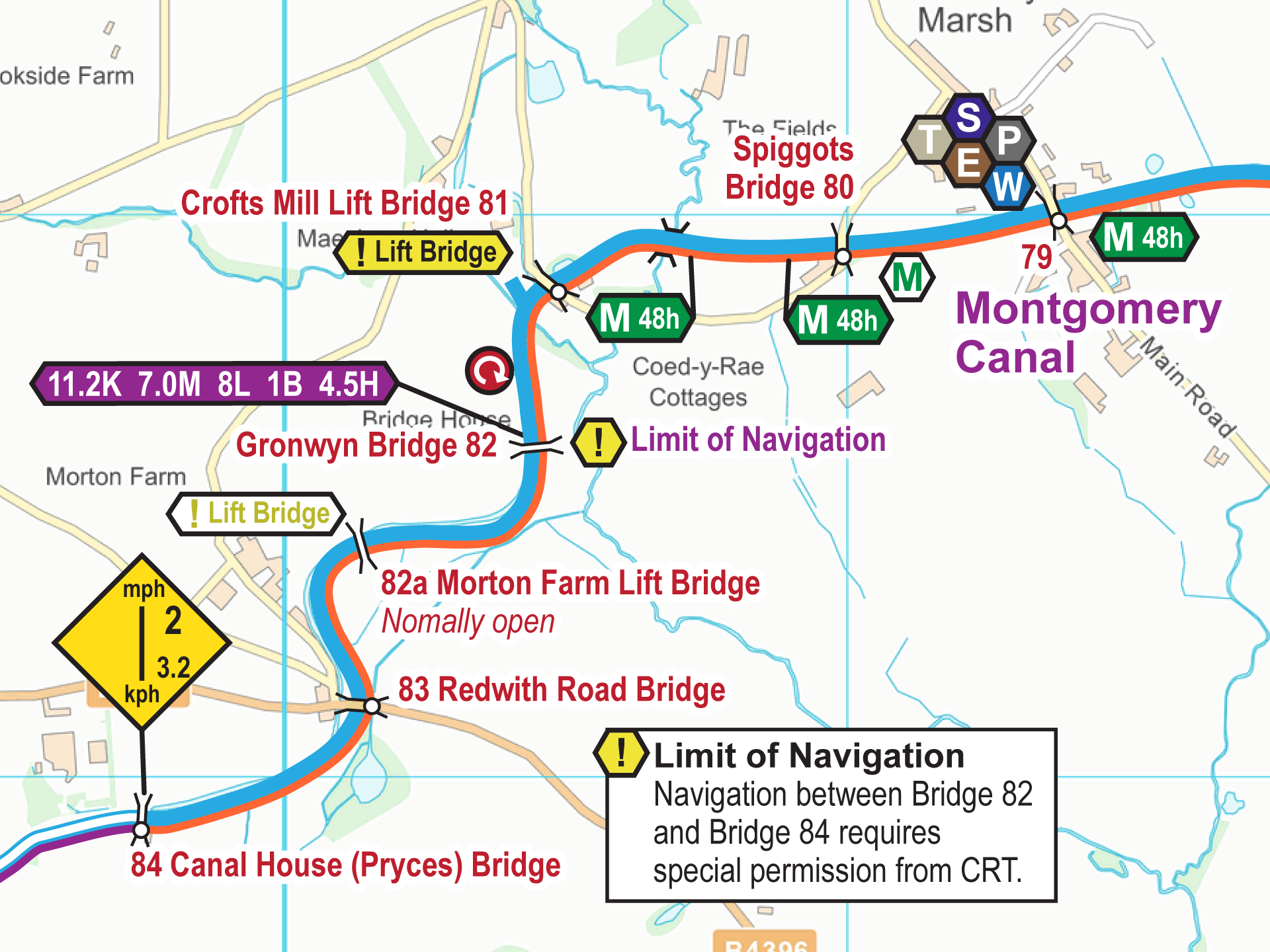
Free Maps These are my free maps covering the Montgomery Canal. Download these free maps (from the links at the end) to see how good my maps are, and to check you can install...

Download maps of the Llangollen Canal. The most up to date and clearest maps of the Llangollen Canal are available for download. View on your computer, laptop, smart phone, or tablet, or print if...
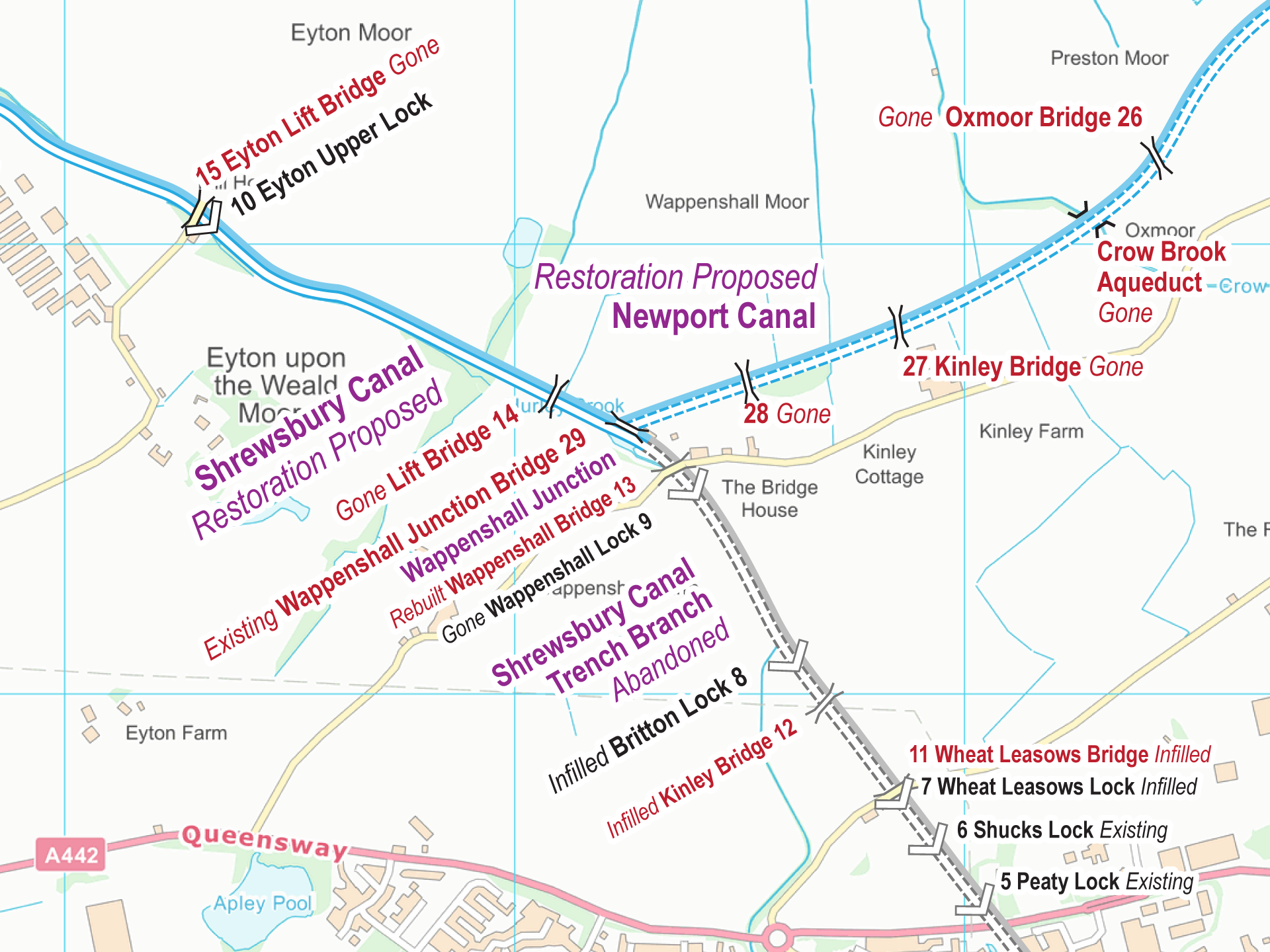
Free Maps These are my free maps covering the Shrewsbury and Newport Canals. Download these free maps (from the links at the end) to see how good my maps are, and to check you...
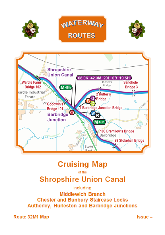
Download maps of the Shropshire Union Canal. The most up to date and clearest maps of the Shropshire Union Canal are available for download. View on your computer, laptop, smart phone, or tablet, or...
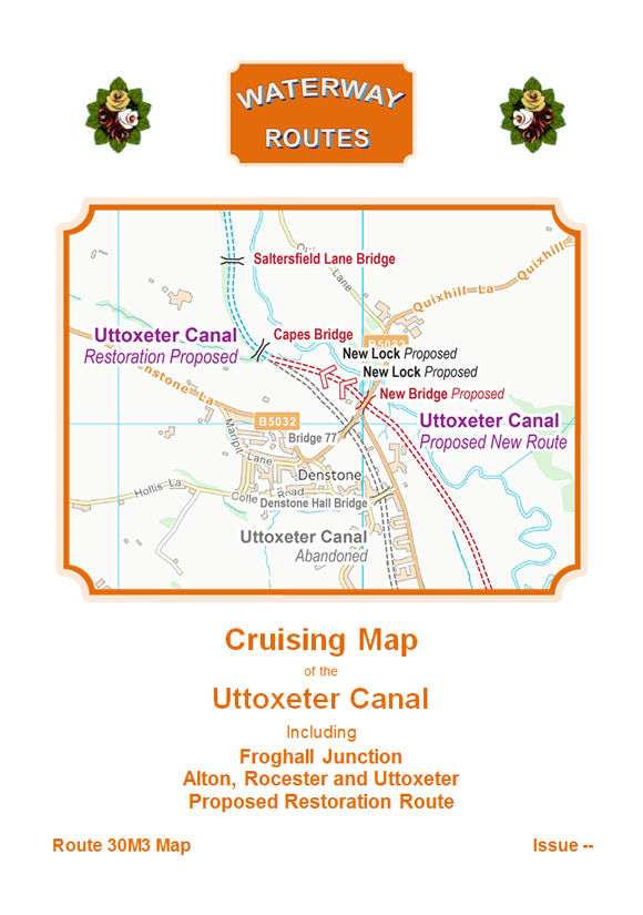
Free Maps These are my free maps covering the Uttoxeter Canal. Download these free maps (from the links at the end) to see how good my maps are, and to check you can install...
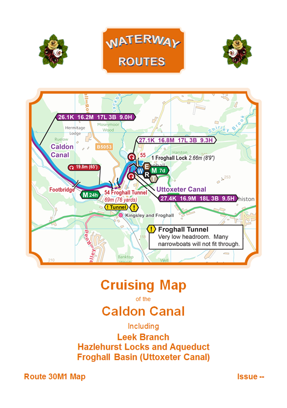
Download maps of the Caldon Canal. The most up to date and clearest maps of the Caldon Canal are available for download. View on your computer, laptop, smart phone, or tablet, or print if...

Download maps of the Trent & Mersey Canal. The most up to date and clearest maps of the Trent & Mersey are available for download. View on your computer, laptop, smart phone, or tablet,...
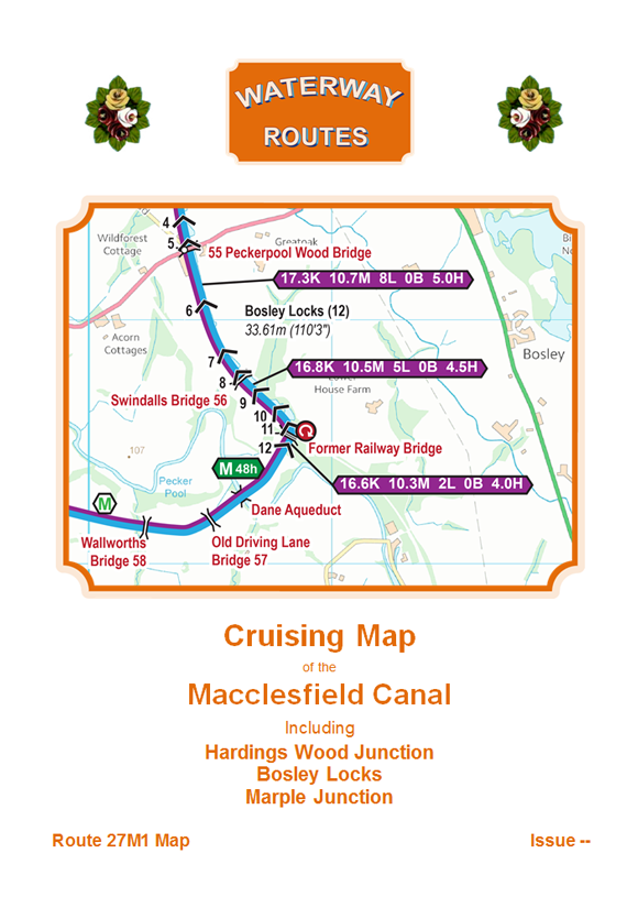
Download maps of the Macclesfield Canal. The most up to date and clearest maps of the Macclesfield Canal are available for download. View on your computer, laptop, smart phone, or tablet, or print if...
Free Maps These are my free maps covering the Hollinwood and Stockport Canals. Download these free maps (from the links at the end) to see how good my maps are, and to check you...
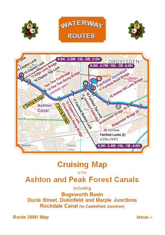
Download maps of the Ashton and Peak Forest Canals. The most up to date and clearest maps of the Ashton and Peak Forest Canals are available for download. View on your computer, laptop, smart...
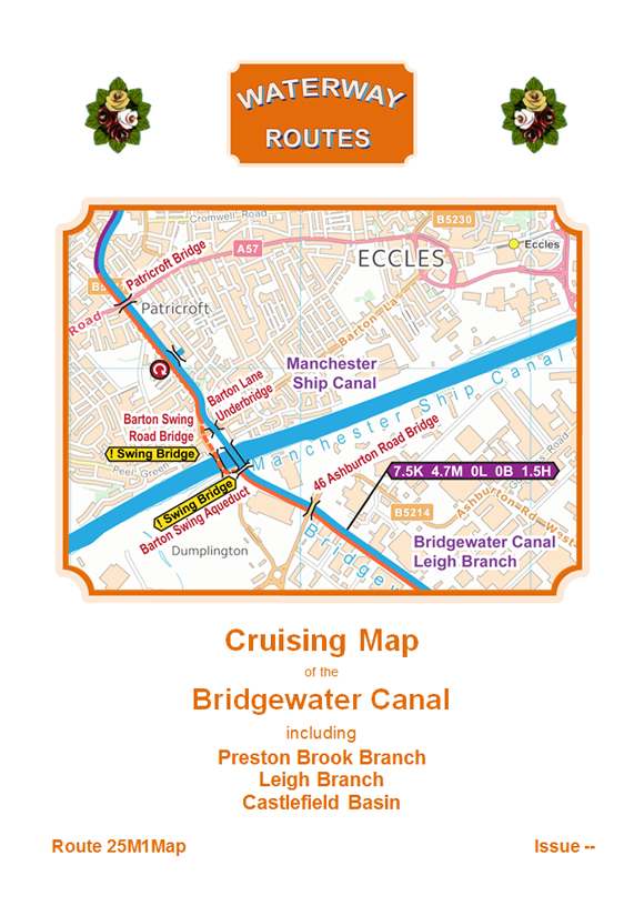
Download maps of the Bridgewater Canal. The most up to date and clearest maps of the Bridgewater Canal are available for download. View on your computer, laptop, smart phone, or tablet, or print if...
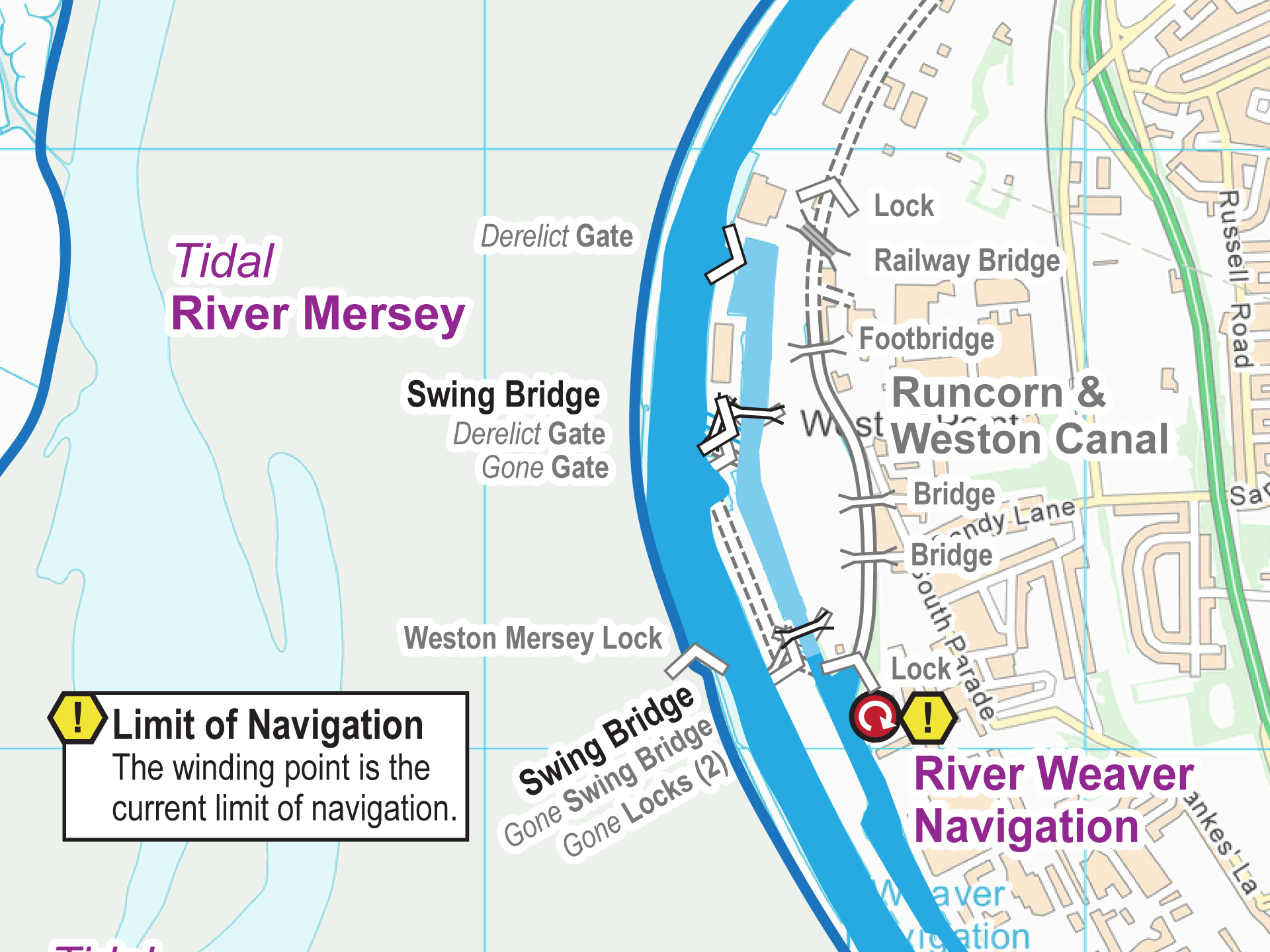
Free Maps These are my free maps covering the Runcorn & Weston Canal. Download these free maps (from the links at the end) to see how good my maps are, and to check you...
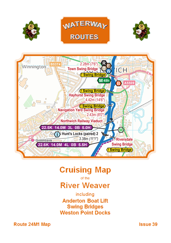
Download maps of the River Weaver. The most up to date and clearest maps of the River Weaver are available for download. View on your computer, laptop, smart phone, or tablet, or print if...
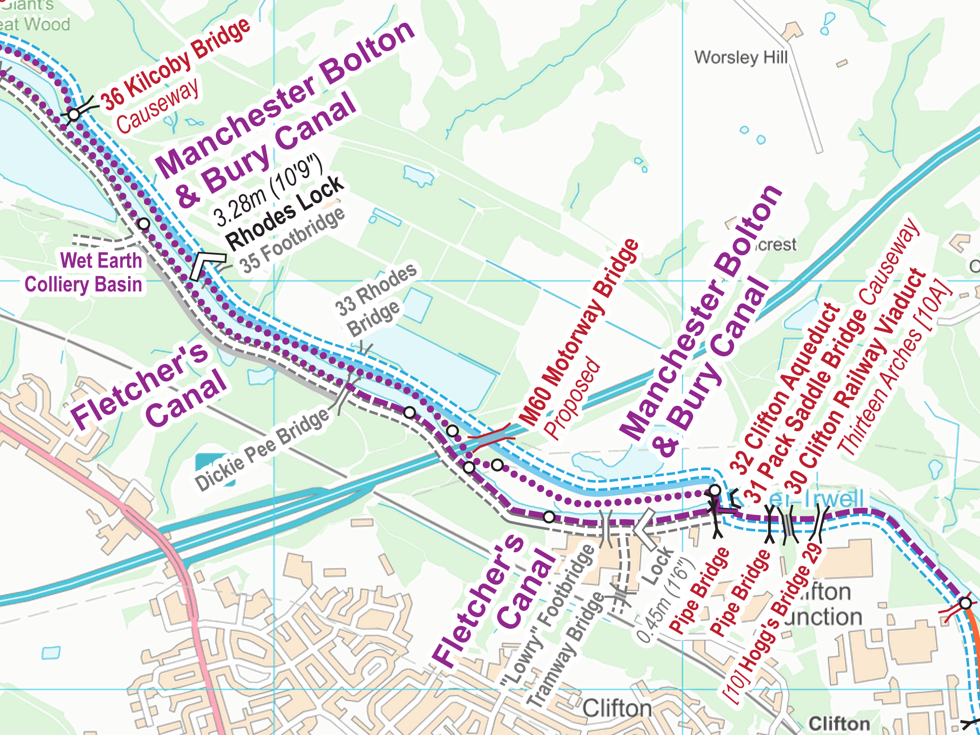
Free Maps These are my free maps covering the Manchester Bolton & Bury Canal. Download these free maps (from the links at the end) to see how good my maps are, and to check...
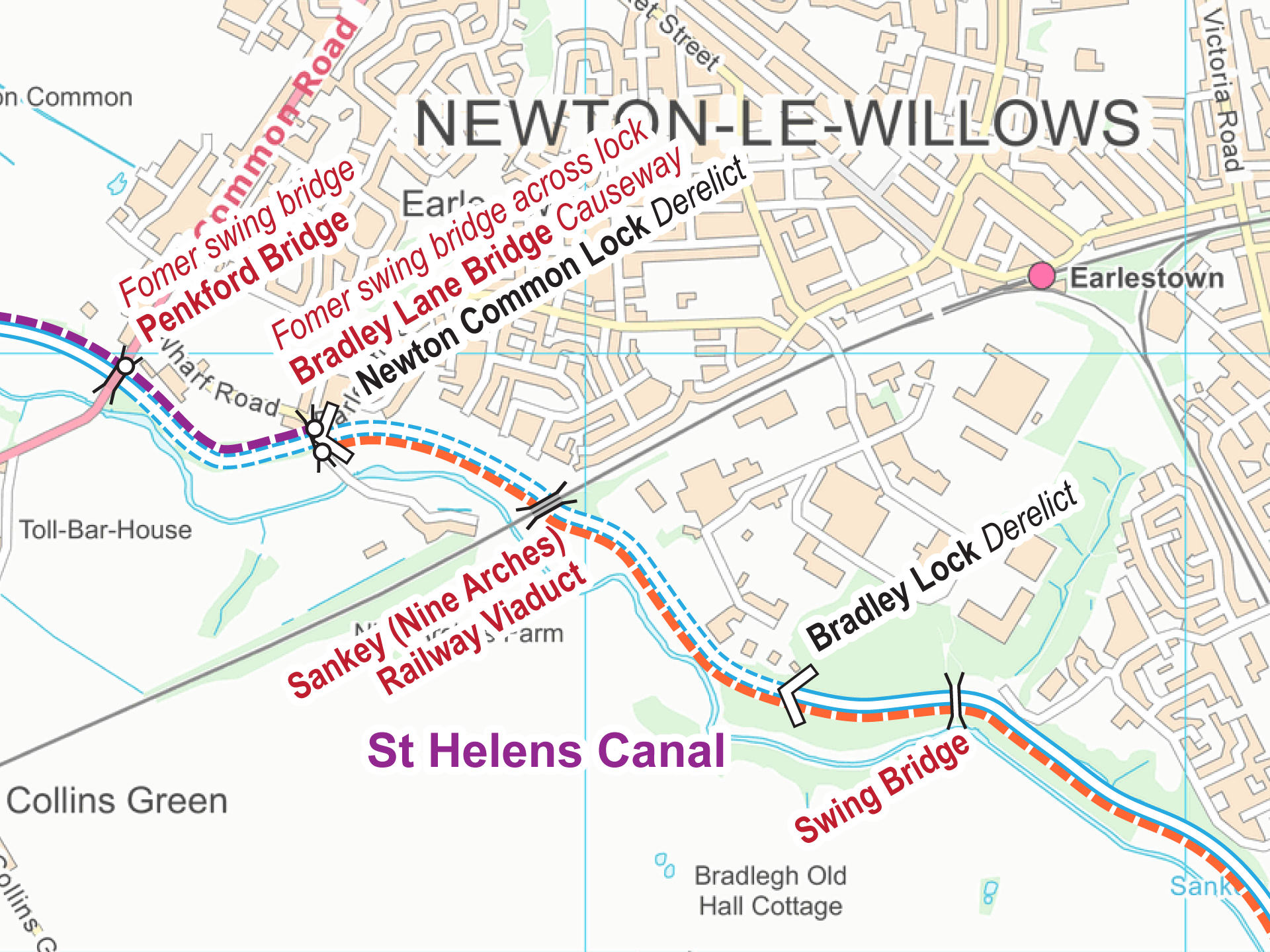
Free Maps These are my free maps covering the St Helens Canal. Download these free maps (from the links at the end) to see how good my maps are, and to check you can...
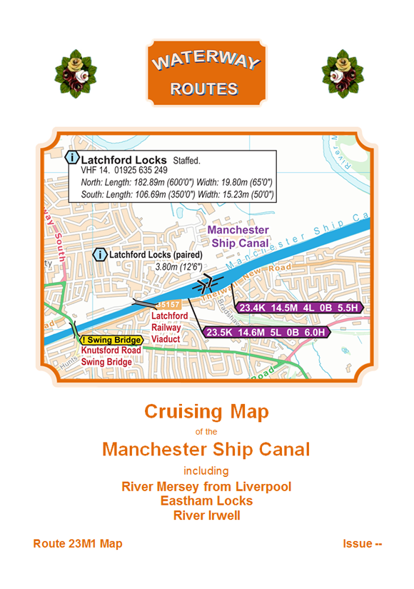
Download maps of the Manchester Ship Canal. The most up to date and clearest maps of the Manchester Ship Canal are available for download. View on your computer, laptop, smart phone, or tablet, or...
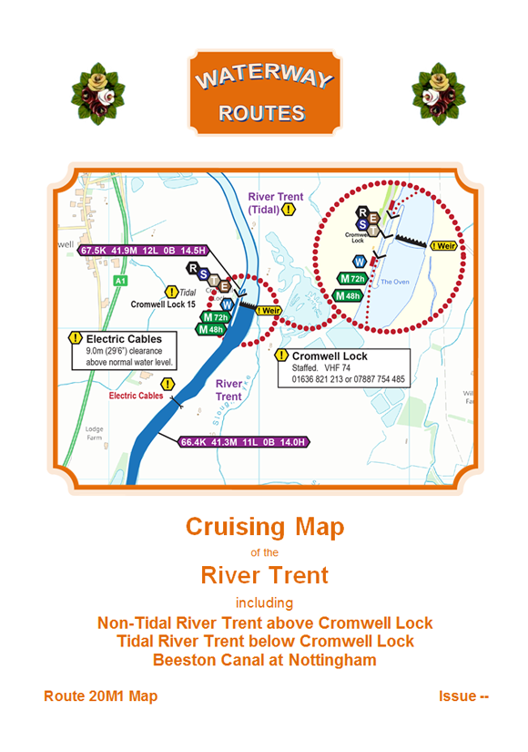
Download maps of the River Trent. The most up to date and clearest maps of the River Trent are available for download. View on your computer, laptop, smart phone, or tablet, or print if...
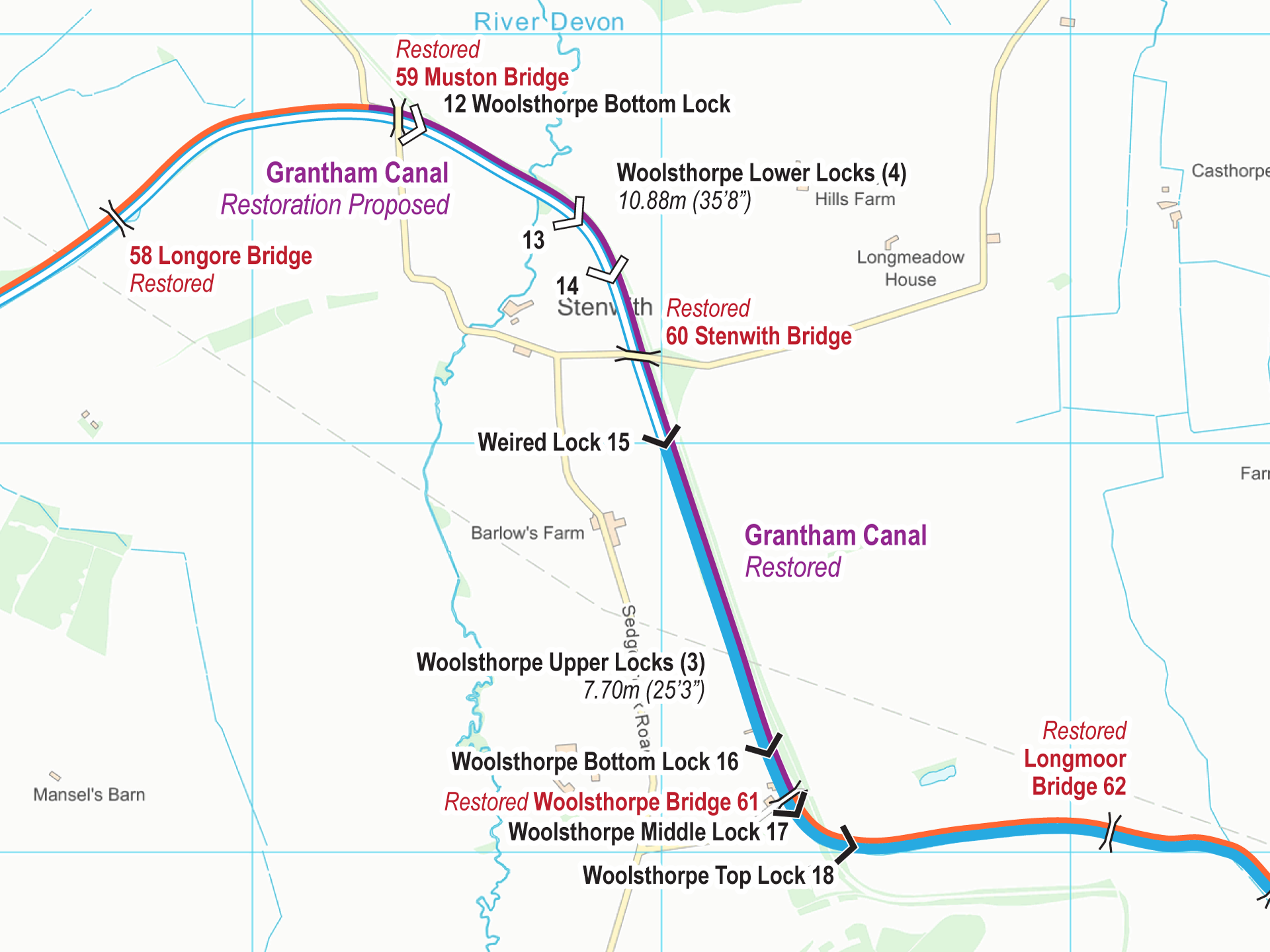
Free Maps These are my free maps covering the Grantham Canal. Download these free maps (from the links at the end) to see how good my maps are, and to check you can install...
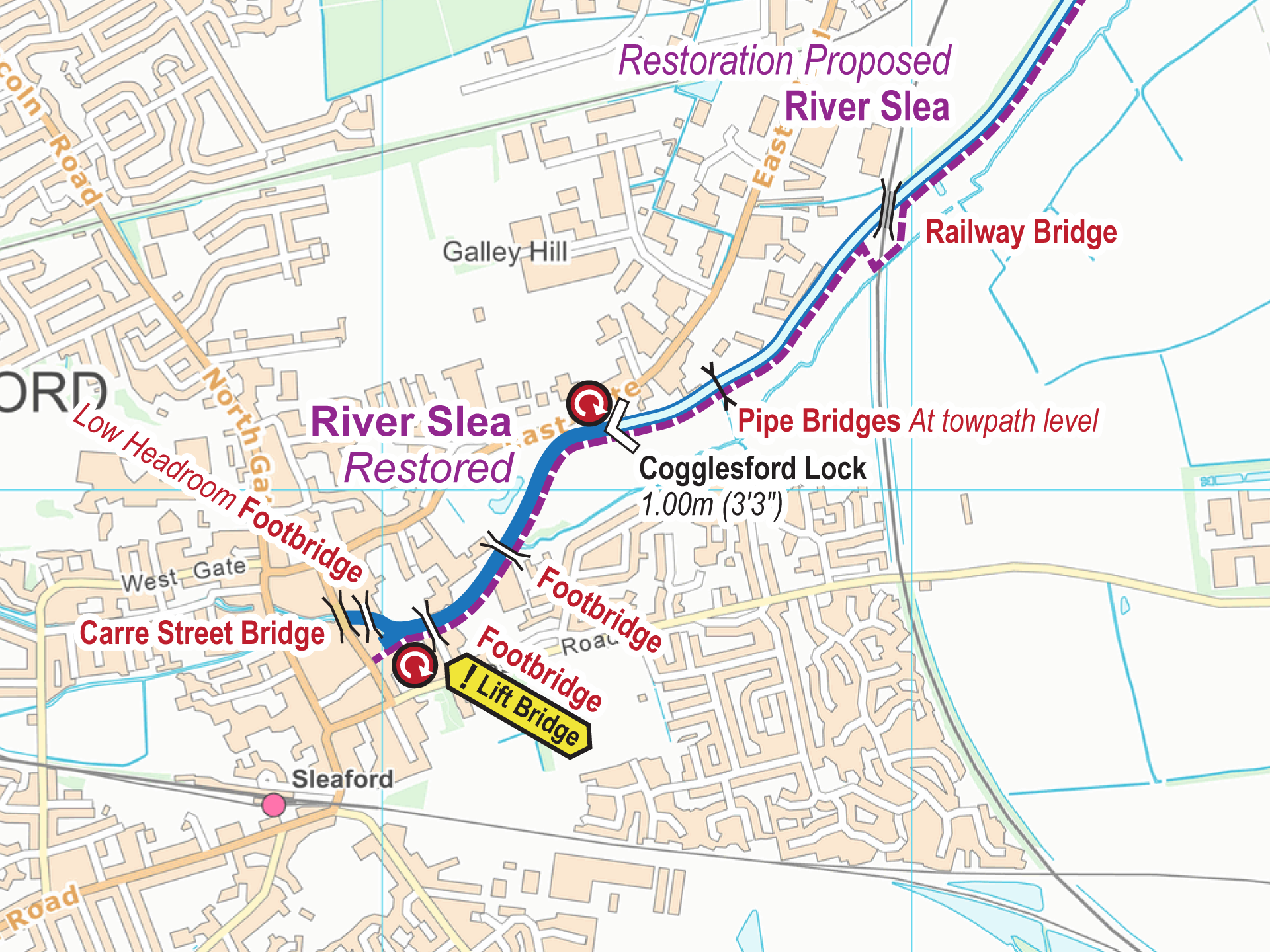
Free Maps These are my free maps covering the River Slea. Download these free maps (from the links at the end) to see how good my maps are, and to check you can install...
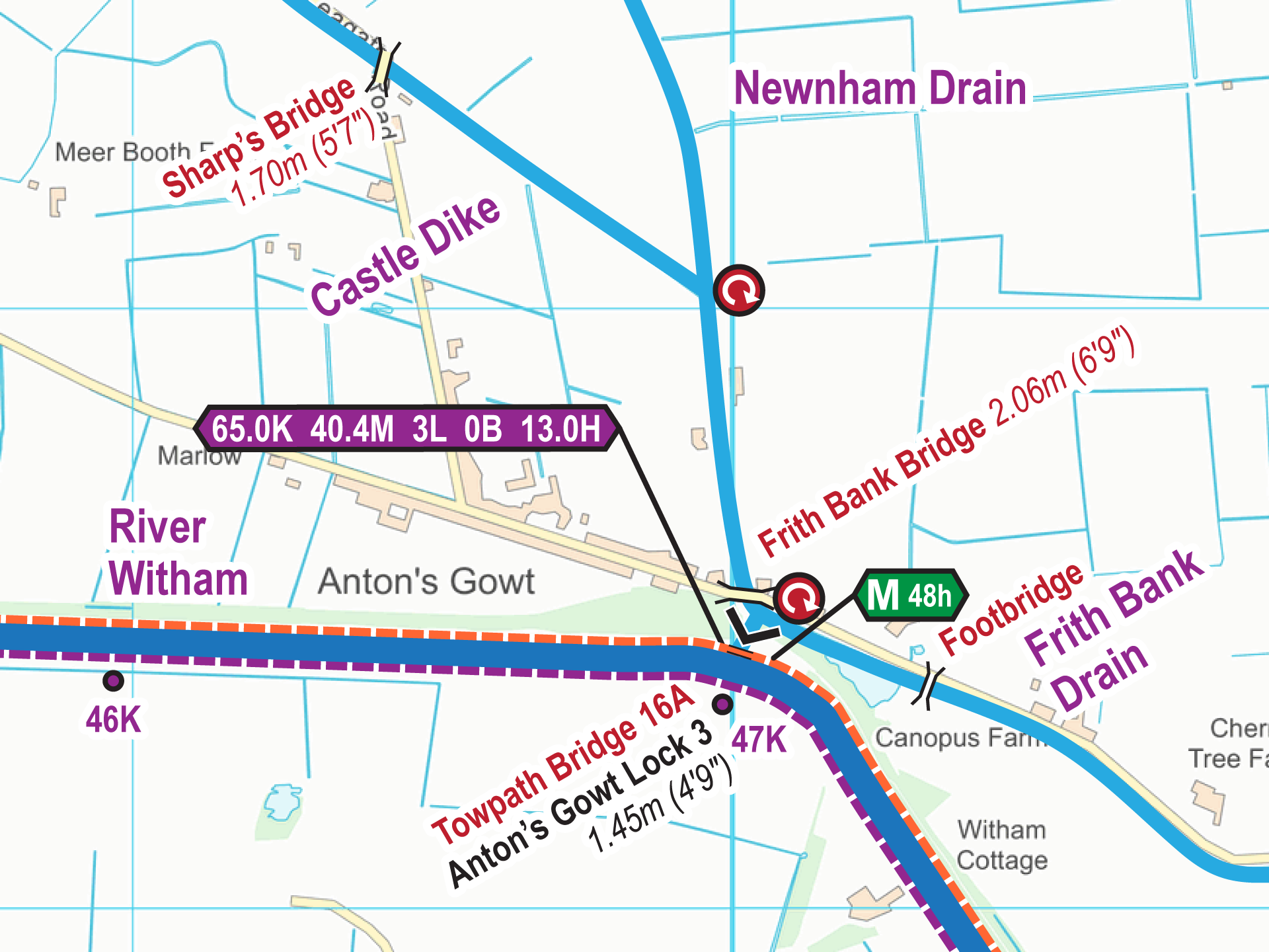
The most up to date and clearest maps of the Fossdyke & Witham Navigation and Tributaries are available for download.
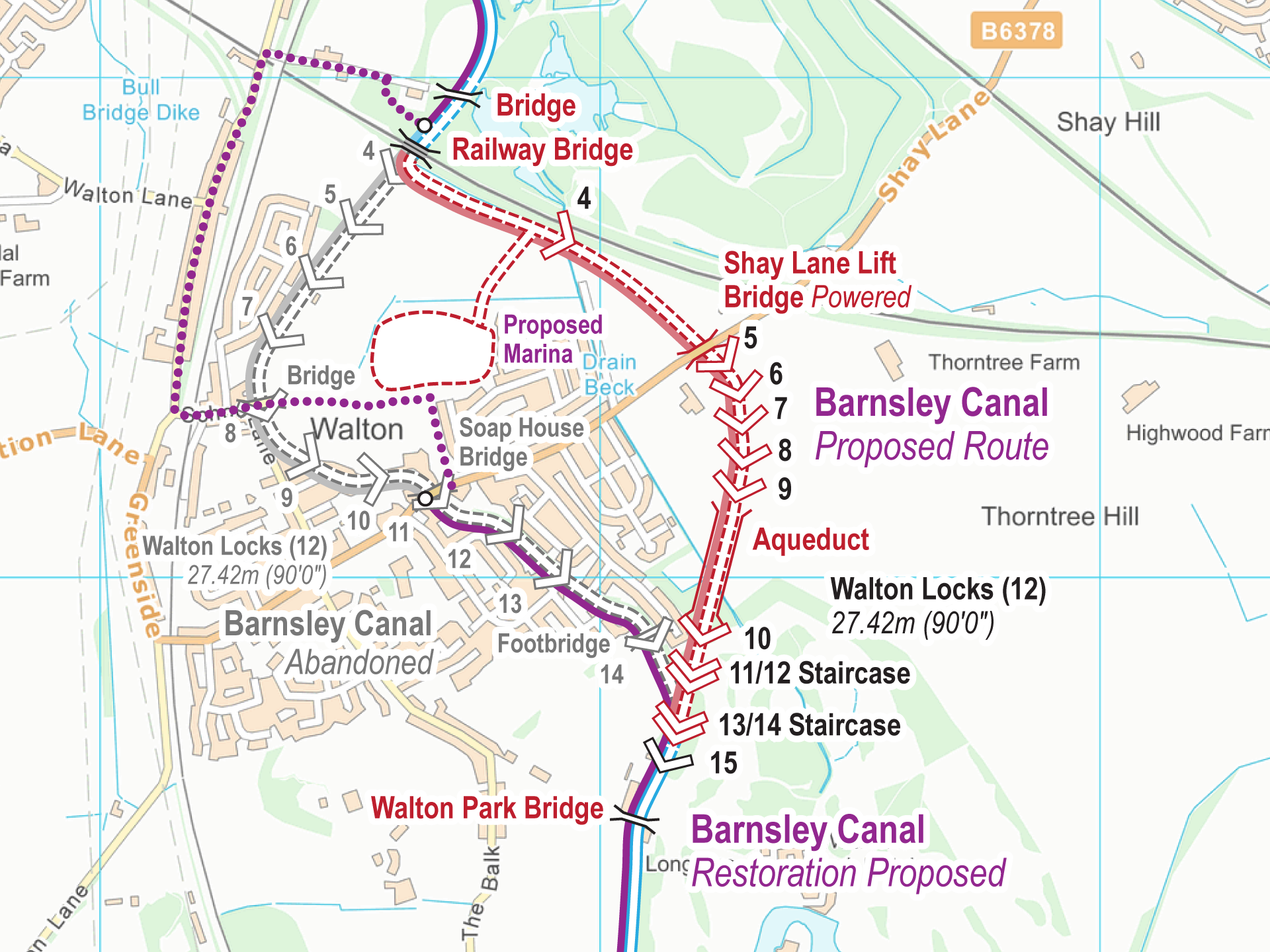
Free Maps These are my free maps covering the Barnsley and Dearne & Dove Canals. Download these free maps (from the links at the end) to see how good my maps are, and to...
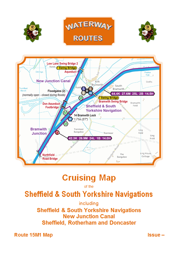
Download maps of the Sheffield & South Yorkshire Navigations. The most up to date and clearest maps of the Sheffield & South Yorkshire Navigations are available for download. View on your computer, laptop, smart...
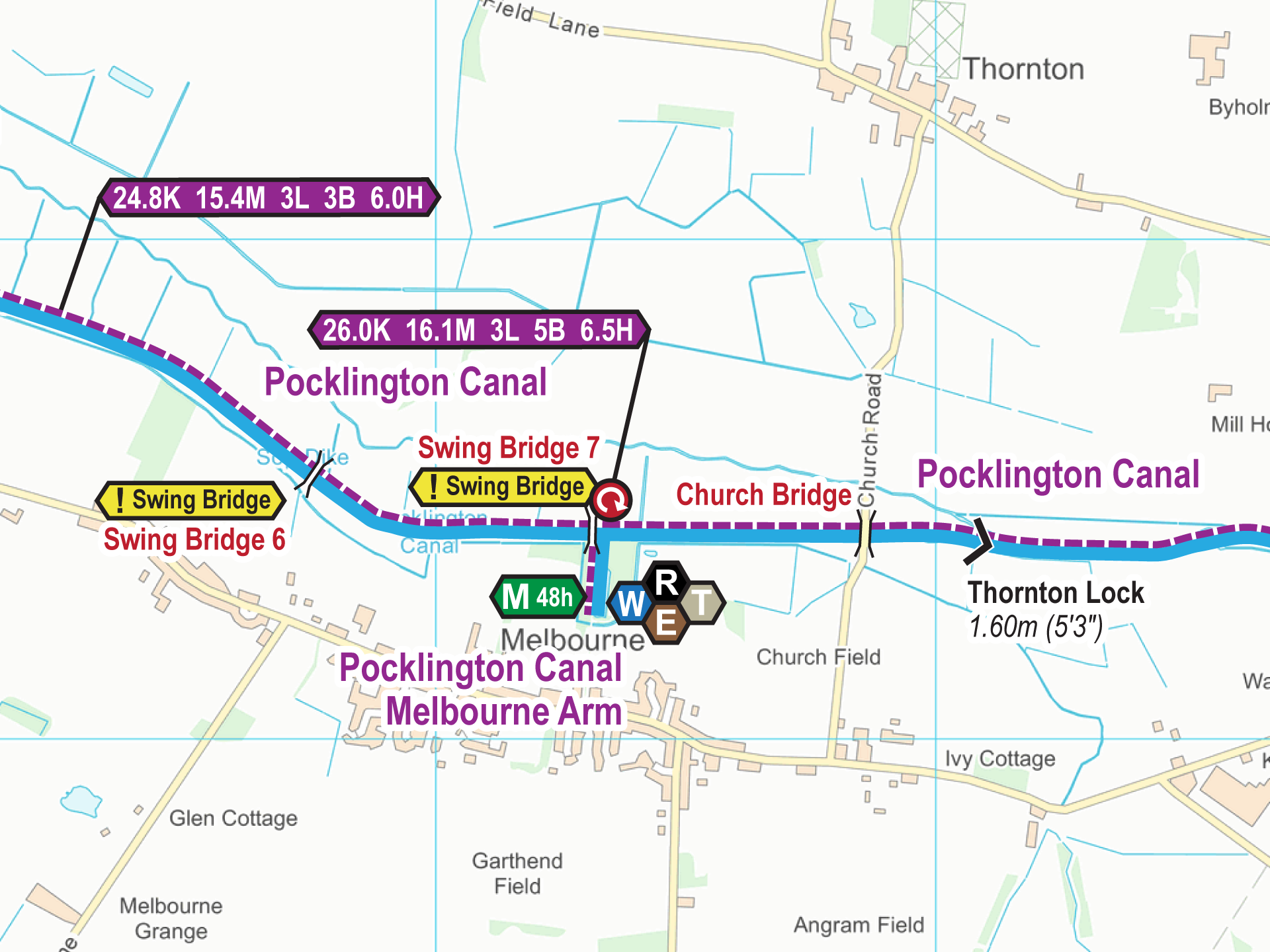
Free Maps These are my free maps covering the Pocklington Canal. Download these free maps (from the links at the end) to see how good my maps are, and to check you can install...
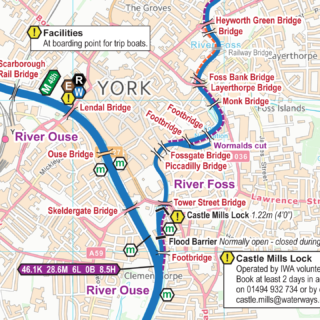
The most up to date and clearest maps of the River Ouse and Tributaries are available for download.
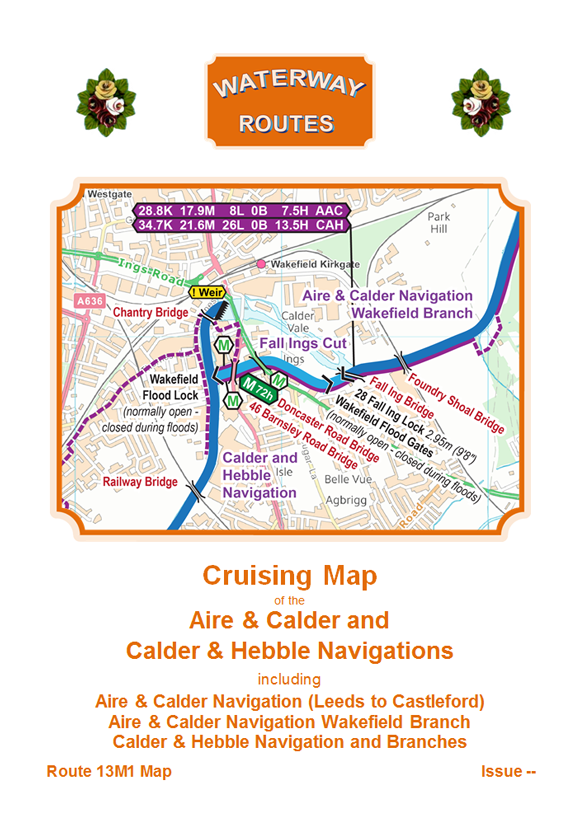
Download maps of the Aire & Calder and Calder & Hebble Navigations. The most up to date and clearest maps of the Aire & Calder and Calder & Hebble Navigations are available for download....
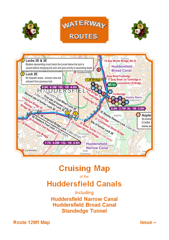
Download maps of the Huddersfield Canals. The most up to date and clearest maps of the Huddersfield Canals are available for download. View on your computer, laptop, smart phone, or tablet, or print if...
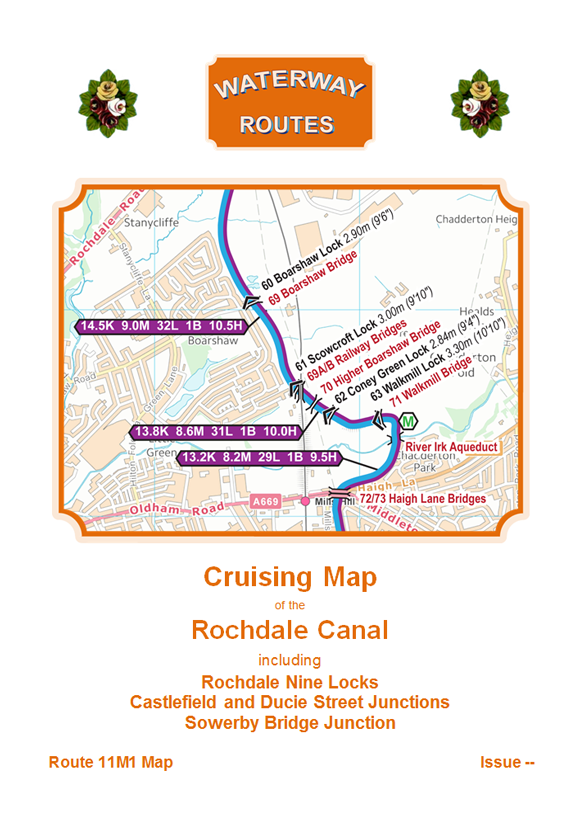
Download maps of the Rochdale Canal. The most up to date and clearest maps of the Rochdale Canal are available for download. View on your computer, laptop, smart phone, or tablet, or print if...
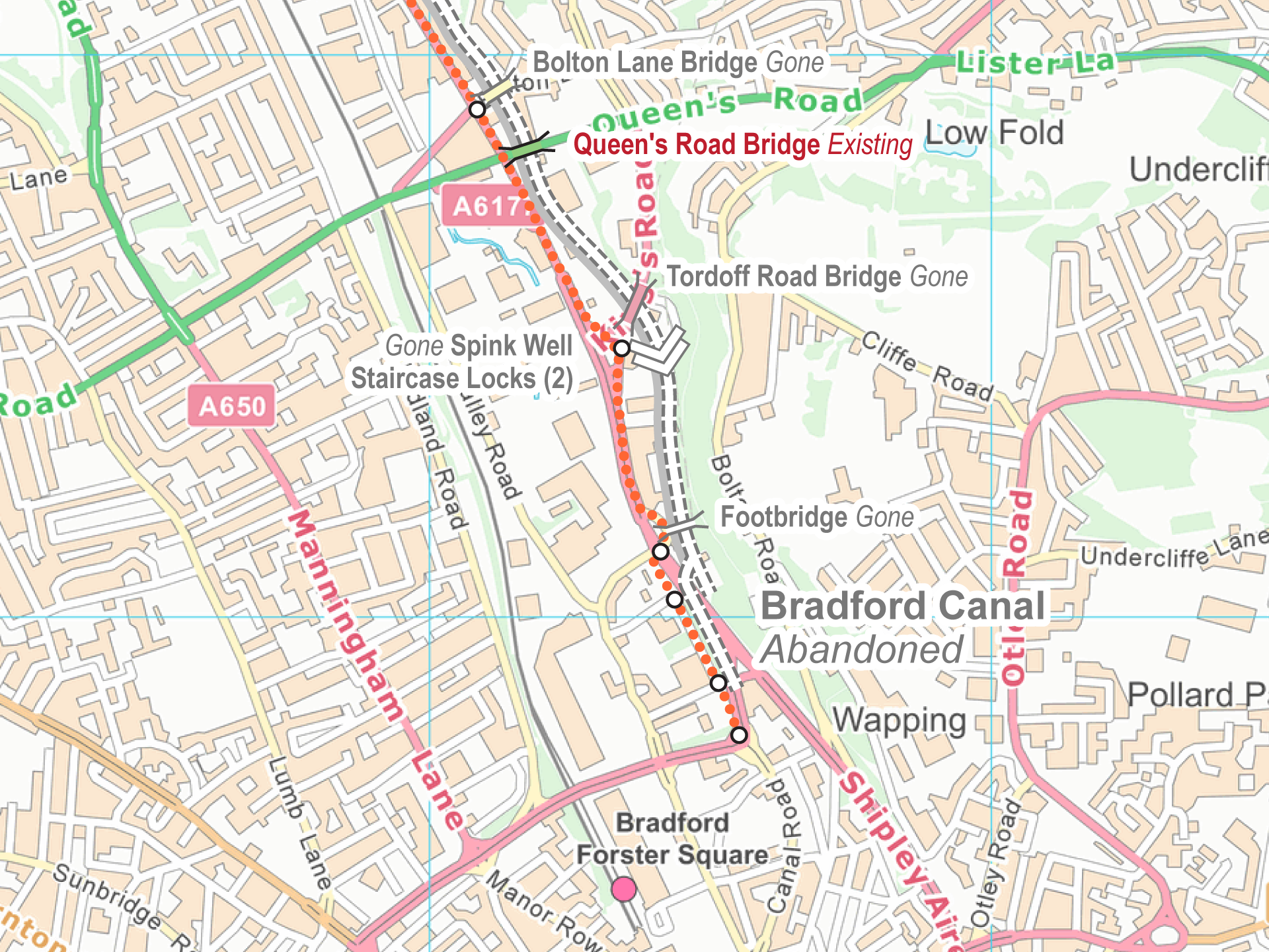
Free Maps These are my free maps covering the Bradford Canal. Download these free maps (from the links at the end) to see how good my maps are, and to check you can install...
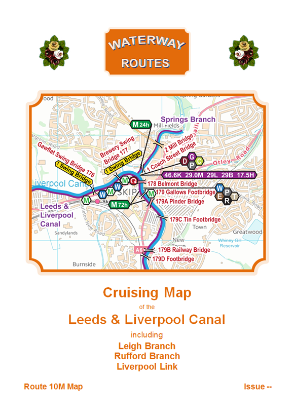
Download maps of the Leeds & Liverpool Canal. The most up to date and clearest maps of the Leeds & Liverpool Canal are available for download. View on your computer, laptop, smart phone, or...
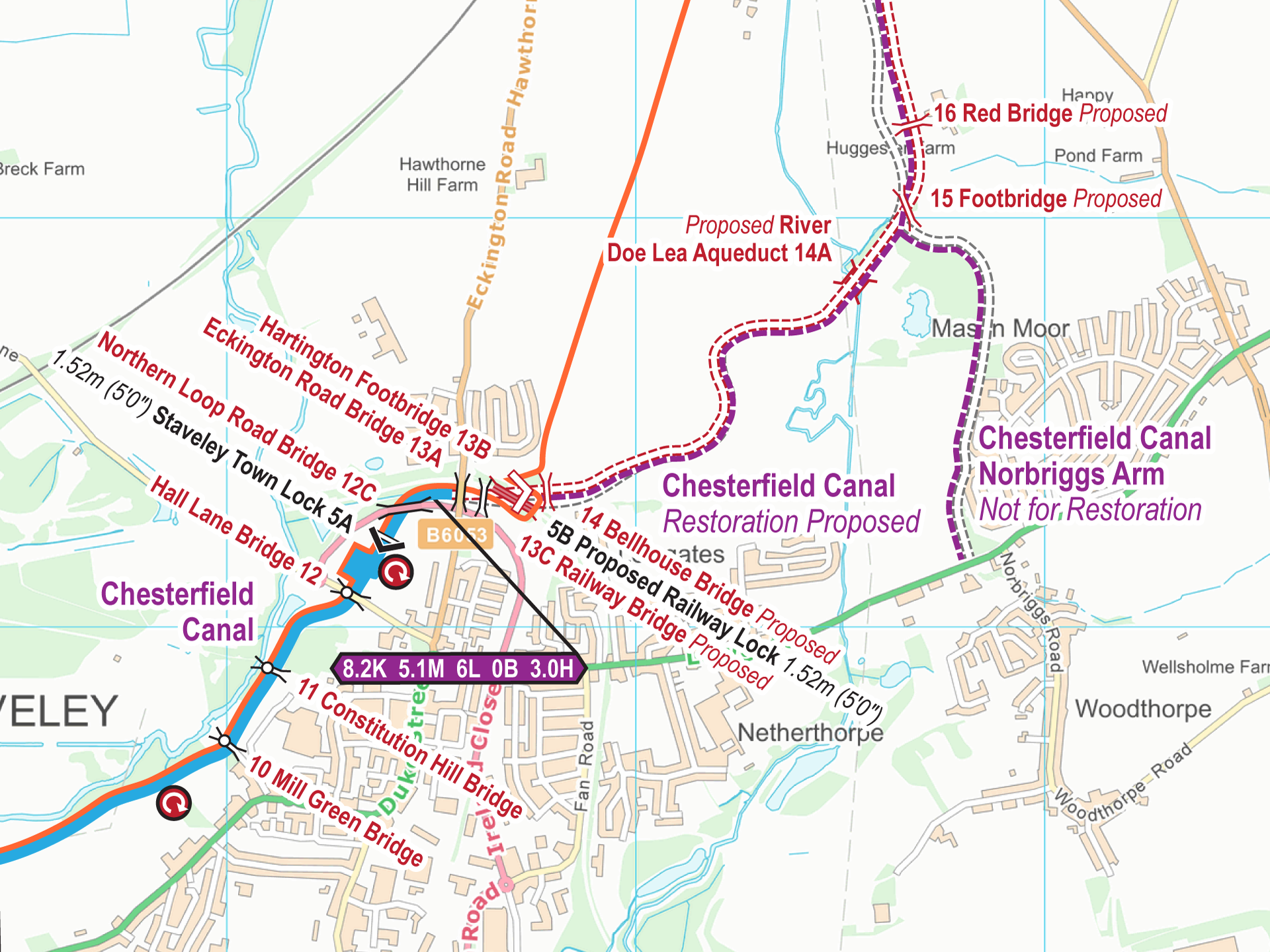
Free Maps These are my free maps covering the Chesterfield Canal (Restoration Section) Download these free maps (from the links at the end) to see how good my maps are, and to check you...
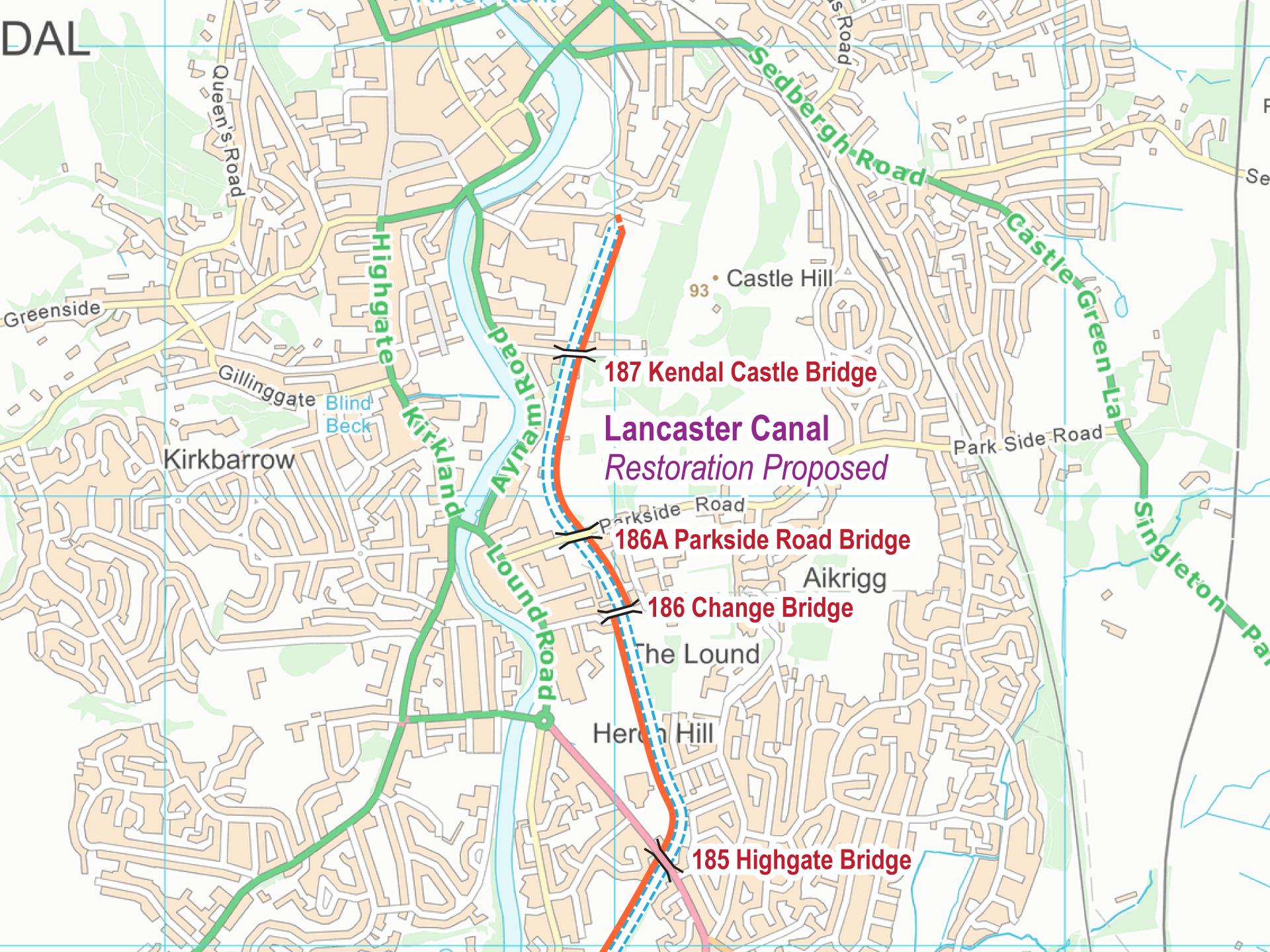
These are my free maps covering the Lancaster Canal (Restoration Section)
Download these free maps (from the links at the end) to see how good my maps are, and to check you can install them on your device(s).
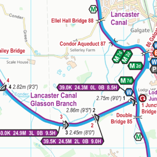
The most up to date and clearest maps of the Lancaster Canal are available for download.
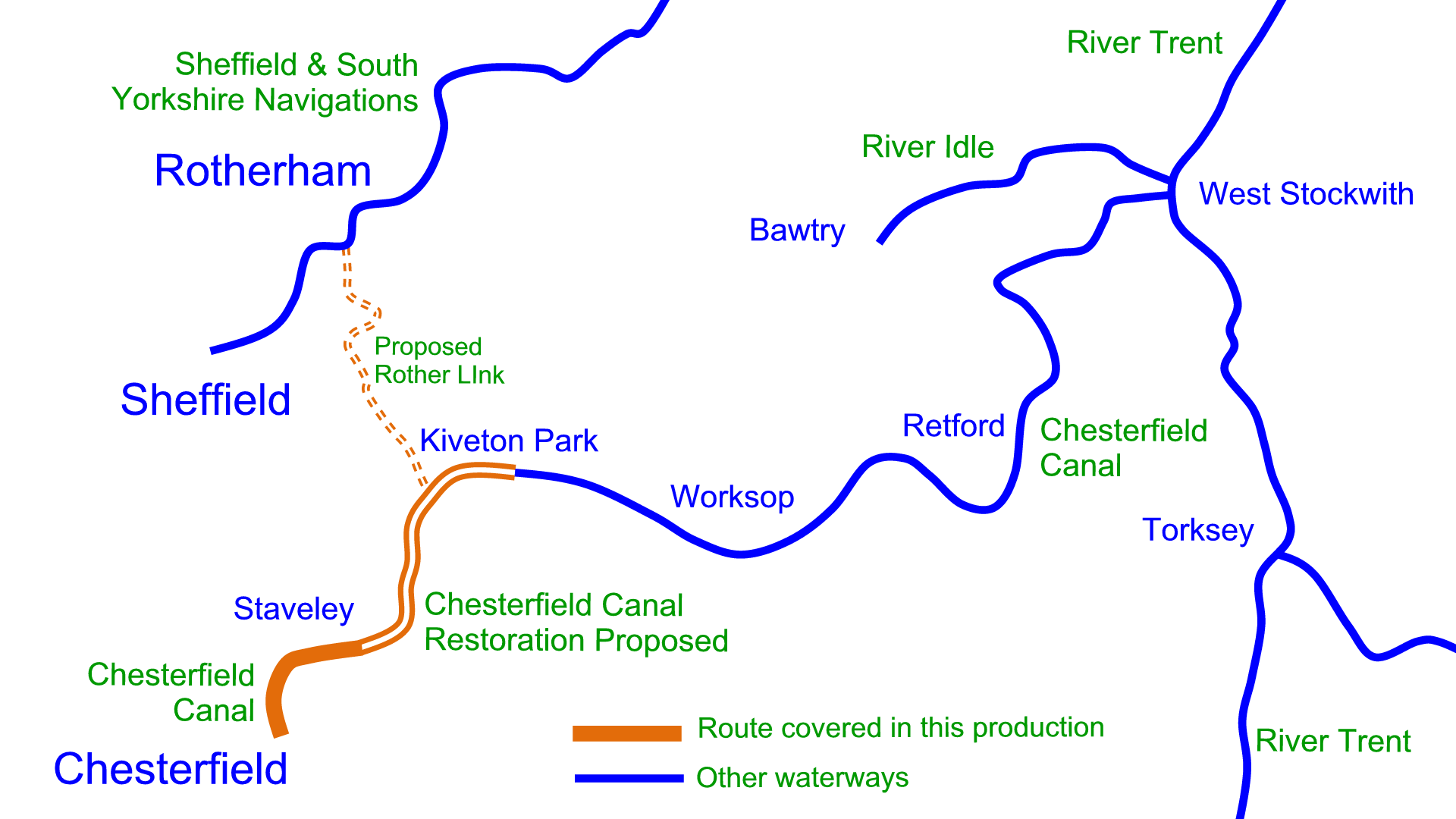
The River Idle is not available as a separate map. It is included in:- England & Wales Maps Chesterfield Canal Maps
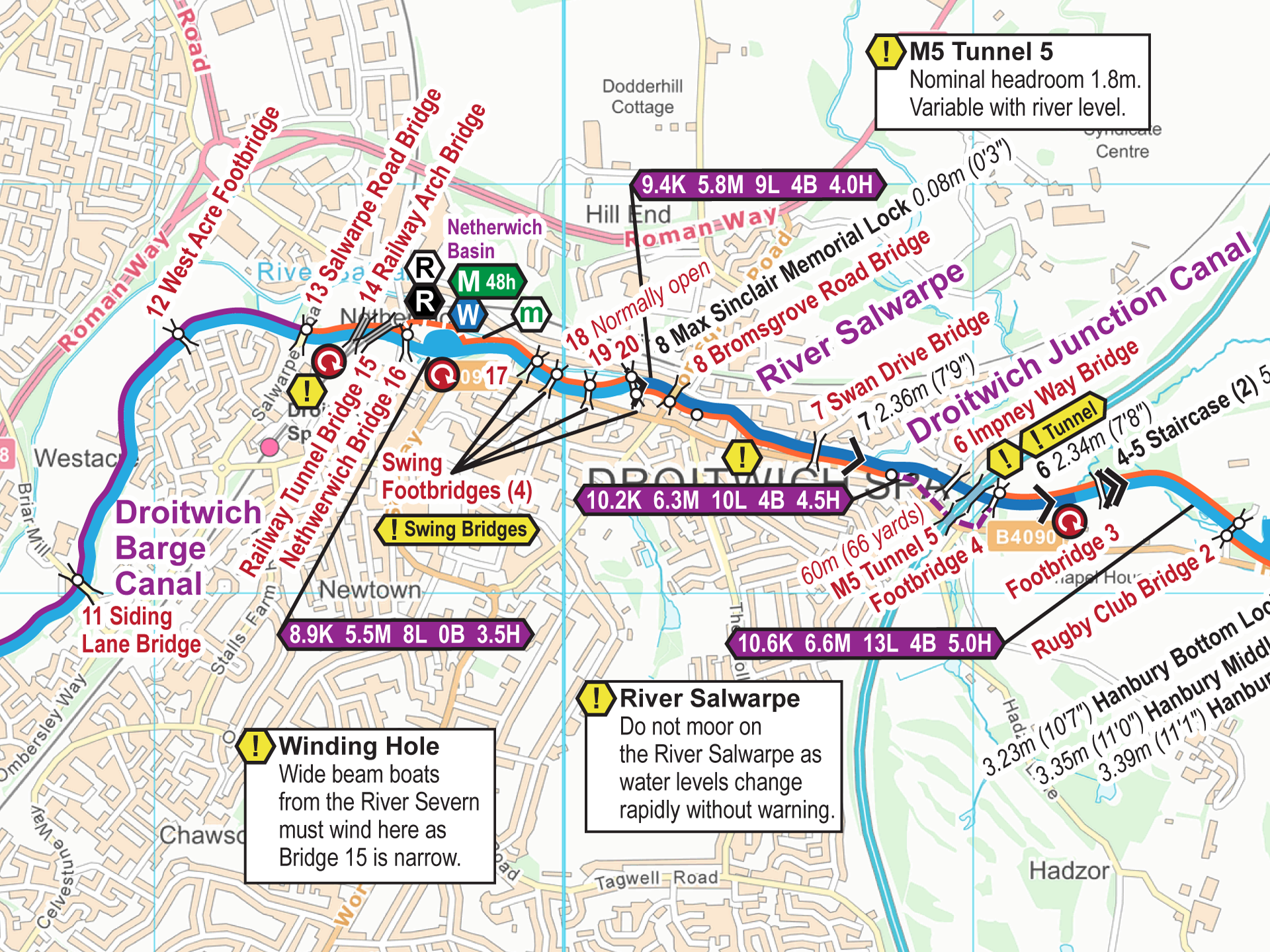
Free Maps These are my free maps of the Droitwich Canals. Download these free maps (from the links at the end) to see how good my maps are, and to check you can install...
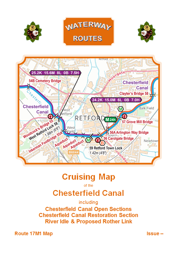
Download maps of the Chesterfield Canal. The most up to date and clearest maps of the Chesterfield Canal are available for download. View on your computer, laptop, smart phone, or tablet, or print if...
You can make a virtual cruise (VC) along the canal from the comfort of your armchair. Just select your starting point below, then click the next buttons to move along the canal.
Select one of these starting points then keep clicking on the “Next” link to progress along the Gower Branch.
The Canal & River Trust (CRT) issued an email this morning saying that the River Severn was now navigable after being in flood for several days. The water levels were very raised when cycled...
There are approximately sixty rivers with tidal bores around the world, with eleven in Great Britain, where the River Severn Bore is probably the best known. The River Great Ouse has a bore, which...
We’ve continued downstream on the River Nene passing many lovely locations along the way. The heatwave slowed us down a little but the blue sky and fluffy white cloud was great for filming. We...
Another stunning day of sunshine saw us cruising down the River Nene to Thrapston. One of our first challenges was the Radial Gate on Ditchford Lock. This is power operated, like most of the...
Having recovered from a very busy Crick Boat Show where we met lots of lovely customers, we were ready to set off for our summer cruise this morning. We’ve travelled a long distance if...
In 2013 we passed through Standedge Tunnel as we were filming for our South Pennine Ring DVDs. I was steering the boat and didn’t have much chance to appreciate the inside of the tunnel. Here we...
We’ve just returned from our first cruise of the season over the past two days, from our home mooring at Sherborne Wharf to Wolverhampton and back. It’s always nice to be cruising again, and...
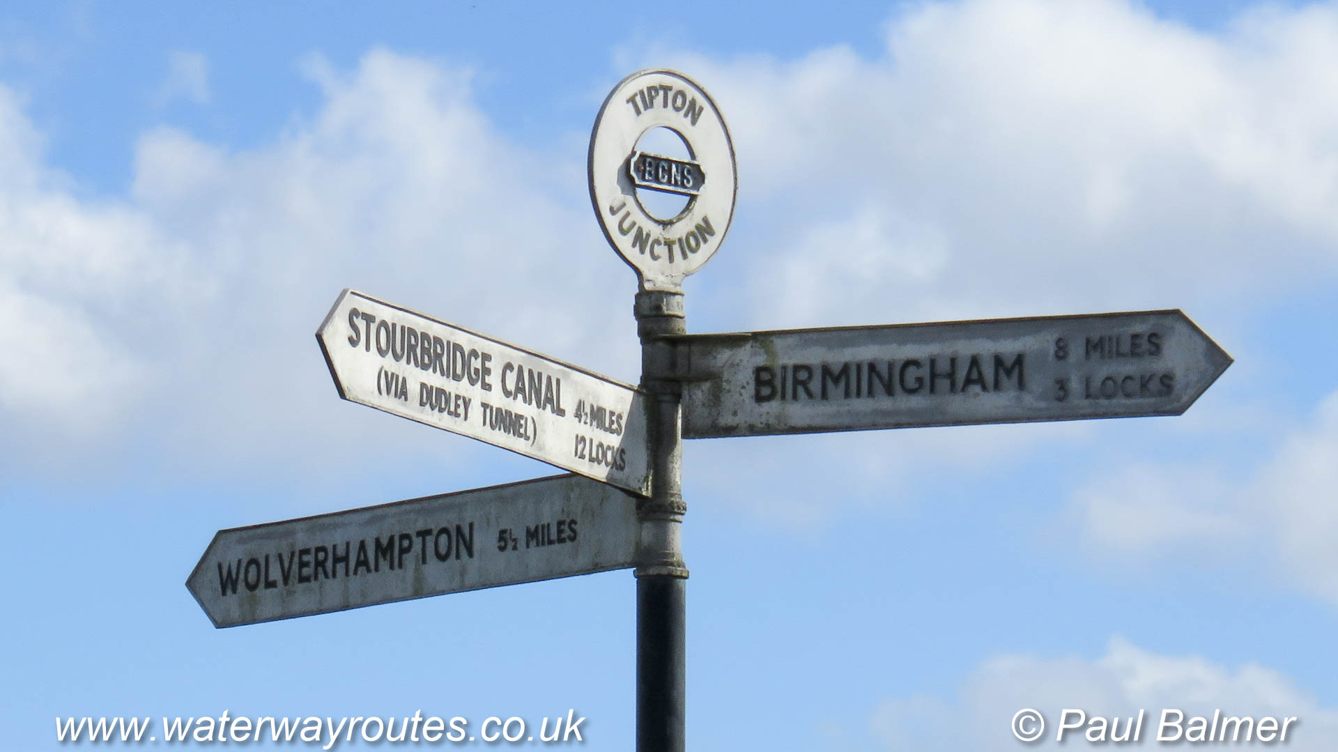
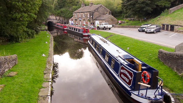
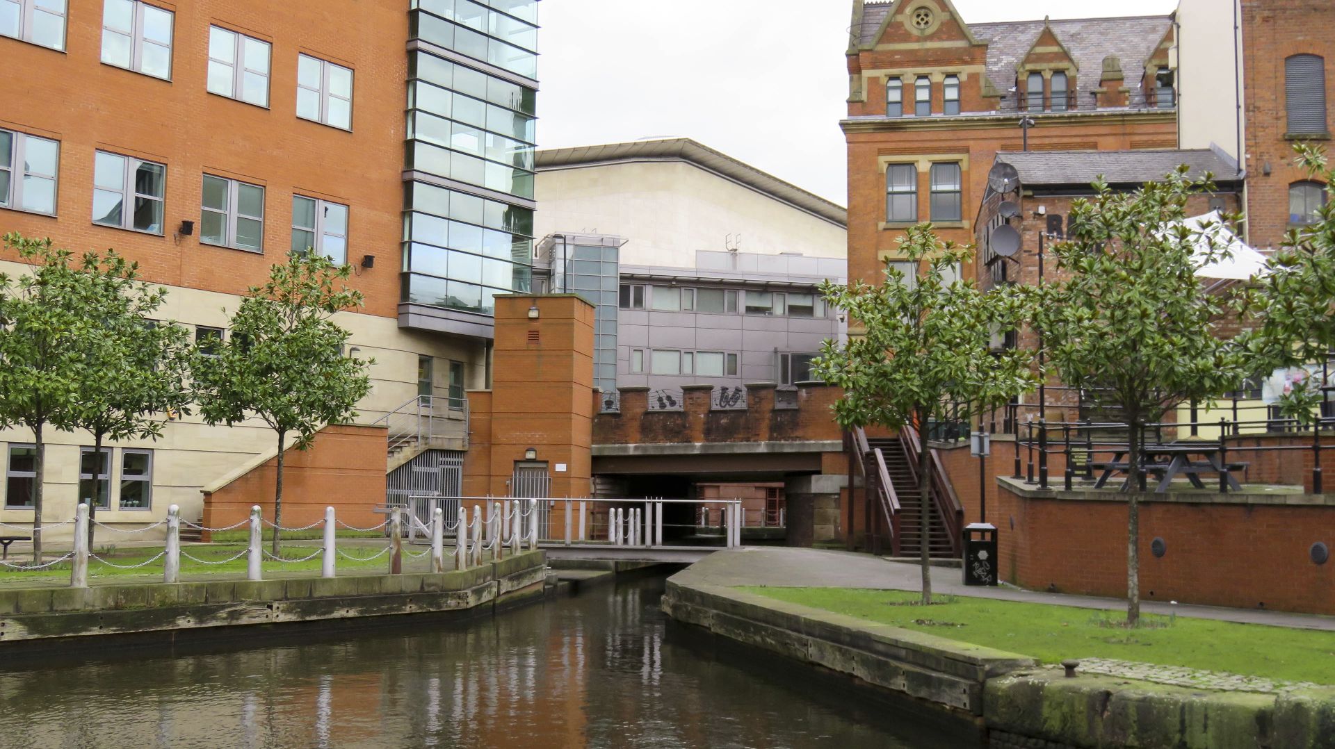
The Old Main Line of the Birmingham Canal Navigations passes Tipton Junction between Birmingham and Wolverhampton.
< Factory Junction Brades Hall Junction > < Next Birmingham Canal Navigations (BCN)Old Main Line Next > < Parkhead Junction < Next Birmingham Canal Navigations (BCN)Dudley No 1 Canal The Old Main Line of...

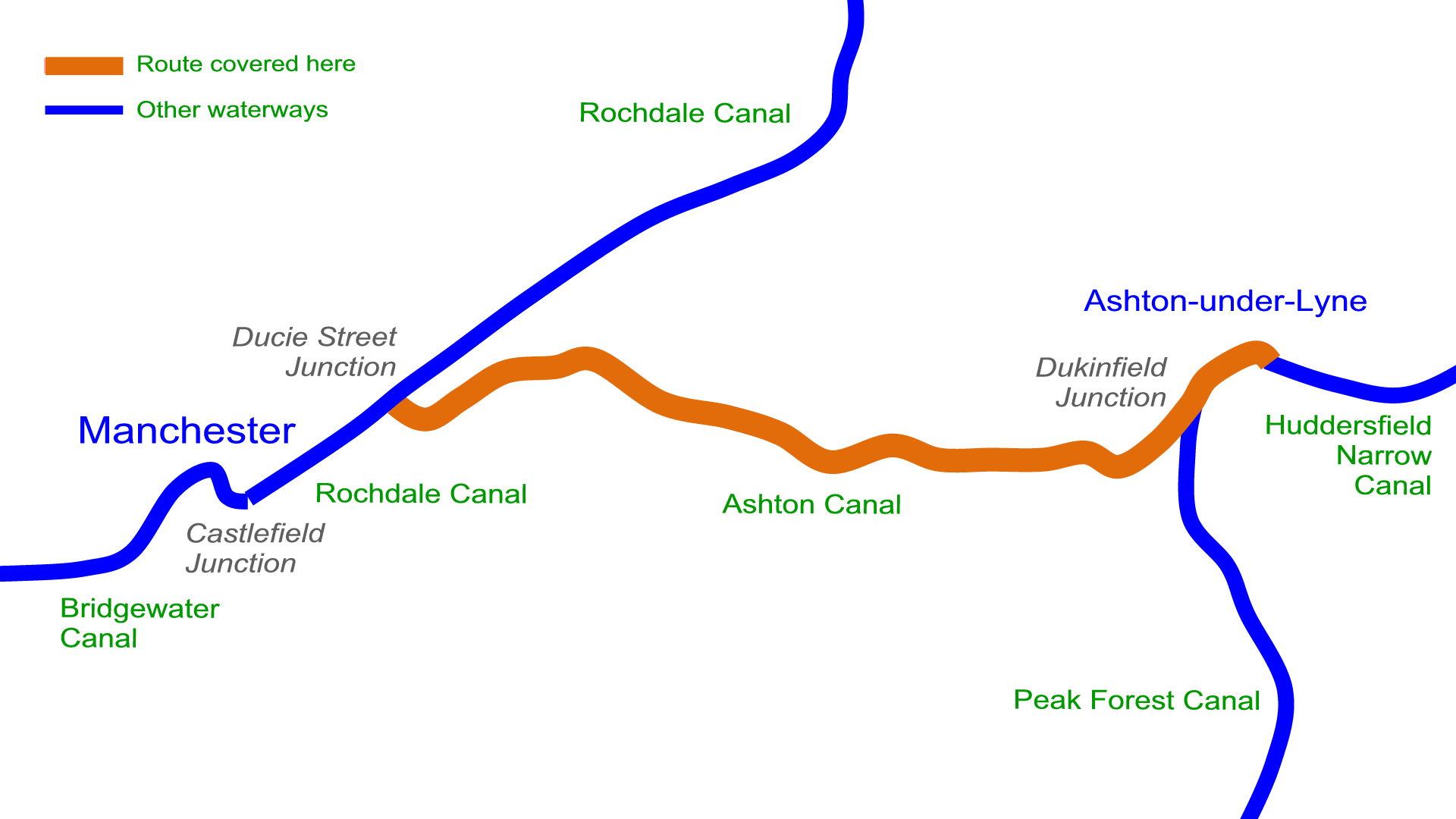
The Manchester & Ashton Under Lyne Canal, now know simply as the Ashton Canal, ran east from Manchester to Ashton Under Lyne. The Stockport Branch Canal linked the canal to Stockport. The Hollinwood Branch...
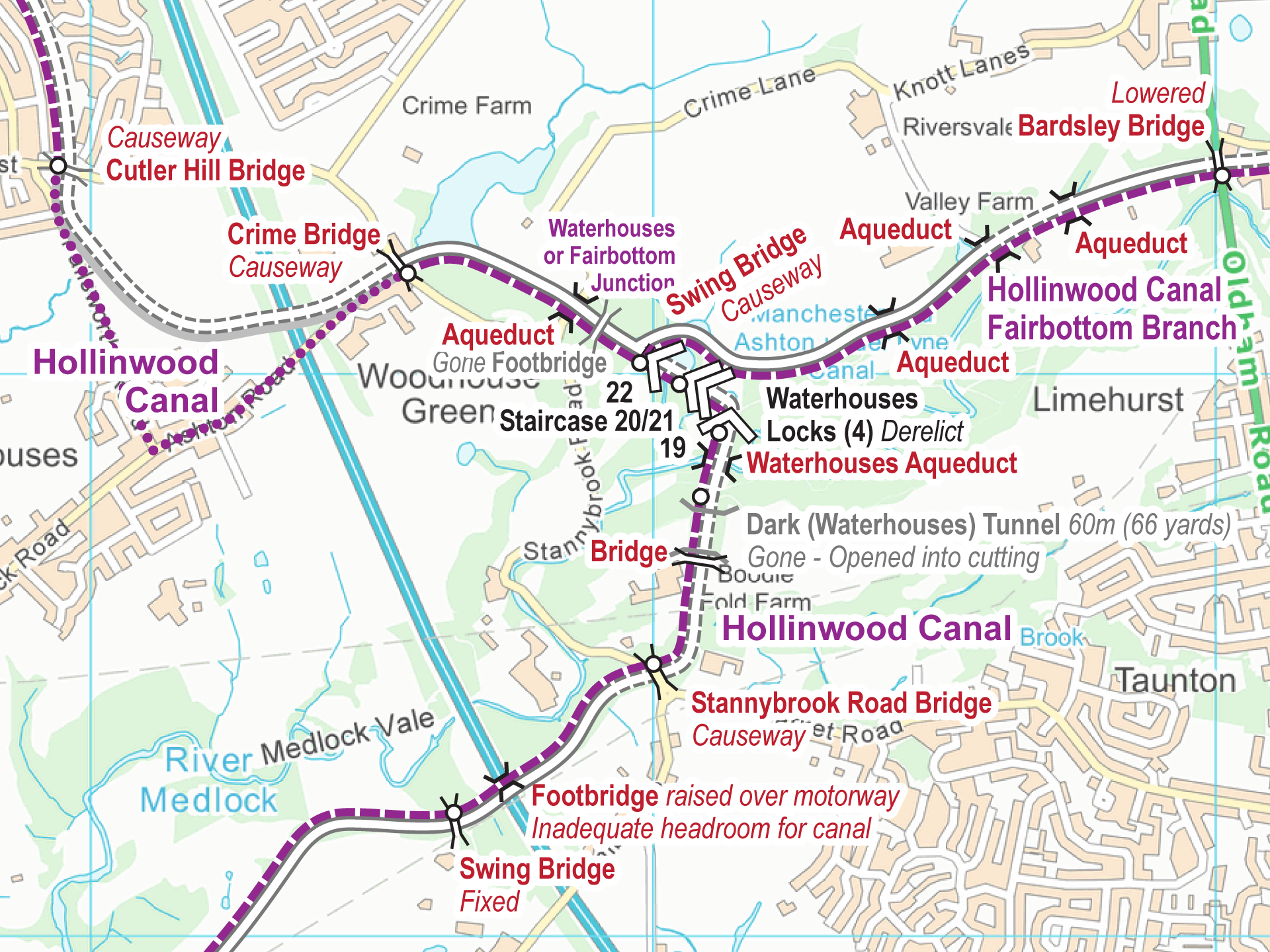
See also … Maps Virtual Cruise Features History The Hollinwood Canal is derelict and navigation is no longer possible. It ran to the east of Manchester, heading generally northwards from the Ashton Canal at Fairfield...
Maps of the Hollinwood Canal are available for download – FREE. The maps cover the Hollinwood Canal, including the Fairbottom Branch, plus the Werneth Branch Canal and the Stockport Canal, all in one map....
Distances are measured from the south end of the canal. Kilometerage Feature 00.000 Start of Navigation. 00.140 Junction with Hollinwood Canal. 00.840 End of Navigation. Kilometerage Feature
Distances are measured along the Hollinwood Canal from Fairfield Junction with the Ashton Canal. Kilometerage Feature 04.200 Waterhouses (Fairbottom) Junction with the Hollinwood Canal. 04.685 Aqueduct. 04.905 Aqueduct. 05.065 Aqueduct. 05.345 Bardsley Bridge. Bridge...
Distances are measured from Fairfield Junction with the Ashton Canal. Kilometerage Feature 00.000 Fairfield Junction with the Ashton Canal. 00.230 Manchester Road Bridge. 00.590 Harrison’s Bridge. 00.955 Medlock Street Bridge. 01.255 Swing Bridge. Gone. 01.730...
The Hulme Locks Branch of the Bridgewater Canal was opened in 1838 to provide a link from the main line of the Bridgewater Canal to the River Irwell, then the Mersey and Irwell Navigation....
< Next Hulme Locks Branch JUMP TO > < River Irwell Jn River Irwell Jn > Hulme Locks Junction is where the Hulme Locks Branch (to the right of the photo) meets the main line of...
< Next Hulme Locks Branch Next > < River Irwell Jn Hulme Locks Jn > The top gates of the top lock on the Hulme Locks branch have seen better days and it’s doubtful they could...
< Next Hulme Locks Branch Next > < River Irwell Jn Hulme Locks Jn > The top lock of the Hulme Locks Branch was crossed by a swing footbridge and the semi-circle shows where it swung....
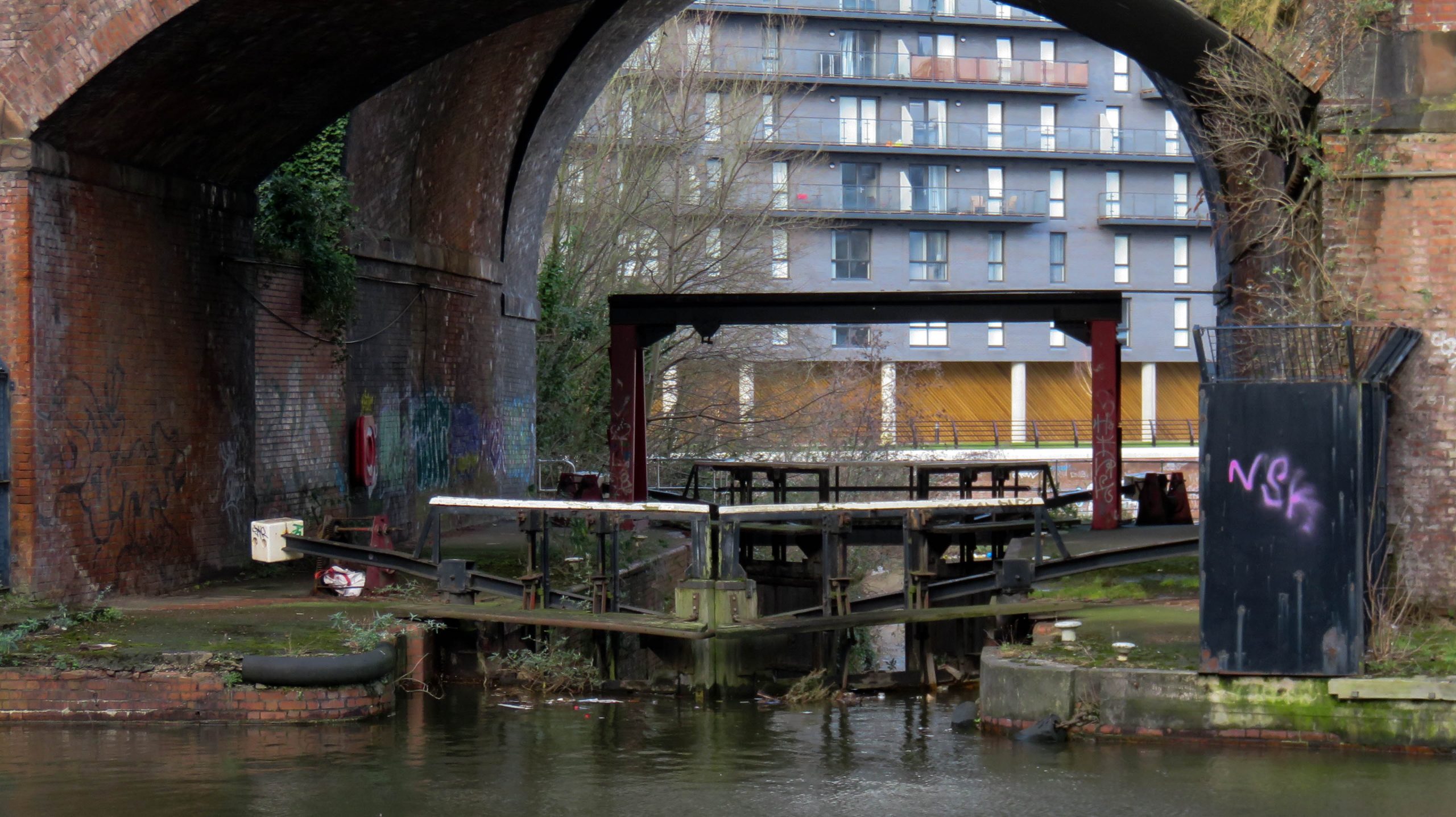
< Next Hulme Locks Branch Next > < River Irwell Jn Hulme Locks Jn > Looking from the top lock into the basin between the locks where boats turned through a right angle to pass through...
< Next Hulme Locks Branch Next > < River Irwell Jn Hulme Locks Jn > Looking at the bottom lock of the Hulme Locks Branch across the basin between the two locks, with the upper lock...
< Next Hulme Locks Branch Next > < River Irwell Jn Hulme Locks Jn > The top gates of the bottom lock of the Hume Locks Branch are all that’s holding back all the water in...
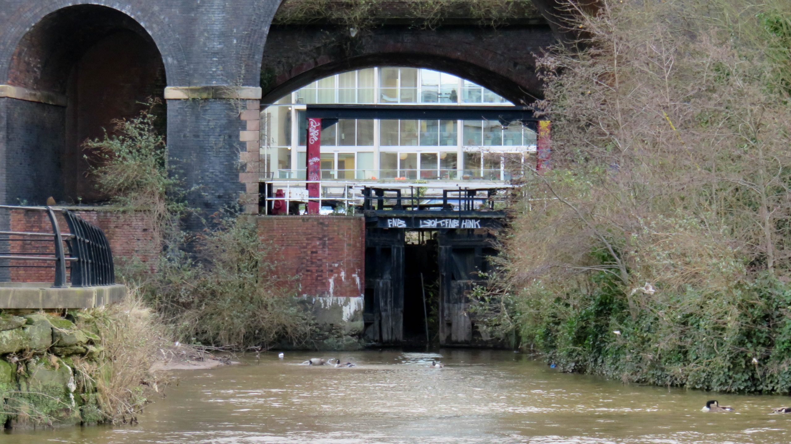
< Next Hulme Locks Branch Next > < River Irwell Jn Hulme Locks Jn > Viewed from below, the bottom gates of the bottom lock on the Hulme Locks Branch have drifted open and all sorts...
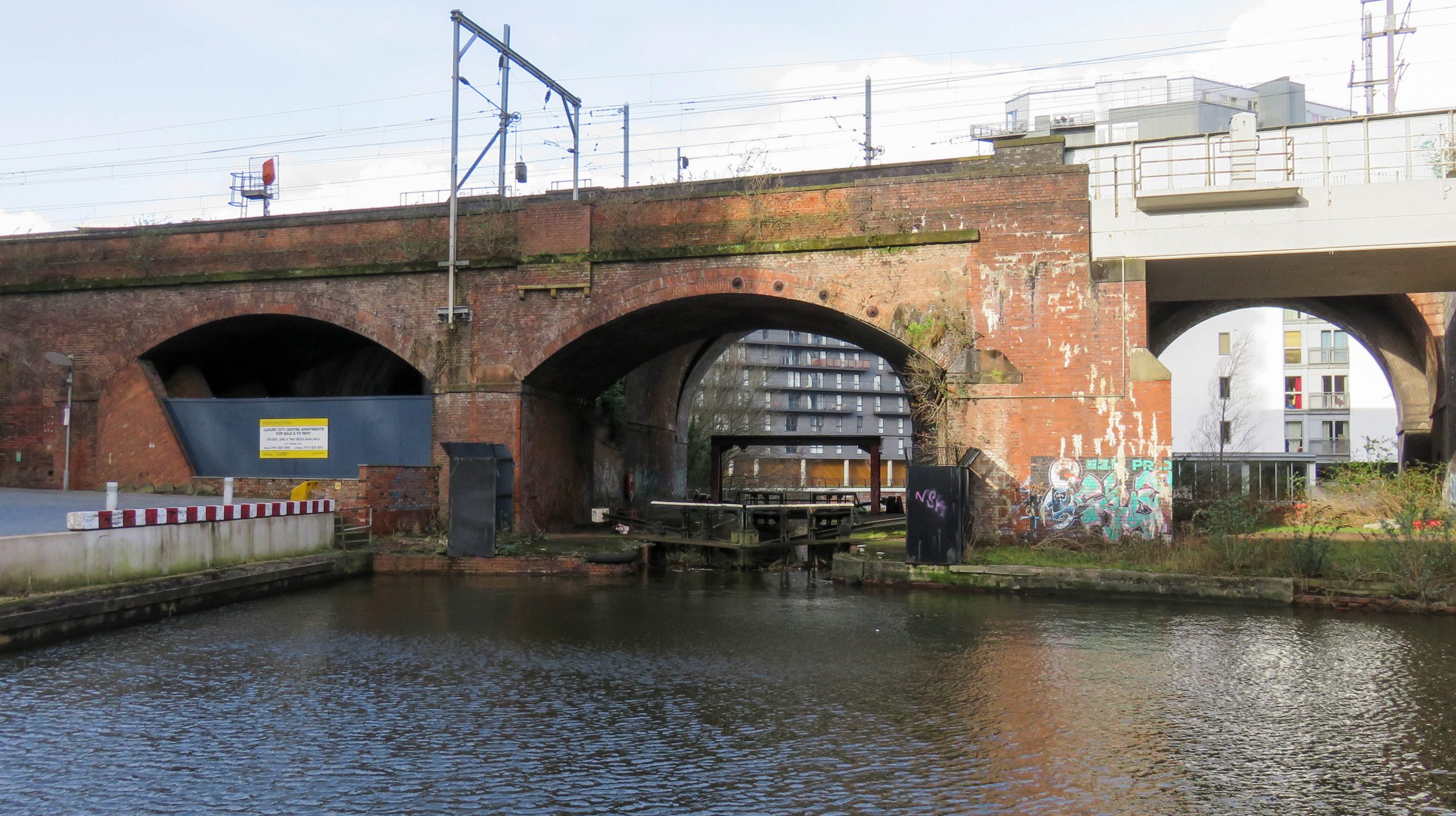
< JUMP TO Hulme Locks Branch Next > < Hulme Locks Jn Hulme Locks Jn > The lower end of the former Hulme Locks Branch of the Bridgewater Canal emerges from the leftmost visible arch of...

While cycling along the Leigh Branch of the Leeds & Liverpool Canal recently to check my map data I encountered new signs, intended for cyclists. This was the first sign I found, at Leigh....
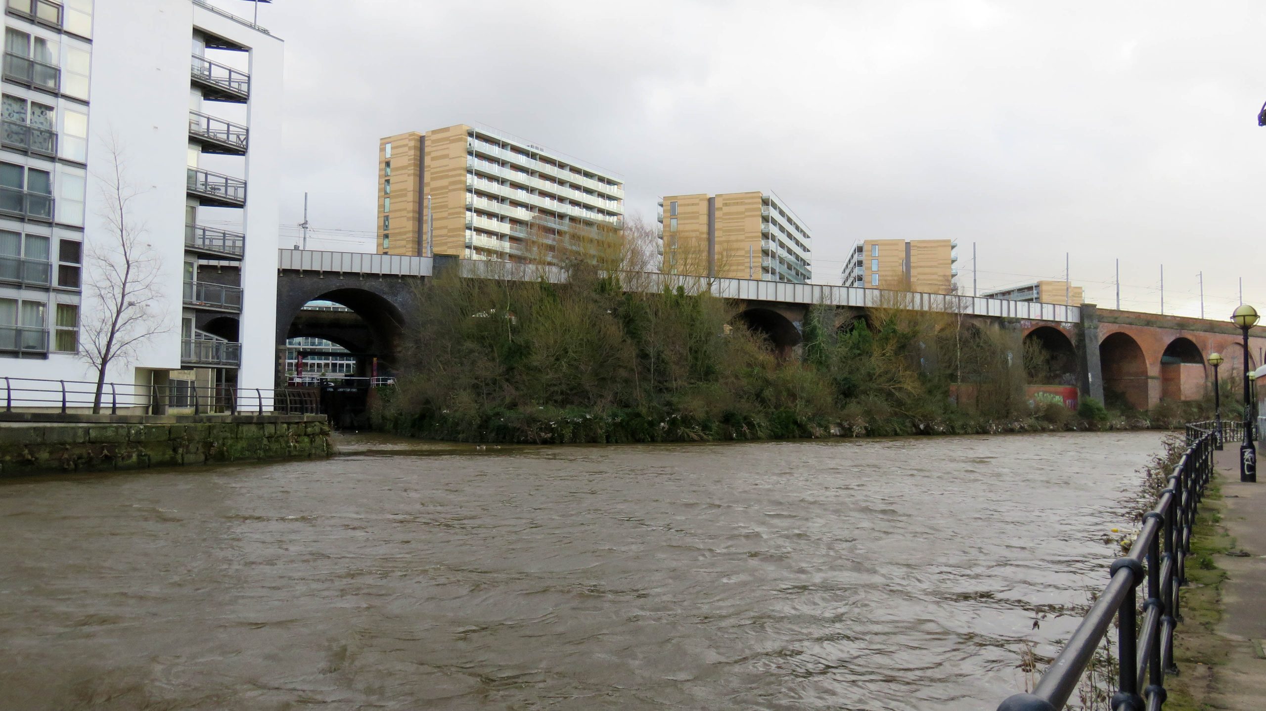
In my previous post about the Mersey Gateway I described a new bridge being constructed across the Manchester Ship Canal near Runcorn. There’s another new bridge being constructed across the ship canal nearer Manchester....

< Next M&SJ Canal Next > < River Irwell Jn Rochdale Canal Jn > Lock 1 was never paired, unlike locks 2, 3 and 4 which were paired. The lock leads under the lift bridge onto the...
< Next M&SJ Canal Next > < River Irwell Jn Rochdale Canal Jn > Having passed through the paired lock 2, the other side of Water Street behind the wall, the canal comes towards us through...
< Next M&SJ Canal Next > < River Irwell Jn Rochdale Canal Jn > The canal continued straight ahead at Lower Byrom Street where pedestrians now have to walk around the television studios which now cover...
< Next M&SJ Canal Next > < River Irwell Jn Rochdale Canal Jn > Still following a straight line the Manchester & Salford Junction Canal passed along what is now the pedestrianised length of Camp Street....
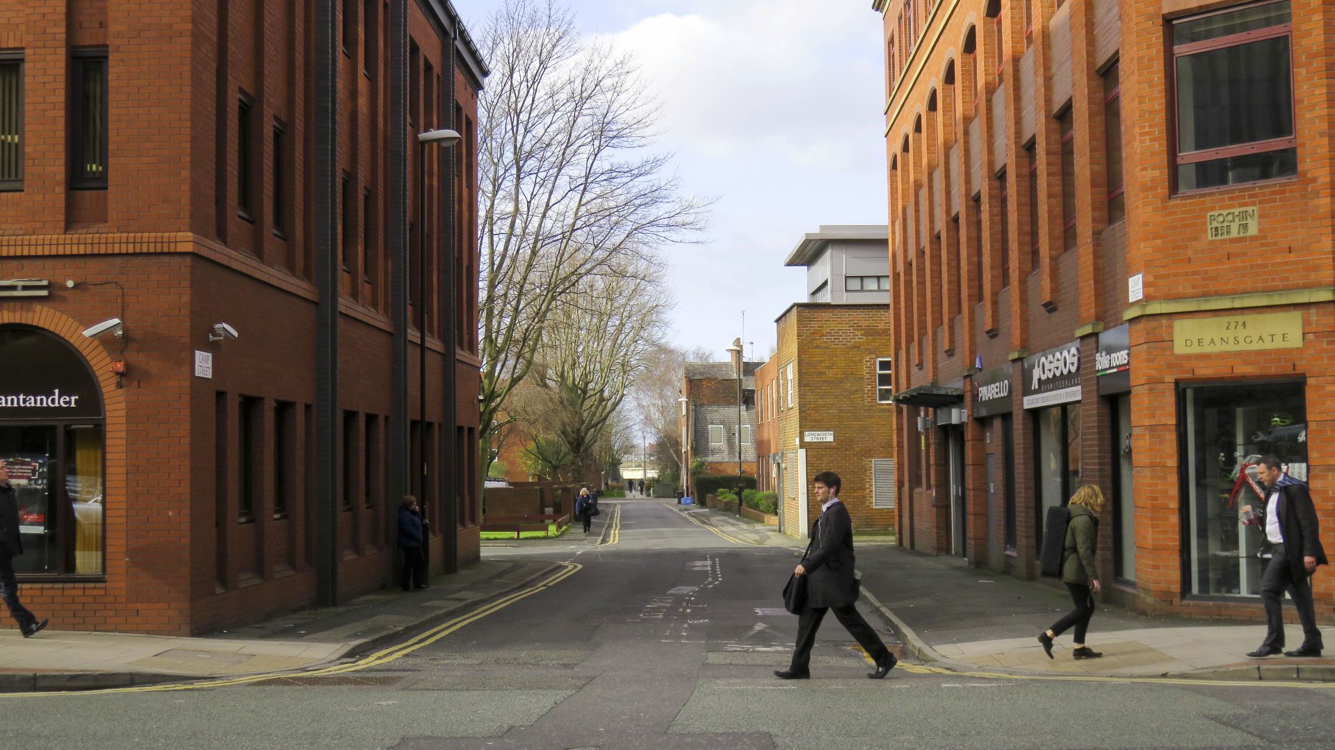
< Next M&SJ Canal Next > < River Irwell Jn Rochdale Canal Jn > After passing under the railway goods station and crossing Deansgate the canal continued straight ahead along what is now Camp Street in its...
< Next M&SJ Canal Next > < River Irwell Jn Rochdale Canal Jn > Now used as a car park, the canal would have passed under the former railway goods depot between Watson Street and Deansgate....
< Next M&SJ Canal Next > < River Irwell Jn Rochdale Canal Jn > After emerging from under the Manchester Central Goods Depot and crossing Watson Street the canal continued under another railway goods depot, between...
< Next M&SJ Canal Next > < River Irwell Jn Rochdale Canal Jn > Having descended through the paired staircase locks 3 and 4 as it comes towards us under Manchester Central’s Goods Depot, the canal...
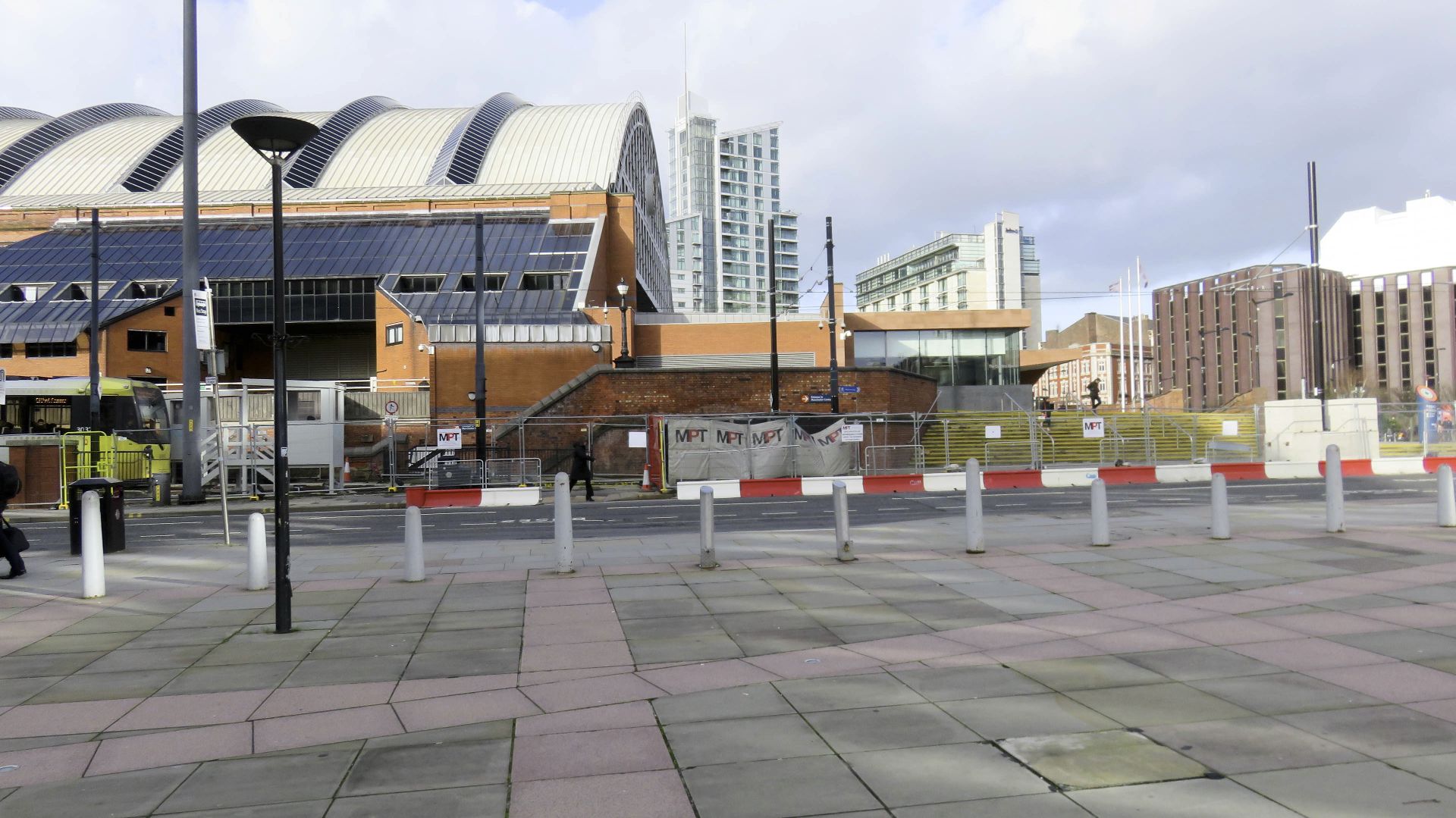
< Next M&SJ Canal Next > < River Irwell Jn Rochdale Canal Jn > Passing under the former Manchester Central Station the canal would have passed under arches like these, now used for access to the...
< Next M&SJ Canal Next > < River Irwell Jn Rochdale Canal Jn > Now used as a car park under the former Manchester Central Station, the Manchester & Salford Junction Canal would have passed through...
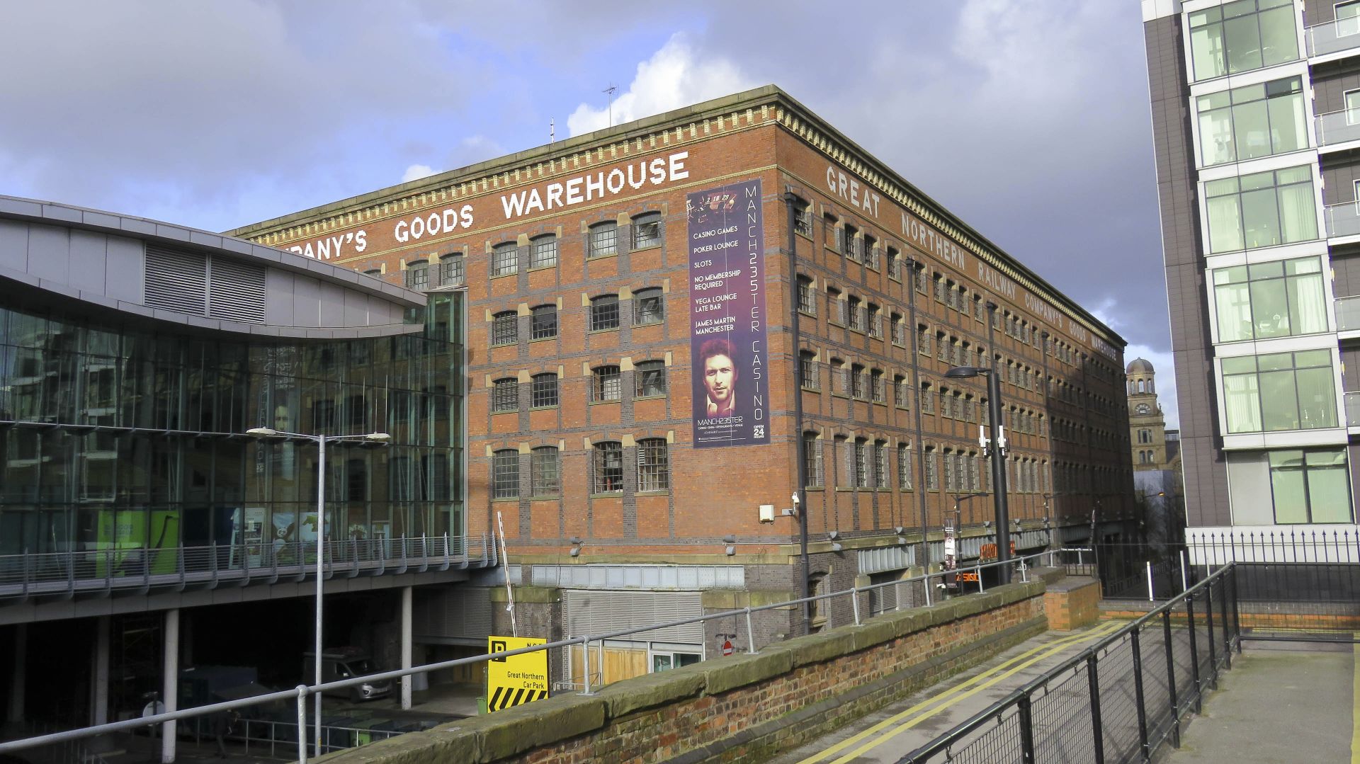
< Next M&SJ Canal Next > < River Irwell Jn Rochdale Canal Jn > The text around the top of the warehouse reads “Great Northern Railway Company’s Goods Warehouse”. It stands to the side of the...
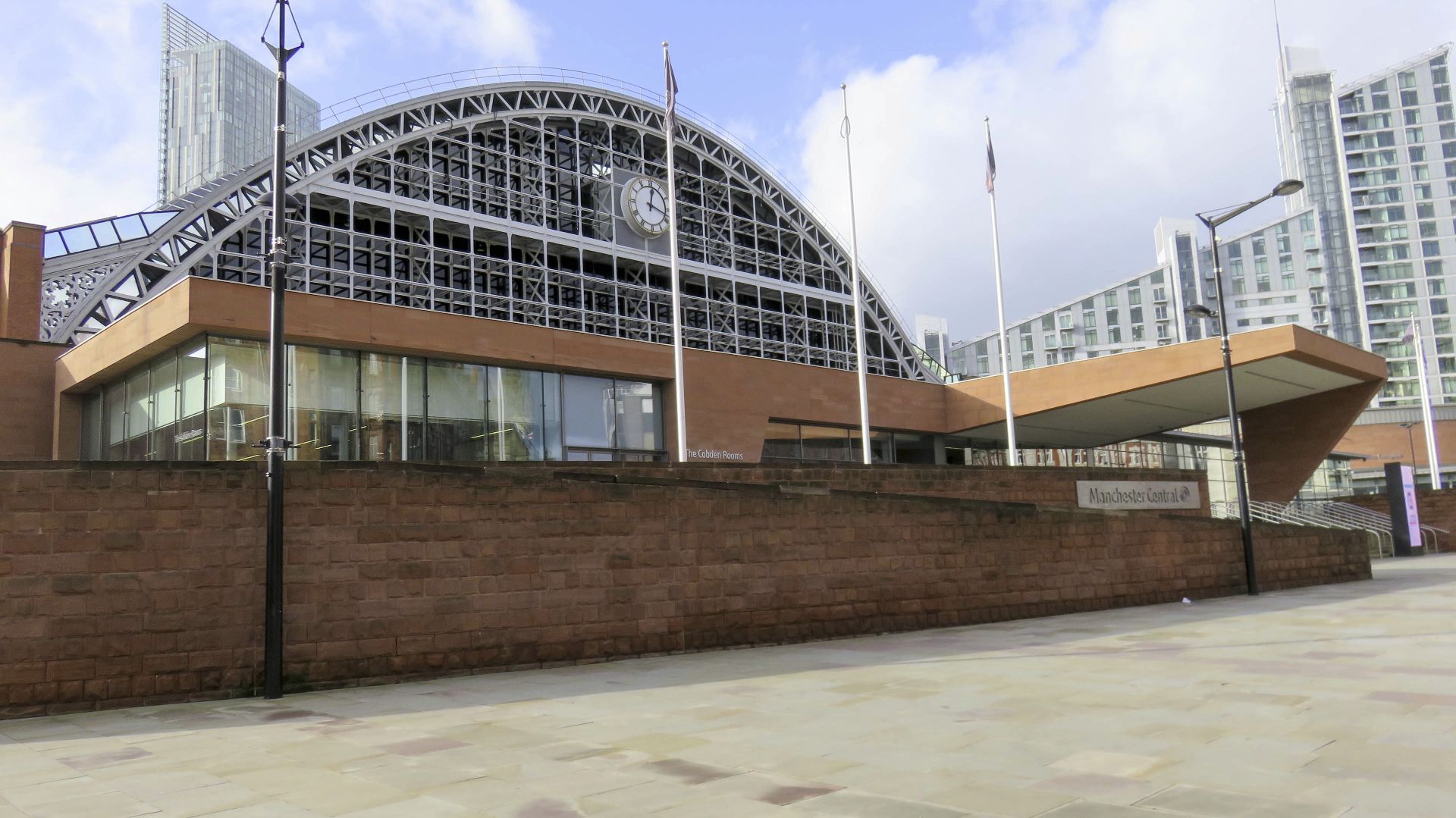
< Next M&SJ Canal Next > < River Irwell Jn Rochdale Canal Jn > The Manchester & Salford Junction canal was built over so it passed under the former Manchester Central Station, approximately at right angles...
< Next M&SJ Canal Next > < River Irwell Jn Rochdale Canal Jn > Looking across Lower Mosley Street, at the top of the embankment in the next (right) photo there’s no visible trace of the...
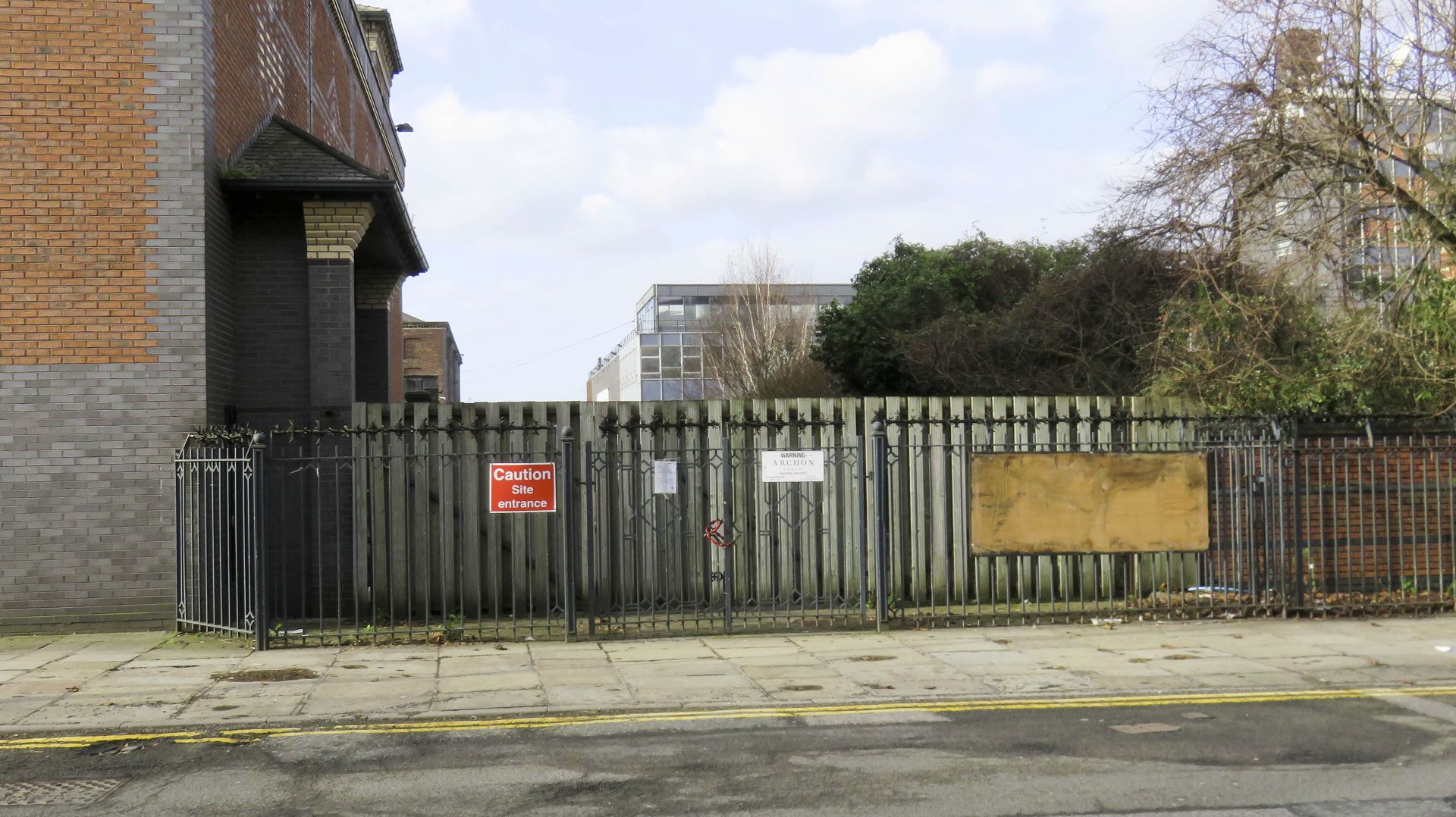
< Next M&SJ Canal Next > < River Irwell Jn Rochdale Canal Jn > The narrow channel leads into a former basin where the canal made a right angle turn. There was once a stop lock...
< Next M&SJ Canal Next > < River Irwell Jn Rochdale Canal Jn > The channel marks the line of the canal. This was once wide enough to pass wide beam boats. Waterway and Kilometerage MASJ...
< Next M&SJ Canal Next > < River Irwell Jn Rochdale Canal Jn > A sharp bend follows the bridges at the entrance to the canal. It still looks as if a short narrowboat could squeeze...
< Next M&SJ Canal Next > < River Irwell Jn Rochdale Canal Jn > Looking back towards the junction with the Rochdale Canal near the middle of the Rochdale Nine Locks. Ducie Street Junction is uphill to...
< Next M&SJ Canal Next > < River Irwell Jn Rochdale Canal Jn > A swing bridge crosses the entrance to the Manchester & Salford Junction Canal. The bridge is fixed closed to prevent attempts to...
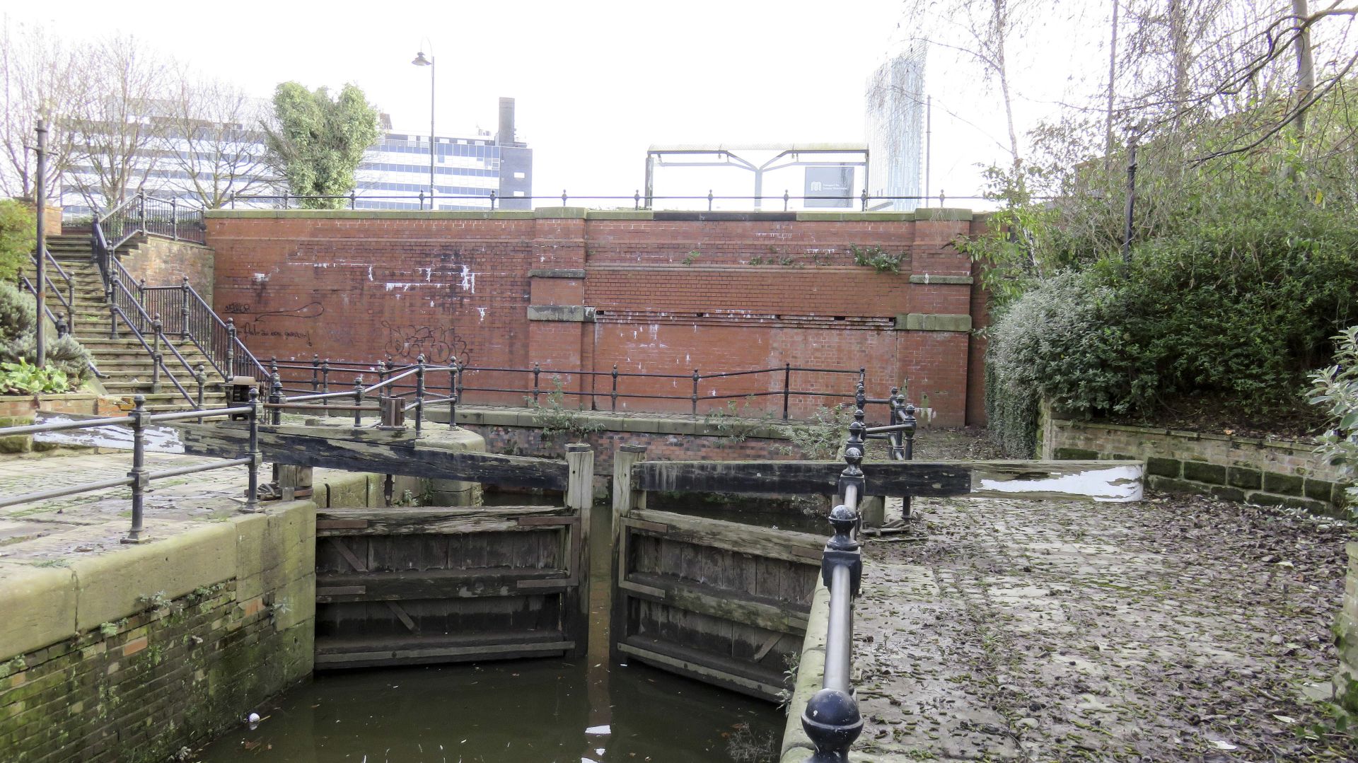
< Next M&SJ Canal JUMP TO > < River Irwell Jn River Irwell Jn > The Manchester & Salford Junction Canal meets the Rochdale Canal immediately above Tib Lock 89 near the middle of the Rochdale...
< JUMP TO M&SJ Canal Next > < Rochdale Canal Jn Rochdale Canal Jn > The Manchester & Salford Junction Canal enters the River Irwell under the lift bridge. The first lock is immediately behind the...
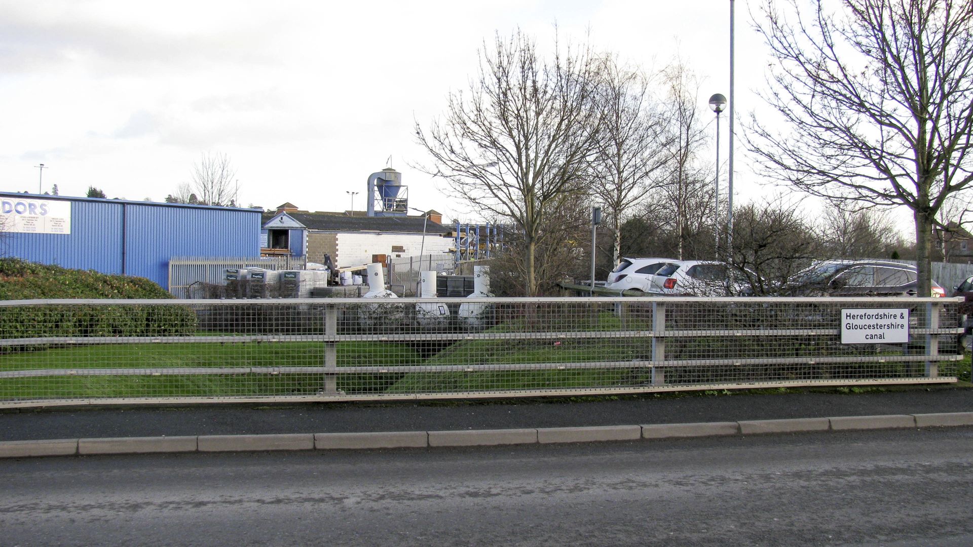
< JUMP TO H&G Canal Next > < Entry to Hereford Entry to Hereford > Viewed from the railway station, the Herefordshire & Gloucestershire Canal canal once ended at a wharf in the middle of this...
< Next H&G Canal Next > < End of Navigation Entry to Hereford > There’s a big clue in the name of the road which once led to the wharf at the end of the Herefordshire...
< Next H&G Canal Next > < End of Navigation Entry to Hereford > Sections of the original route are still available and will be used to bring the canal close to it’s original terminus near...
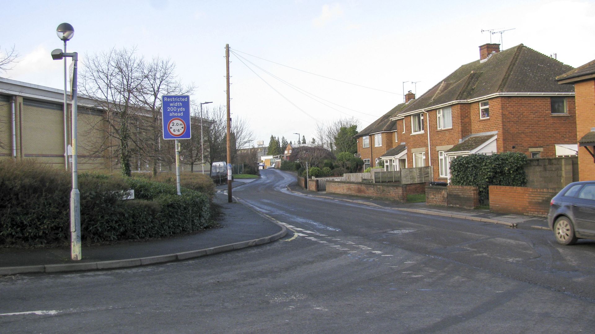
< Next H&G Canal Next > < End of Navigation Entry to Hereford > The original route of the Herefordshire & Gloucestershire Canal would have come towards the camera along the line now occupied by Burcott...
< Next H&G Canal Next > < End of Navigation Entry to Hereford > The new route passes under Farriers Way Bridge and curves to the right to rejoin the original alignment of the Herefordshire &...
 England & Wales Waterway Map for Download
by Mike Fielding
England & Wales Waterway Map for Download
by Mike Fielding
 South Pennine Ring Map for Download
by Mark Adley
England & Wales Waterway Map for Download
by John DiDonato
England & Wales Waterway Map for Download
by John Charnock
South Pennine Ring Map for Download
by Mark Adley
England & Wales Waterway Map for Download
by John DiDonato
England & Wales Waterway Map for Download
by John Charnock
 Llangollen Canal Map for Download
by Mike Moreau
Llangollen Canal Map for Download
by Mike Moreau
 RSS Blog Feed
Recent Comments