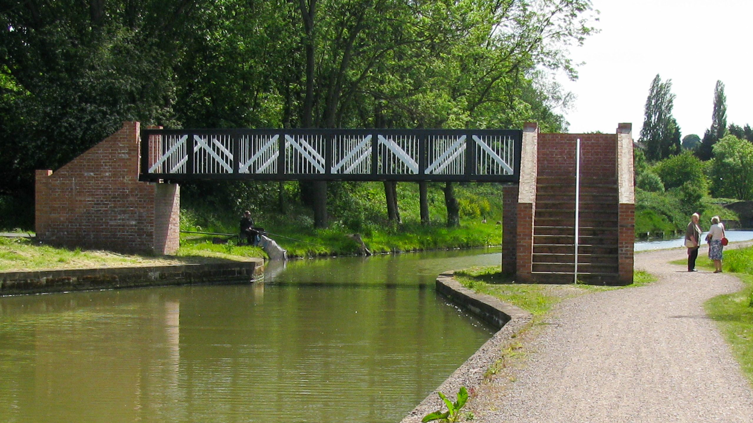
Footbridge over the Canal
< Next H&G Canal Next > < End of Navigation Entry to Hereford > The modern footbridge stands ready to cross the canal where the new route curves around the end of the retail park near...
![]()
Maps and DVDs for the Waterways of Britain
< Next H&G Canal Next > < End of Navigation Entry to Hereford > The modern footbridge stands ready to cross the canal where the new route curves around the end of the retail park near...
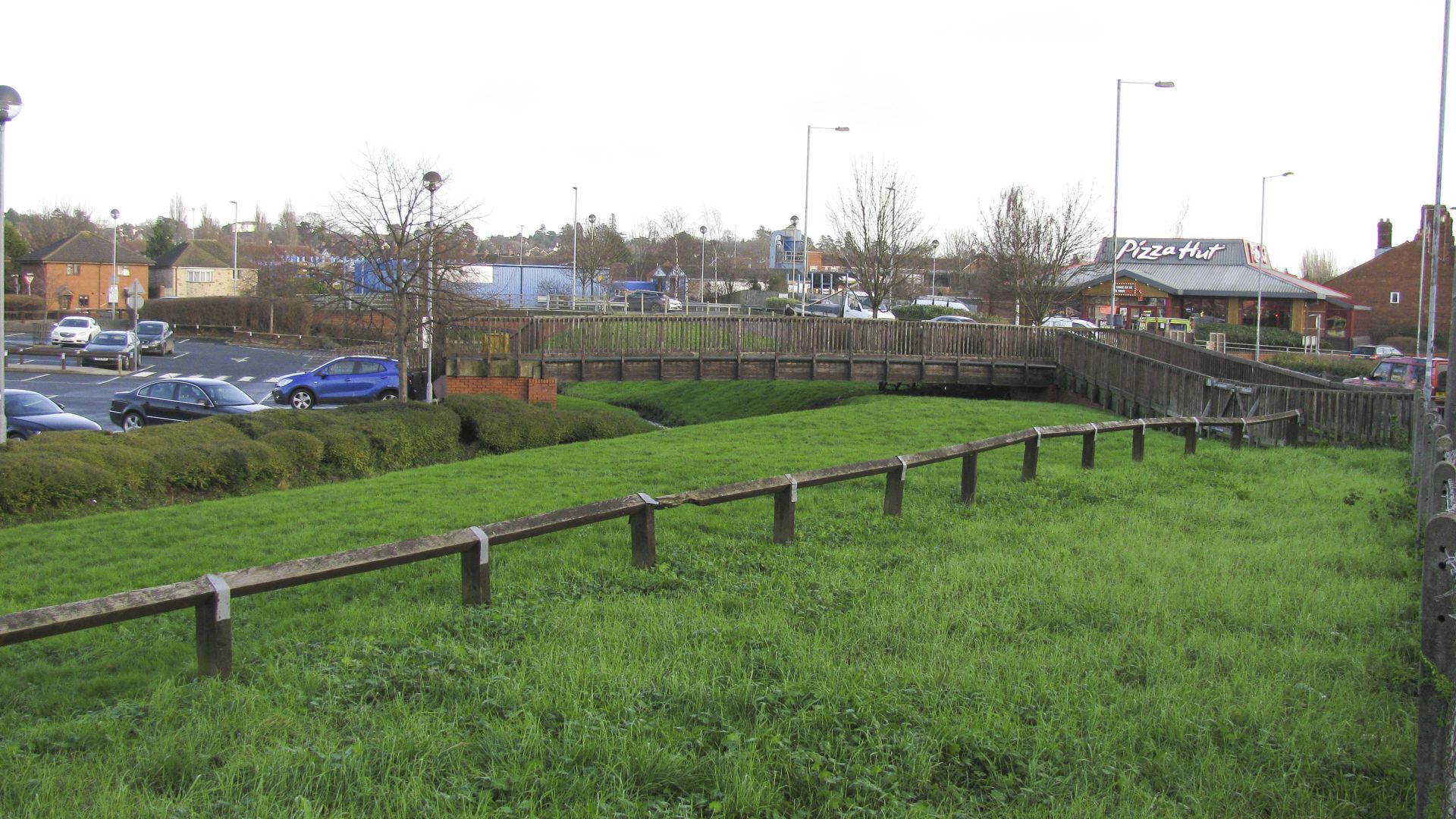
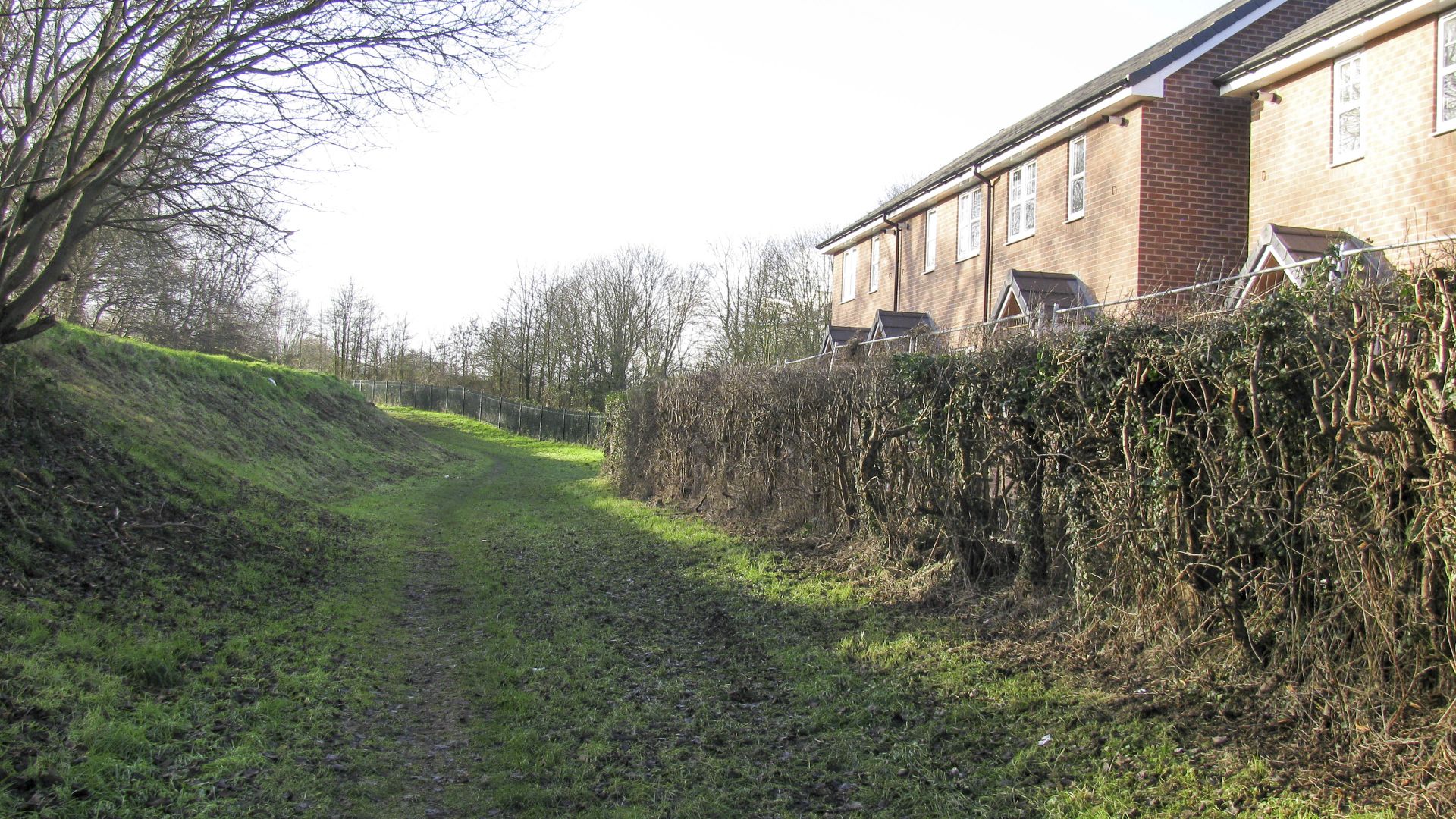
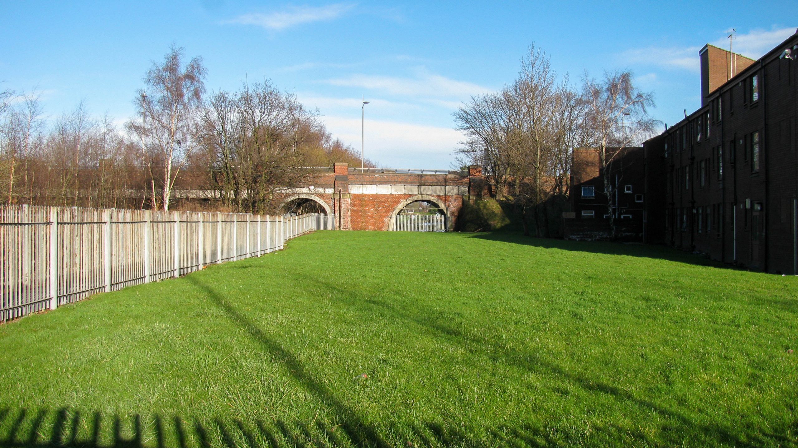
< Next H&G Canal Next > < End of Navigation Entry to Hereford > The grassed area along the edge of the retail park next to Newtown Road marks the new route for the restored Herefordshire &...
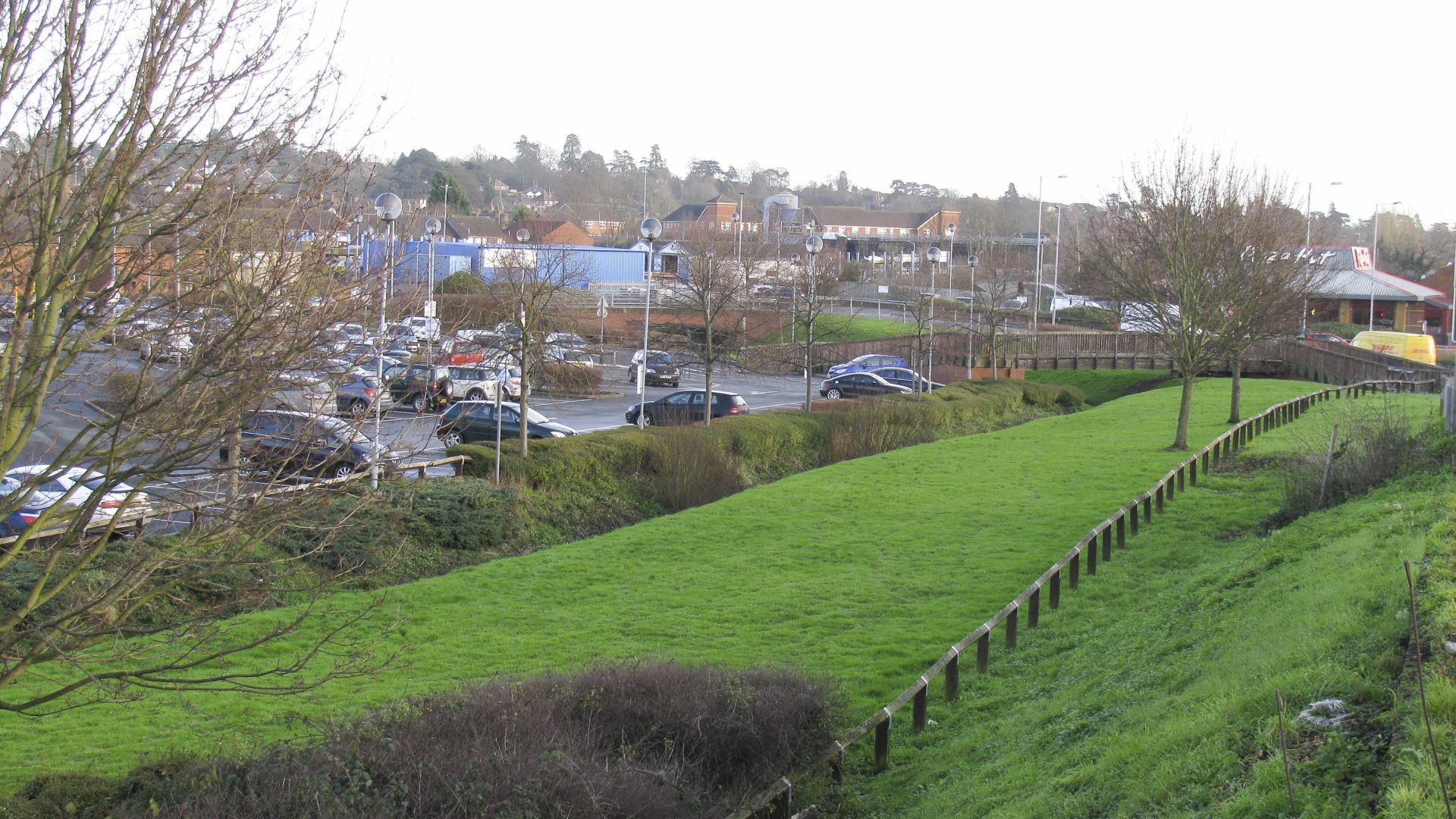
< Next H&G Canal Next > < End of Navigation Entry to Hereford > The proposed new alignment for the Herefordshire & Gloucestershire Canal comes towards the camera near the centre of the picture. The old...
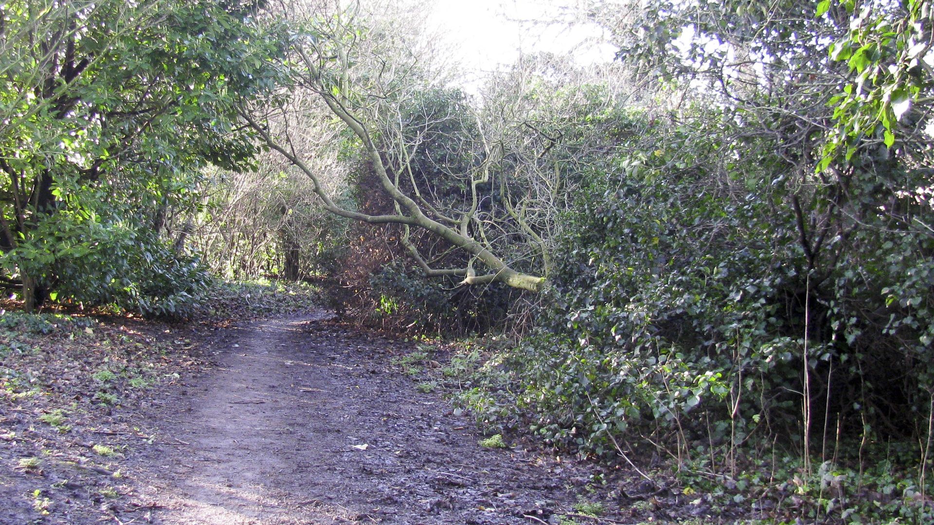
< Next H&G Canal Next > < End of Navigation Entry to Hereford > The footpath comes close to the original alignment of the Herefordshire & Gloucestershire Canal which came towards the camera between the road...
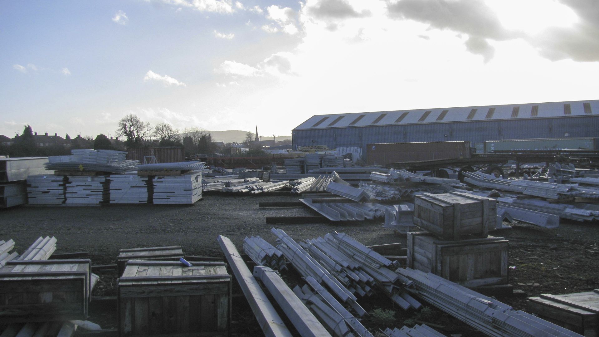
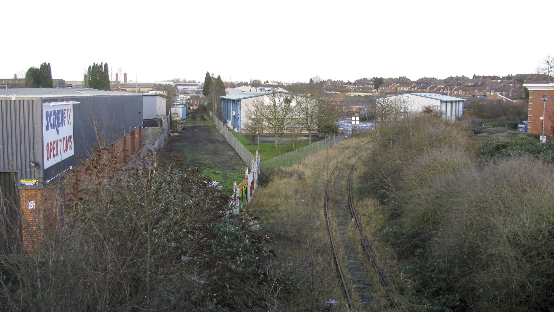
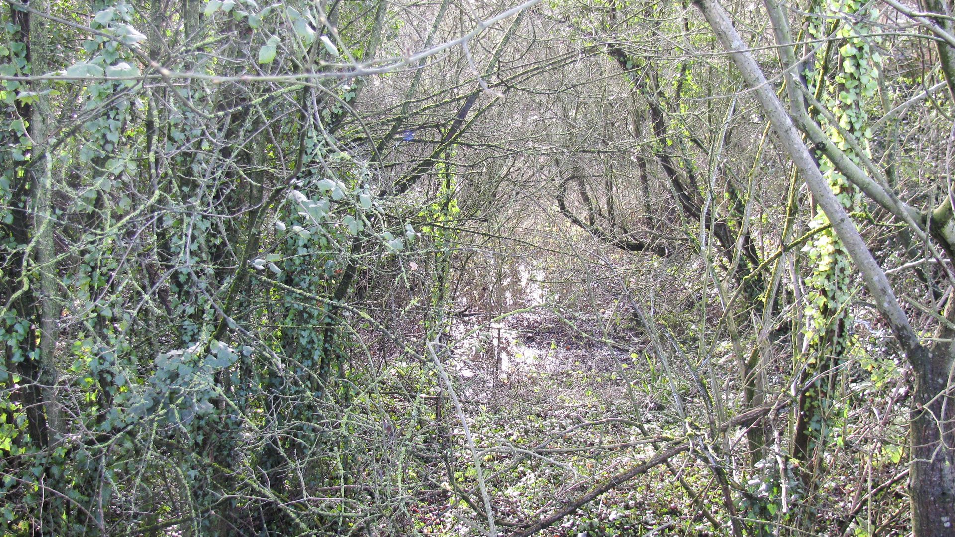
< Next H&G Canal Next > < End of Navigation Entry to Hereford > Walking along the footpath around these works permits occasional glimpses of the original route of the canal, running left to right close...
< Next H&G Canal Next > < End of Navigation Entry to Hereford > The path follows above the first half of Aylestone Tunnel, then we must take to separate footpaths and roads which merely follow the...
< Next H&G Canal Next > < End of Navigation Entry to Hereford > The footpath climbs to pass over the mouth of Aylestone Tunnel, with the channel, to the right, becoming less distinct as we...
< Next H&G Canal Next > < End of Navigation Entry to Hereford > A footpath follows the line of the canal until it reaches Aylestone Tunnel. Here the line, to the right of the tree,...
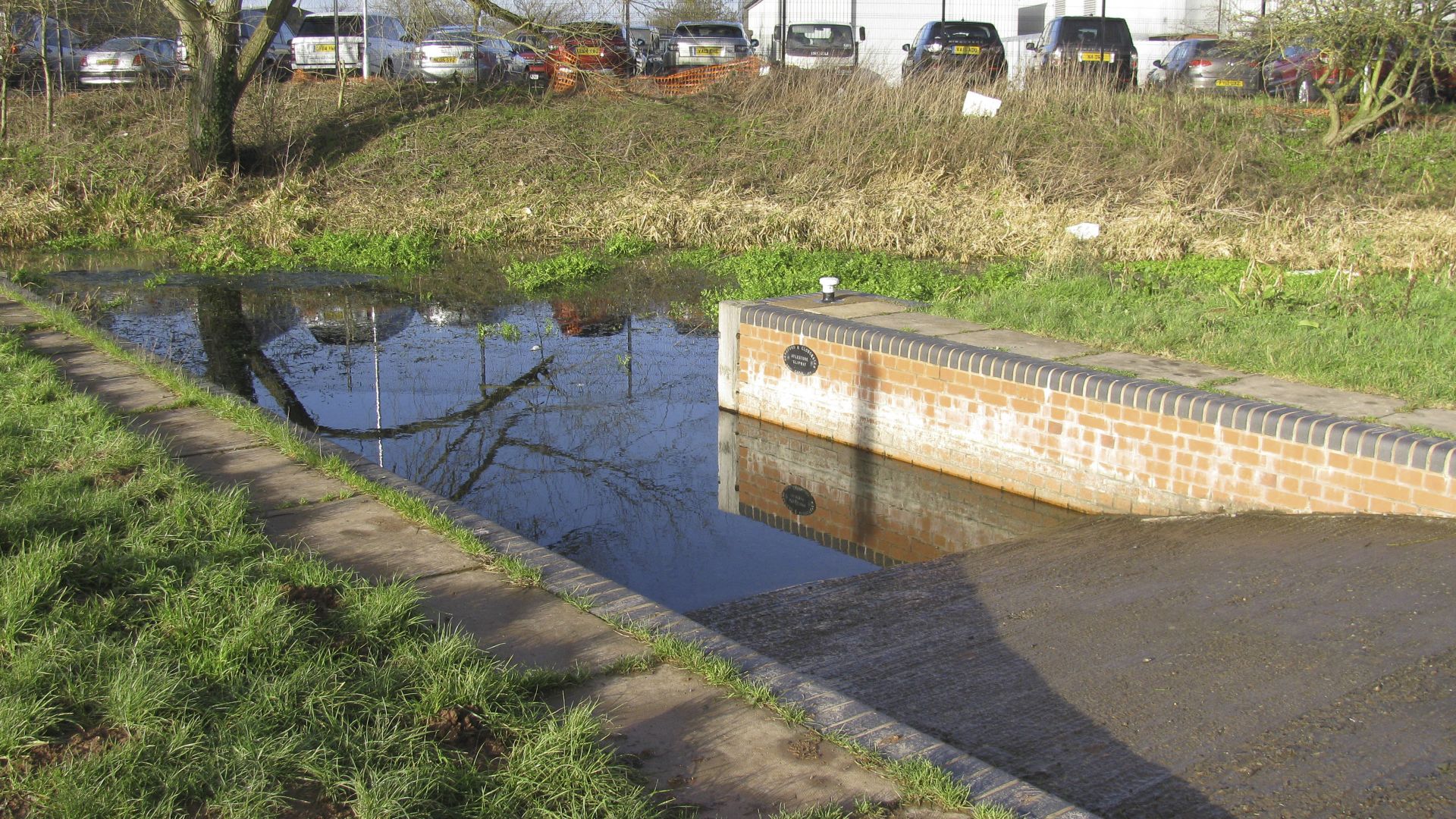
< Next H&G Canal Next > < End of Navigation Entry to Hereford > The prepared section of channel has a slipway allowing visiting boats to be launched. It won’t be long before there’s a little...
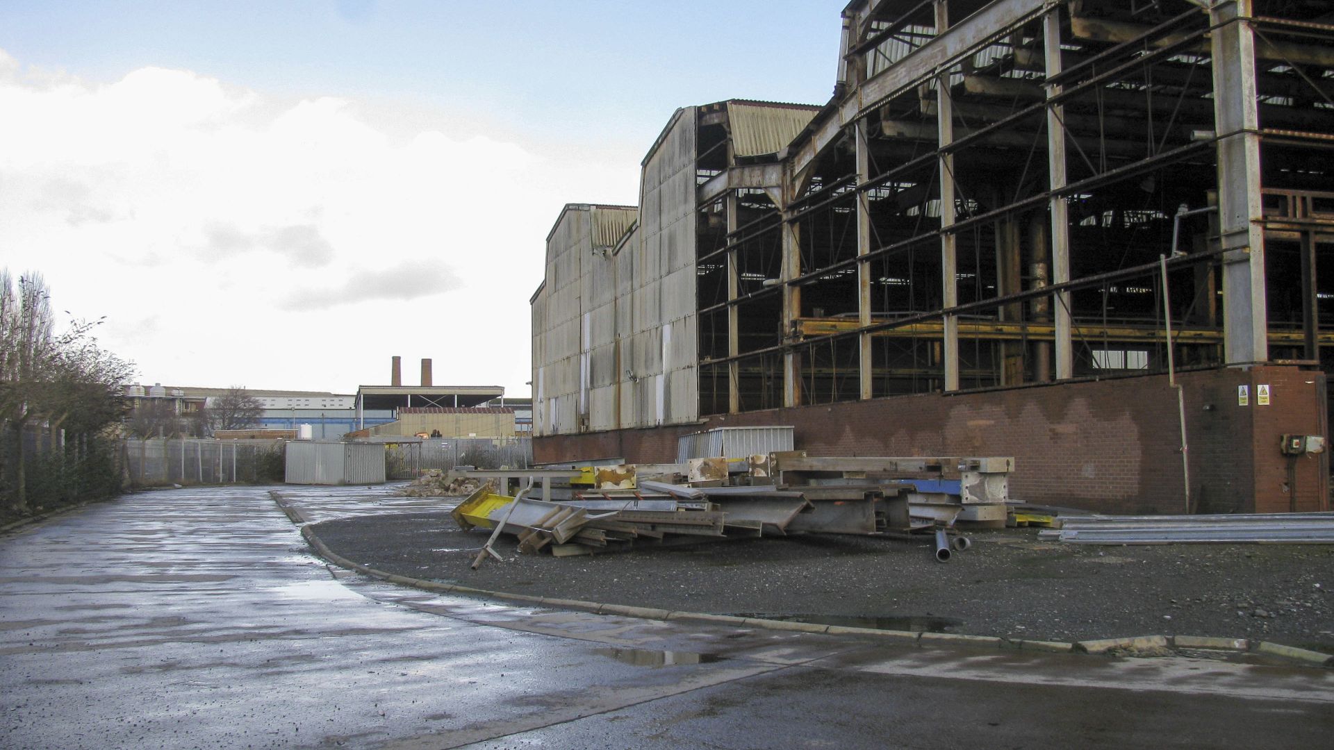
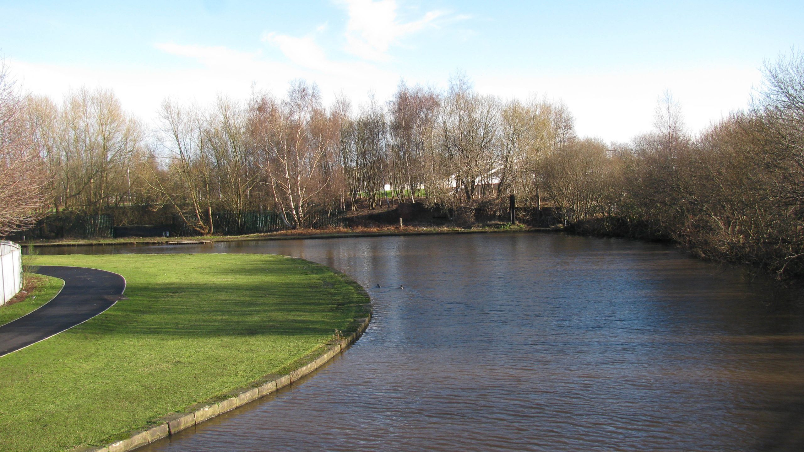
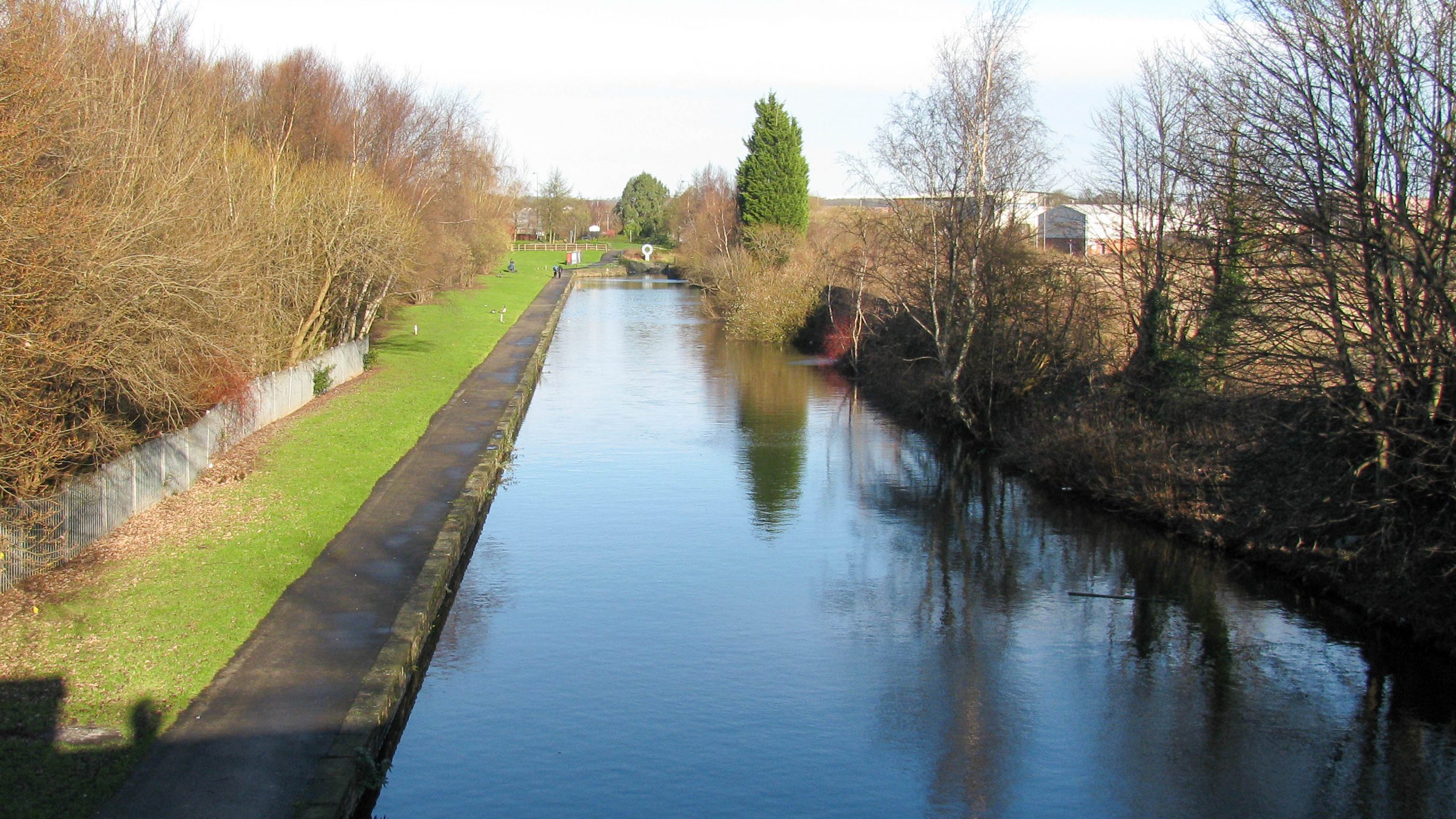
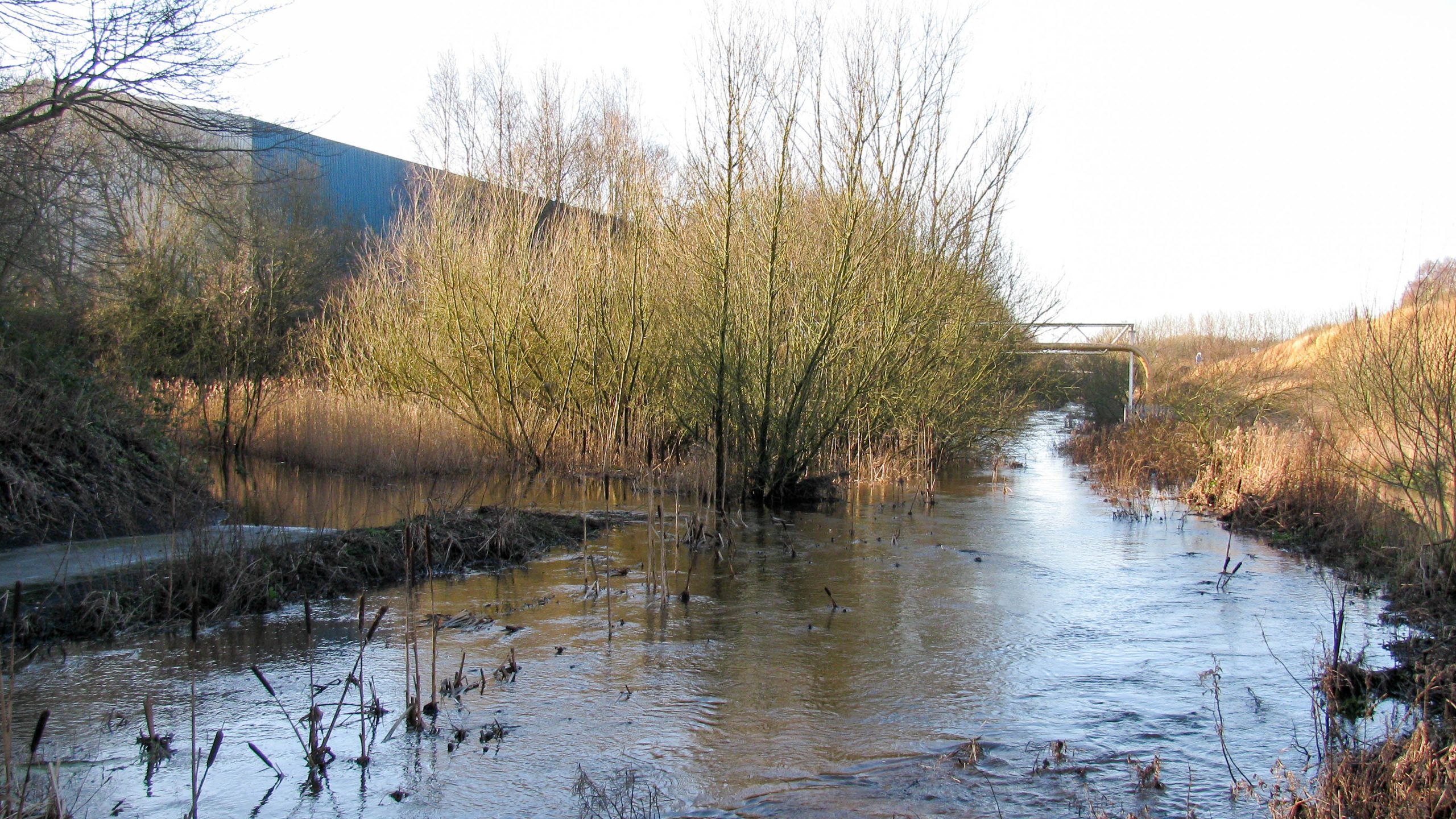
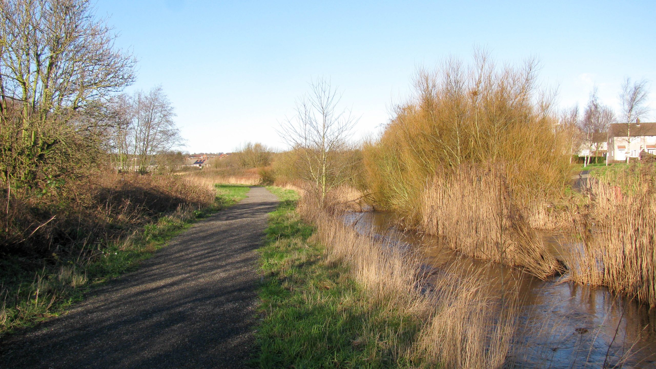
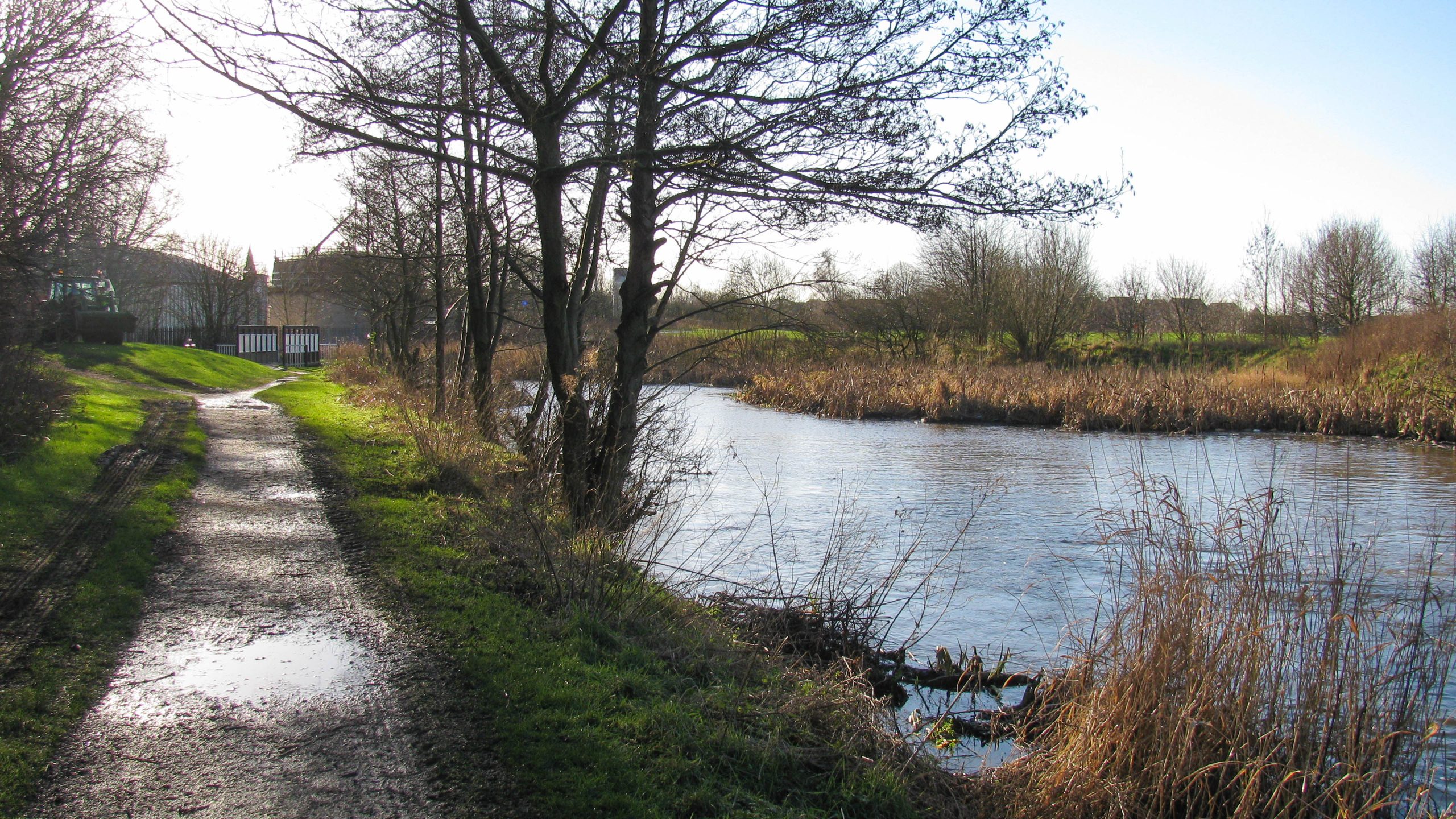
< Next H&G Canal Next > < End of Navigation Entry to Hereford > Looking towards Hereford the channel has been prepared for around 350m (380 yards). The buildings glimpsed to the right are in the area...
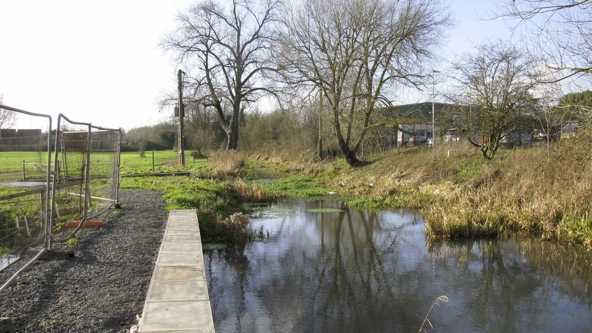
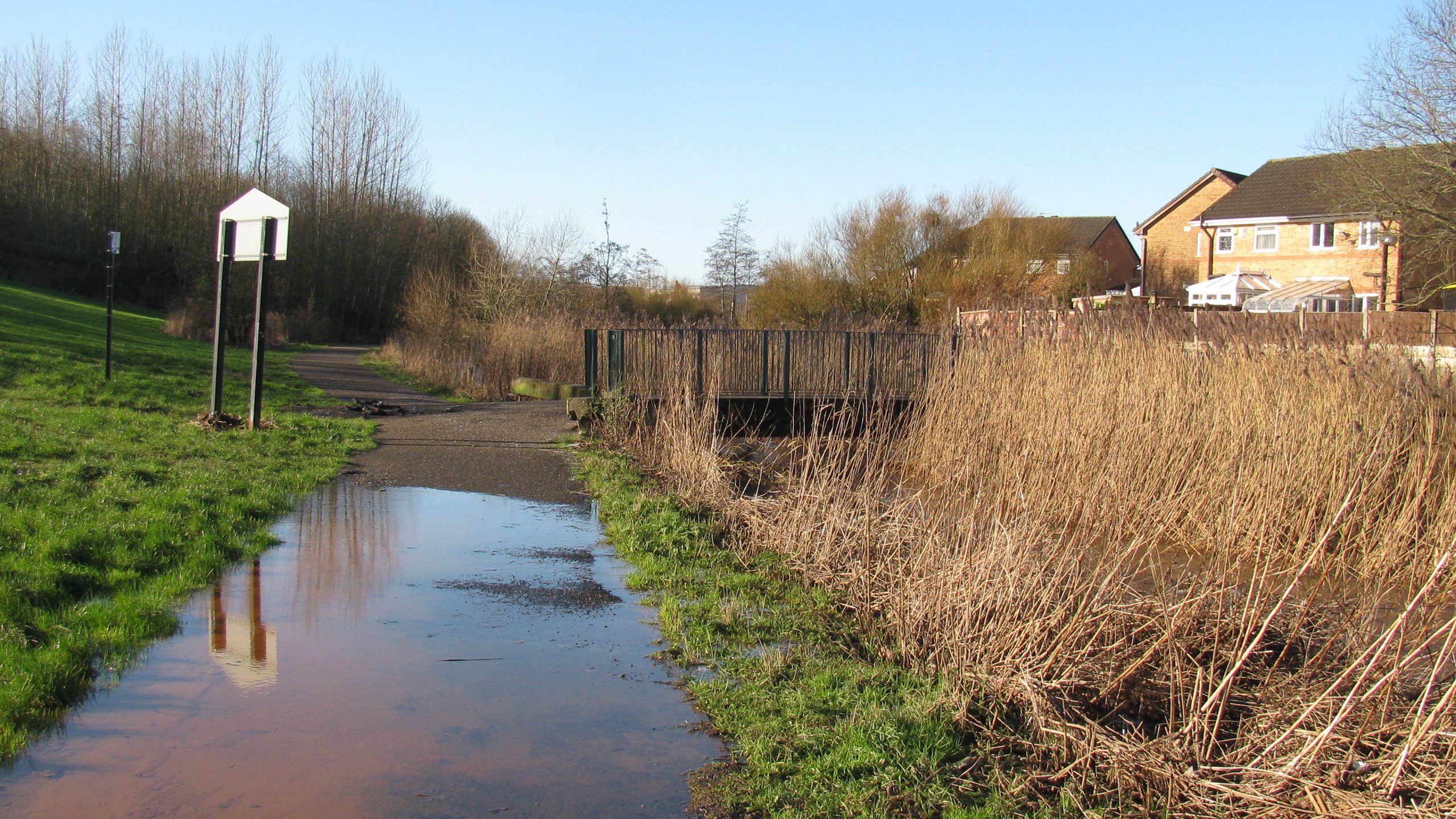
< Next H&G Canal Next > < End of Navigation Entry to Hereford > About 200m south of Roman Road Bridge (through the trees straight ahead) the channel has been prepared and is starting to look...
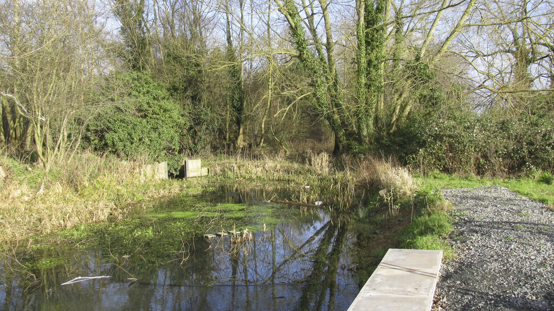
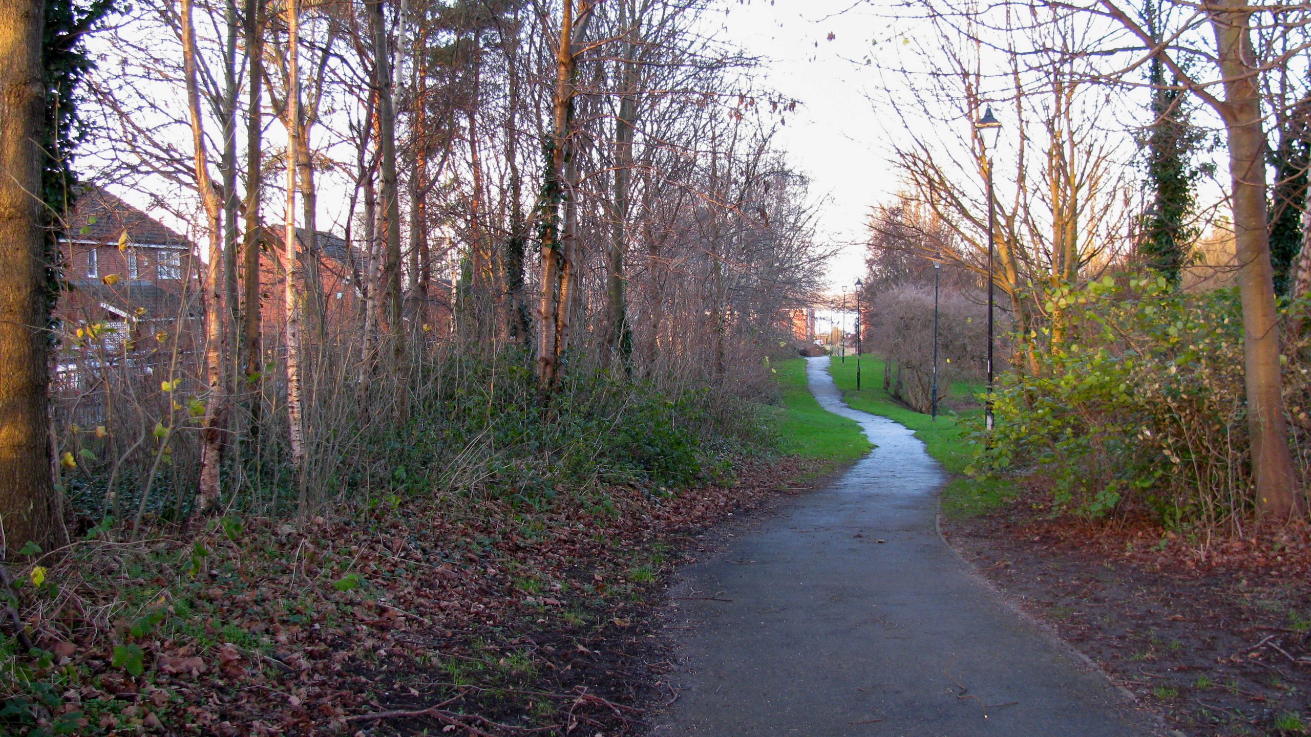
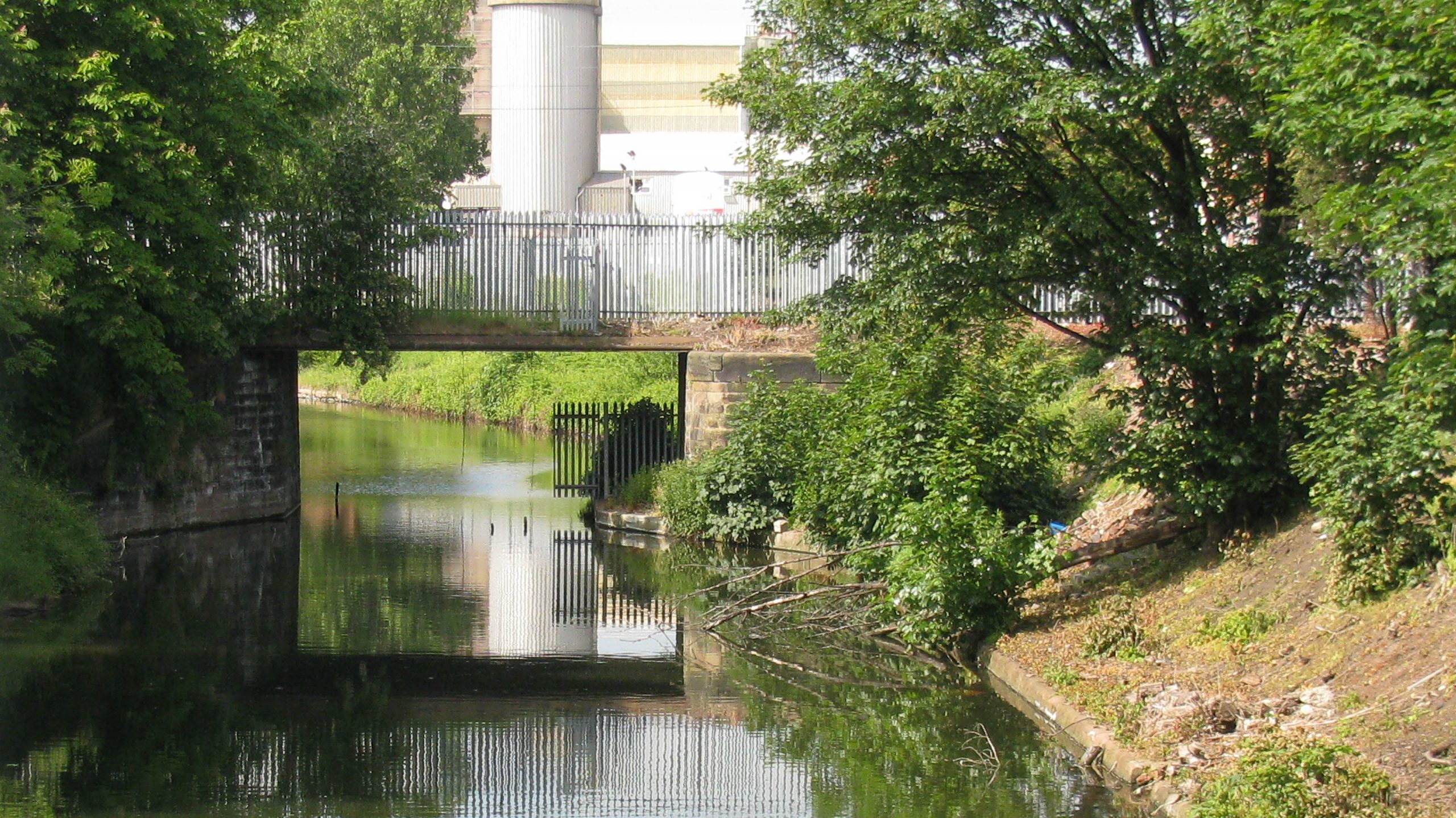
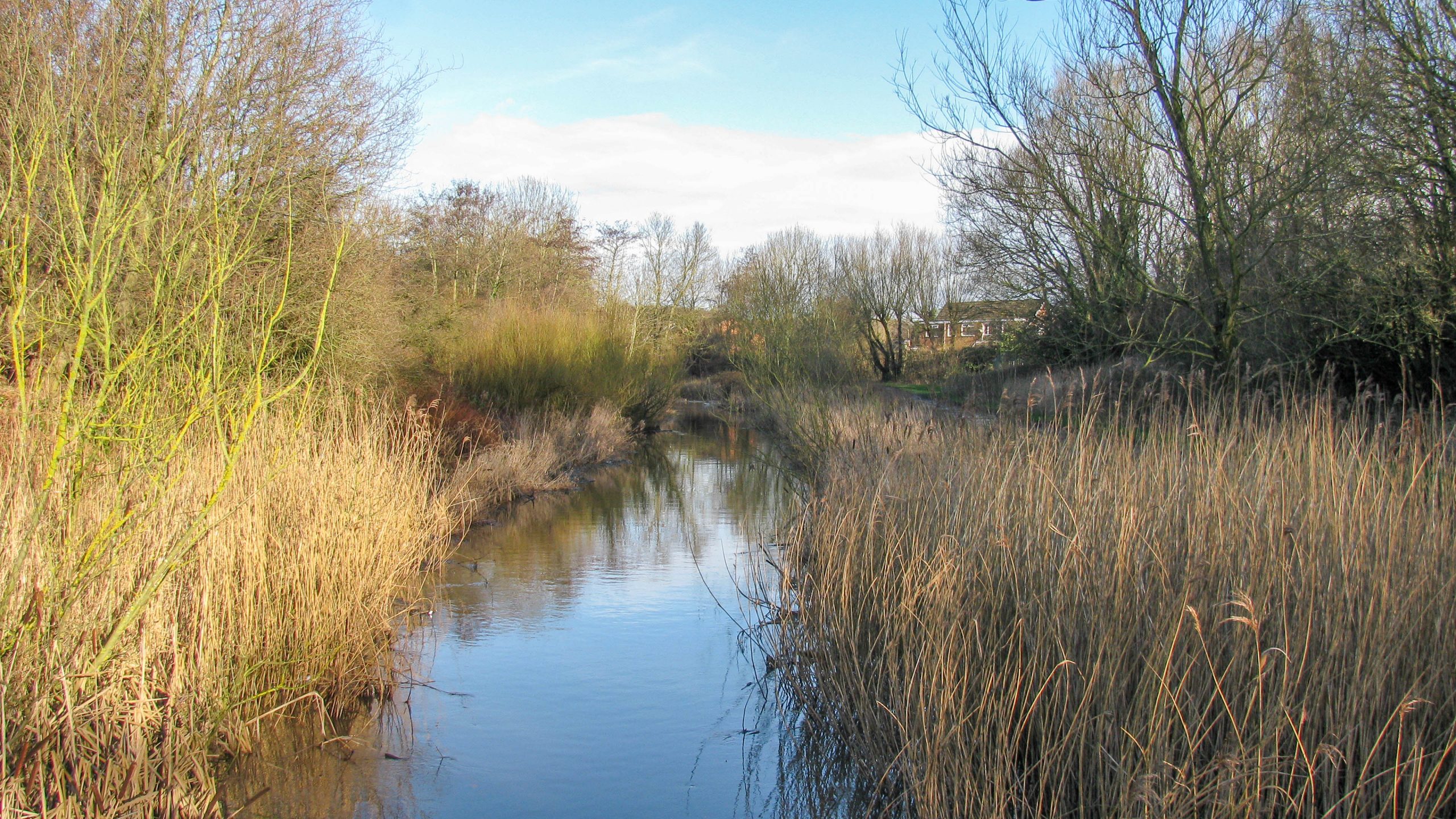
< Next H&G Canal Next > < End of Navigation Entry to Hereford > Looking south from Roman Road Bridge there’s a narrow channel through the trees which still holds water. It might be a messy...
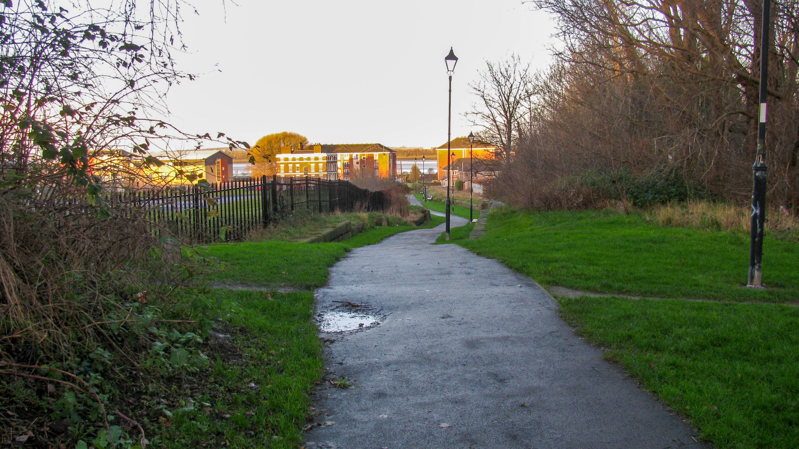
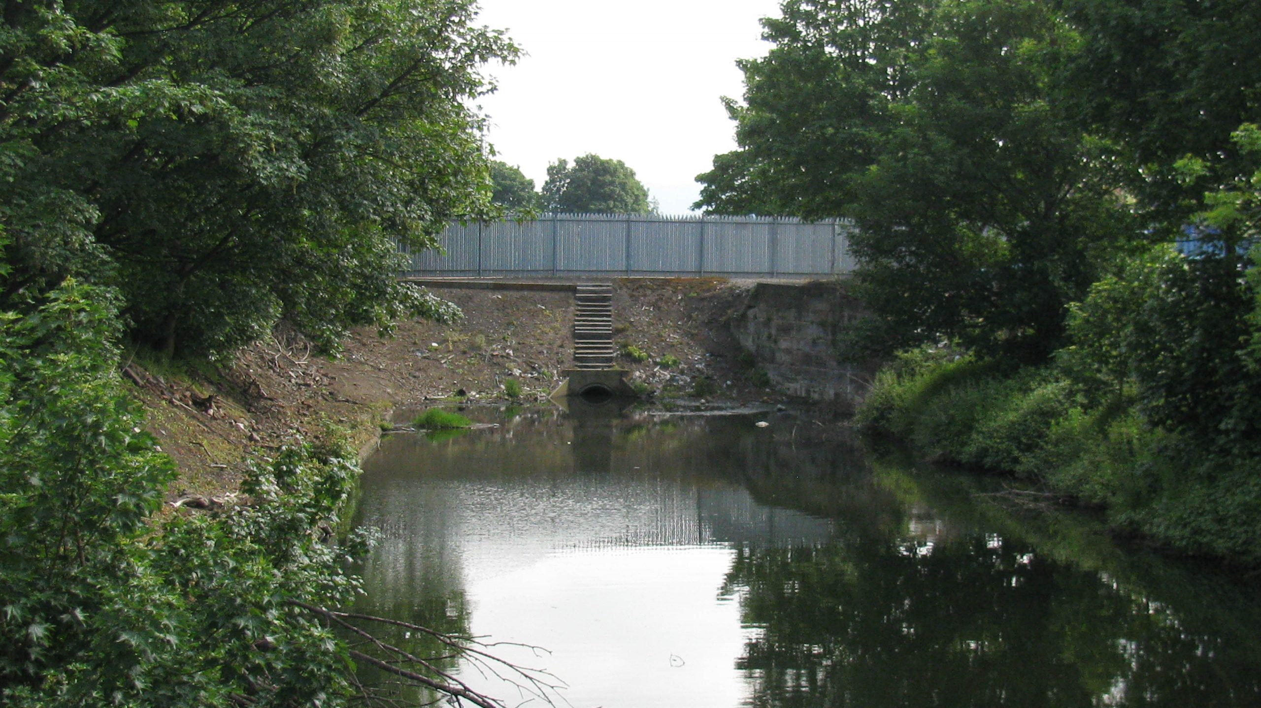
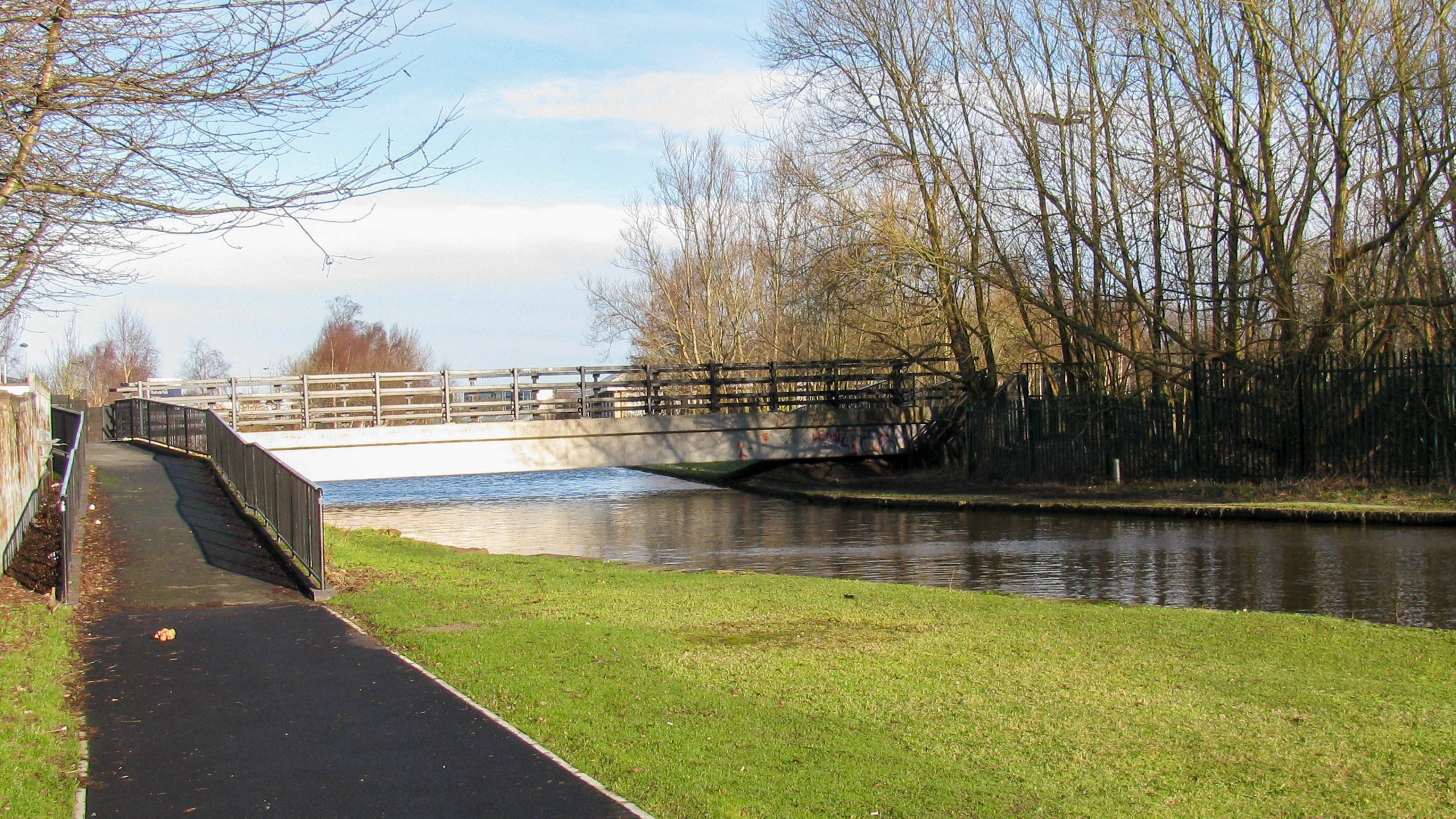
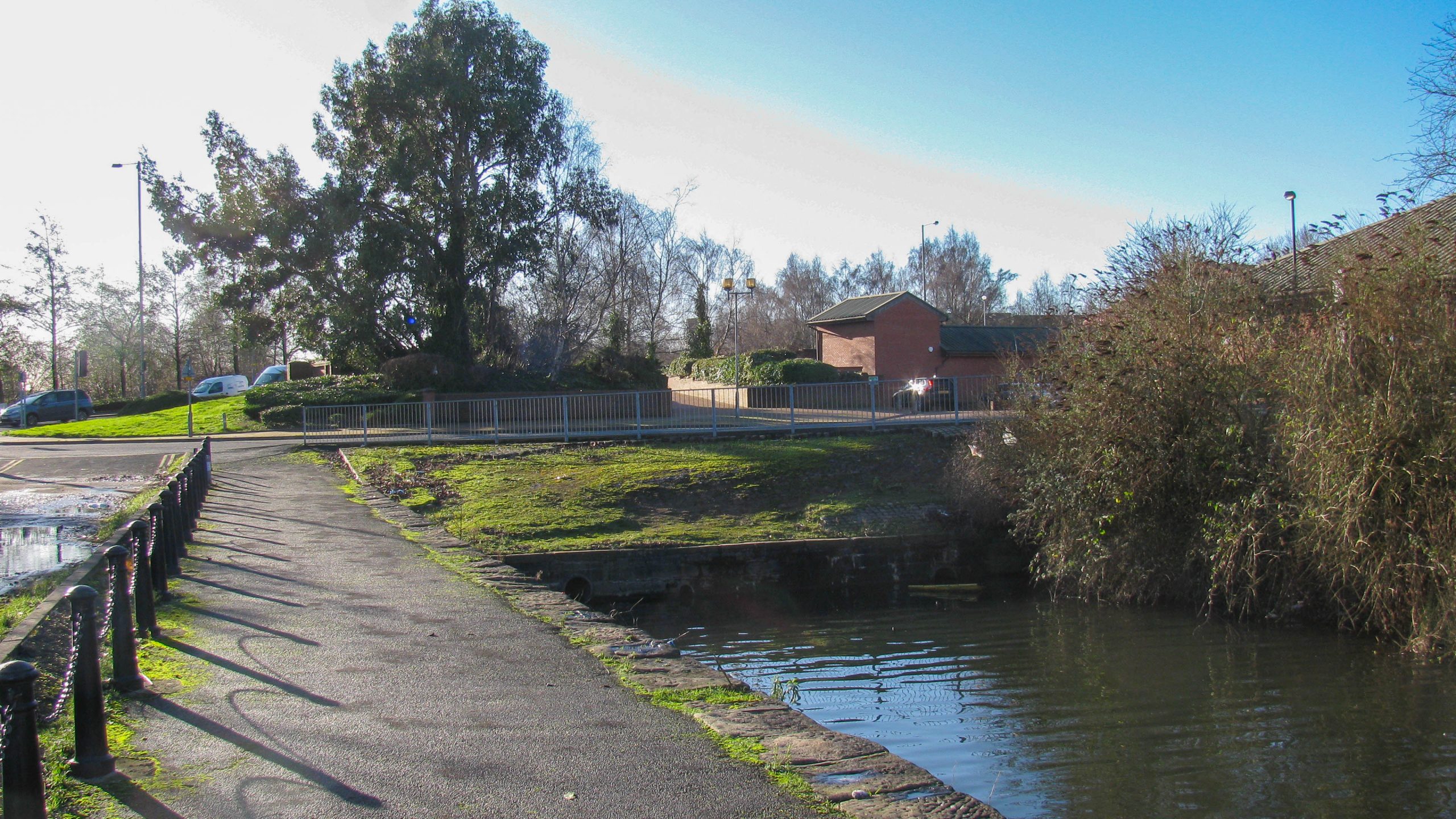
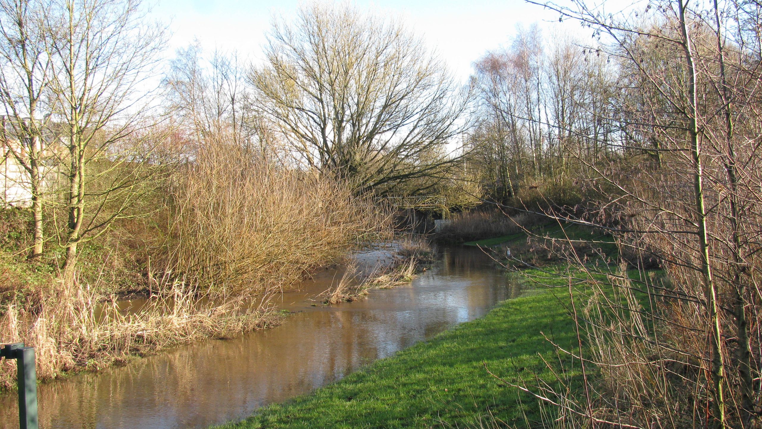
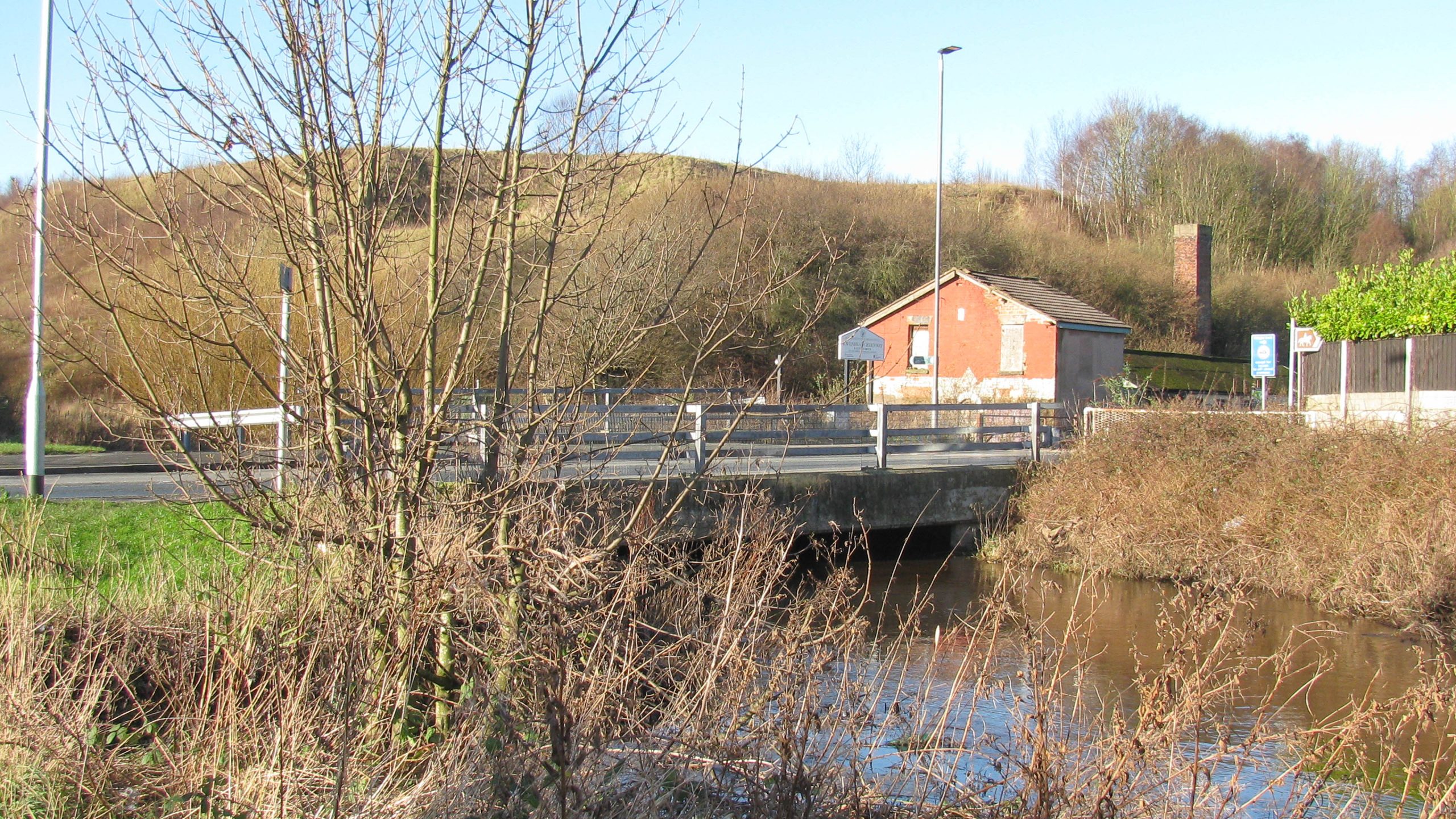
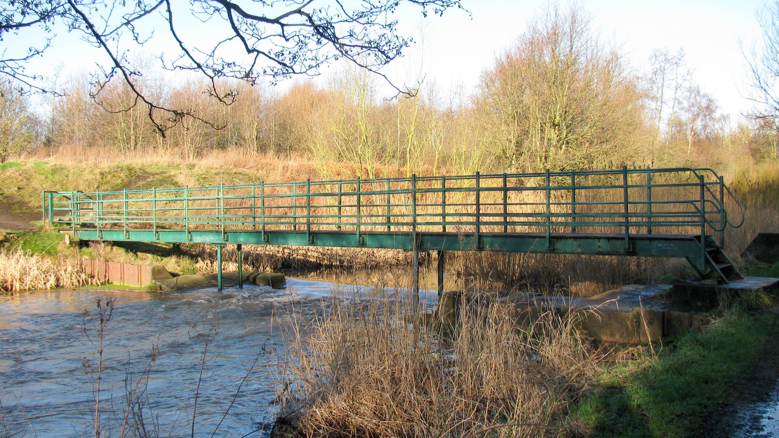
< Next H&G Canal Next > < End of Navigation Entry to Hereford > Looking north from Roman Road Bridge the restored Herefordshire & Gloucestershire Canal will come towards us and pass under our feet. Signs...
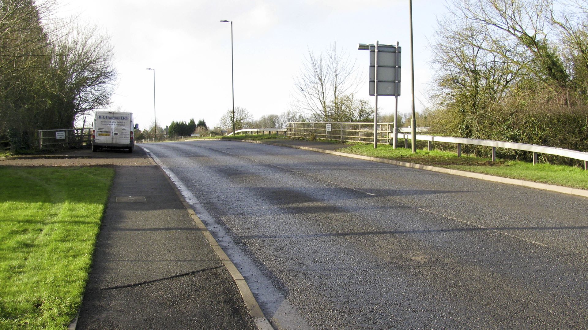
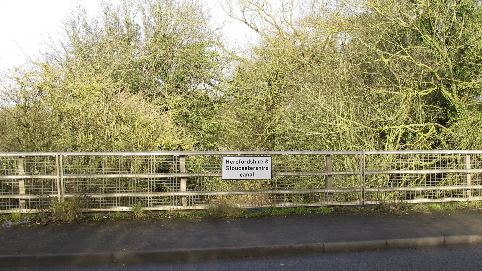
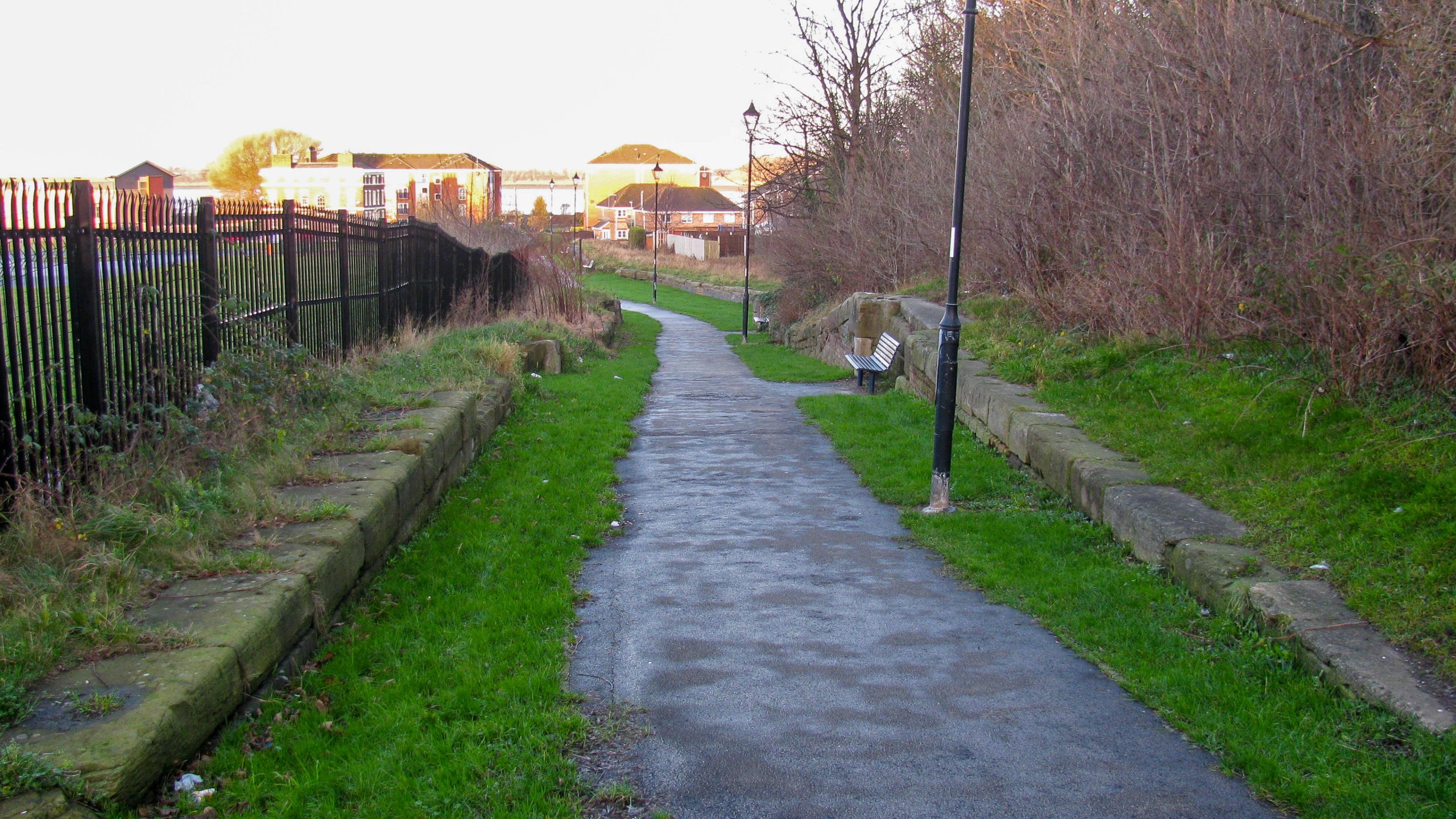
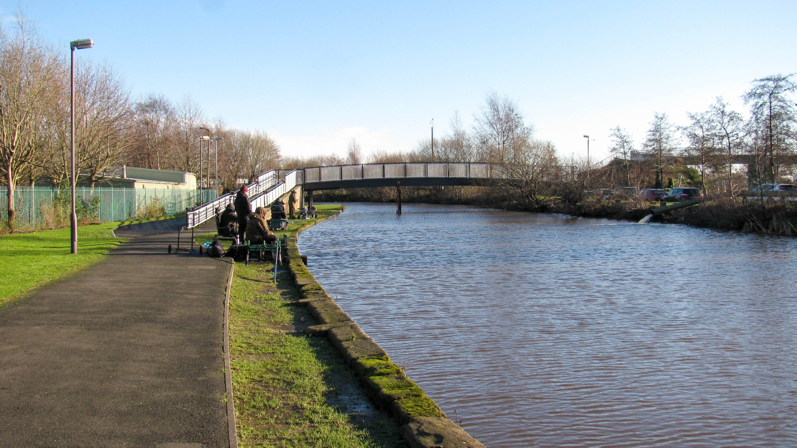
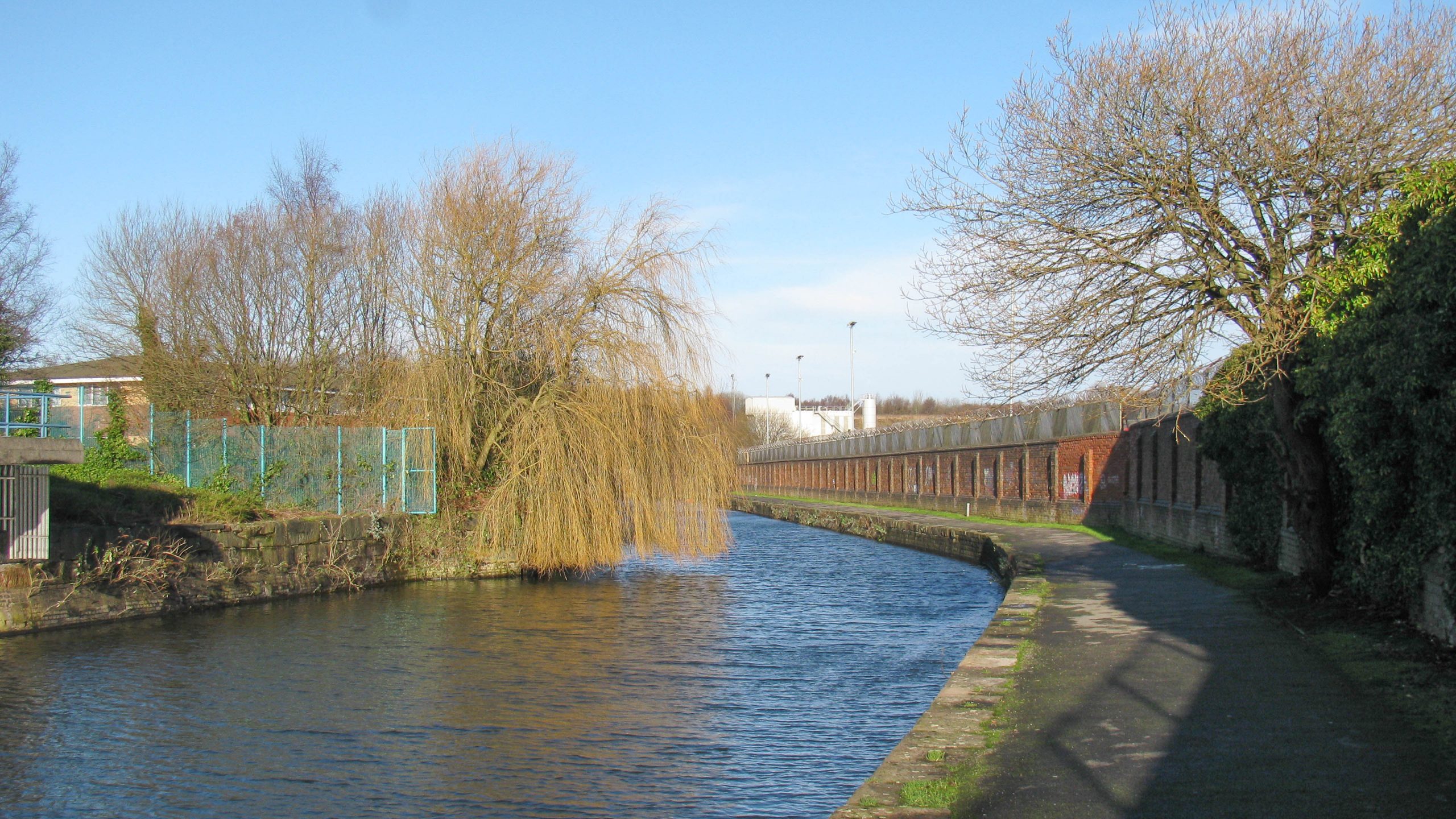
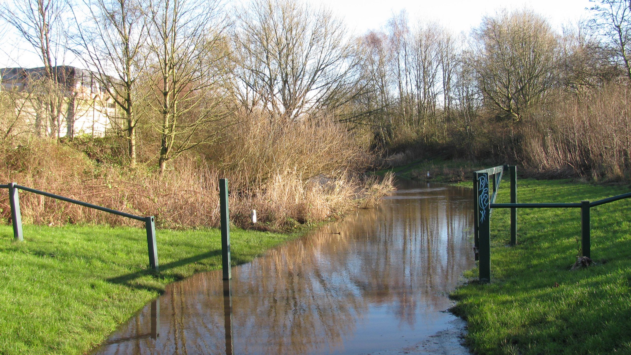
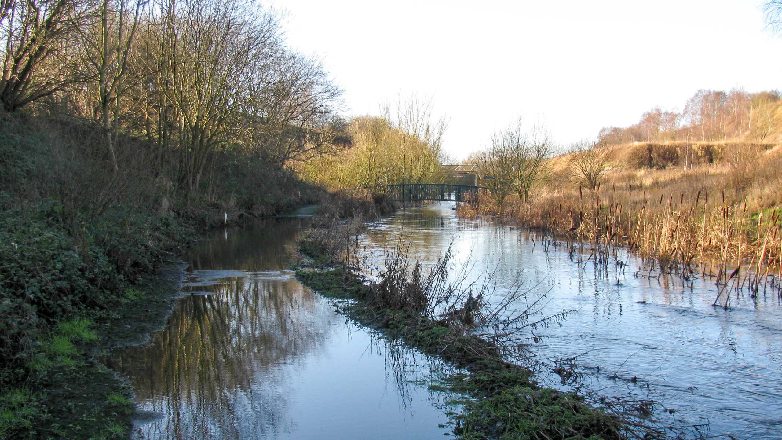
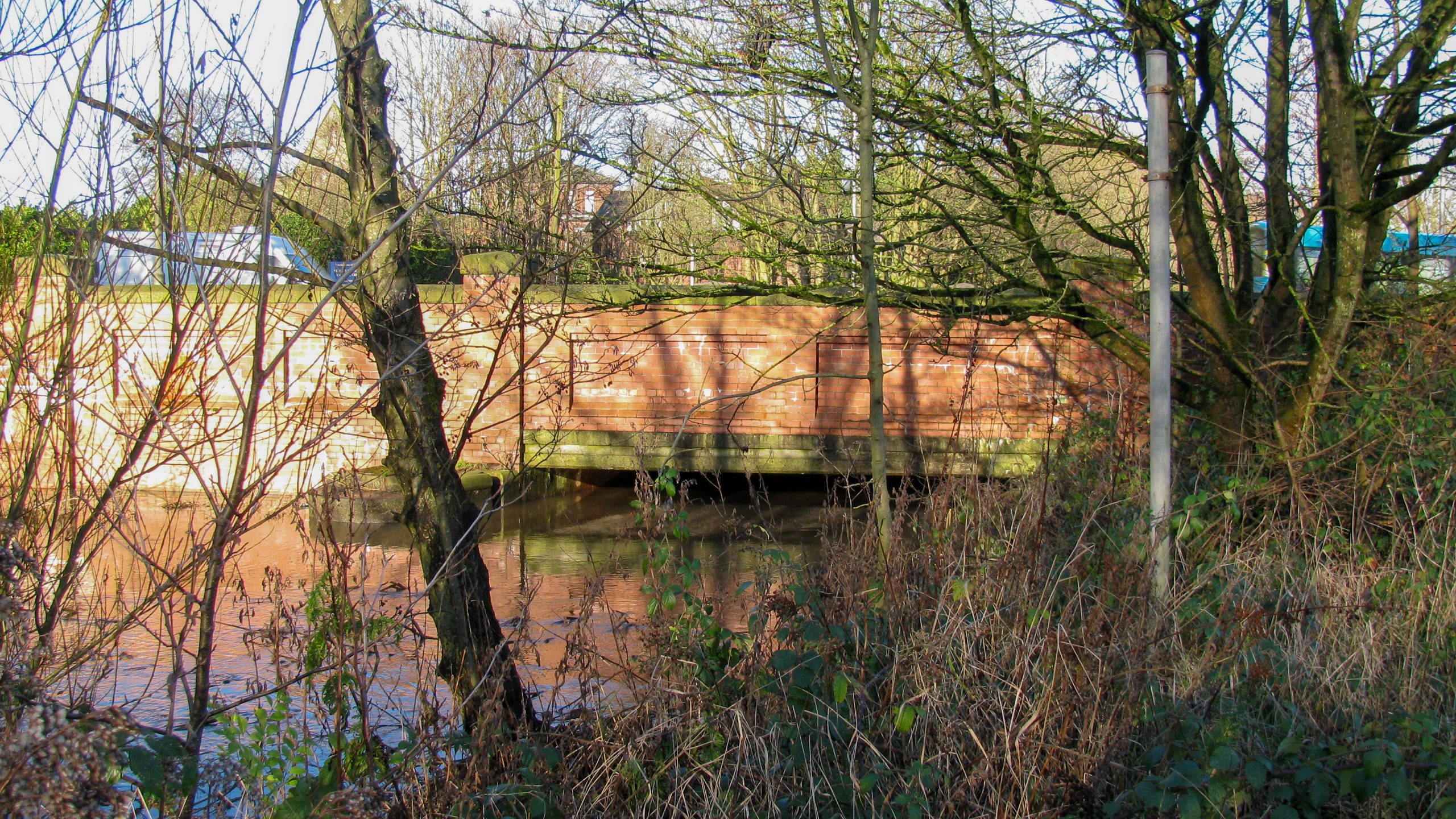
< Next H&G Canal Next > < End of Navigation Entry to Hereford > The Herefordshire & Gloucestershire Canal enters Hereford under Roman Road Bridge, identified by the hump in the road to maintain navigation clearances,...
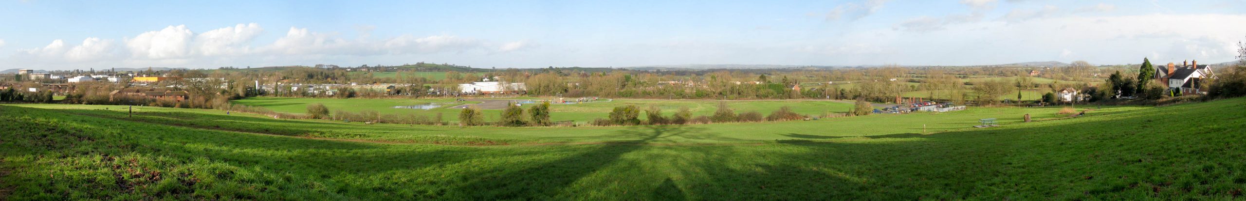
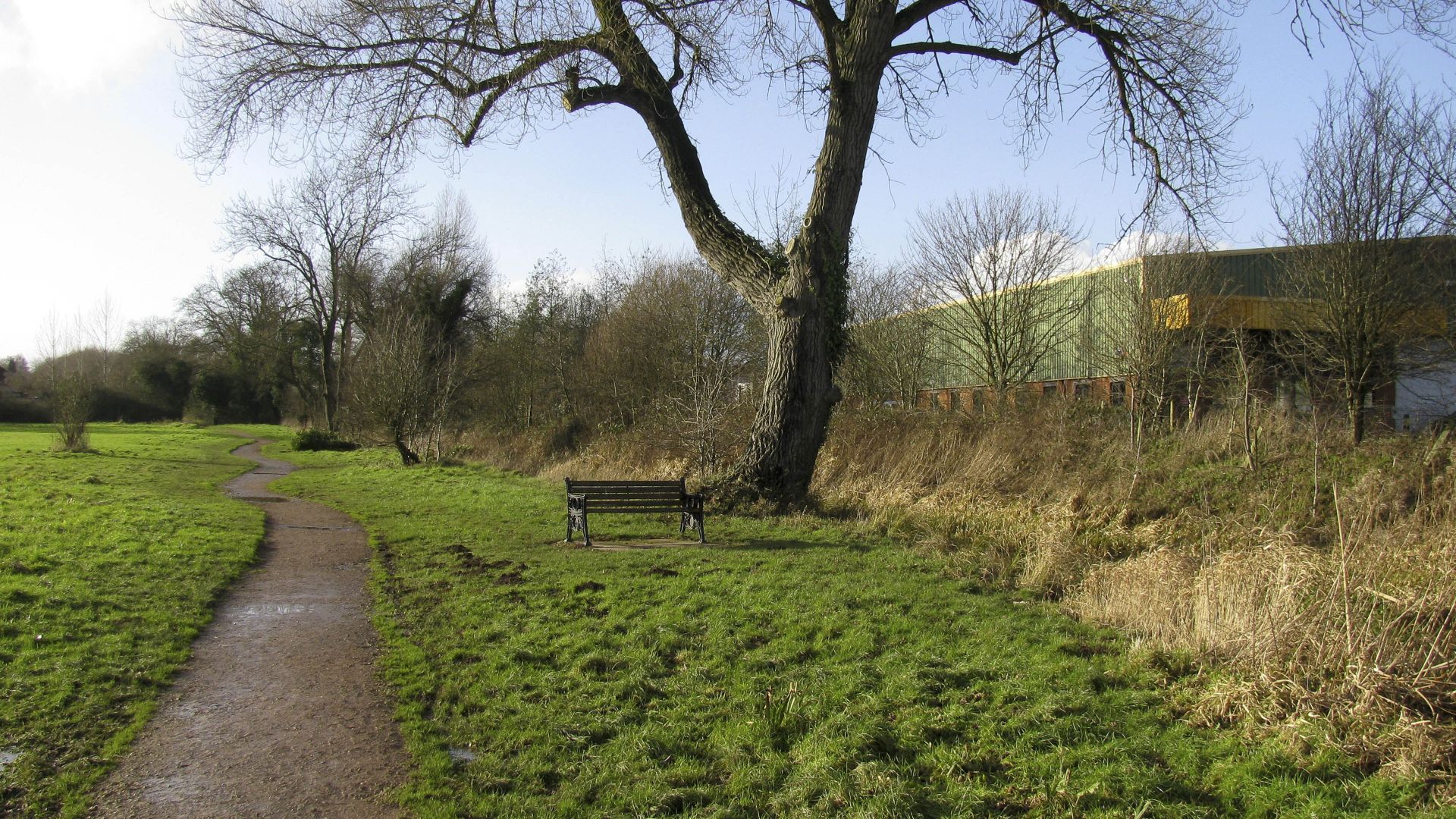
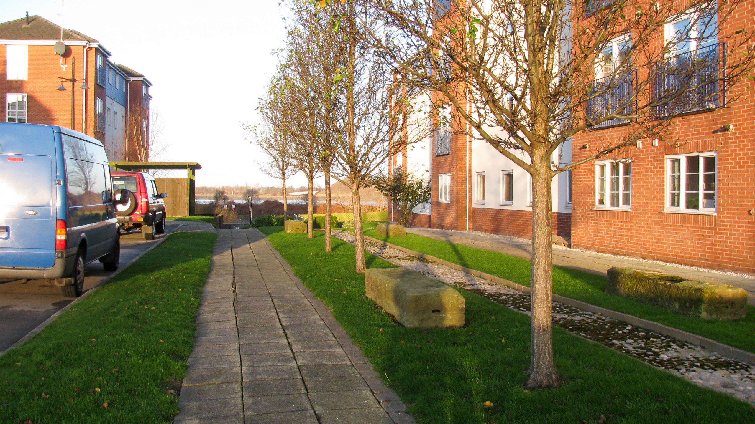
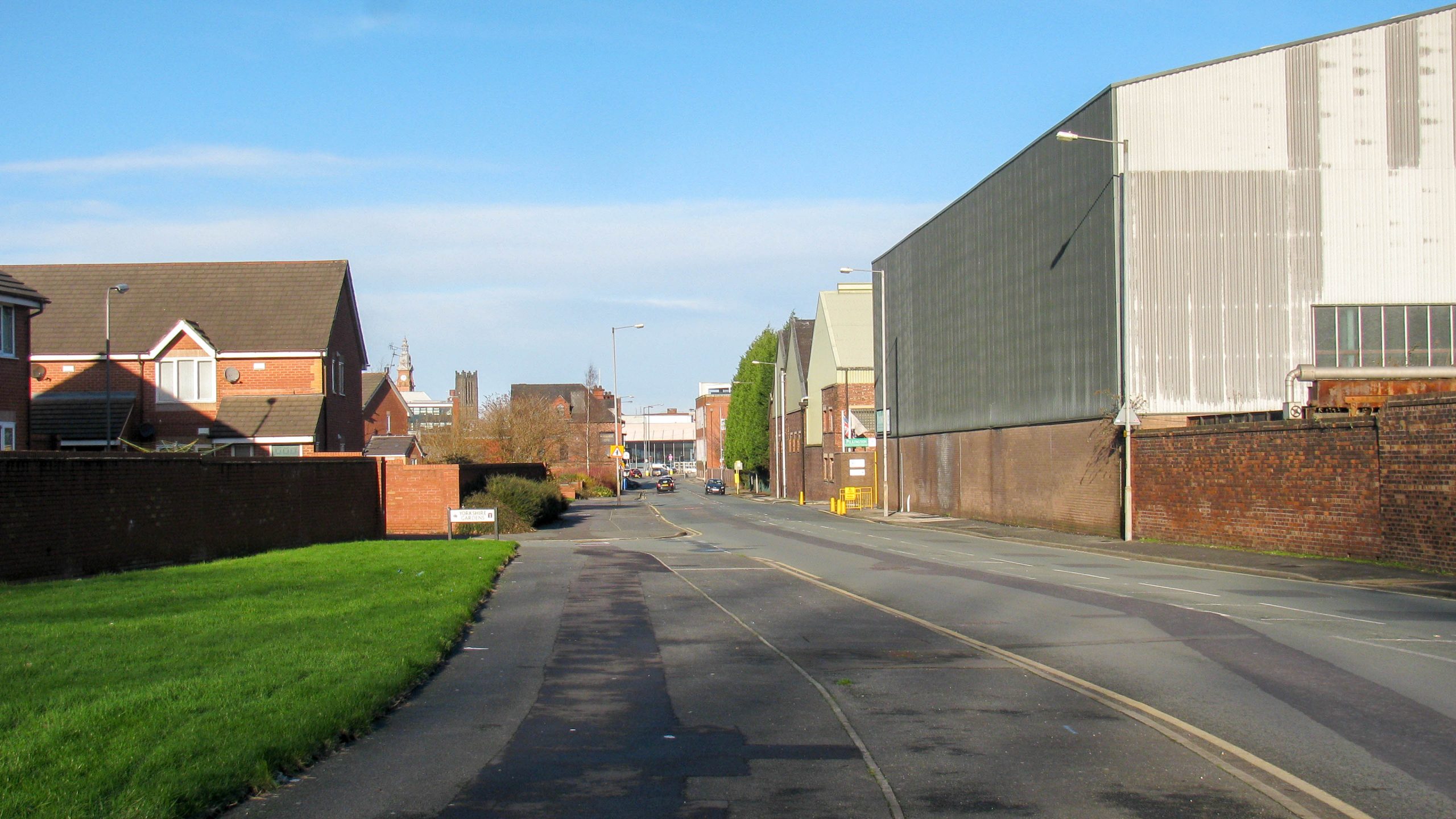
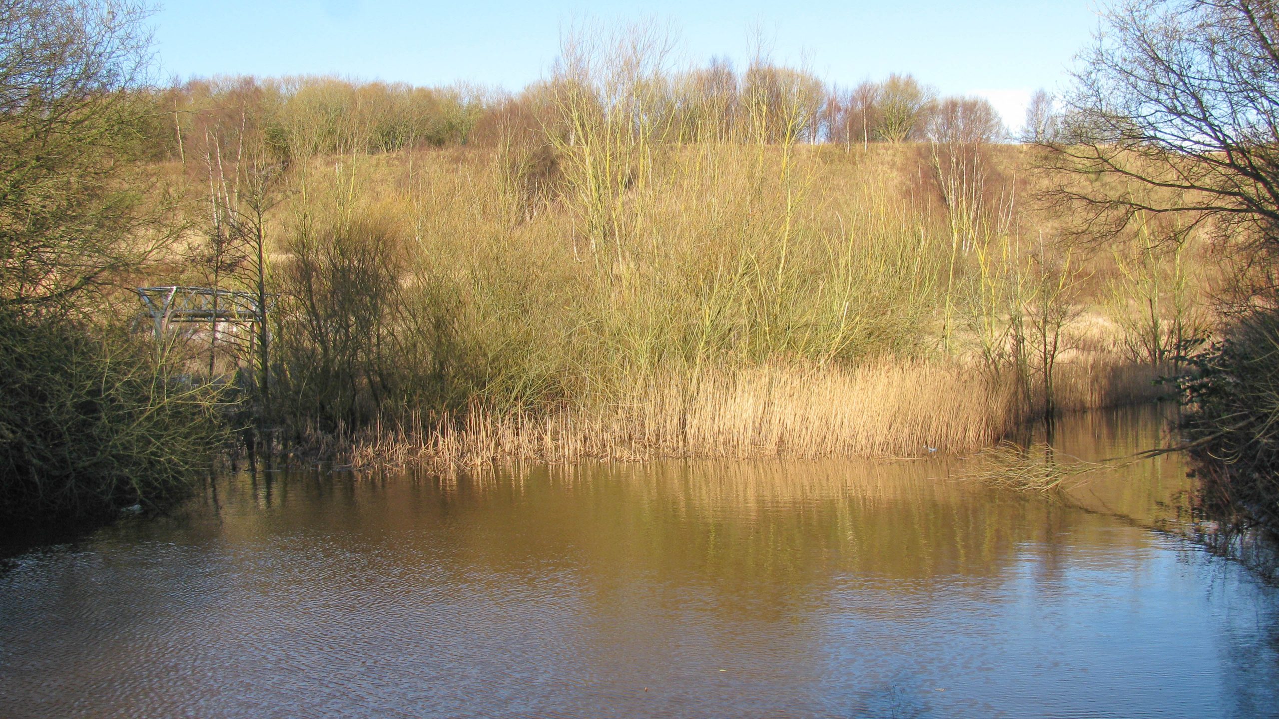
< Next H&G Canal JUMP TO > < End of Navigation End of Navigation > Looking north from the top of Aylestone Hill, this shows the route the Herefordshire & Gloucestershire Canal follows into Hereford. Having passed...
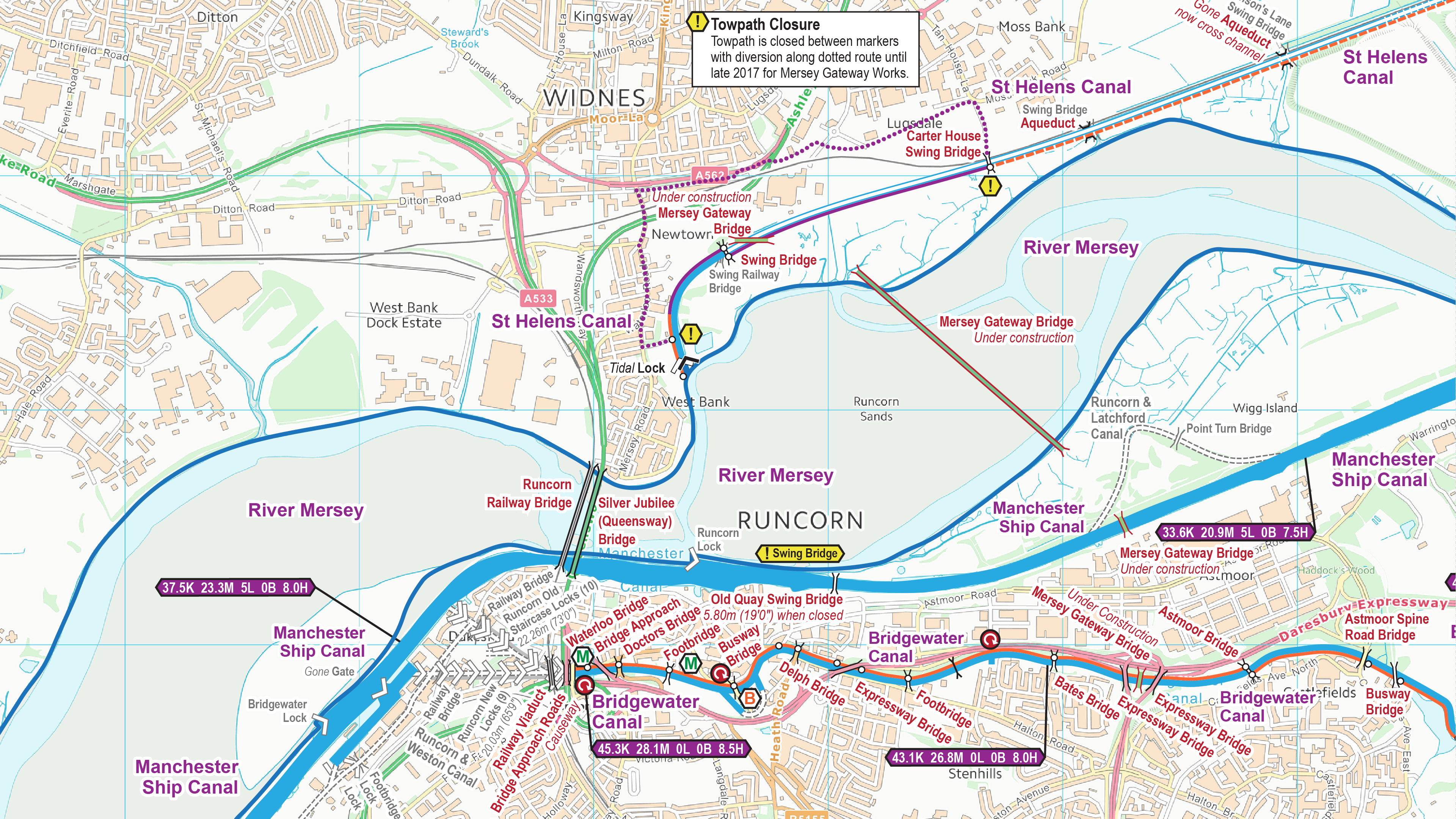
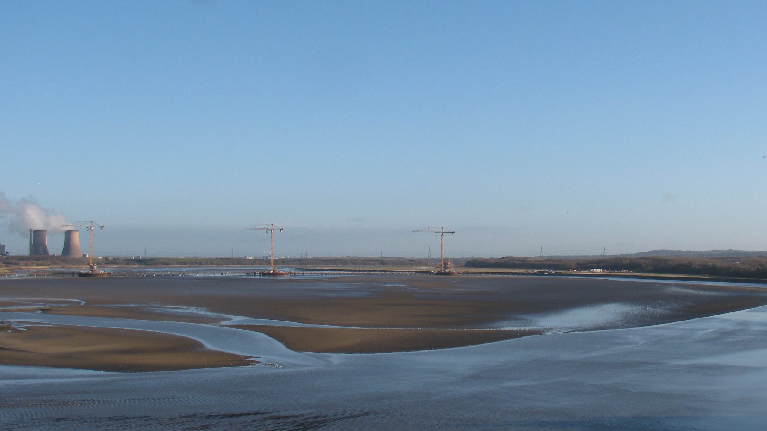
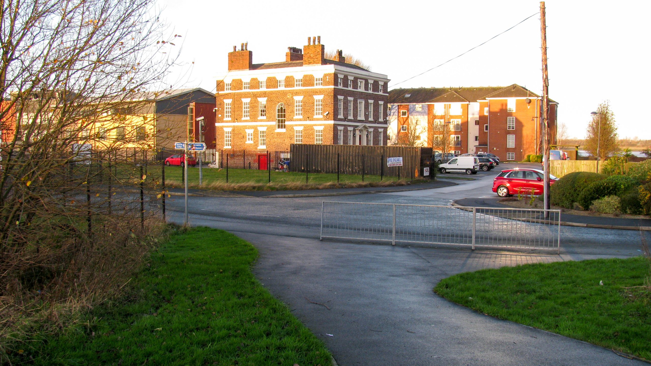
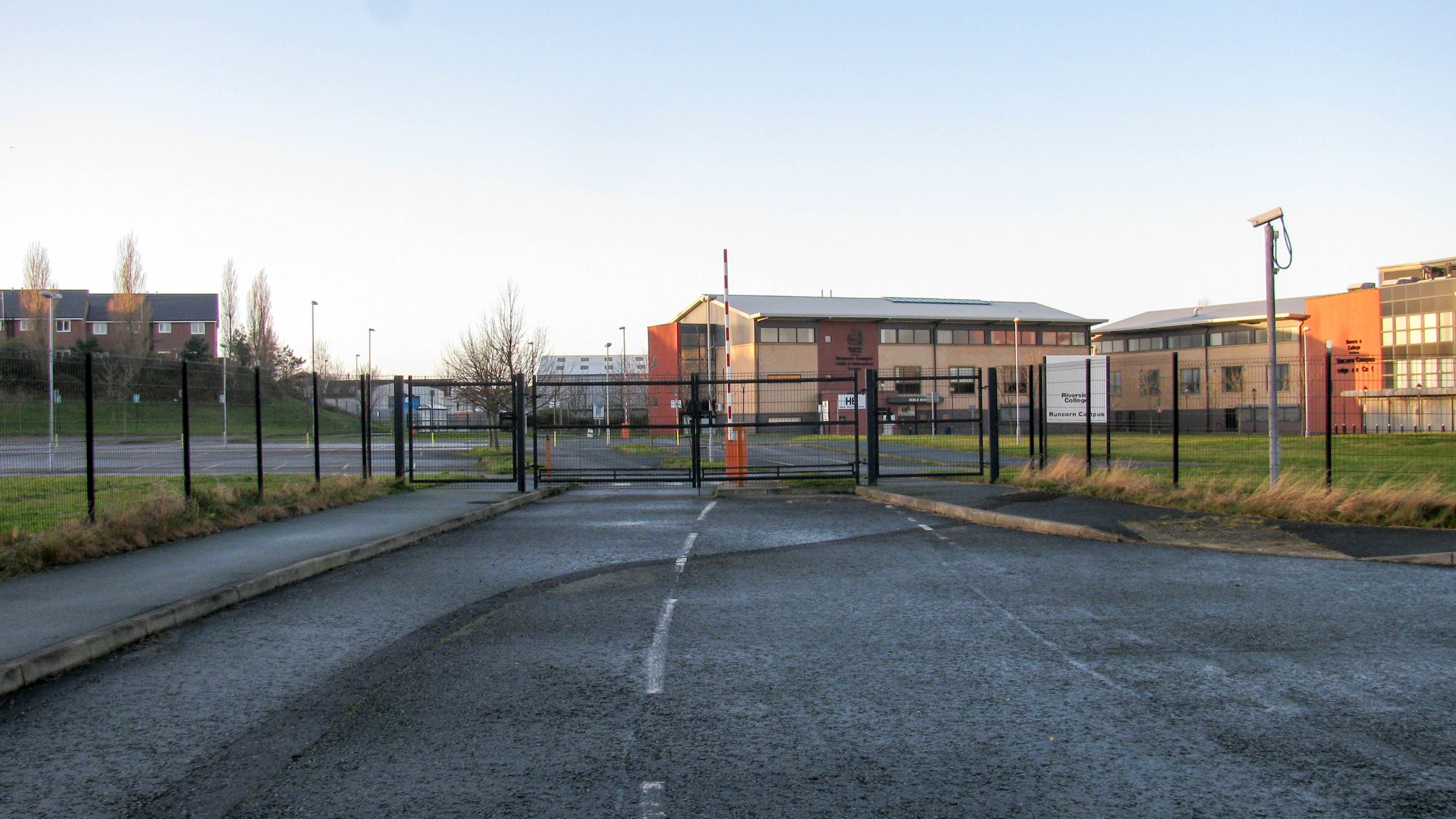
The Mersey Gateway project will provide a new road link to relive pressure on the existing road bridge at Runcorn. It’s being constructed to the east of the existing bridge, and scheduled for completion in...
On the way back from seeing progress with repainting our boat in the autumn I took up an invitation to visit Willow Wren Training. They are excavating the arm at their training centre which...
Runcorn Locks once linked the Bridgewater Canal to the Runcorn & Weston Canal, the Manchester Ship Canal and, previously, the River Mersey. History Opened in 1776, the Bridgewater Canal was linked to the River...
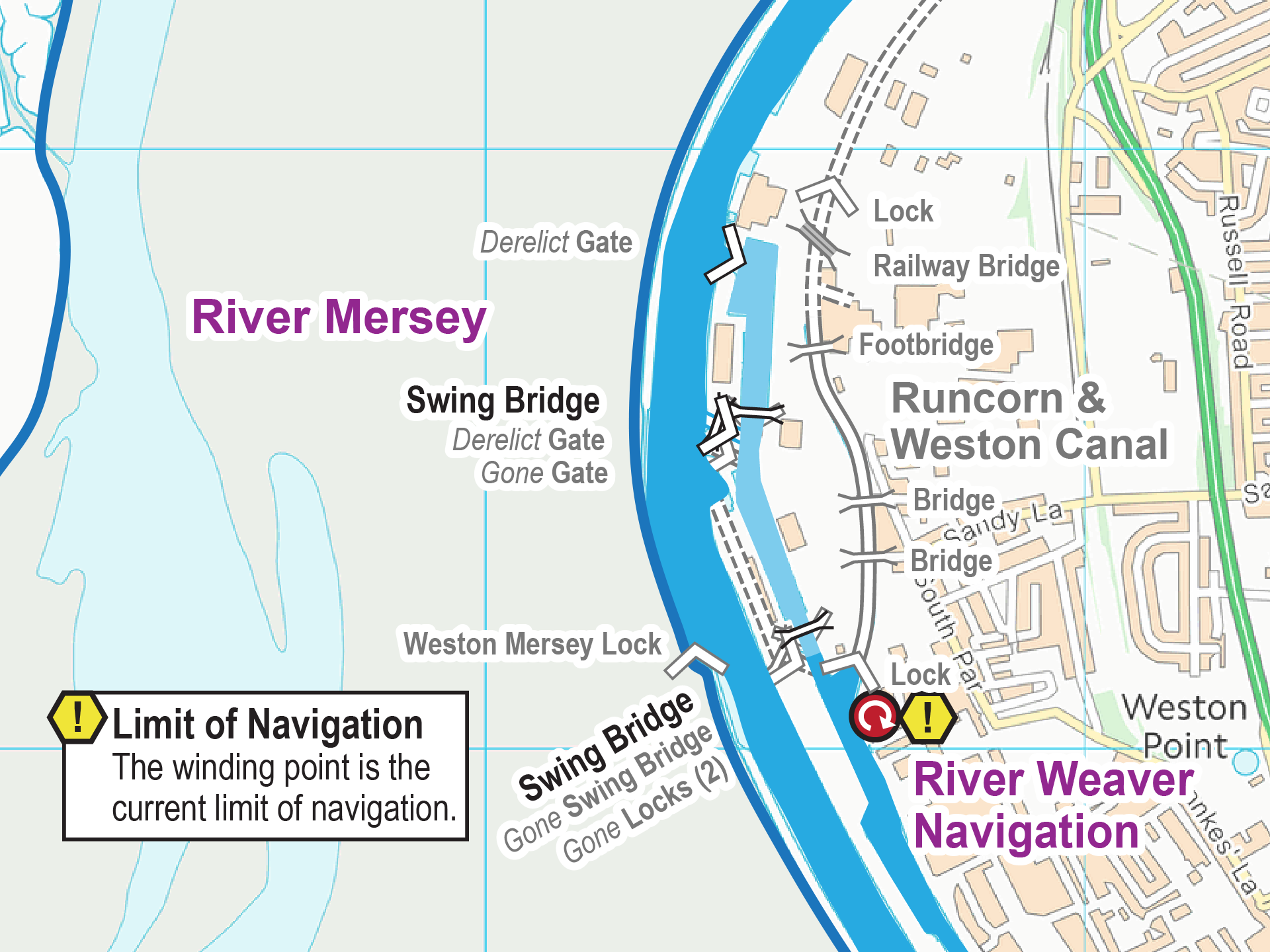
The Runcorn & Weston Canal ran parallel to the River Mersey, through the outskirts of Runcorn, for 2.4km (1.5 miles). At the southern end it joined the Weston Canal of the River Weaver Navigation through...
< JUMP TO Bridgewater Canal Next > < Top of Locks R&W Canal Jn > The bottom of Runcorn Old Locks leads onto the Manchester Ship Canal, having previously joined the River Mersey before the ship...
< Next Bridgewater Canal Next > < MSC Jn R&W Canal Jn > The bottom pair of staircase locks originally linked to the River Mersey, then linked to the Manchester Ship Canal after its construction. The trees...

< Next Bridgewater Canal Next > < MSC Jn Top of Locks > < Next Runcorn & Weston Canal JUMP TO > < River Weaver Jn River Weaver Jn > The Runcorn & Weston Canal once came...
< Next Bridgewater Canal Next > < R&W Canal Jn Top of Locks > After descending through four pairs of staircase locks, and before the final fifth pair, the Runcorn Old Locks line met the...
< Next Bridgewater Canal Next > < R&W Canal Jn Top of Locks > The gate recesses in the locks have been repurposed for the seats. Hopefully they will be used for gates again...
< Next Bridgewater Canal Next > < R&W Canal Jn Top of Locks > The stonework marks the position of the five pairs of staircase locks for the line of Runcorn Old Locks. To the...
< Next Bridgewater Canal Next > < R&W Canal Jn Top of Locks > The stonework clearly shows the position of the staircase locks. We’re standing at the top gates, with the seat positioned in...
< Next Bridgewater Canal Next > < R&W Canal Jn Top of Locks > Looking down the staircase locks where the Manchester Ship Canal and River Mersey can just be seen between the buildings in...
< Next Bridgewater Canal Next > < R&W Canal Jn Top of Locks > A footpath wanders gently down the line of Runcorn Old Locks, passing through the centre of the lock chambers. There were...
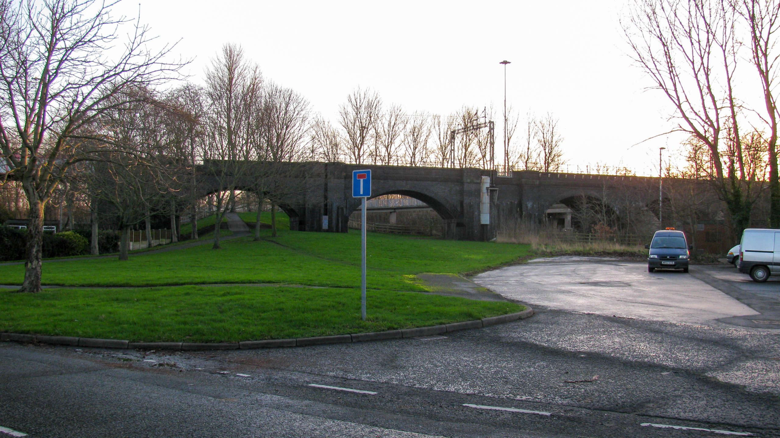
< Next Bridgewater Canal Next > < R&W Canal Jn Top of Locks > Looking up the line of Runcorn Locks the two arches of the railway viaduct that once straddled the two lines of...
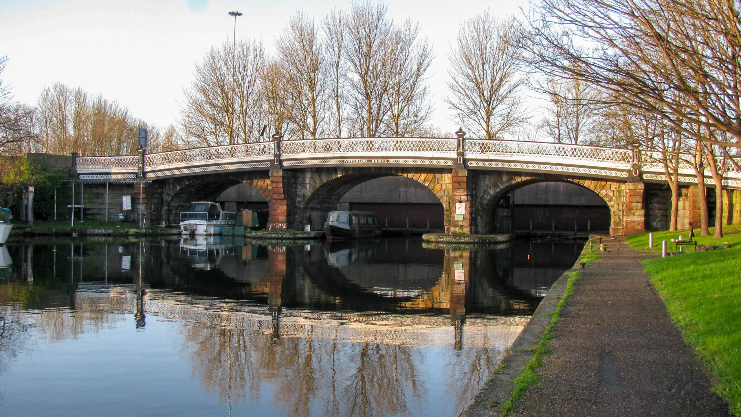
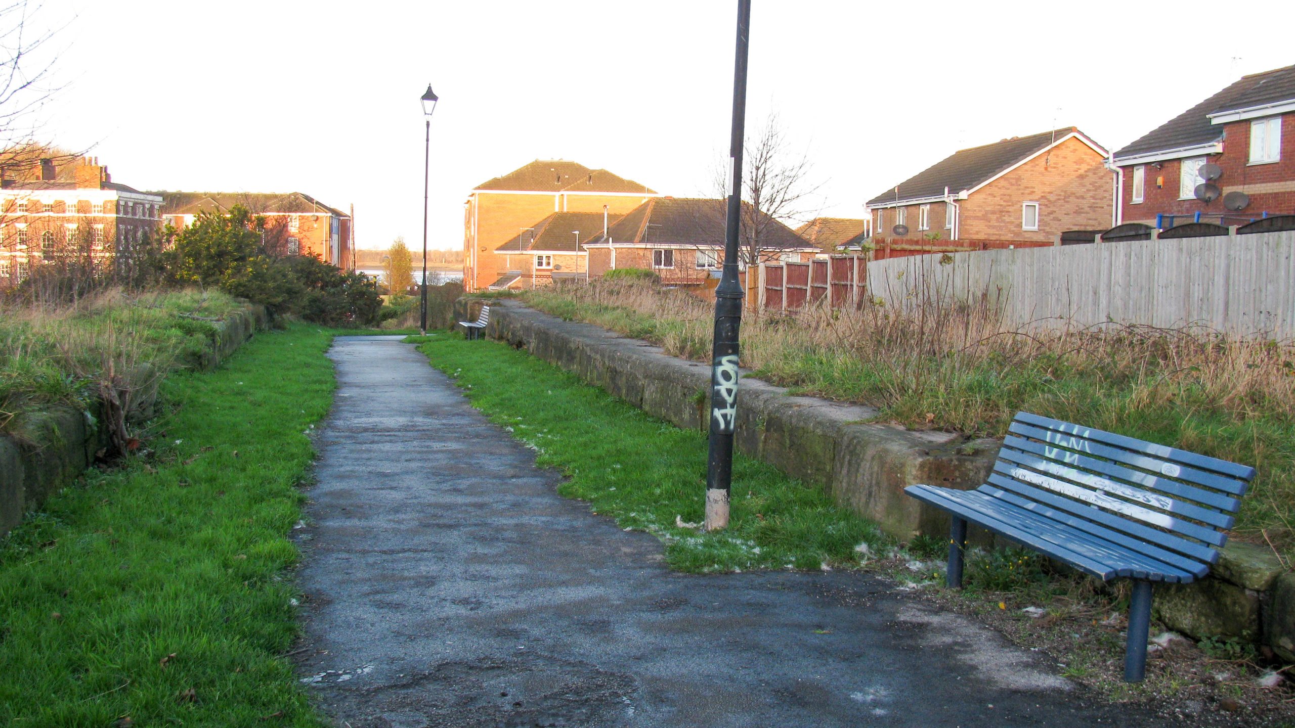
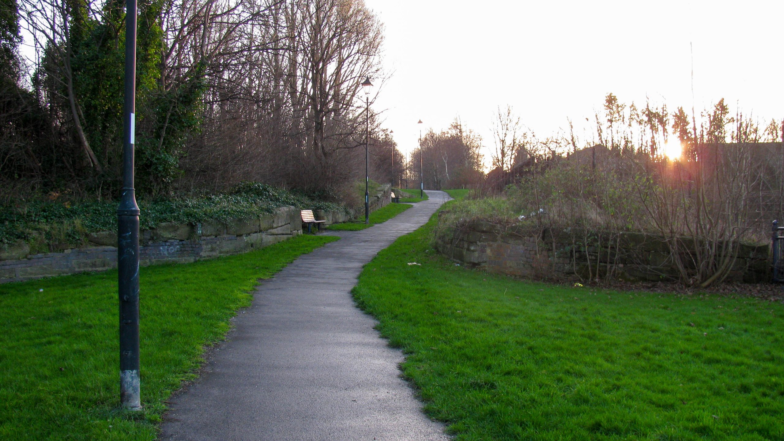
< Next Bridgewater Canal JUMP TO > < R&W Canal Jn MSC Jn > The limit of navigation on the Bridgewater Canal is Waterloo Bridge at Runcorn. Immediately beyond is the approach road for the Runcorn...
< Next Runcorn & Weston Canal JUMP TO > < River Weaver Jn River Weaver Jn > < Next Bridgewater Canal Next > < MSC Jn Top of Locks > We’re standing at the end of the...
< Next Runcorn & Weston Canal Next > < River Weaver Jn Runcorn Locks Jn > The line of Runcorn New Locks has been built over and we are looking down the flight which passes through...
< Next Runcorn & Weston Canal Next > < River Weaver Jn Runcorn Locks Jn > The limit of the water on the Runcorn & Weston Canal. The remaining 1.7km (just over a mile) is filled...
< Next Runcorn & Weston Canal Next > < River Weaver Jn Runcorn Locks Jn > Beyond the second bridge the water finishes where it disappears from sight in this photo. The canal is filled in and,...
< Next Runcorn & Weston Canal Next > < River Weaver Jn Runcorn Locks Jn > Looking back from the second bridge to the first, that has been infilled with a culver in the centre to...
< Next Runcorn & Weston Canal Next > < River Weaver Jn Runcorn Locks Jn > Looking from the first bridge to the second, this one is navigable, if only you could get a boat there....
< Next Runcorn & Weston Canal Next > < River Weaver Jn Runcorn Locks Jn > We’re standing on the first bridge of the Runcorn & Weston Canal and peering through the adjacent pipe bridge towards...
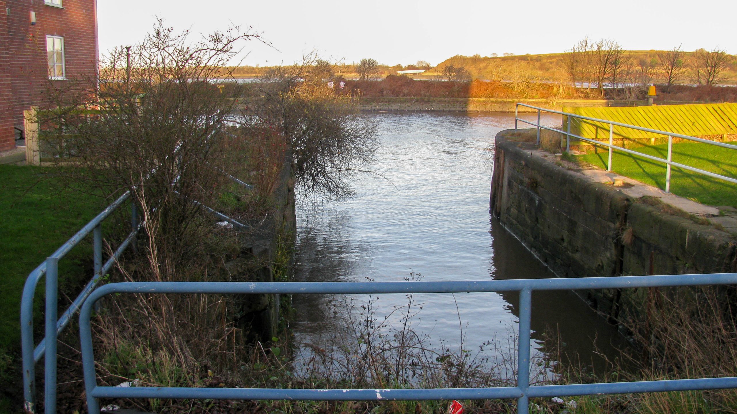
< Next Runcorn & Weston Canal Next > < River Weaver Jn Runcorn Locks Jn > The derelict entrance lock from the River Weaver leads onto the Runcorn & Weston Canal which is in water for...
< Next Runcorn & Weston Canal Next > < River Weaver Jn Runcorn Locks Jn > Leaving the River Weaver, the Runcorn & Weston Canal climbed through one lock, now derelict. RAW 00.015.01 OS Grid Reference...
< JUMP TO Runcorn & Weston Canal Next > < Runcorn Locks Jn Runcorn Locks Jn > Looking along the River Weaver towards Runcorn, with the Runcorn & Weston Canal diverging to the right. Waterway and...
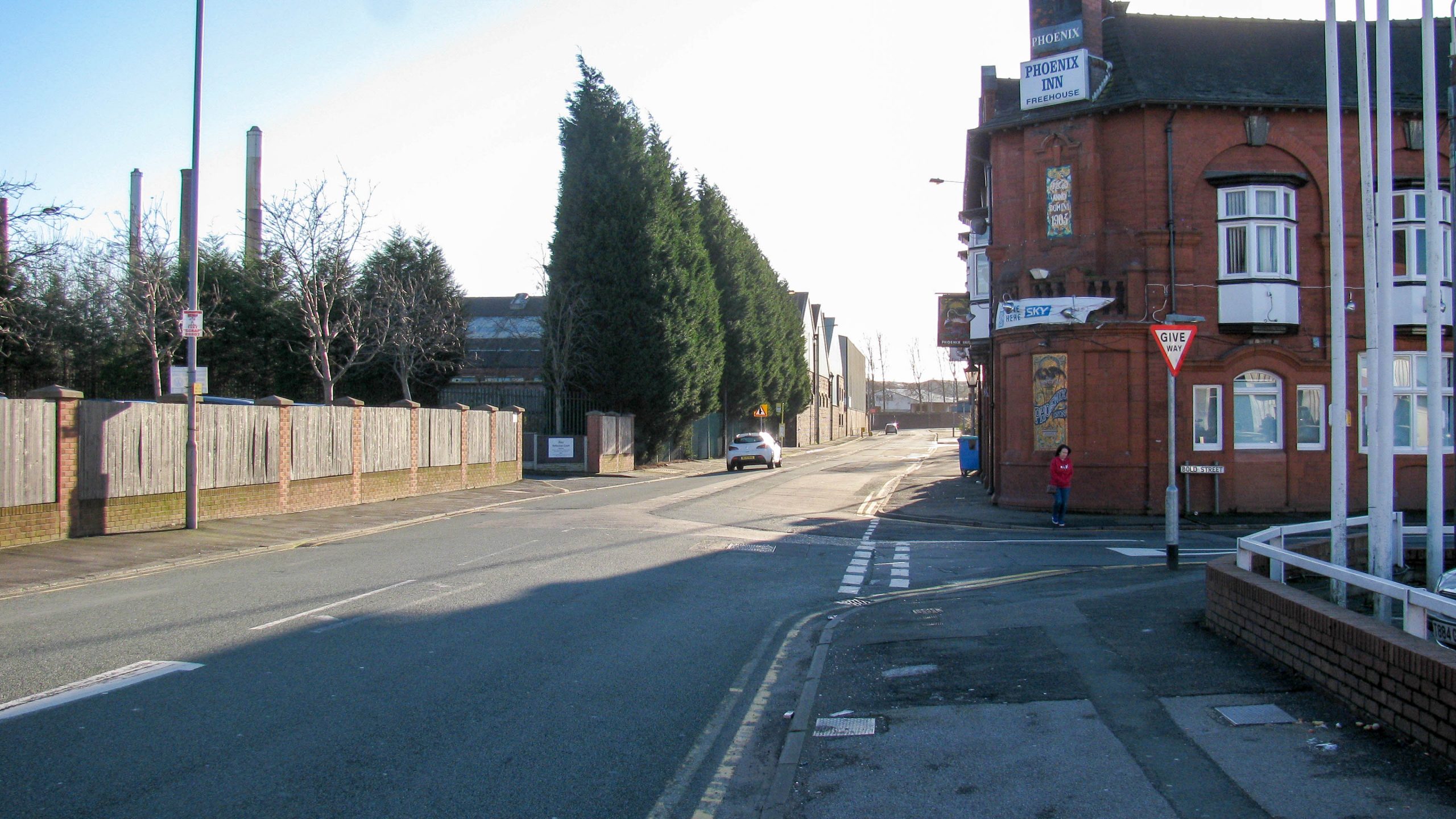
< Next Ravenhead Canal Next > < First Last > Looking East along Elm Road. The Ravenhead Canal would probably have crossed below road level near the crest of the hill, where the 20 mph signs...
< Next Ravenhead Canal Next > < First Last > Looking west along Elm Road. The Ravenhead Canal would probably have crossed the line of the road between the 20 mph signs. Waterway and Kilometerage RAV...
The Sankey Canal is the name sometimes used for the St Helens Canal, partly because it used the line of the Sankey Brook when it was constructed. For consistency, I use the name St...
History The St Helens Canal ran from the River Mersey near Warrington to reach the outskirts of St Helens. It’s sometimes known as the Sankey Canal as it used the line of the Sankey Brook in...
< JUMP TO Ravenhead Branch Next > < Boardman’s Bridge Jn Boardman’s Bridge Jn > We’re standing at the end of the Ravenhead Branch of the St Helens Canal. This final section of the canal closed...
< Next Ravenhead Branch Next > < End of Navigation Boardman’s Bridge Branch Jn > From Tavern Swing Bridge in the distance near the white building, the Ravenhead Branch once came towards the camera along what...
< Next Ravenhead Branch Next > < End of Navigation Boardman’s Bridge Branch Jn > The final 400m (¼ mile) of the Ravenhead Branch once headed into the distance along what is, rather cheekily, called Canal...
< Next Ravenhead Branch Next > < End of Navigation Boardman’s Bridge Branch Jn > Photographed just beyond the current limit of navigation of the Ravenhead Branch, this is where the canal once passed from where...
< Next Ravenhead Branch Next > < End of Navigation Boardman’s Bridge Branch Jn > This will be the limit of navigation on the Ravenhead Branch when it’s restored. Visitor moorings and a winding point are...
< Next Ravenhead Branch Next > < End of Navigation Boardman’s Bridge Branch Jn > The limit of navigation of the Ravenhead Branch of the St Helens Canal. The branch once continued for around 650m (700 yards) further...
< Next Ravenhead Branch Next > < End of Navigation Boardman’s Bridge Branch Jn > Very near the end of the St Helens Canal is passes between modern shopping outlets and car parking spaces. Waterway and...
< Next Ravenhead Branch Next > < End of Navigation Boardman’s Bridge Branch Jn > The Railway Line through St Helens crosses a bridge over the towpath. It’s not clear if the bridge over the canal...
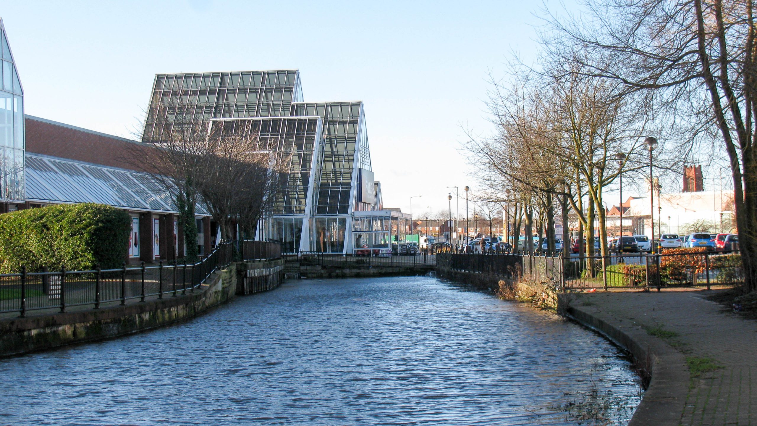
< Next Ravenhead Branch Next > < End of Navigation Boardman’s Bridge Branch Jn > The glass sided footbridge links the two parts of Pilkington’s World of Glass in St Helens. Waterway and Kilometerage HELENS-RB 24.790 OS...
< Next Ravenhead Branch Next > < End of Navigation Boardman’s Bridge Branch Jn > The first bridge on the Ravenhead Branch is a footbridge with adequate clearances making navigation possible. Waterway and Kilometerage HELENS-RB 24.700 OS...
< Next Ravenhead Branch Next > < End of Navigation Boardman’s Bridge Branch Jn > Looking back towards the start of the Ravenhead Branch where the Boardman’s Bridge Branch once continued from the left to pass...
< Next Ravenhead Branch JUMP TO > < End of Navigation End of Navigation > < Next Boardman’s Bridge Branch Next > < End of Navigation New Double Locks Jn > Where the Boardman’s Bridge Branch once went...
< JUMP TO Boardman’s Bridge Branch Next > < New Double Locks Jn Ravenhead Branch Jn > Filmed from the junction with the Ravenhead Branch, the Boardman’s Bridge Branch once continues around 300m (330 yards) straight ahead,...

< Next Boardman’s Bridge Branch Next > < End of Navigation New Double Locks Jn > < Next Ravenhead Branch JUMP TO > < End of Navigation End of Navigation > Looking from the inside of the curve...
< Next Boardman’s Bridge Branch Next > < Ravenhead Branch Jn New Double Locks Jn > With canal restoration seriously proposed it’s a little surprising that a recently installed footbridge has been constructed with such limited...

< Next Boardman’s Bridge Branch Next > < Ravenhead Branch Jn New Double Locks Jn > The wildlife is quite happy with the restored sections of canal. In the distance is a railway bridge which, like...
< Next Boardman’s Bridge Branch Next > < Ravenhead Branch Jn New Double Locks Jn > The line of the canal is still available for restoration where this hasn’t already been been done. Here the route...
< Next Boardman’s Bridge Branch Next > < Ravenhead Branch Jn New Double Locks Jn > Between the low bridges the canal is largely restored, just waiting for boats to cruise along. Waterway and Kilometerage HELENS-BBB...
< Next Boardman’s Bridge Branch Next > < Ravenhead Branch Jn New Double Locks Jn > As the canal passes through St Helens there are several roads that cross the canal just above water level which will make...
< Next Boardman’s Bridge Branch Next > < Ravenhead Branch Jn New Double Locks Jn > There’s nothing to stop boats cruising along this restored section of the Boardman’s Bridge Branch in St Helens. Note the...

< Next Boardman’s Bridge Branch Next > < Ravenhead Branch Jn New Double Locks Jn > The first bridge, with the light coloured railings, has been replaced by a causeway and the road level will have...

< Next Boardman’s Bridge Branch Next > < Ravenhead Branch Jn New Double Locks Jn > The two lock staircase at the end of the Boardman’s Bridge Branch of the St Helens Canal was restored some...
< Next Boardman’s Bridge Branch Next > < Ravenhead Branch Jn New Double Locks Jn > There are no walkways across the middle and bottom lock gates of the New Double Locks but there are footbridges...

< Next Boardman’s Bridge Branch Next > < Ravenhead Branch Jn New Double Locks Jn > The restored centre gates of the two lock staircase known as the New Double Locks have been allowed to deteriorate,...
< Next Boardman’s Bridge Branch Next > < Ravenhead Branch Jn New Double Locks Jn > The bottom of the two lock staircase, known as the New Double Locks. These were restored some time ago and...
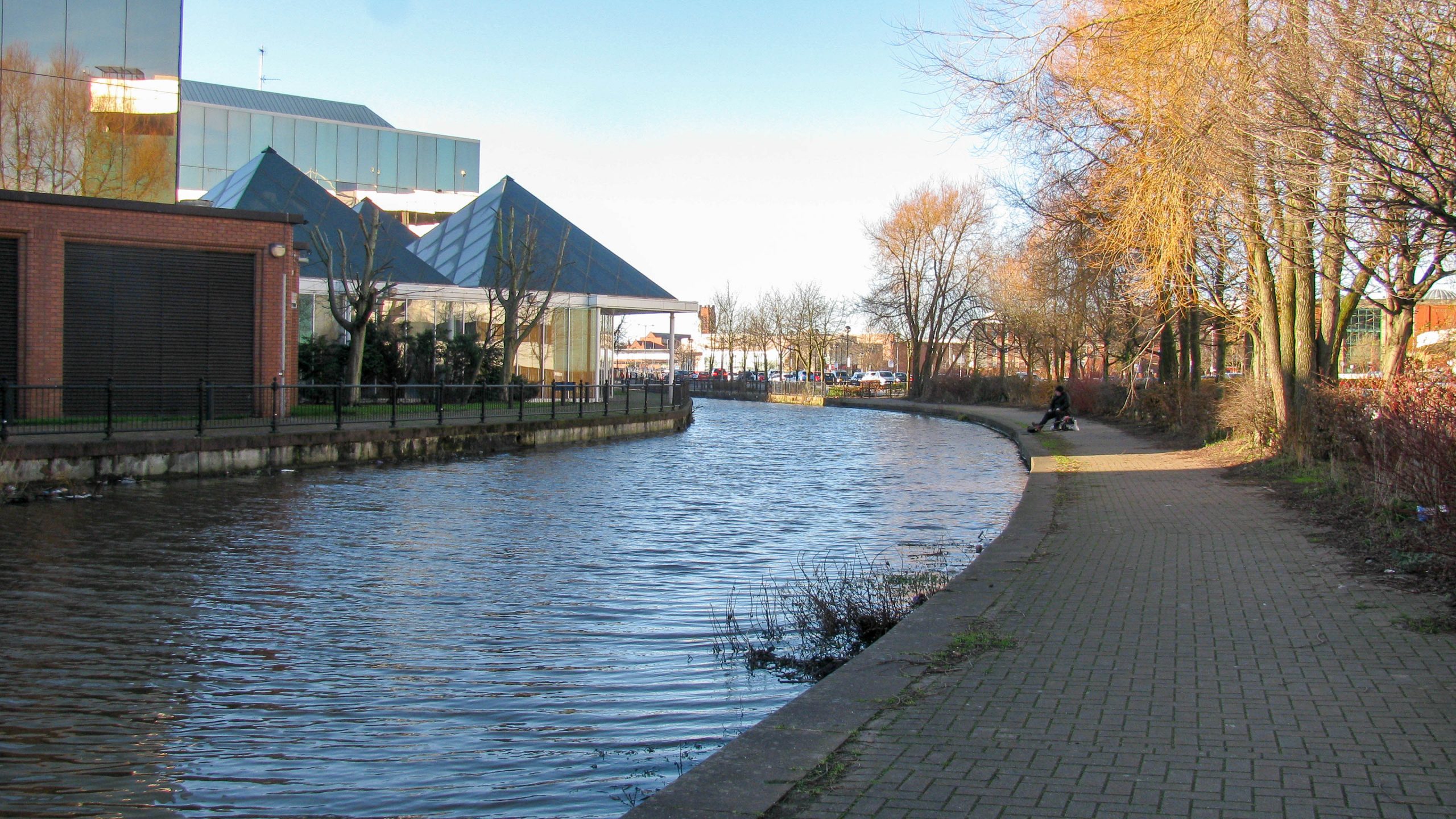
< Next Boardman’s Bridge Branch Next > < Ravenhead Branch Jn New Double Locks Jn > The high water levels make it almost impossible to distinguish where the junction is. We are looking from the New...
< Next Boardman’s Bridge Branch JUMP TO > < Ravenhead Branch Jn End of Navigation > < Next Gerard’s Bridge Branch Next > < End of Navigation Old Double Locks Jn > The picture is looking along the...
< JUMP TO Gerard’s Bridge Branch Next > < Old Double Locks Jn New Double Locks Jn > The end of the Gerard’s Bridge Branch is to the left of the photo. The towpath, nearer the...
< Next Gerard’s Bridge Branch Next > < End of Navigation New Double Locks Jn > The Gerard’s Bridge Branch comes towards us and finished to the left of the photo. The line of the water...
< Next Gerard’s Bridge Branch Next > < End of Navigation Old Double Locks Jn > < Next Boardman’s Bridge Branch JUMP TO > < Ravenhead Branch Jn End of Navigation > Exceptionally high water levels after heavy...
< Next Gerard’s Bridge Branch Next > < New Double Lock Jn Old Double Locks Jn > Exceptionally high water levels after recent heavy rain meant the towpath became flooded and is hard to distinguish from...
< Next Gerard’s Bridge Branch Next > < New Double Lock Jn Old Double Locks Jn > Another bridge fixed close to water level. The name has evolved and appears as Irelands Brow Bridge and Islands...
< Next Gerard’s Bridge Branch Next > < New Double Lock Jn Old Double Locks Jn > Approaching St Helens the route of the canal is still protected as it’s squeezed between the industrial buildings on...
< Next Gerard’s Bridge Branch Next > < New Double Lock Jn Old Double Locks Jn > A low footbridge crosses the channel close to the normal water level. After recent heavy rain the water levels...
< Next Gerard’s Bridge Branch Next > < New Double Lock Jn Old Double Locks Jn > It’s easy to walk or cycle along the route of the canal and, with a little work, it will...
< Next Gerard’s Bridge Branch Next > < New Double Lock Jn Old Double Locks Jn > The footpath / cyclepath regains the line of the towpath to the west of Park Road. A bridge has...
< Next Gerard’s Bridge Branch JUMP TO > < New Double Lock Jn End of Navigation > < Next Blackbrook Branch JUMP TO > < End of Navigation End of Navigation > < JUMP TO St Helens Canal...
< JUMP TO Blackbrook Branch Next > < Old Double Locks Jn Old Double Locks Jn > Looking back from the small basin at the limit of navigation on the Blackbrook Branch of the St Helens...
< Next Blackbrook Branch Next > < End of Navigation Old Double Locks Jn > There’s a small basin at the end of the Blackbrook Branch but nothing else to see. Some old references suggest the adjacent...
< Next Blackbrook Branch Next > < End of Navigation Old Double Locks Jn > Just a short distance from the path along the Blackbrook Branch of the St Helens Canal is the partially restored Stanley...
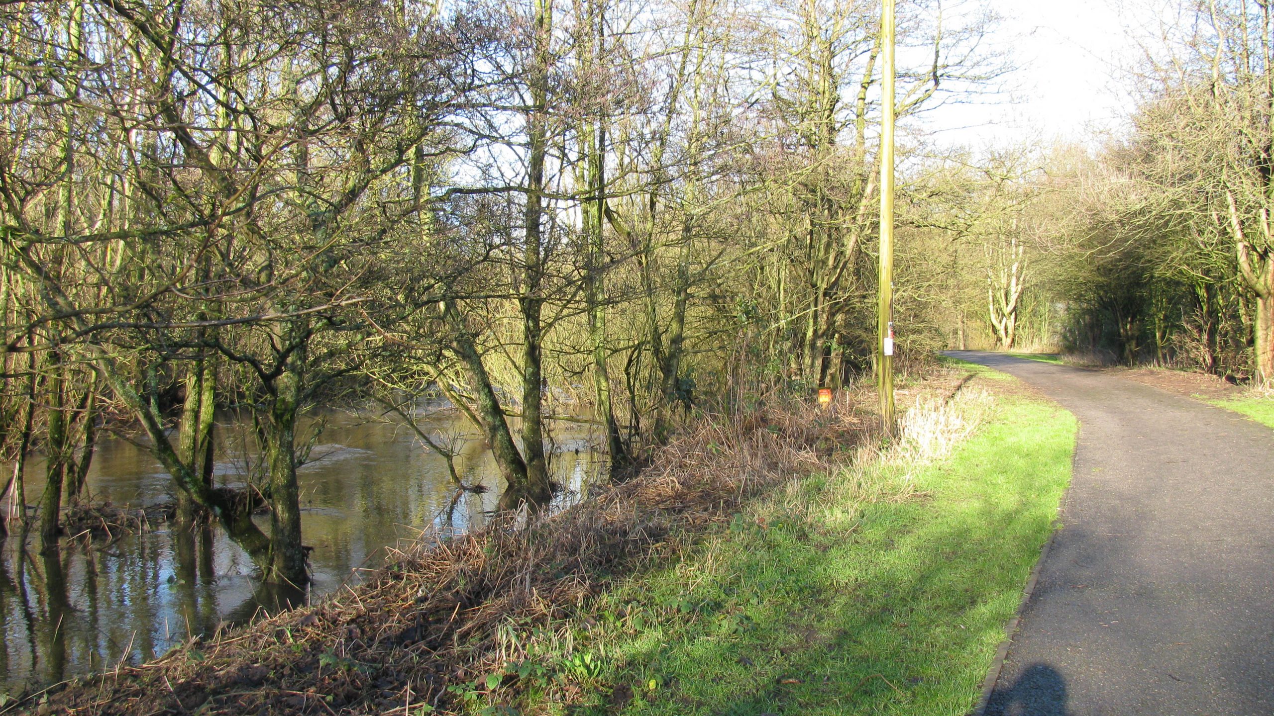
< Next Blackbrook Branch Next > < End of Navigation Old Double Locks Jn > The edges of the Blackbrook Branch are rather overgrown but the centre channel is kept free and used for drainage, especially...
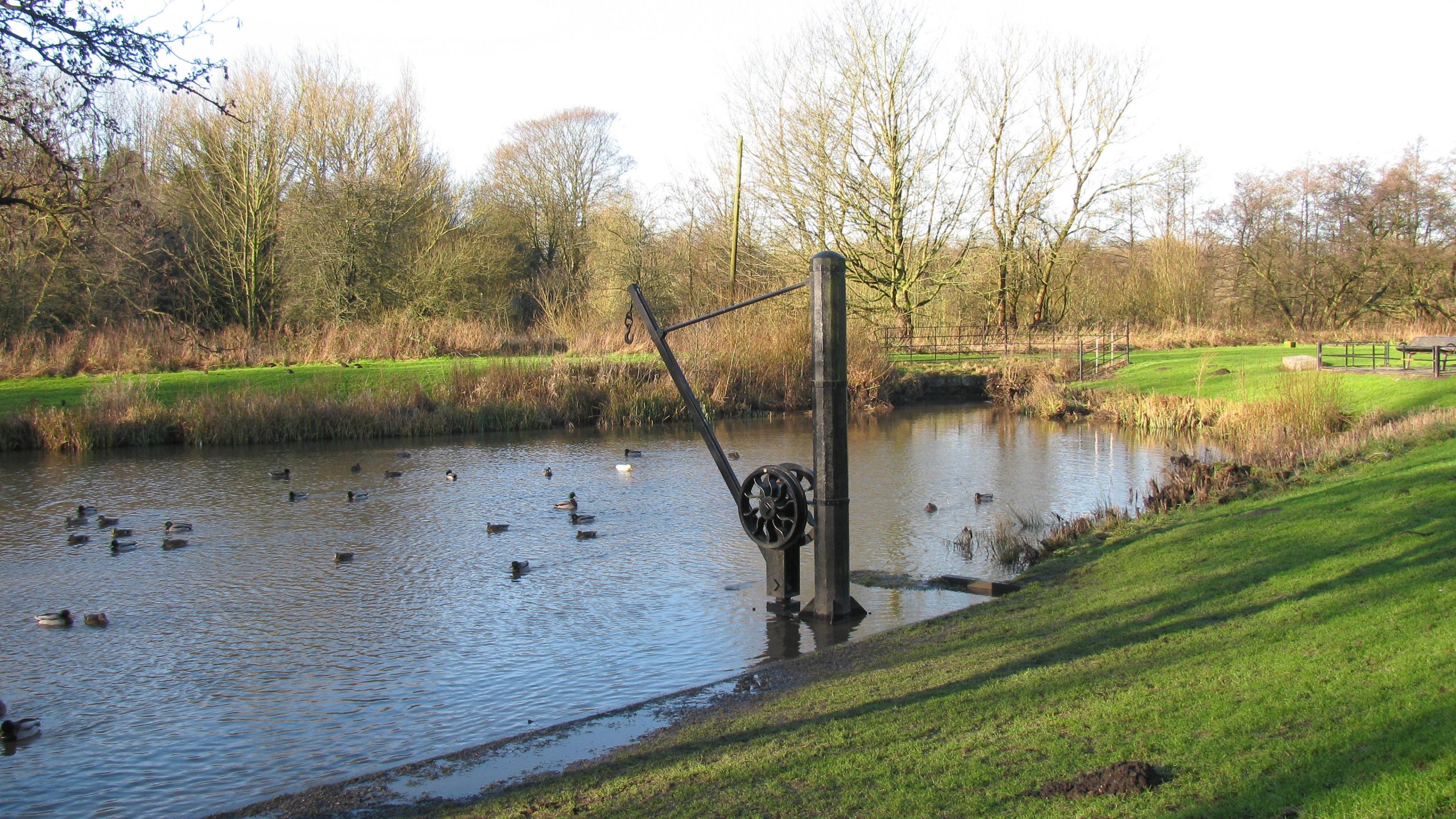
< Next Blackbrook Branch Next > < End of Navigation Old Double Locks Jn > Cranes, like this replica, would have been used at Stanley Basin to lift goods on and off boats which would have...
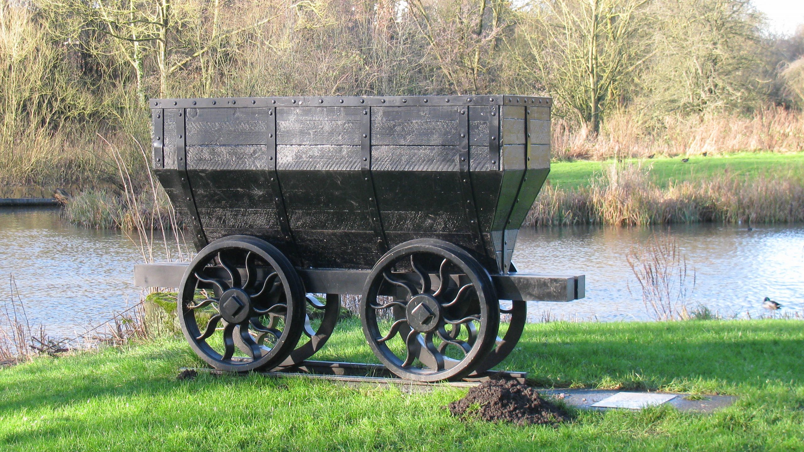
< Next Blackbrook Branch Next > < End of Navigation Old Double Locks Jn > Wagons, like this replica, would have been used to carry loads to and from Stanley Basin for loading to and from...
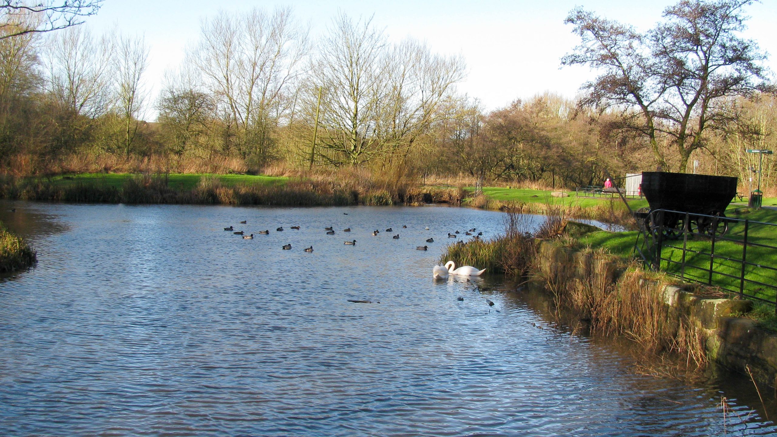
< Next Blackbrook Branch Next > < End of Navigation Old Double Locks Jn > Stanley Basin would once have been busy with boats being loaded and unloaded. It’s not clear if this was dug specially...
< Next Blackbrook Branch Next > < End of Navigation Old Double Locks Jn > There’s very little clearance under Blackpool Road Bridge which carries a busy road across the canal. Providing an opening bridge here...
< Next Blackbrook Branch Next > < End of Navigation Old Double Locks Jn > Rather overgrown with reeds the main channel of the Blackbrook Branch is still visible. Waterway and Kilometerage HELENS-BB 21.250 OS Grid...
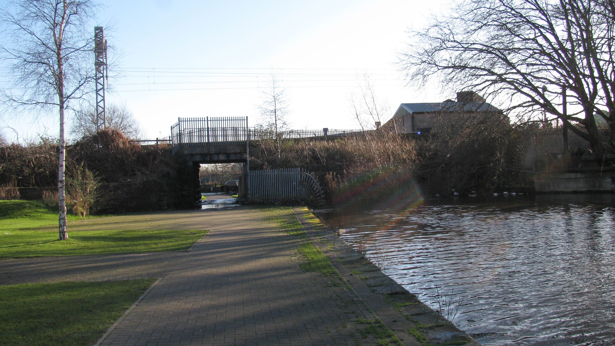
< Next Blackbrook Branch Next > < End of Navigation Old Double Locks Jn > A footbridge crosses near the start of the Blackbrook Branch. There’s also a small weir under the bridge. Waterway and Kilometerage...
< Next Blackbrook Branch Next > < End of Navigation Old Double Locks Jn > Looking back along the Blackbrook Branch to the Junction, where the black and white footbridge is just visible, with the end...
< Next Blackbrook Branch JUMP TO > < End of Navigation End of Navigation > < Next Gerard’s Bridge Branch JUMP TO > < New Double Lock Jn End of Navigation > < JUMP TO St Helens Canal...
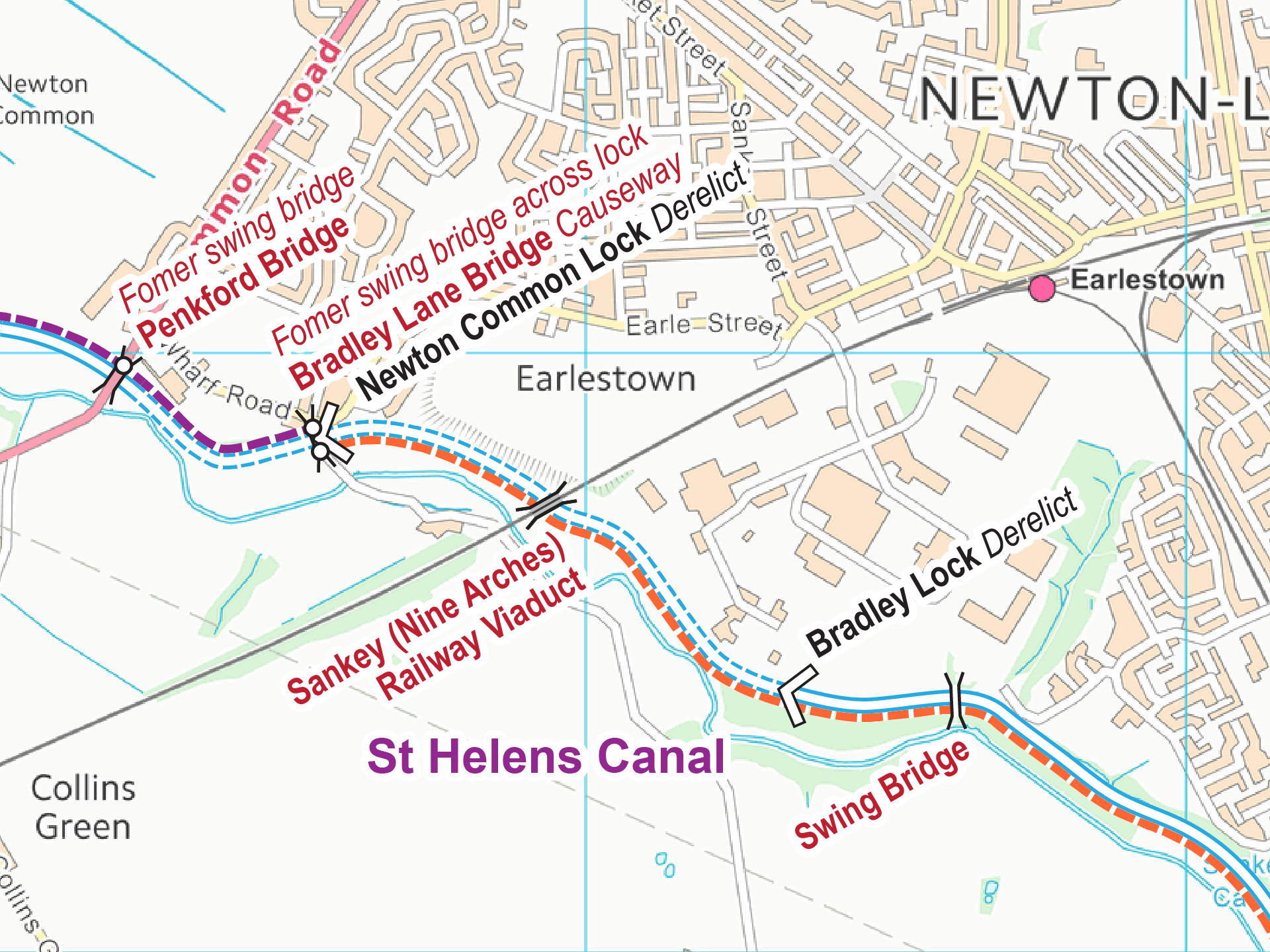
< JUMP TO St Helens Canal Next > < Widnes Earlestown > < Next Blackbrook Branch JUMP TO > < End of Navigation End of Navigation > < Next Gerard’s Bridge Branch JUMP TO > < New Double Lock...
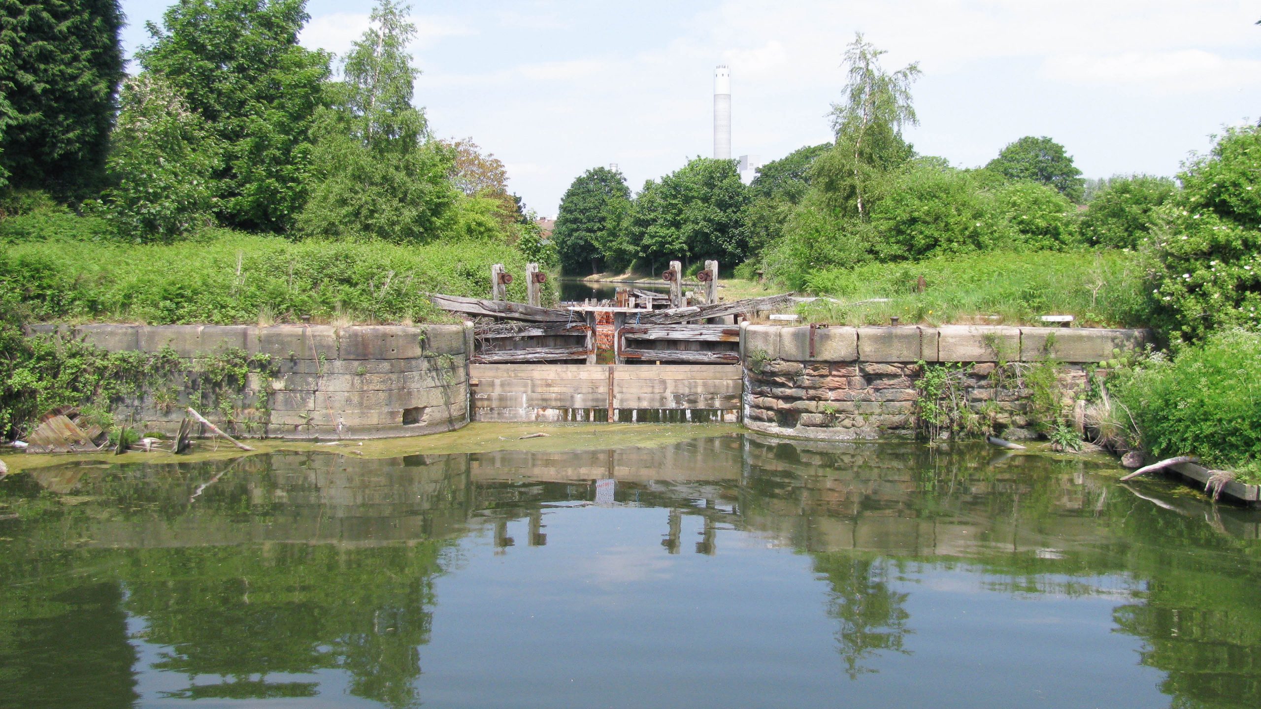
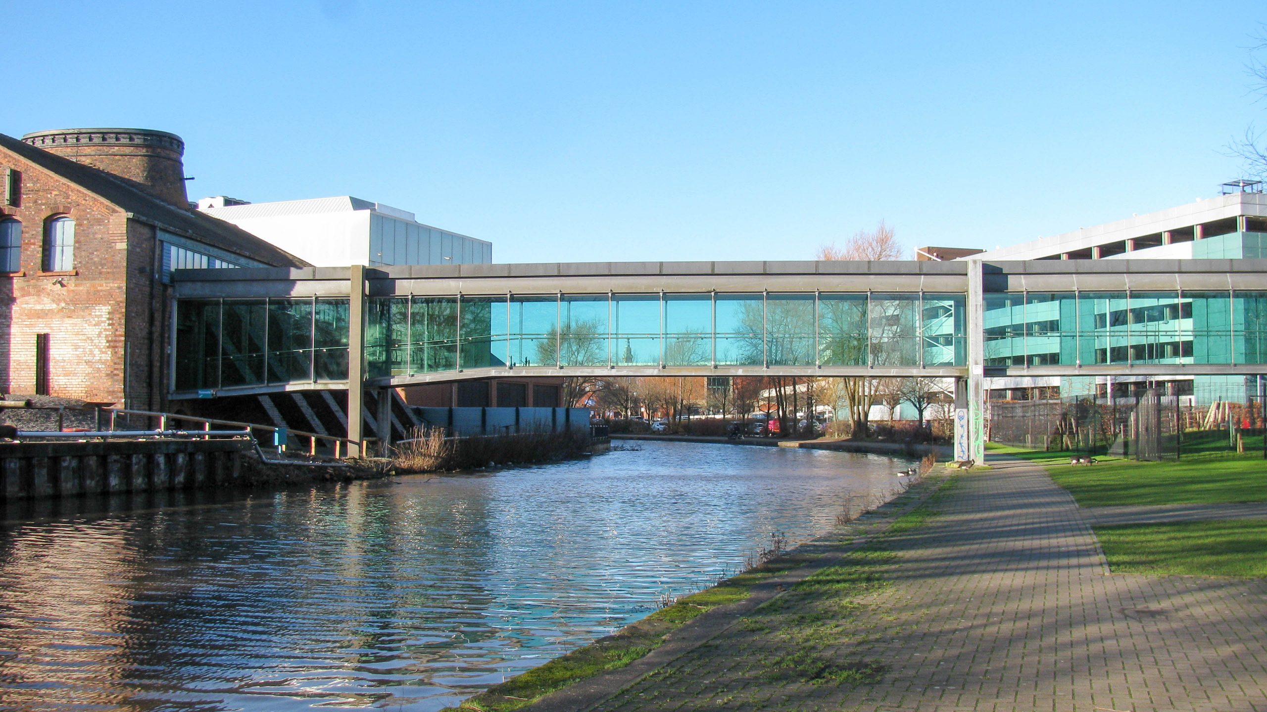
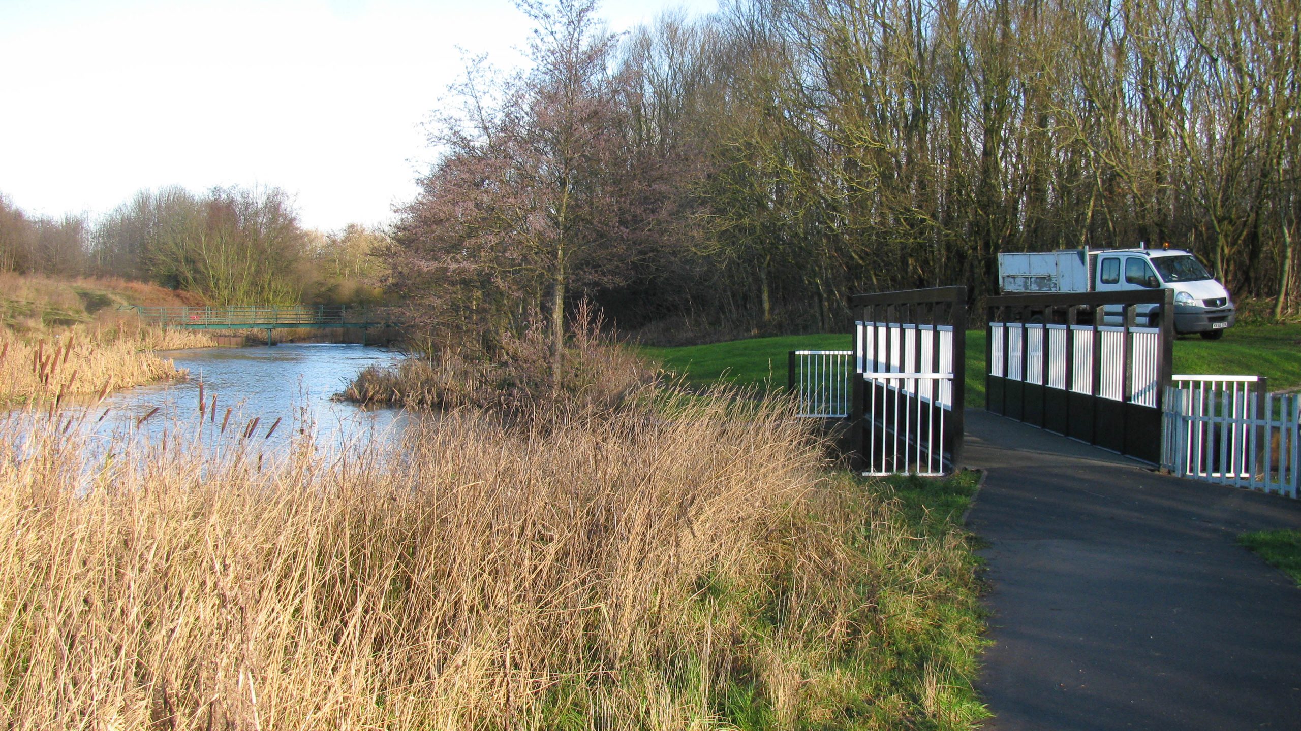
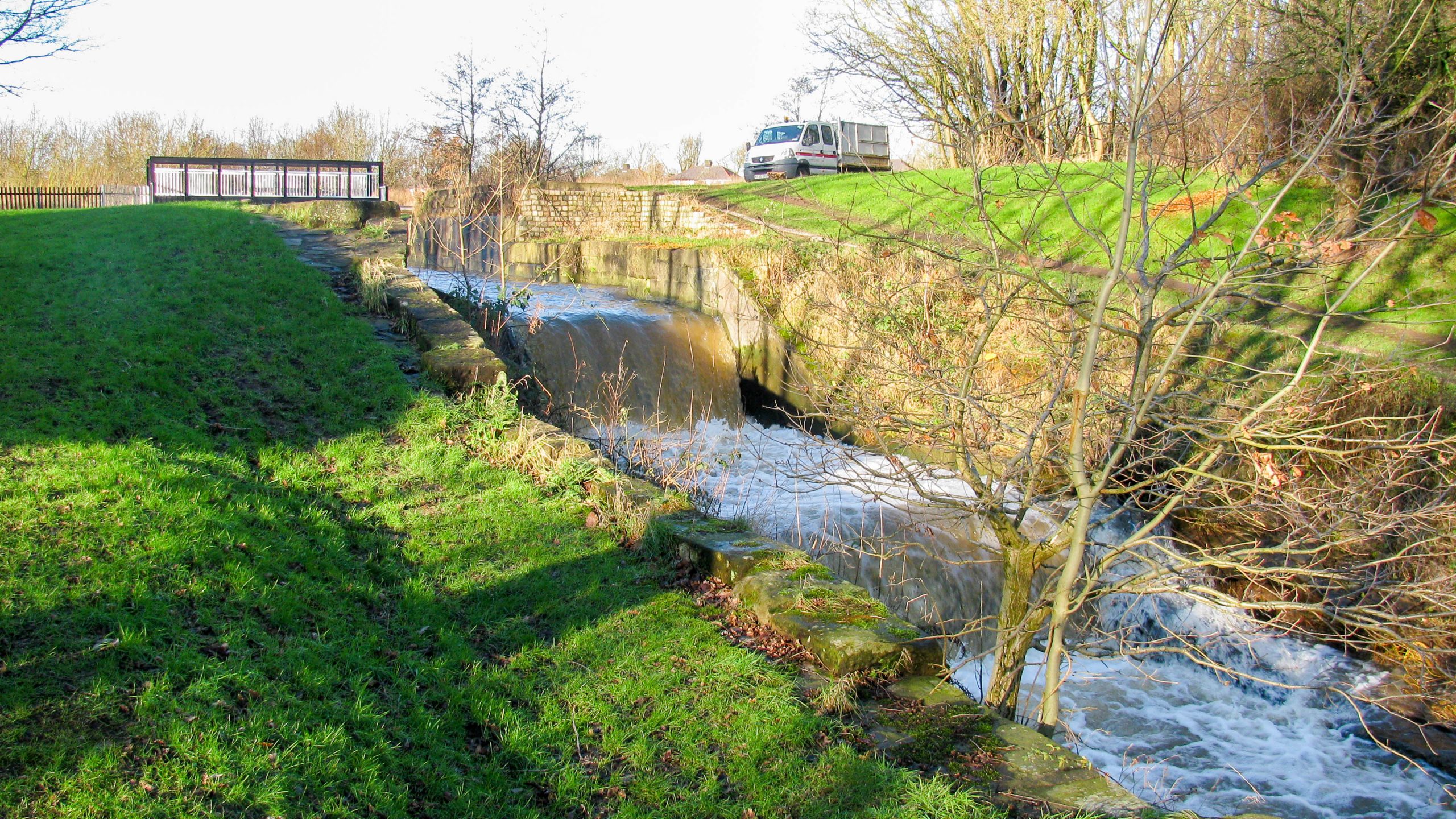
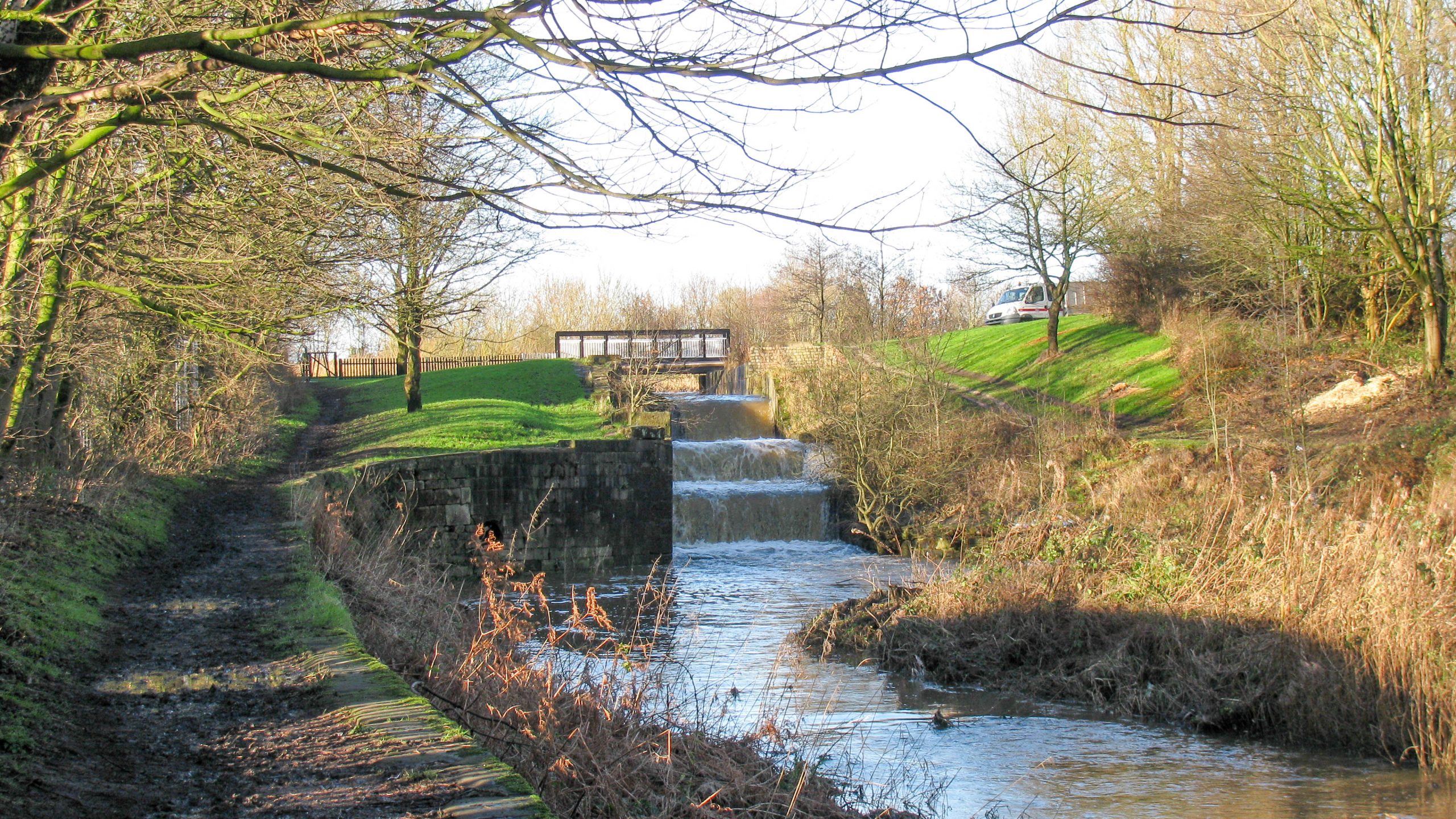
< Next St Helens Canal Next > < Old Double Locks Jn Earlestown > A footbridge carries the towpath across the top of the Old Double Locks. Immediately beyond is the junction which marks the end...
< Next St Helens Canal Next > < Old Double Locks Jn Earlestown > The extra stonework on the left indicates where a swing railway bridge once crossed the top lock, and a swing footbridge once...
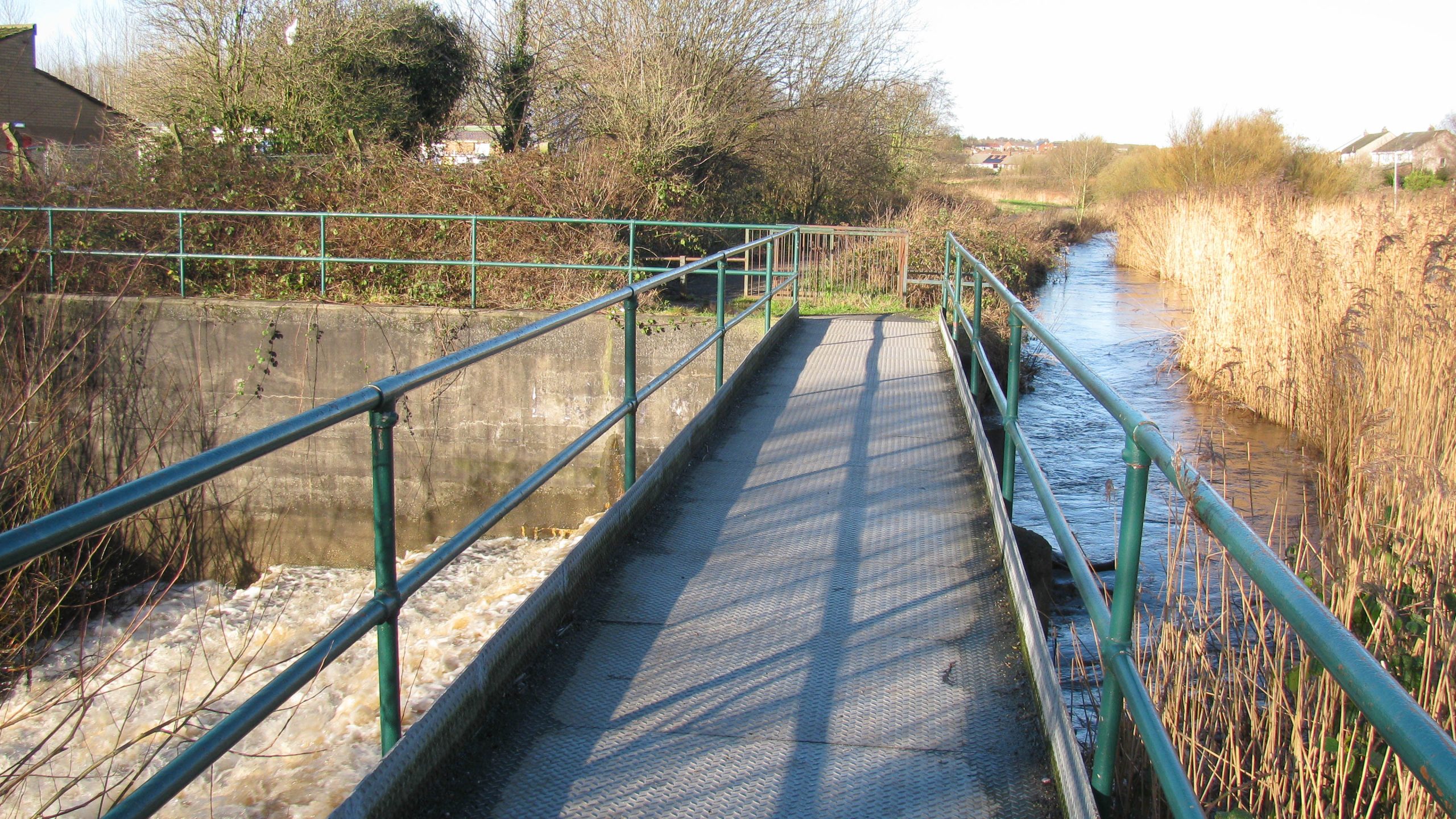
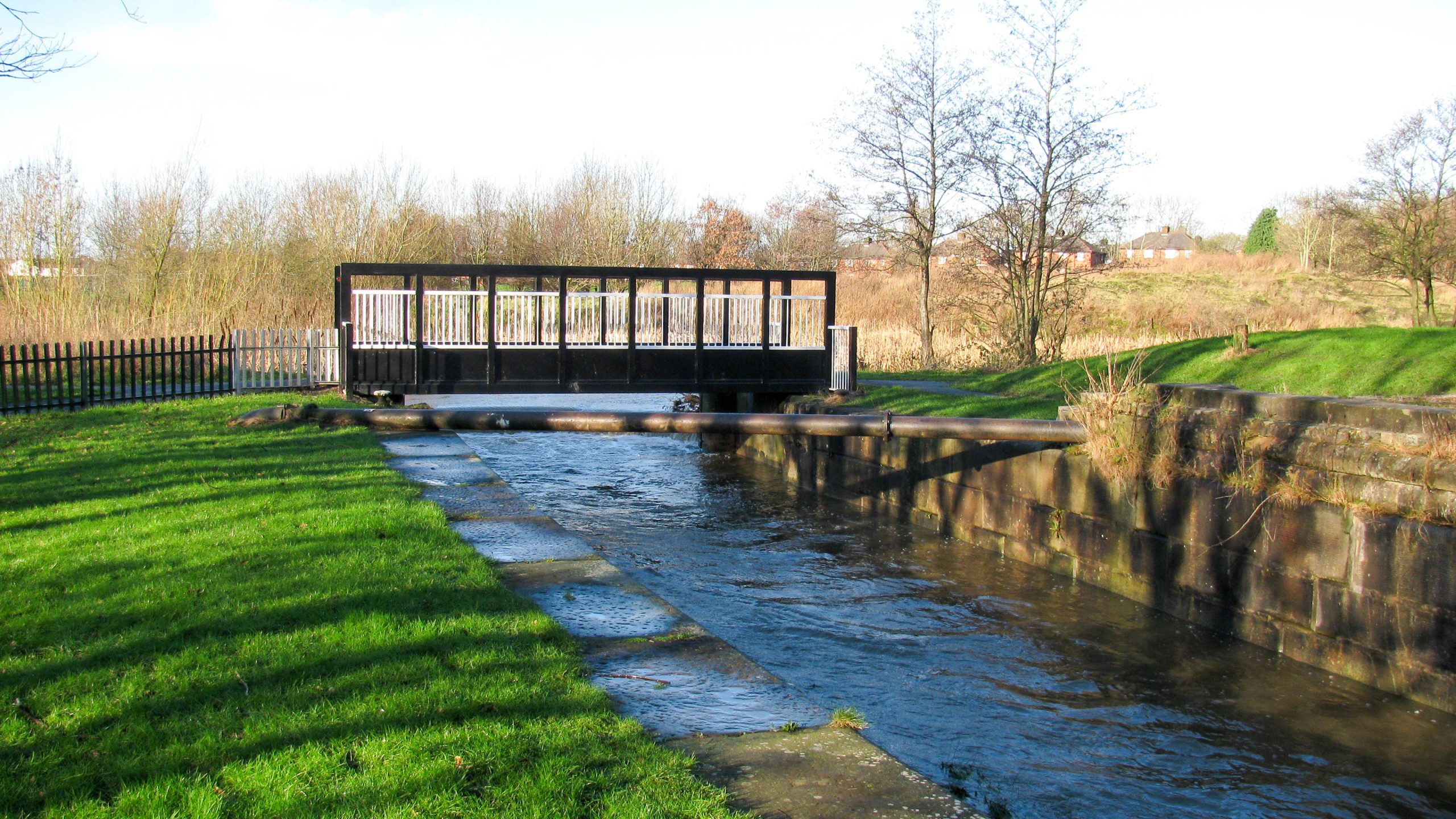
< Next St Helens Canal Next > < Old Double Locks Jn Earlestown > After recent heavy rain, water cascades down through the former two lock staircase known as the Old Double Locks on the St...
< Next St Helens Canal Next > < Old Double Locks Jn Earlestown > Water from local watercourses is diverted to flow along the old canal and cascades through the old staircase locks after heavy rain....
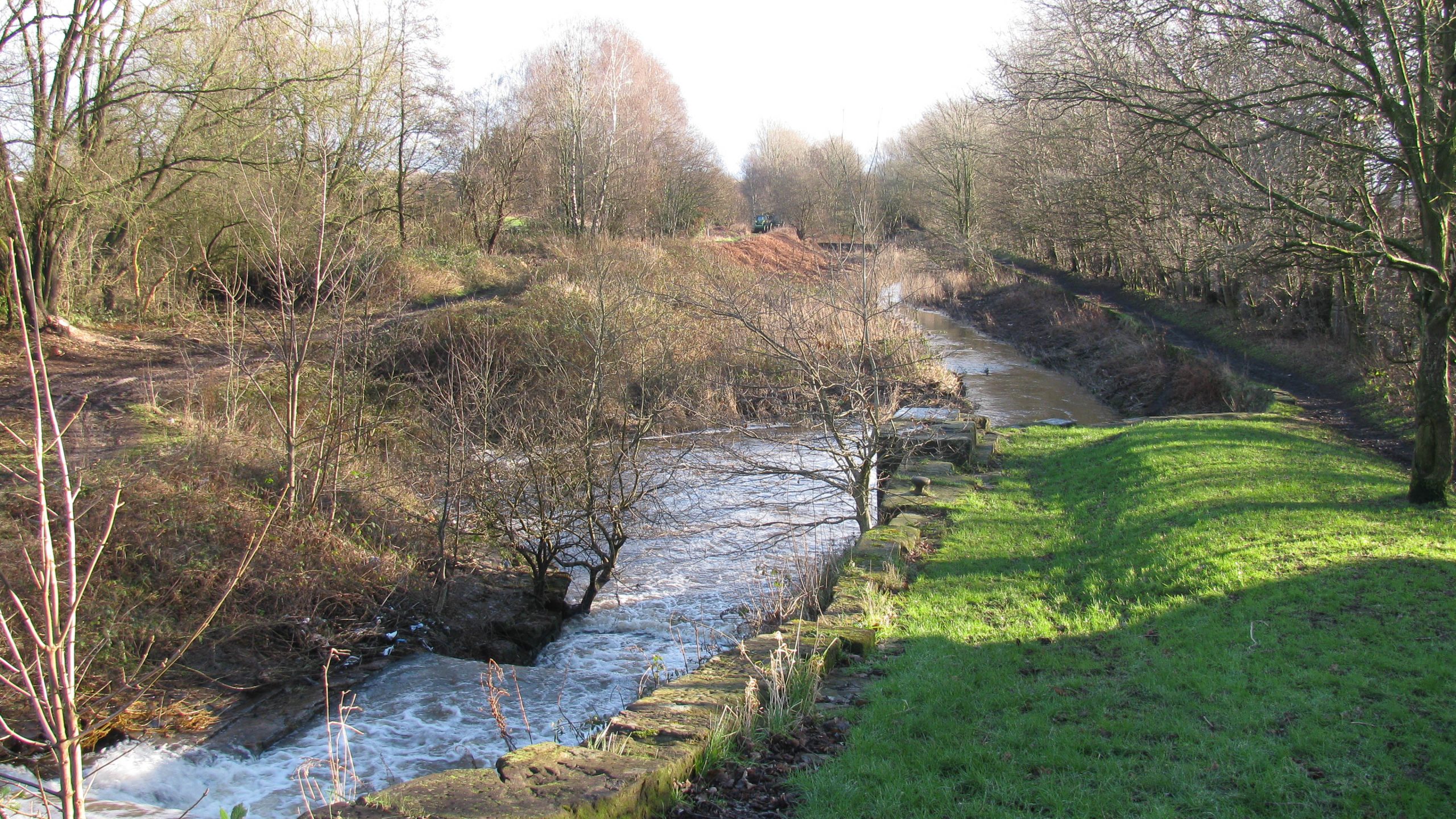
< Next St Helens Canal Next > < Old Double Locks Jn Earlestown > Looking down the Old Double Locks, with an impressive flow of water after recent heavy rain. Waterway and Kilometerage HELENS 21.165 OS...
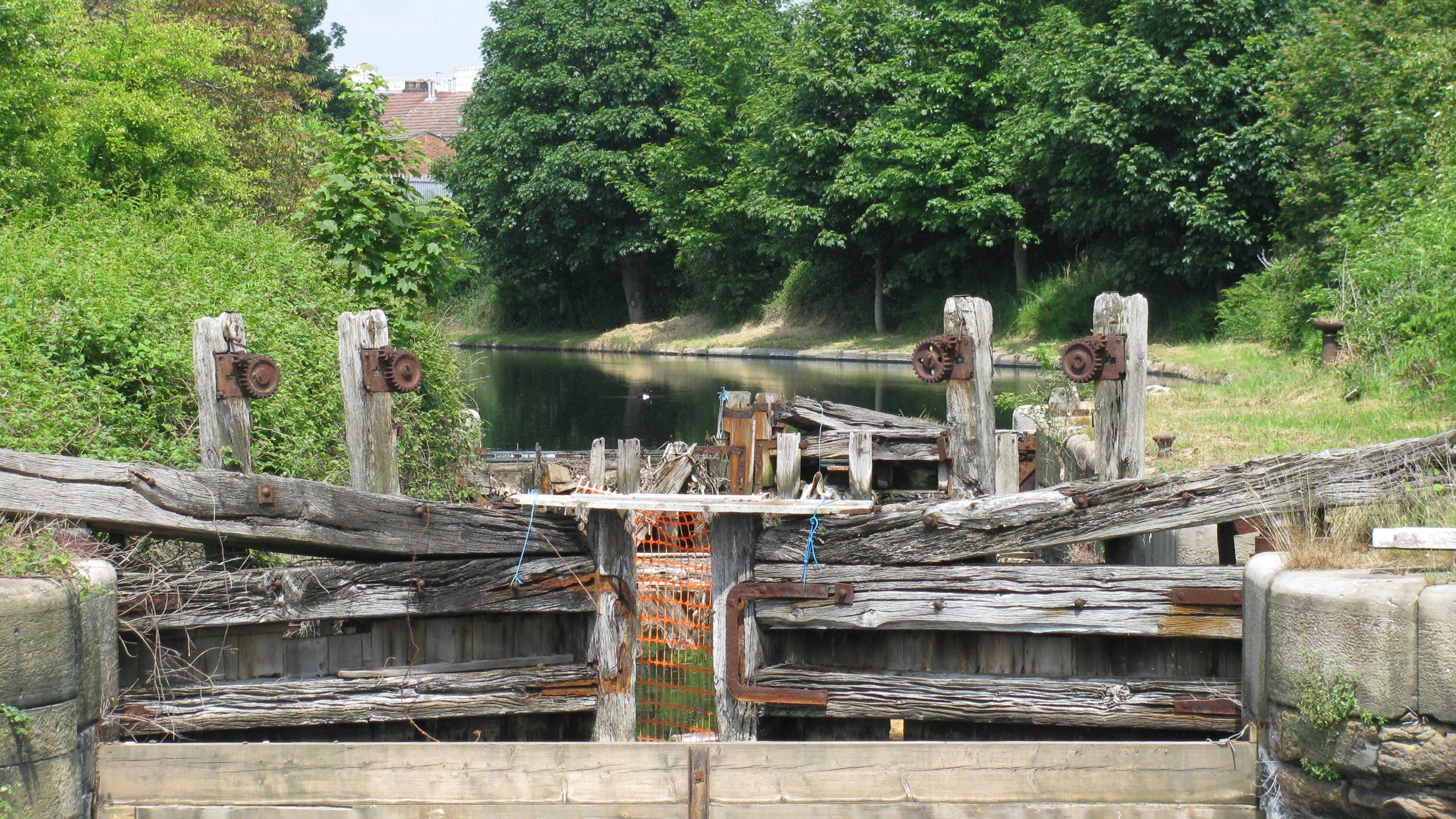
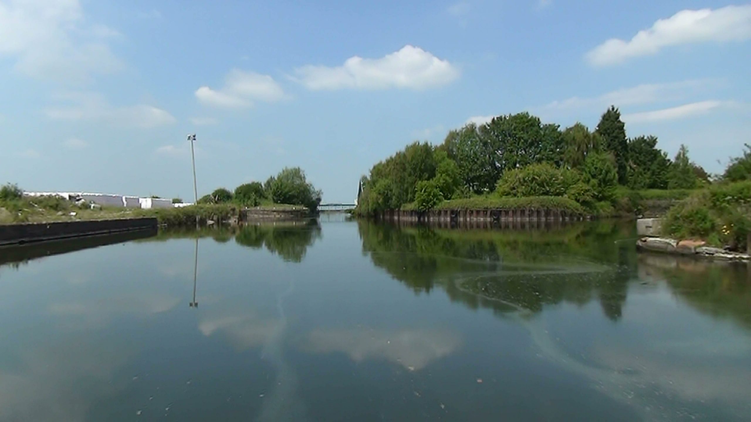
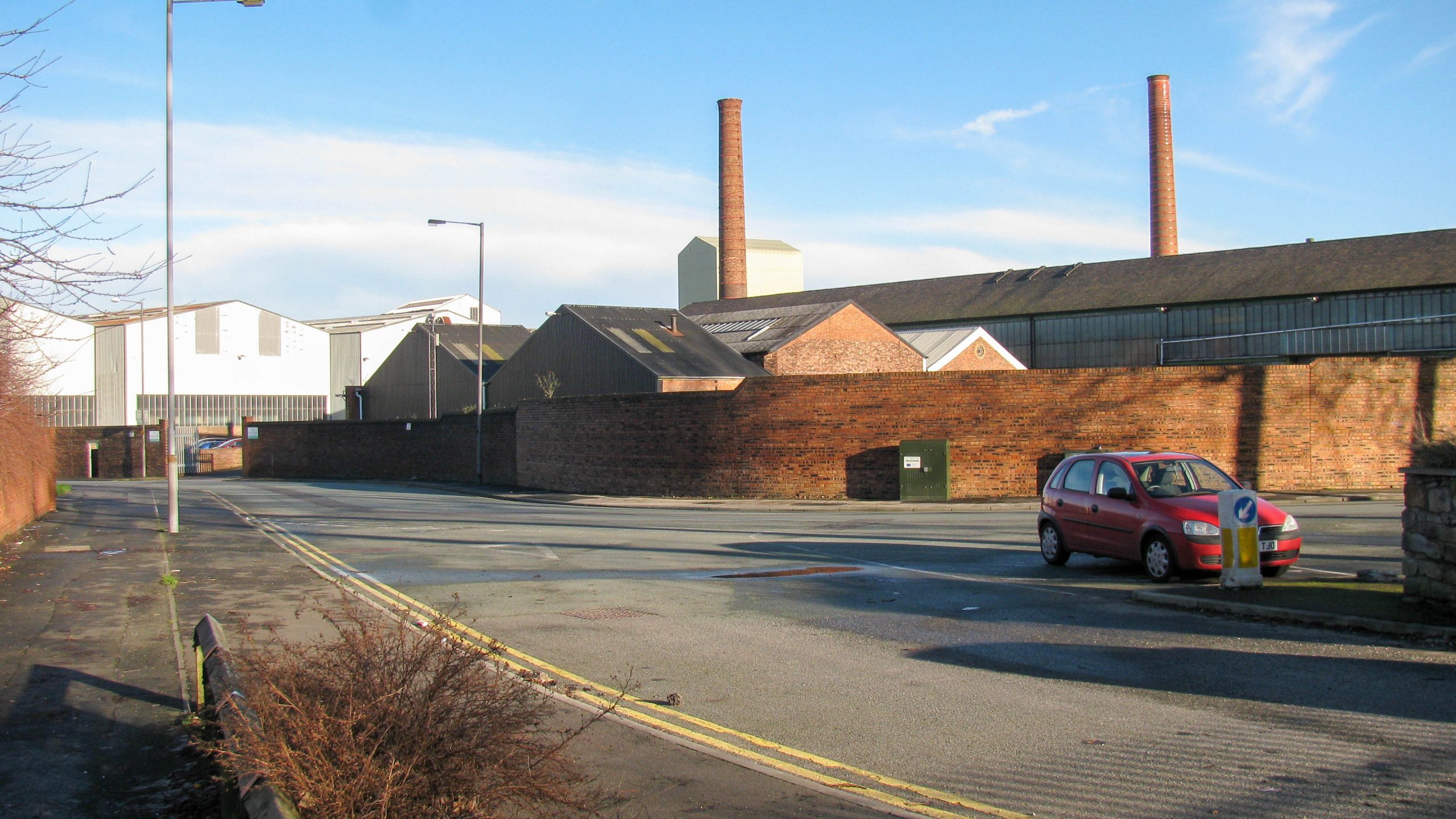
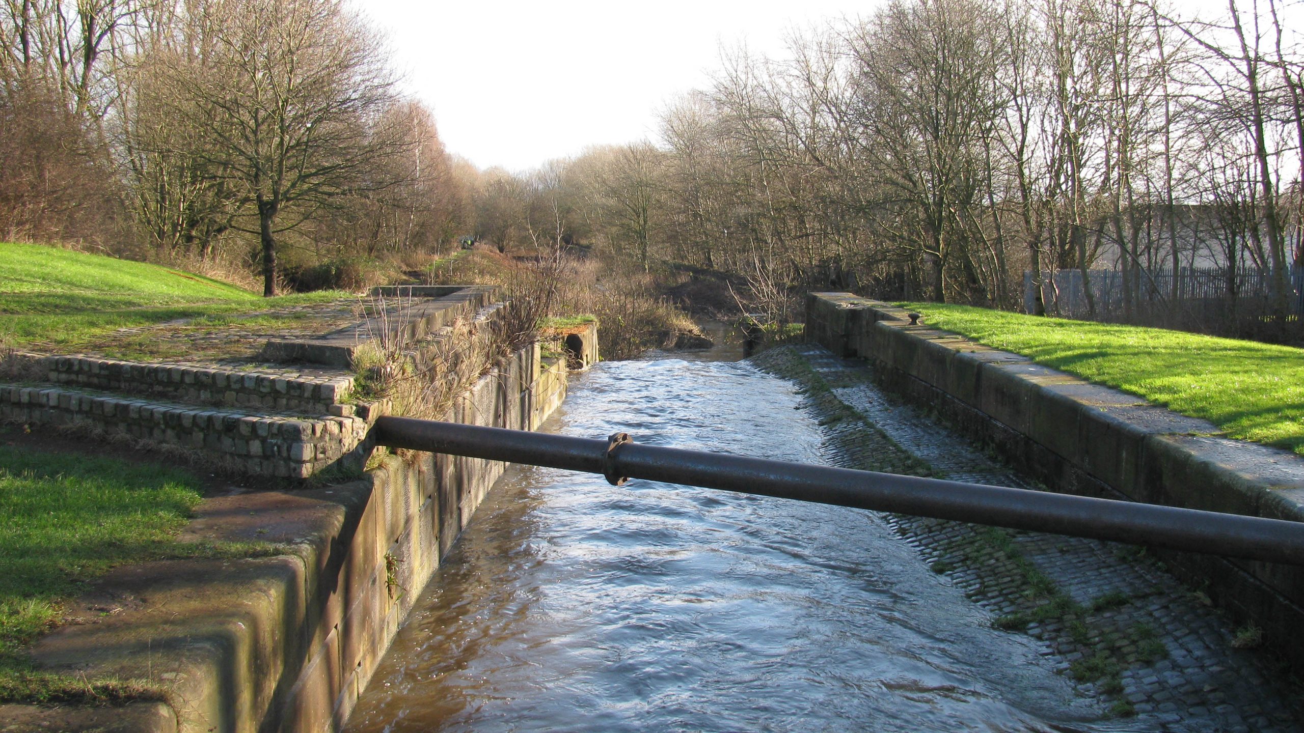
< Next St Helens Canal Next > < Old Double Locks Jn Earlestown > This two lock staircase became know as the “Old Double Locks” to distinguish them from a newer two lock staircase built closer to...
 England & Wales Waterway Map for Download
by John DiDonato
England & Wales Waterway Map for Download
by John Charnock
England & Wales Waterway Map for Download
by John DiDonato
England & Wales Waterway Map for Download
by John Charnock
 Llangollen Canal Map for Download
by Mike Moreau
Llangollen Canal Map for Download
by Mike Moreau
 Bridgewater Canal Map for Download
by PAUL DUNNING
Bridgewater Canal Map for Download
by PAUL DUNNING
 East Midlands (Leicester) Ring Map for Download
by John Howells
East Midlands (Leicester) Ring Map for Download
by John Howells
 RSS Blog Feed
Recent Comments