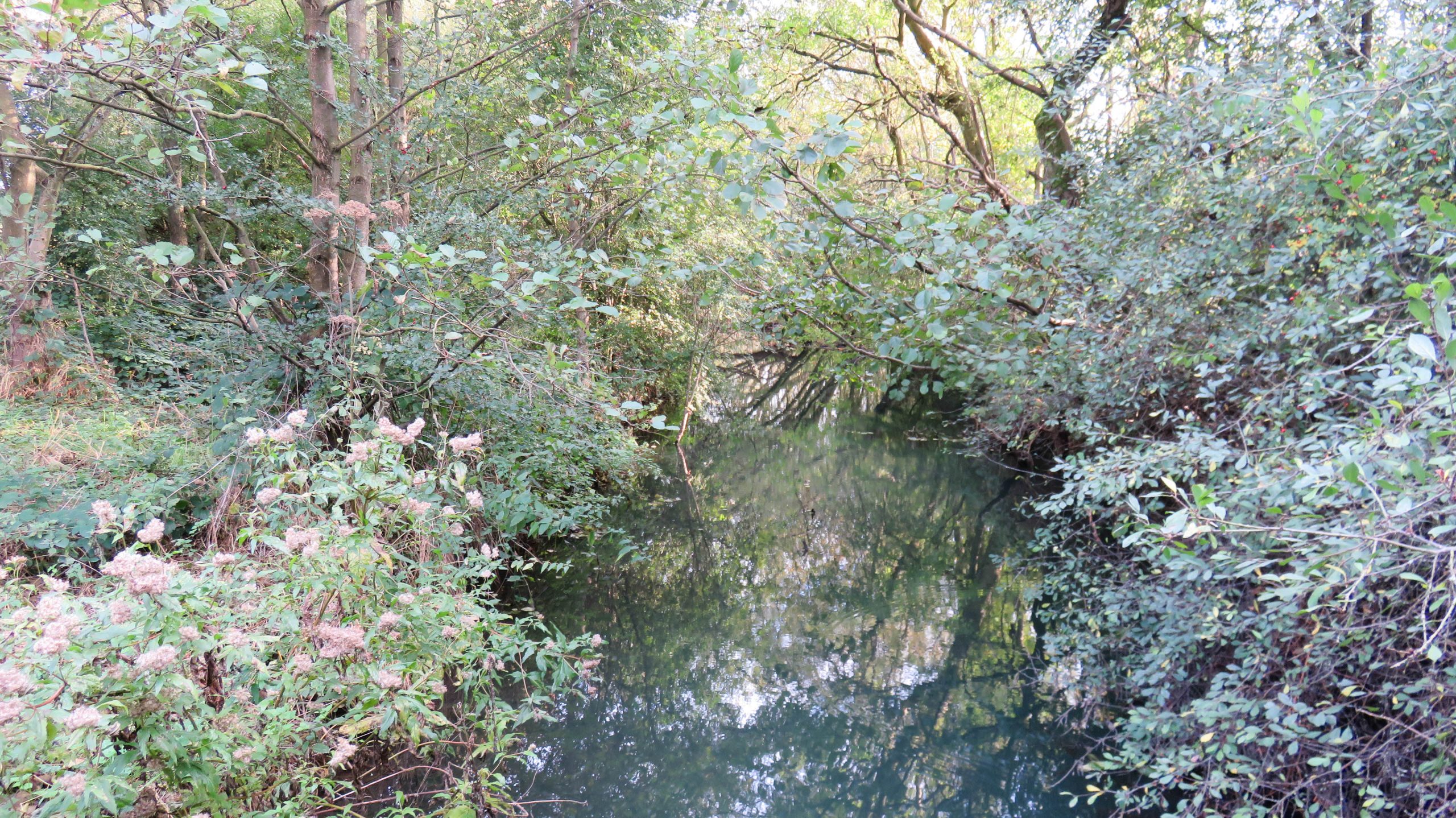
Navigation isn’t practical
Low overhanging trees would make navigation impossible for a narrowboat
![]()
Maps and DVDs for the Waterways of Britain
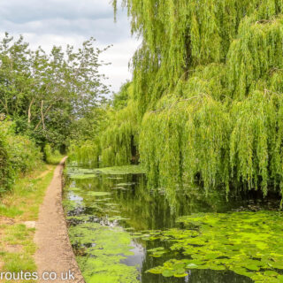
Low overhanging trees would make navigation impossible for a narrowboat
This is as far as we could navigate upstream. A fallen tree, not visible under water in the photo, blocks our progress. We have covered over 2.5km out of the possible 3.1km (1.6 miles out of 1.9 miles).
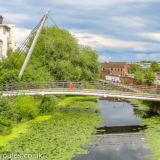
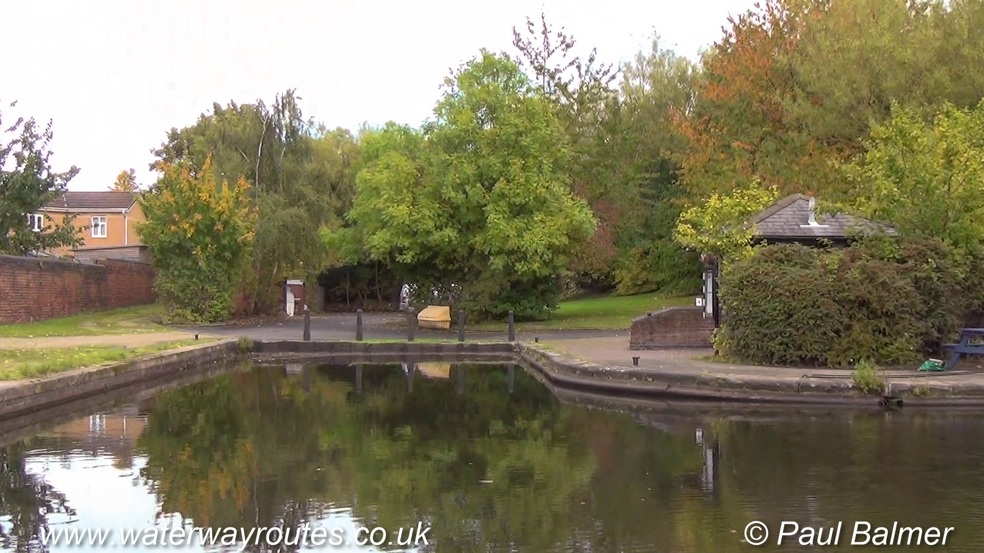
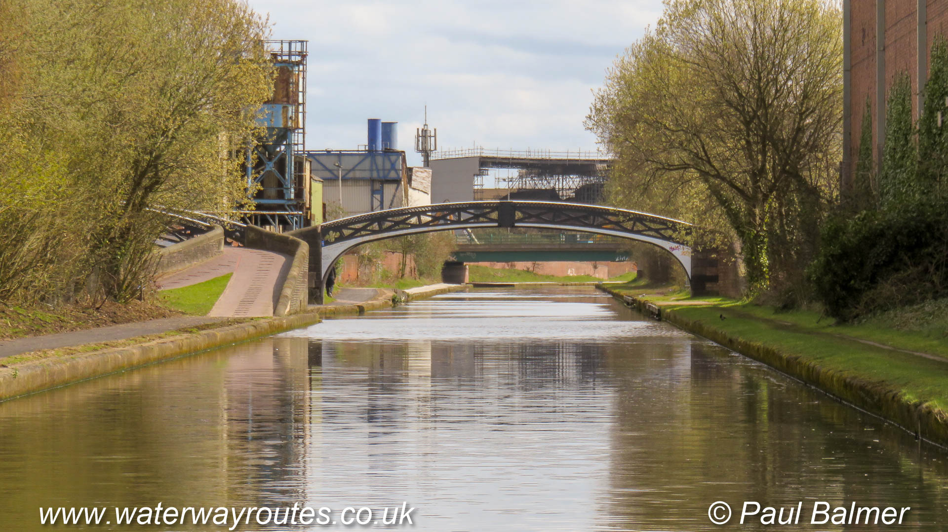
The picnic site and interpretation board above the arched Heyworth Green Bridge
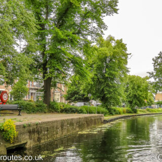
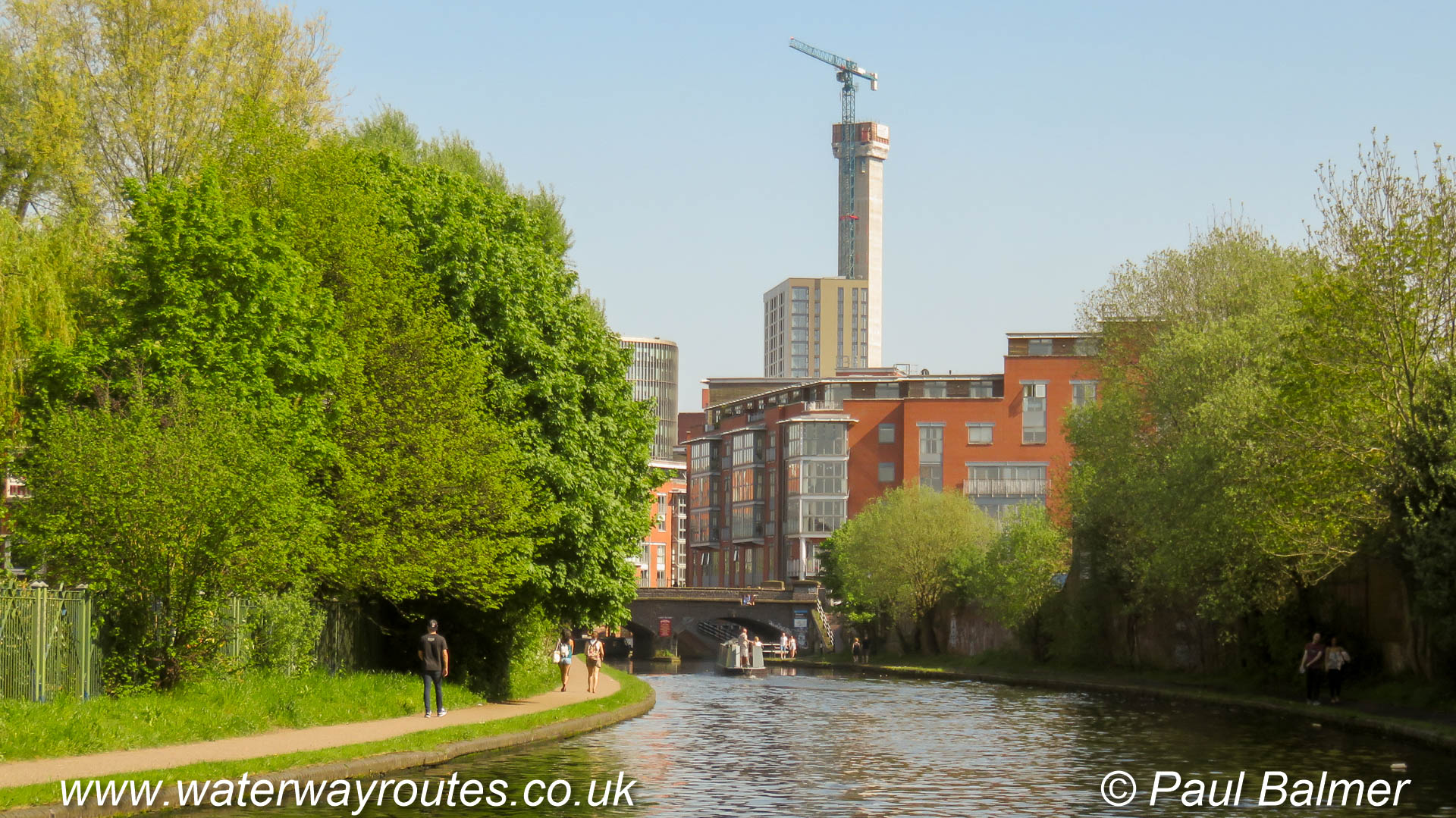
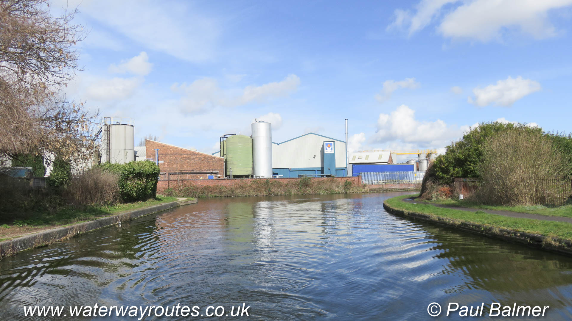
In many places the view, especially from the lower water level, is mostly concrete.
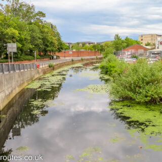
Looking down on the route gives some appreciation of how the River Foss passes through York
We will keep left where the short arm known as Wormalds Cut diverges to the right alongside the wedge shaped building with the tall end tower.
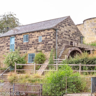
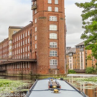
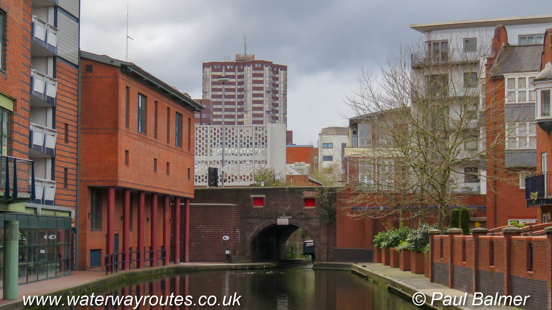
Immediately upstream of Tower Street Bridge and Castle Mills Lock is a watermill with an overshot waterwheel.
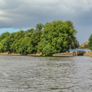
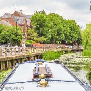
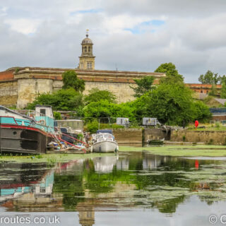
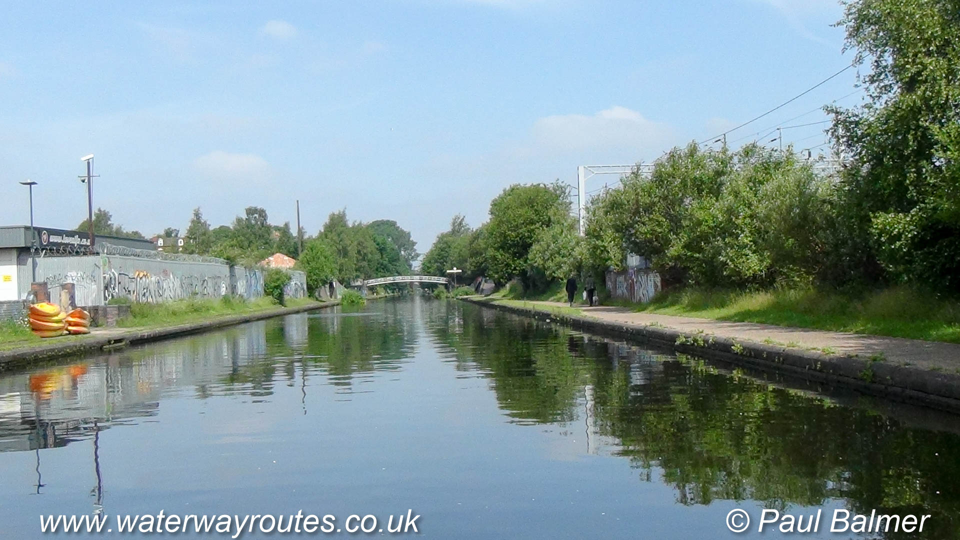
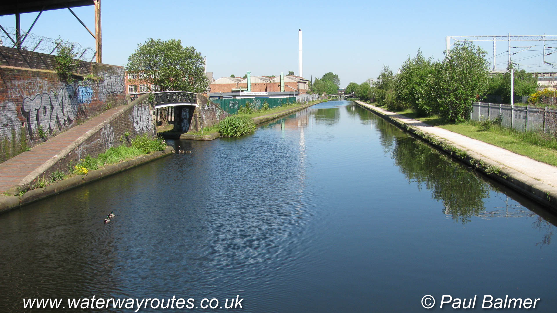
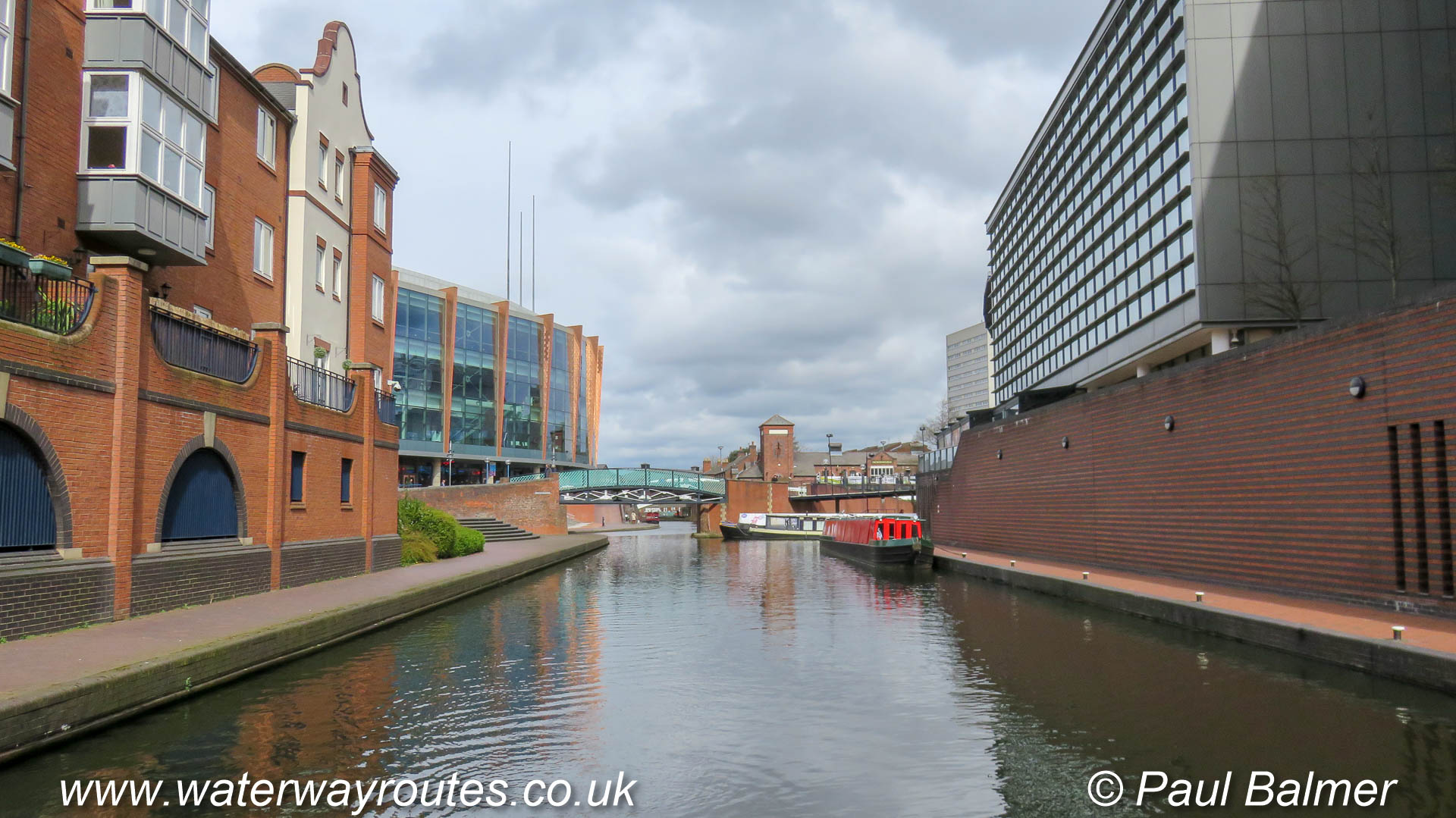
Looking upstream (northwards) on the River Ouse in York with where it is joined by the River Foss flowing in through the Blue Bridge on the right.
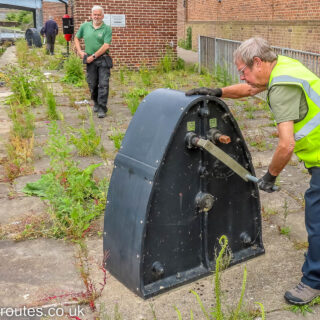
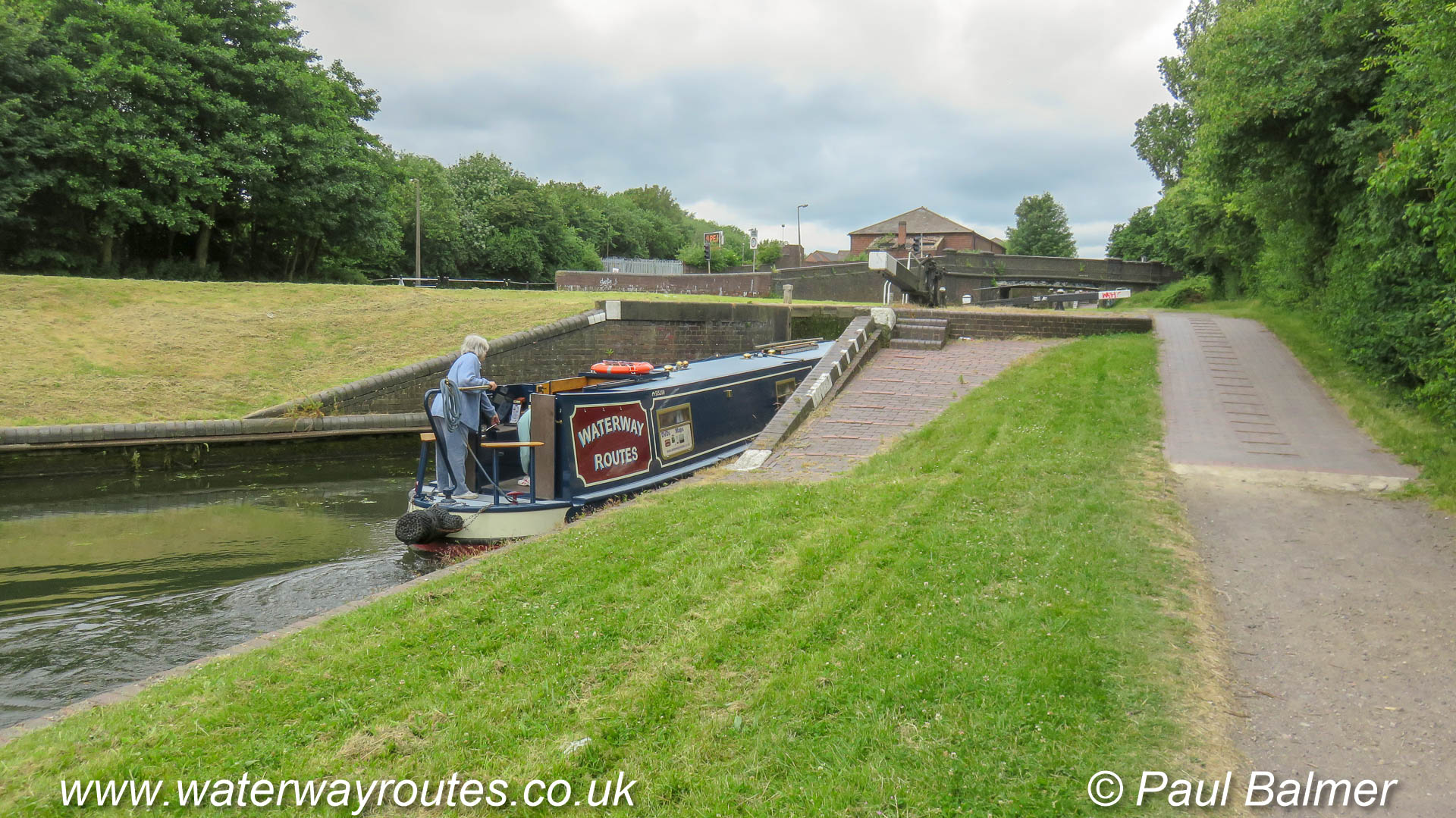
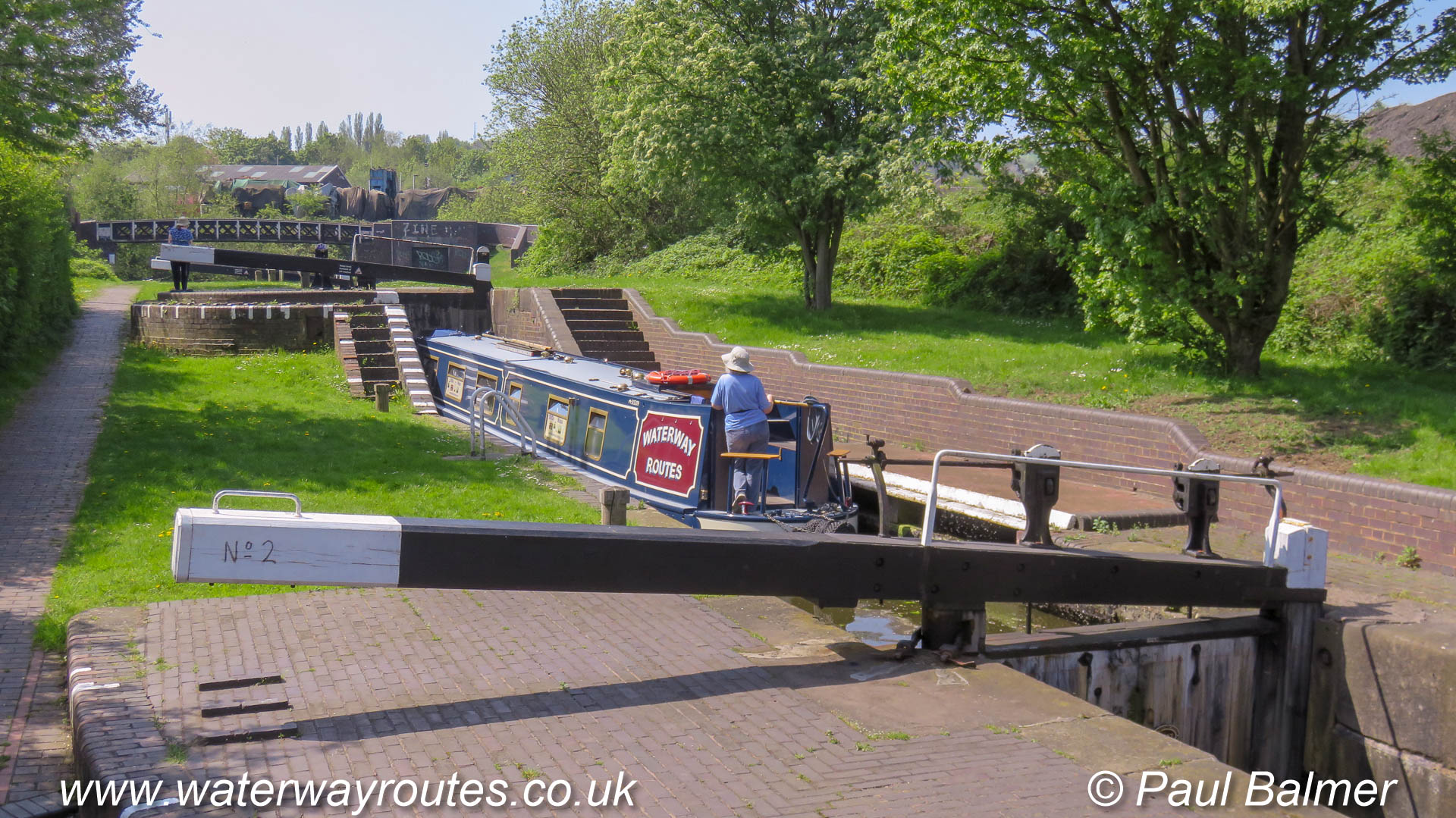
One of the volunteers putting the large windlass onto the winding mechanism ready to open the bottom gate on Castle Mills Lock on the River Foss in York.
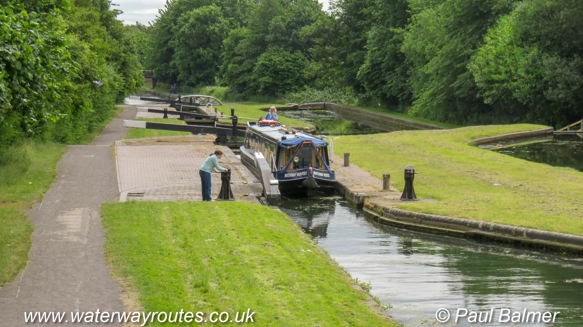
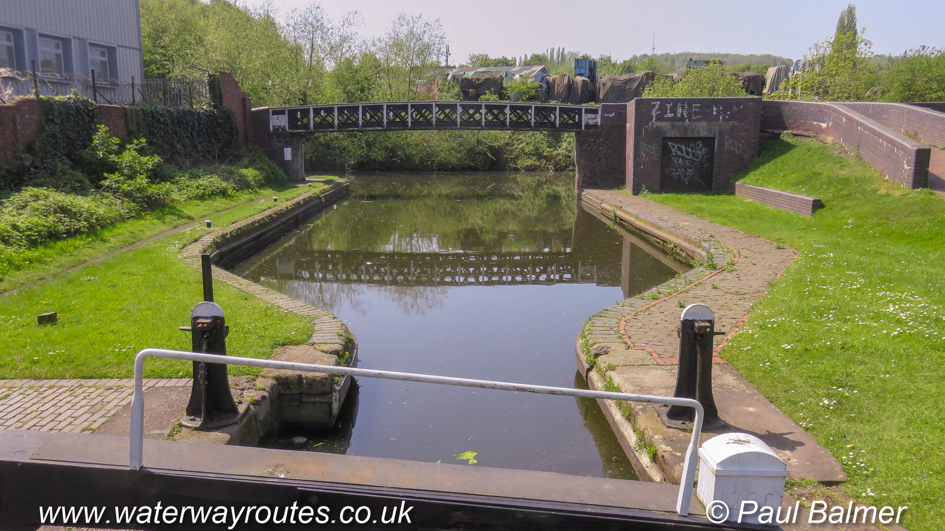
Castle Mills Lock, the only lock on the River Foss, is operated by volunteers from the IWA (Inland Waterways Association) and must be booked well in advance.
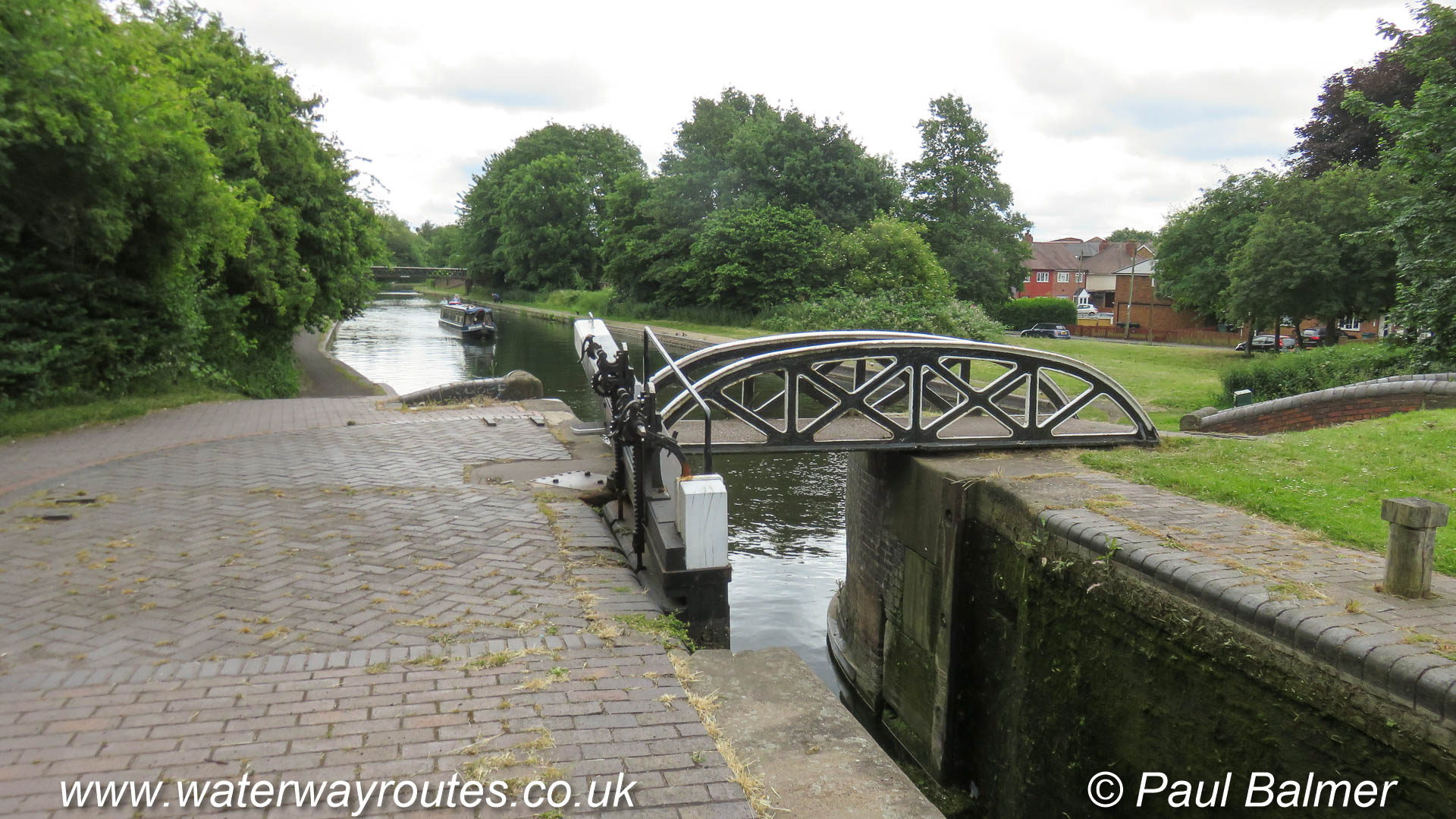
Entering the basin above the flood barrier on the River Foss in York. The basin curves to the right towards Castle Mills Lock.
Looking upstream along the River Foss in York, towards the large structure for the Flood Barrier. The barrier is closed during floods to stop …
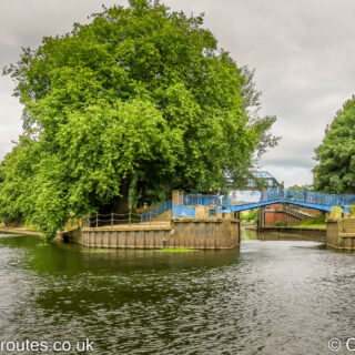
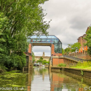
Entrance to the River Foss which flows under the blue bridge to join the River Ouse at York.
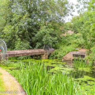
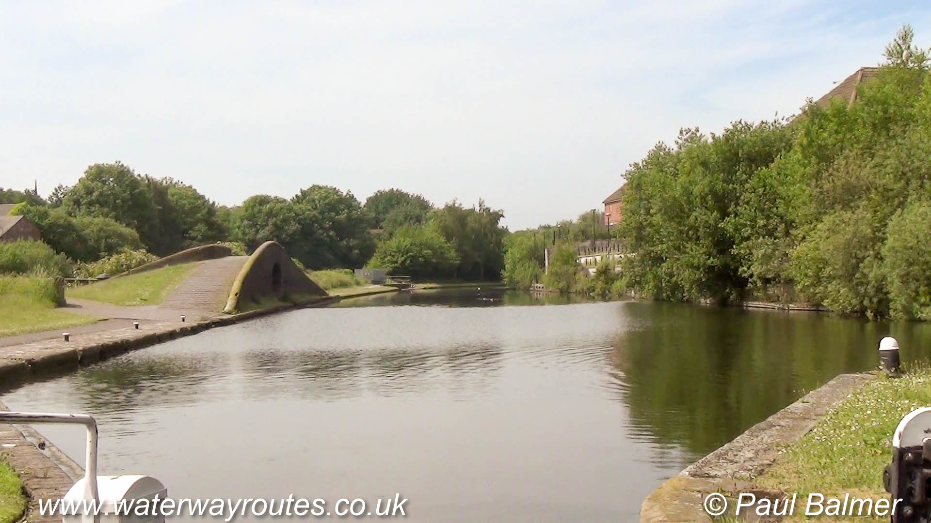
A pipe crosses the River Foss just above water level and forms the limit of navigation, around 3.13 kilometres or 1.95 miles from the junction with the River Ouse.
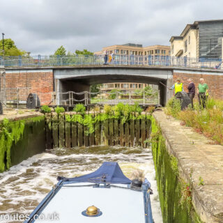
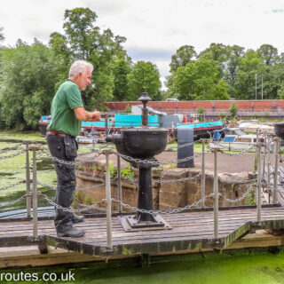
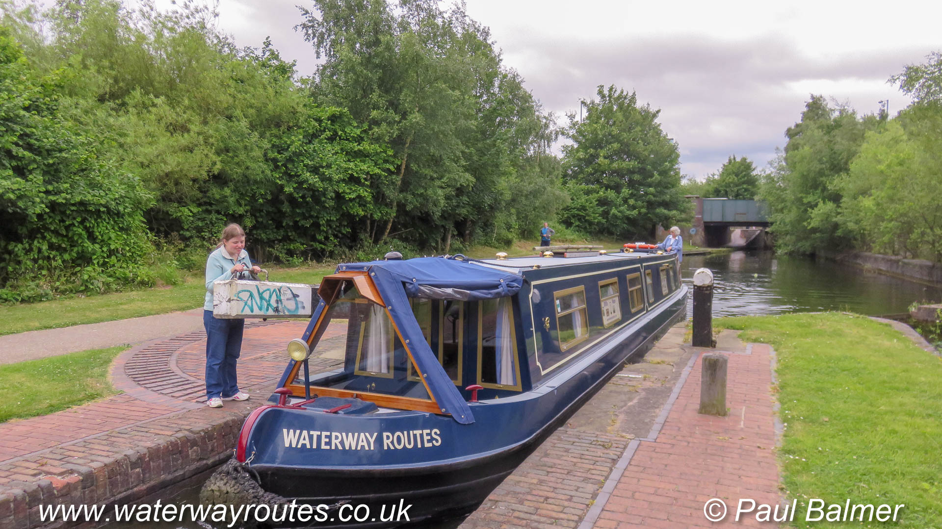
Keeping well back in Castle Mills Lock as the volunteers from the IWA (Inland Waterways Association) operate the lock for us to take our Waterway Routes narrowboat through.
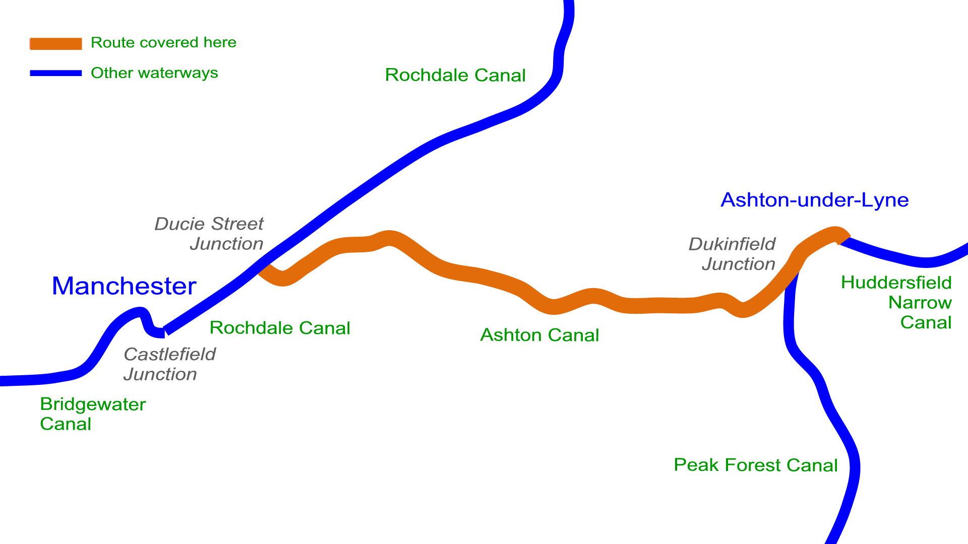
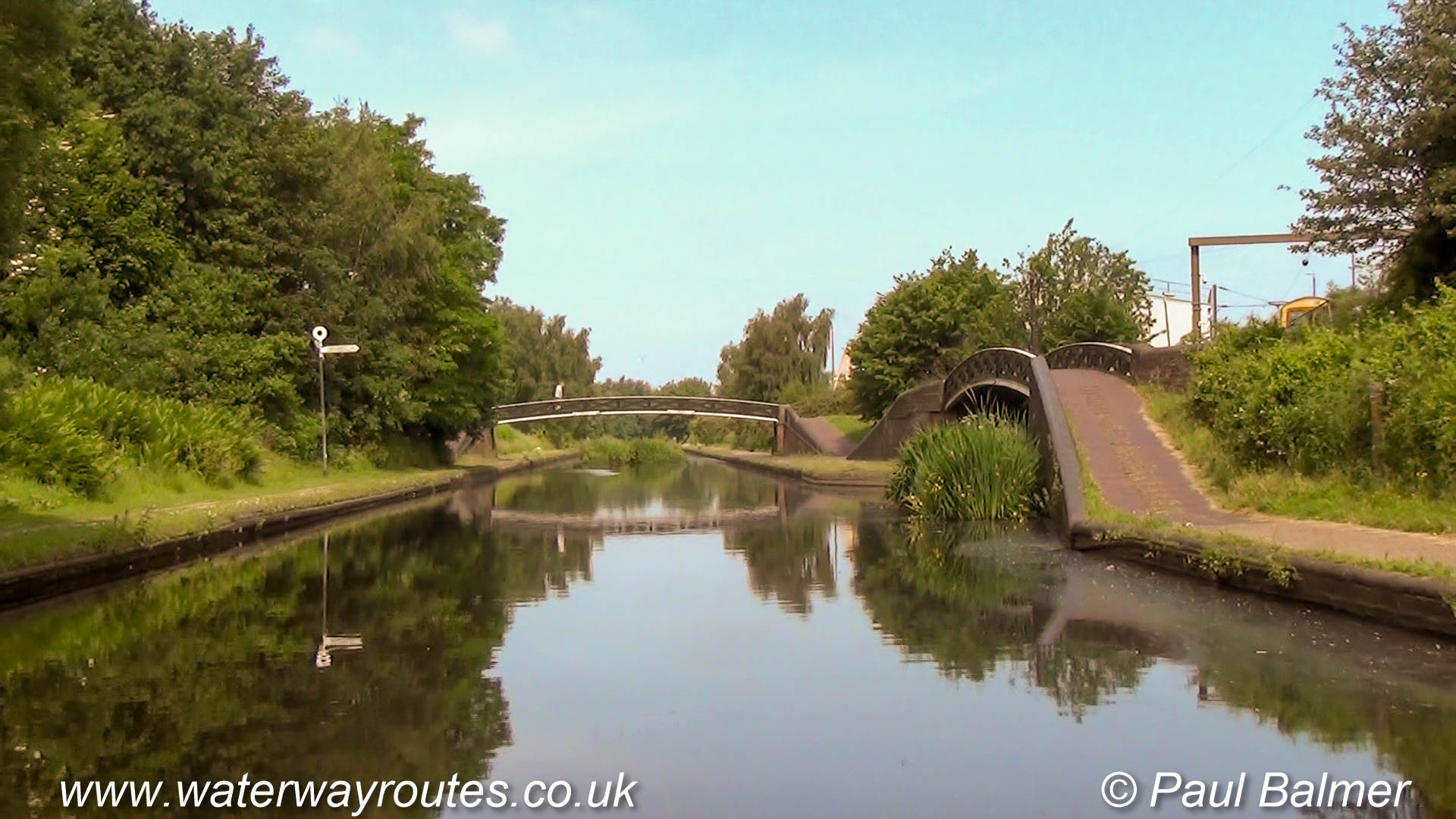
Looking generally northwards along the Coventry Canal at Hawkesbury Junction where …
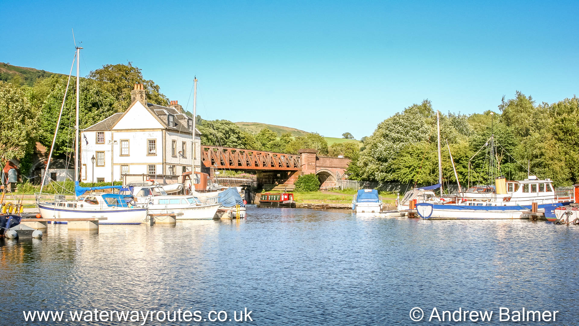
Choose your starting point (from the links below), then keep clicking the next button for your virtual cruise (VC) along the Union Canal.
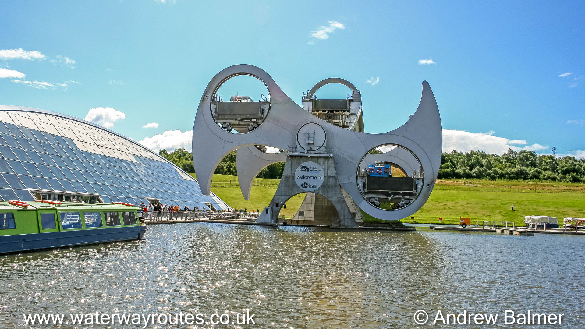
Choose your starting point (from the links below), then keep clicking the next button for your virtual cruise (VC) along the Forth & Clyde Canal and the Glasgow Branch.
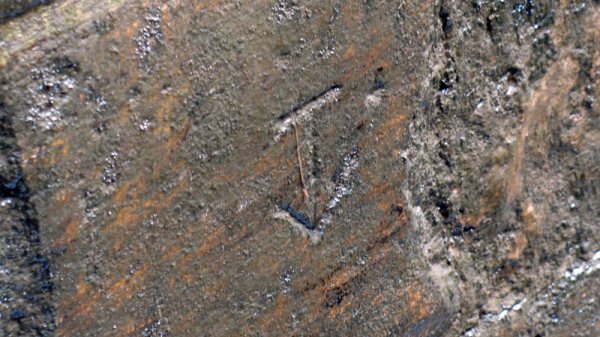
In many places in Stockton Brook Locks the mason’s marks can be seen to identify which stones they prepared.
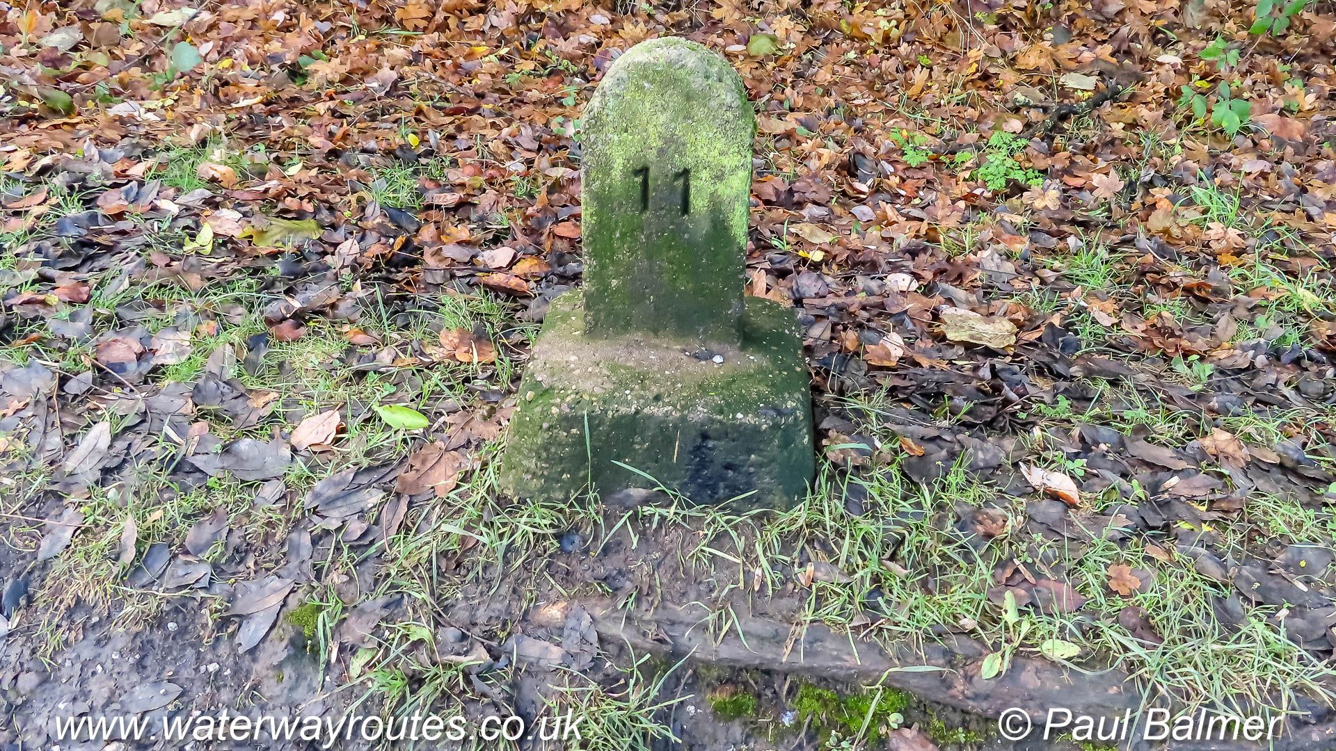
< Sandiacre Junction Junction with Cromford Canal > < Next Erewash Canal Next > At the back of the towpath, between bridges 27 and 28 is the stone milepost showing 11 miles from the junction between the Erewash Canal...
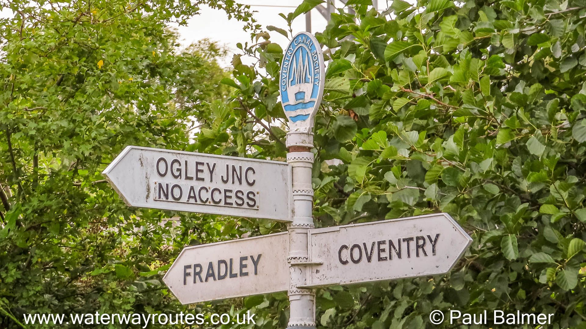
The Wyrley and Essington Canal, part of the Birmingham Canal Navigations (BCN), once linked Huddlesford Junction to …
Looking towards Huddlesford Junction from the Fradley Junction side. The Lichfield Canal diverges to the right before
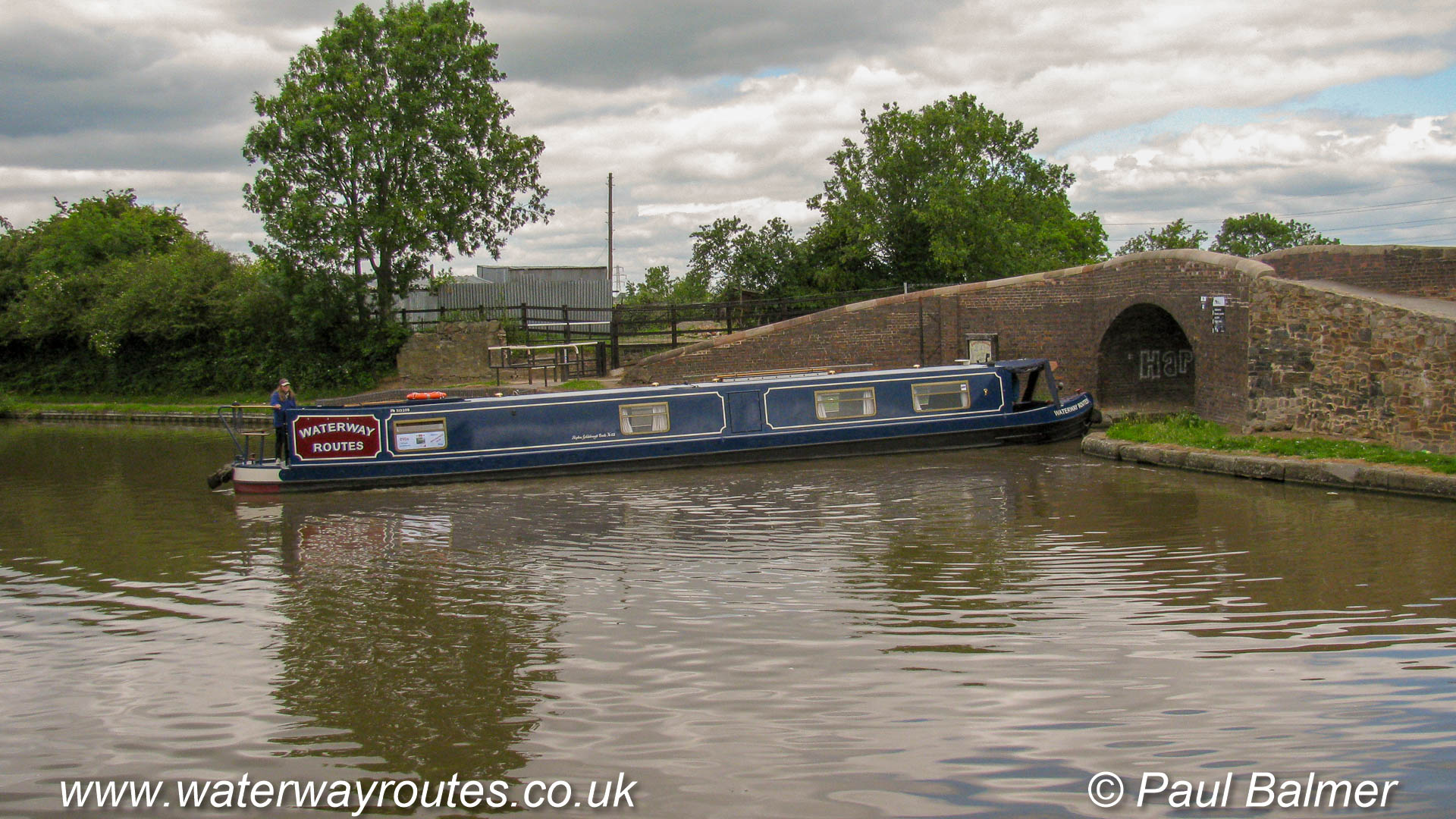
Approaching Autherley Junction from the South West. The oncoming red boat is starting to turn right to pass under the towpath bridge as it enters the Shropshire Union Canal.
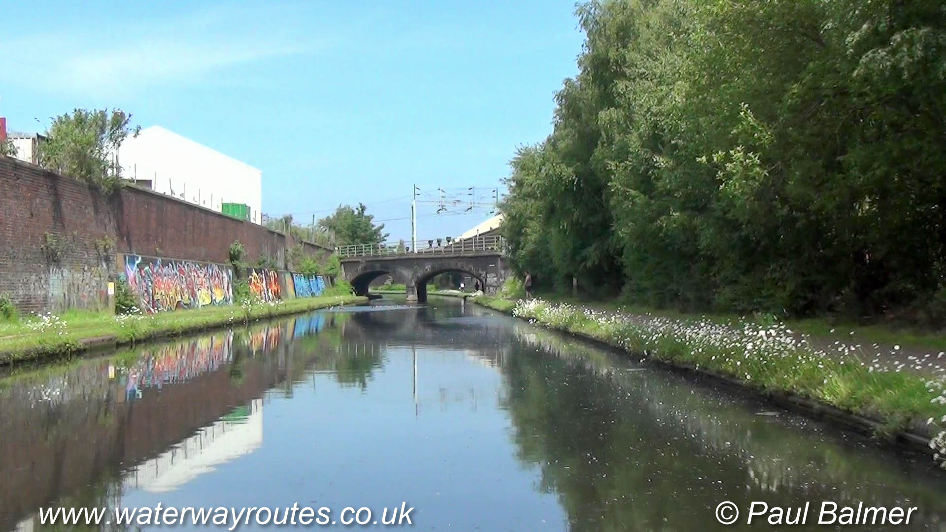
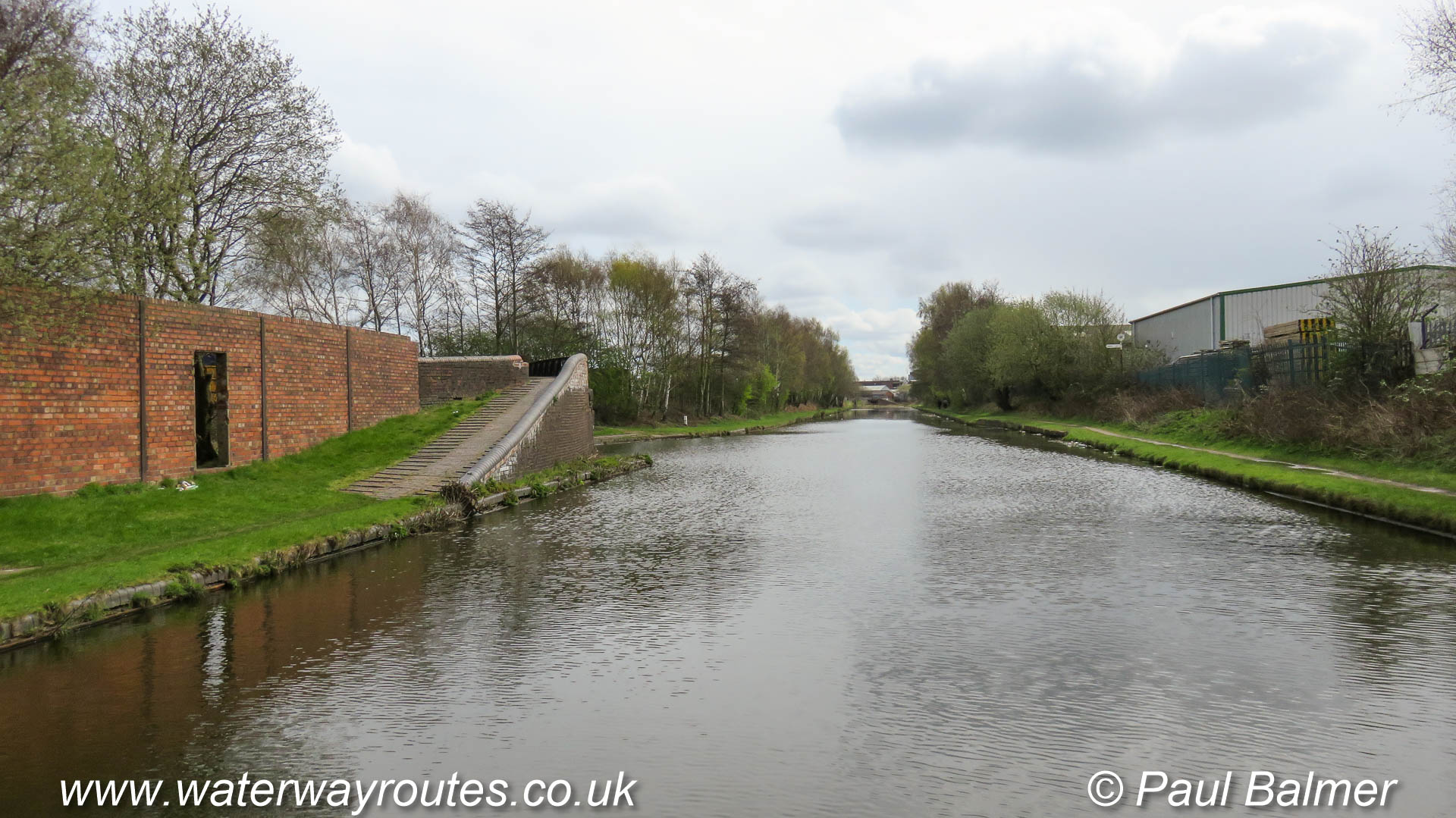
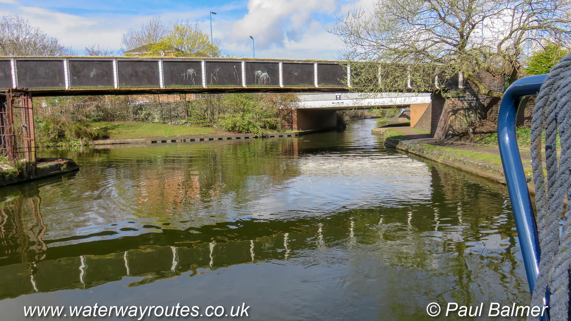
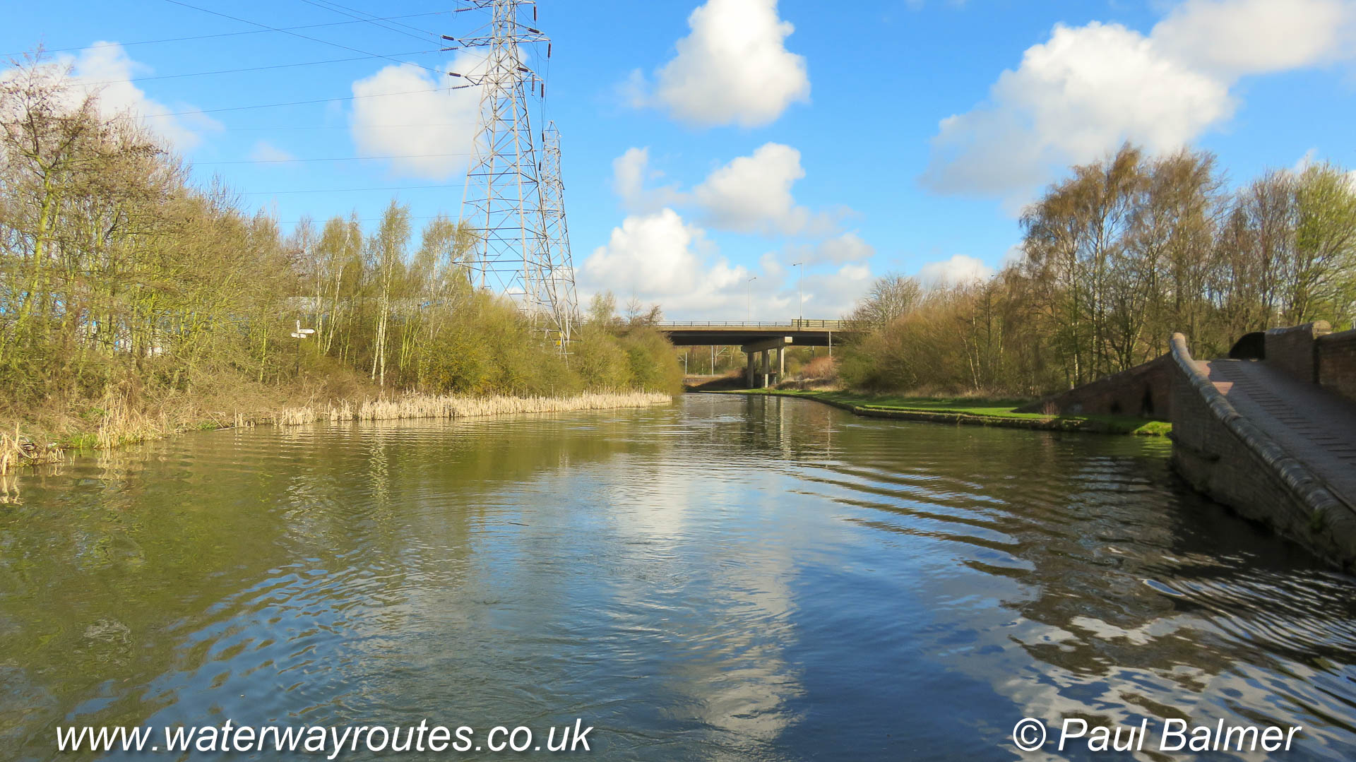
Where the canal passes through a cutting there are many bridges of varying ages and styles carry the roads and railways, with several pipe bridges too.
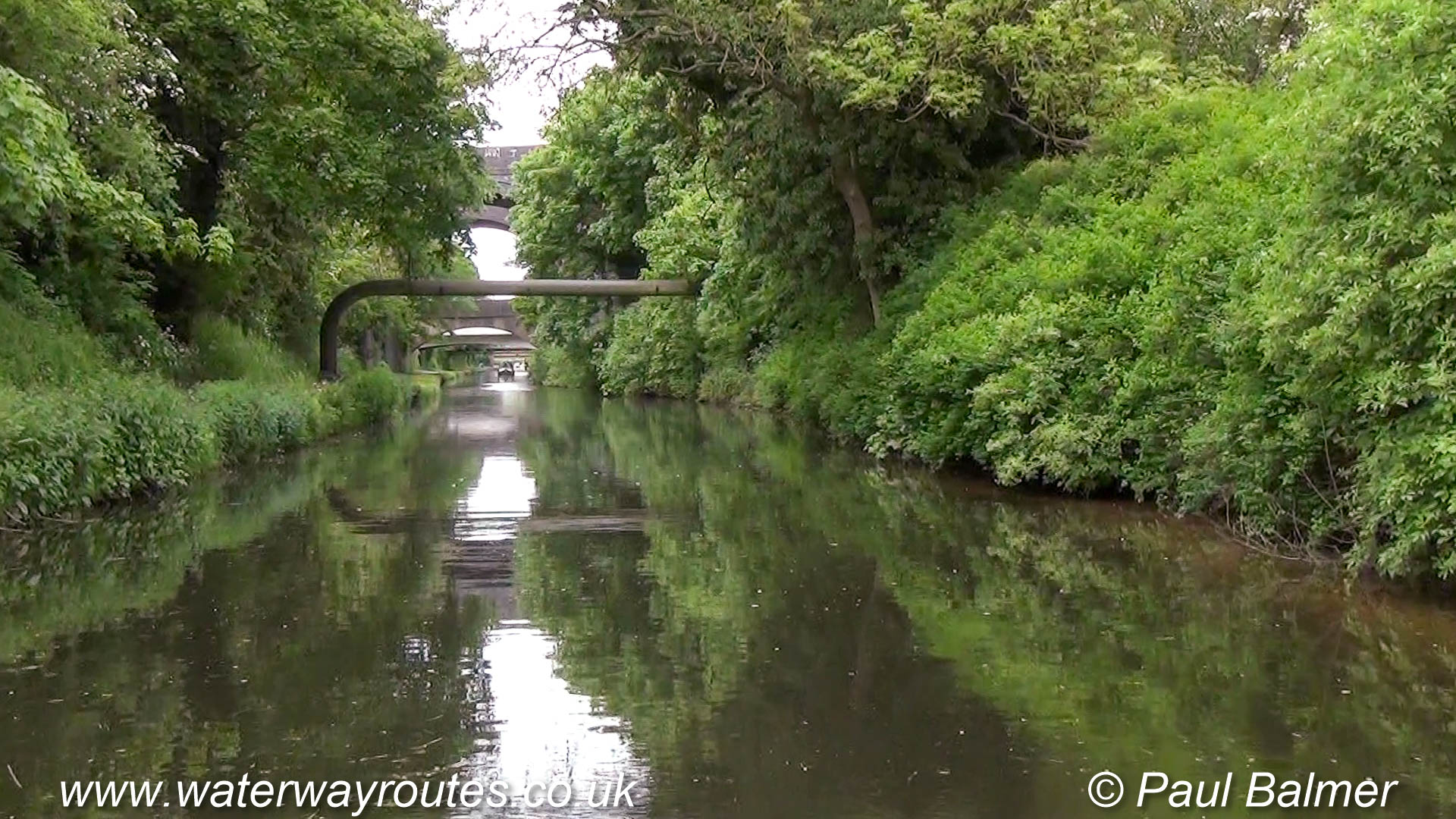
The short section of the Staffs & worcester Canal between Aldersley Junction and Autherley Junction passes through a tree lined cutting which restricts the views.
Looking along the Staffs & Worcester Canal, with Great Haywood Junction behind the camera. The left turn onto the Birmingham Canal Navigations at Autherley Junction is
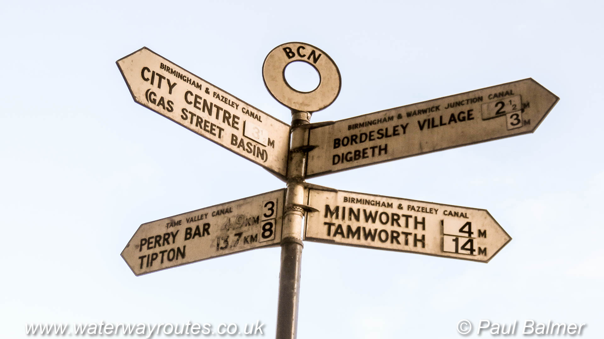
Select one of these starting points then keep clicking on the “Next” link to progress along the Digbeth Branch of the Birmingham & Fazeley Canal.
Select one of these starting points then keep clicking on the “Next” link to progress along the Ashby Canal.
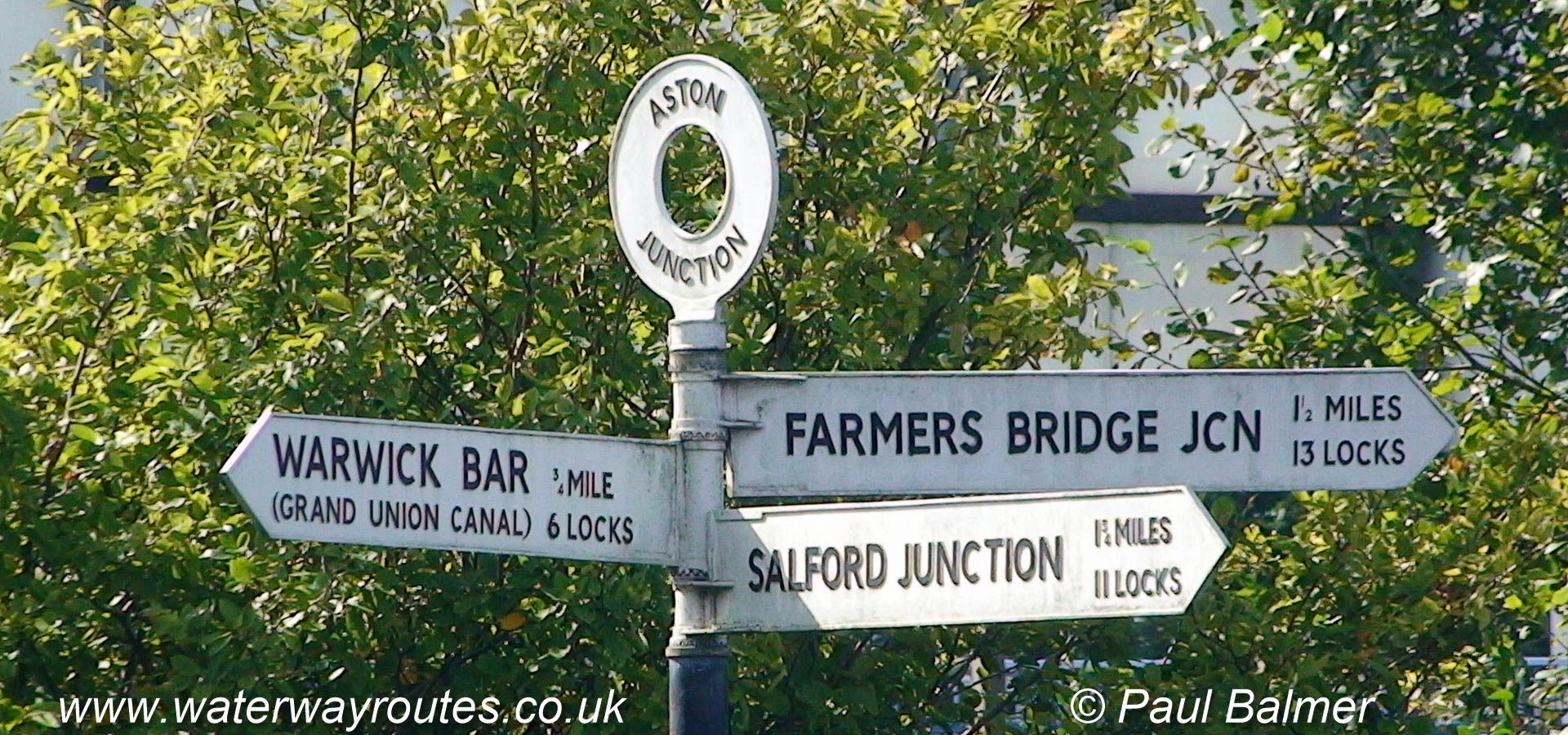
The Birmingham & Fazeley Canal passes Aston Junction between Farmers Bridge Junction and Salford Junction.
Taken from Longford Bridge 10 this photo shows the original site of what we now call …
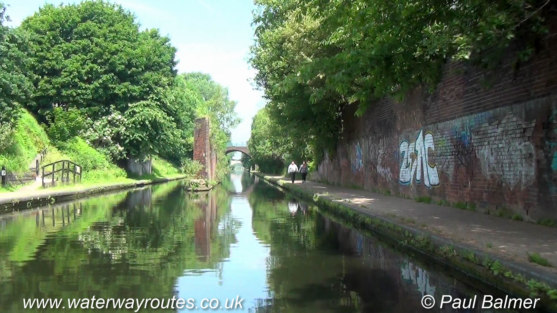
The canal passes through a mixture of mostly urban surroundings on its way out of Coventry.
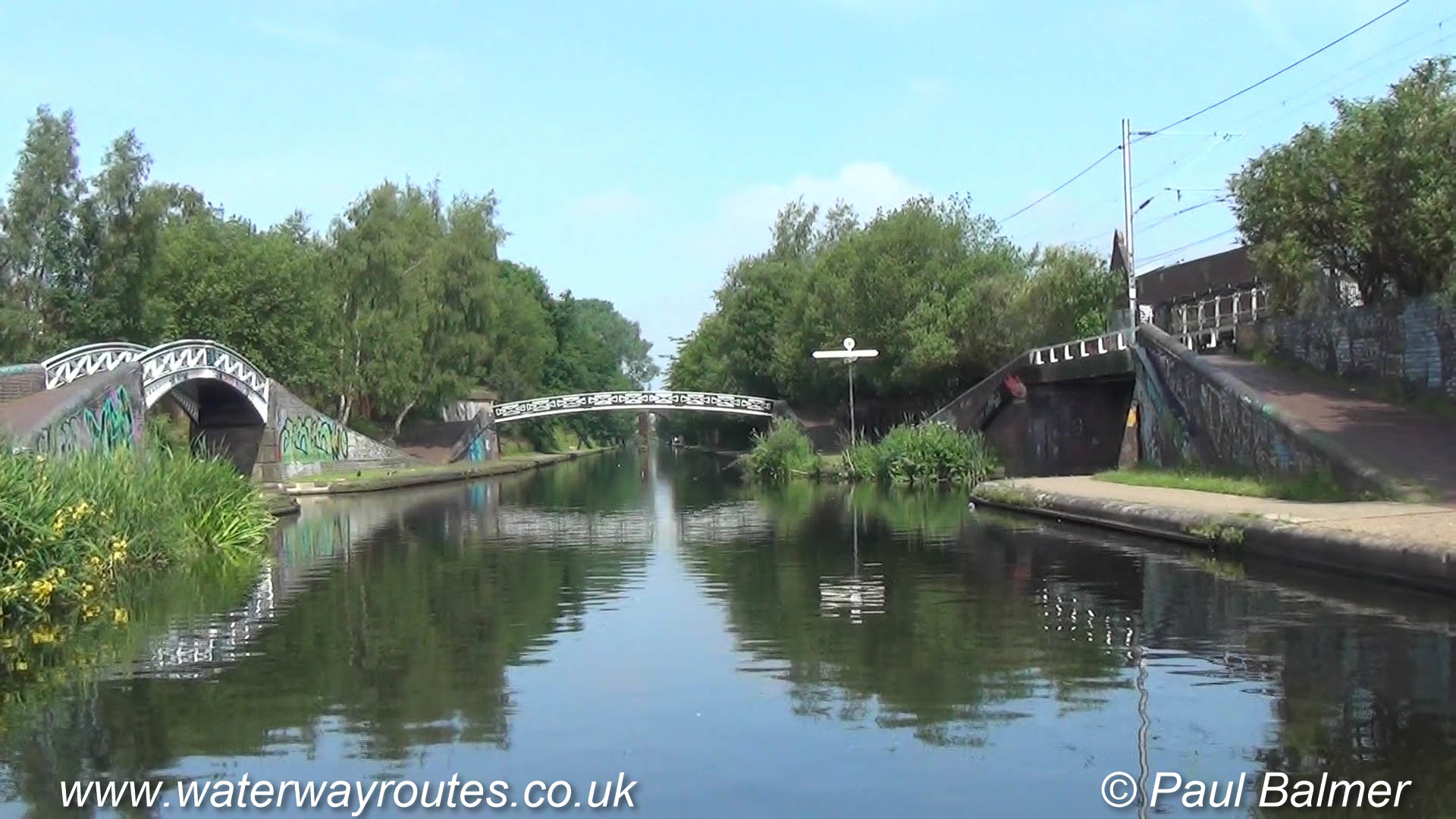
Many of the bridges are of traditional hump-back design, but some modern ones are …
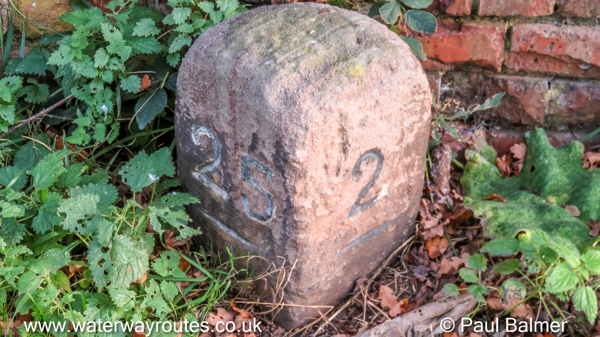
The milepost shows the numbers 2 and 25. It’s placed …
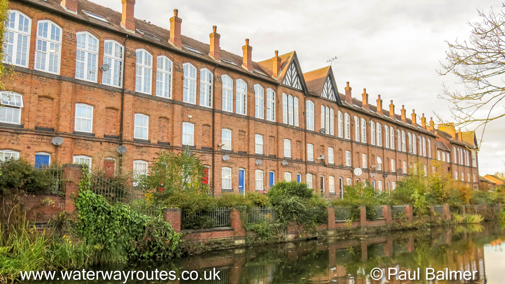
Cash’s are probably know to many for their production of name tapes to be sown into …
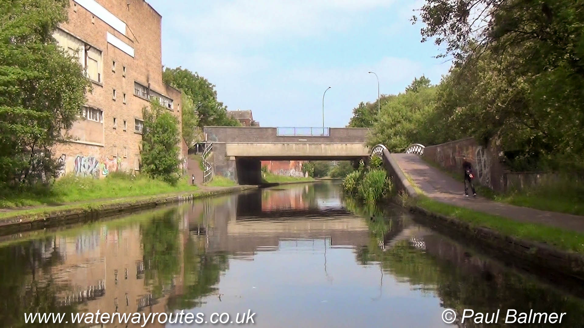
Looking northwards from Drapers Fields Bridge 1 at the basin entrance the towpath starts on …
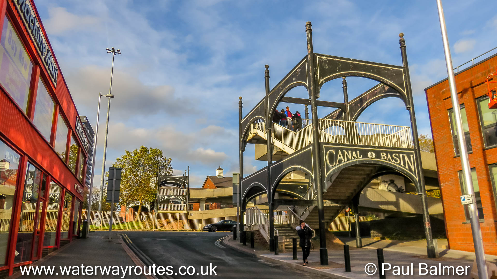
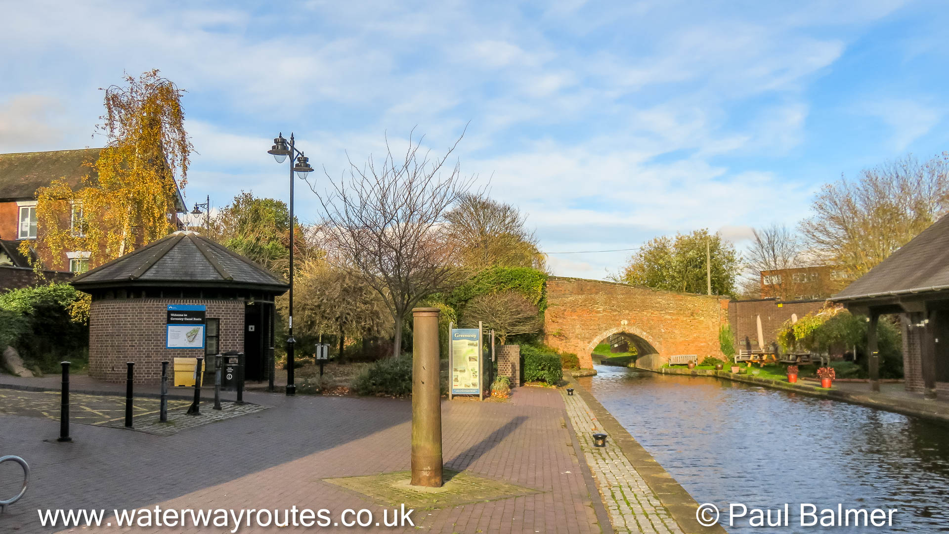
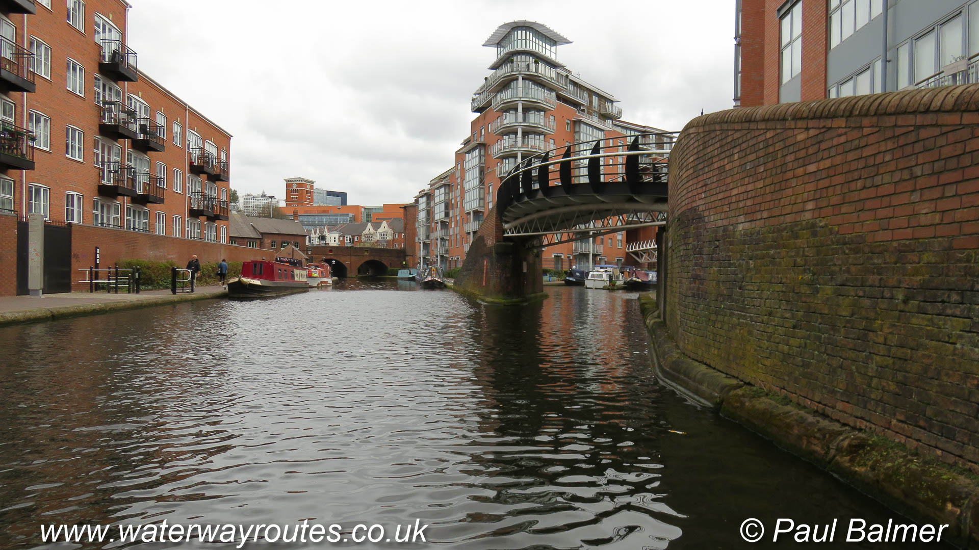
Coventry Basin is to the north of the city centre and …
Salford Junction is one of the few junction where you can cruise in four different directions.
You can make a virtual cruise (VC) along the canal from the comfort of your armchair. Just select your starting point below, then click the next buttons to move along the canal.
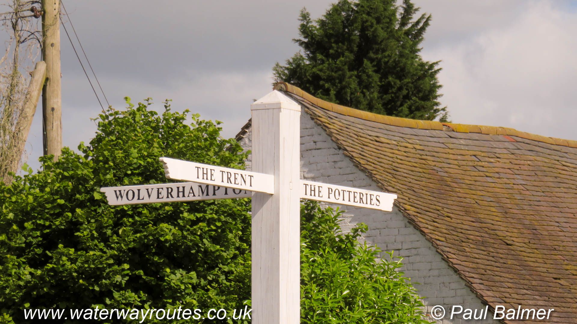
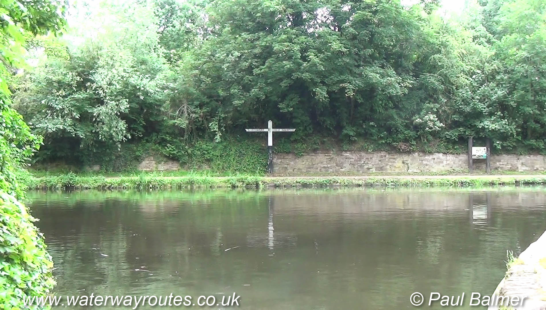
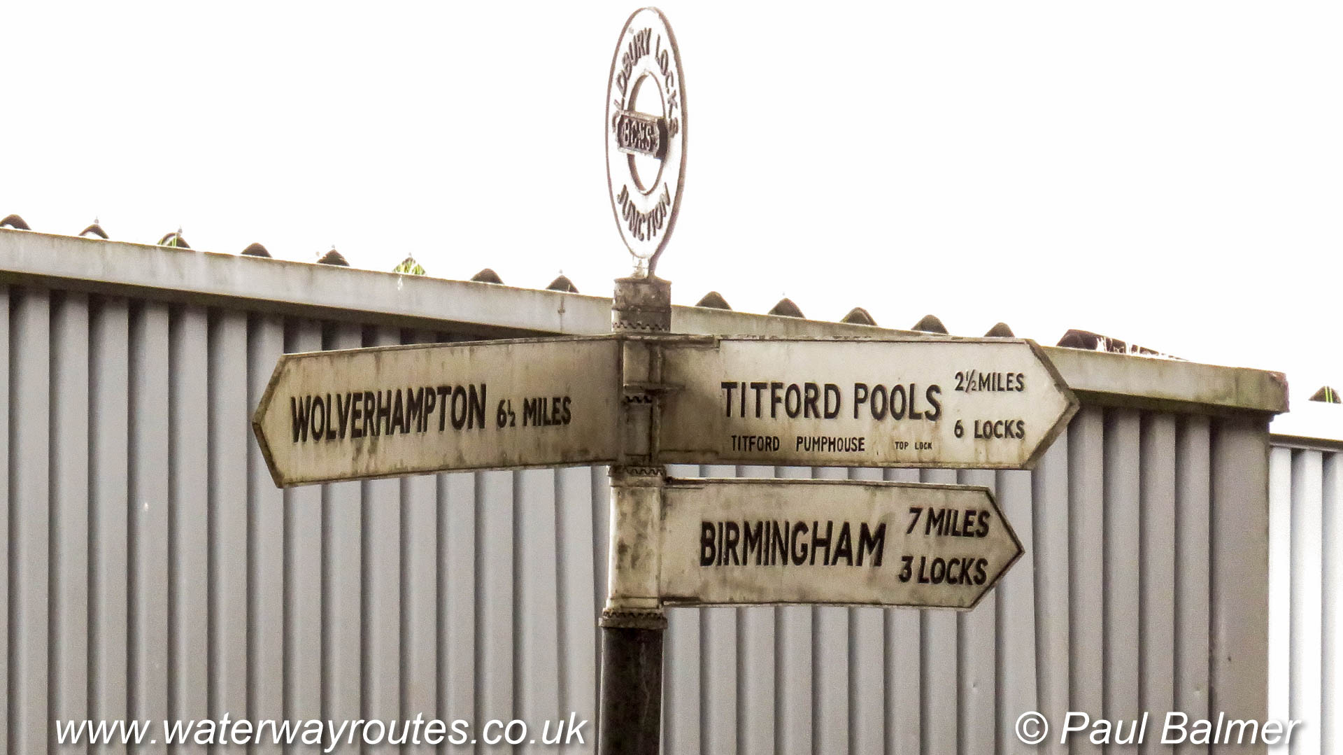
The finger sign shows the way at Great Haywood Junction.
The Trent & Mersey Canal runs straight past the junction on its way from the River Trent near Shardlow and through the Potteries to Preston Brook.
There is no junction here today. The River Sow used to be navigable into Stafford and restoration is proposed to create the Stafford Riverway Link.
The sign is sponsored by
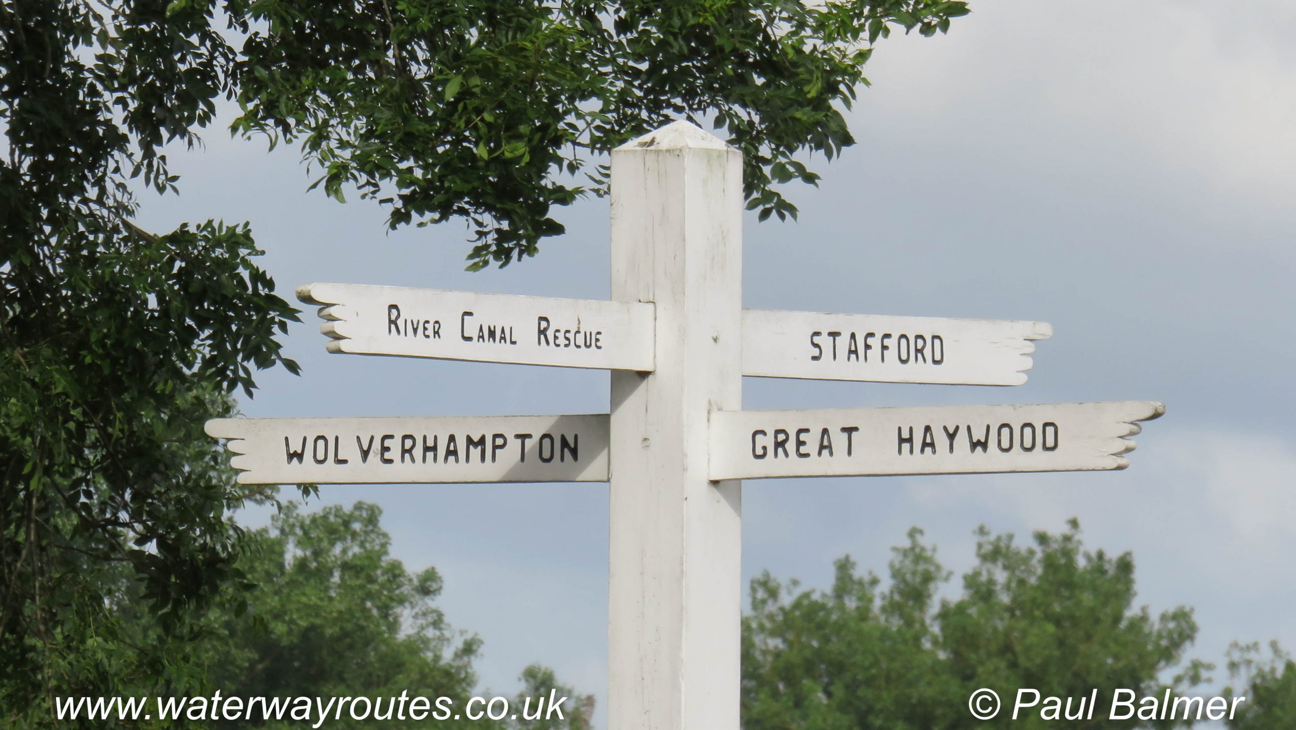
At Hatherton Junction the Staffs & Worcester Canal passes across the foreground of the photo, with Great Haywood Junction to the left and Stourport to
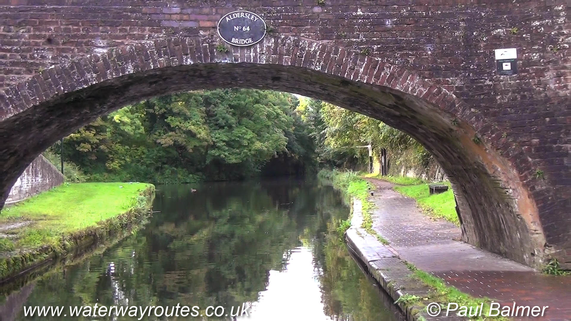
We’re looking at Aldersley Junction from the end of the Main Line of the Birmingham Canal Navigations (BCN).
The Staffs & Worcester Canal passes across the picture from Stourport on the left to Great Haywood Junction on the right.
We’re looking at Aldersley Junction from the end of the Main Line of the Birmingham Canal Navigations (BCN).
The Staffs & Worcester Canal passes across the
Our Waterway Routes narrowboat descending Lock 6 on teh Wolverhampton Flight.
Three Factory Locks are in easy walking distance for the crew to walk between them. They raise the New Main Line up to meet the Old Main
Out Waterway Routes narrowboat is entering Factory Lock 2, the middle of the three Factory Locks. As with many of the locks on the Birmingham Canal Navigations it
Factory Bottom Lock 3 has a wide footbridge across the tail of the lock to carry a public right of way. This is the lowest of the three
A photo taken in the top lock at Smethwick looking along the Old Main Line of the Birmingham Canal Navigations towards Wolverhampton, with Birmingham behind the camera.
Cruising between Smethwick Bottom Lock and Smethwick Middle Lock.
Cutting off the three loops (Oozells Street, Icknield Port, and Soho) the new Main Line is wide and straight with towpaths along both banks. It must have seemed like a motorway to the old boatmen.
We are looking towards Rotton Park Junction where the bridge crosses the canal. Icknield Square Junction is behind the camera.
The main railway line between Birmingham and Wolverhampton follows a very similar route to the canal and they run very close for much or the journey. They swap sides twice along the route, with Avery Rail Bridge being on of those locations.
This is the site of the former Cape Junction which, like Rotton Park Junction, had four routes.
The new route of the Main Line of the Birmingham Canal Navigations (BCN) runs from Birmingham (behind the camera) to Wolverhampton (ahead).
Immediately on the Wolverhampton side of Winson Green Junction is a toll island. Now grass covered the island provides a channel each side just wide enough for a narrowboat to pass through.
As boats passed through the narrows the toll keepers measured their depth in the water and, using information from their records, could calculate the weight of the cargo and the appropriate toll to be paid.
Looking along the Birmingham Canal Navigations (BCN) Main Line towards Wolverhampton, with Birmingham behind the camera.
The finger sign on the left bank point along the Soho Loop which emerges from under the towpath bridge at Winson Green Junction.
The pier of a former railway bridge still stands in the middle of the Birmingham Canal Navigations (BCN) Main Line.
The railway branch linked Harborne to the main railway lines into Birmingham and opened in 1874. Passenger services stopped in 1934, but freight traffic continued until 1963.
Rotton Park Junction is a four-way junction with the waterways meeting at right angles.
We are looking along the main line towards Smethwick Junction and Wolverhampton, with Icknield Port Junction and Birmingham behind the camera.
Monument Road Bridge carries Ladywood Middleway over the Birmingham Canal Navigations (BCN) Main Line.
The towpath bridge on the right crosses the entrance to Monument Lane Basin and this forms a handy winding point. Boats unable to turn or wind at Ladywood Junction, around 500m (¼ mile) nearer Birmingham, can turn here.
At Icknield Square Junction the Icknield Port Loop diverges to the left under the towpath bridge. This loop was the original route of the canal.
The bridge in the distance marks Rotton Park Junction which is at the other end of the Icknield Port Loop.
Looking towards Birmingham on a sunny afternoon. The lovely green corridor leads to St Vincent Street Bridge, with Ladywood Junction just beyond.
Looking from Brades Top Lock 1 towards Brades Hall Junction with the Old Main Line. Turn left for Birmingham or right for Wolverhampton.
Brades Locks 1 and 2 form a staircase, the only staircase on the Birmingham Canal Navigations. In staircase locks the top gate of the lower lock forms the bottom gate of the upper lock and the boat can move between the locks when the water is level.
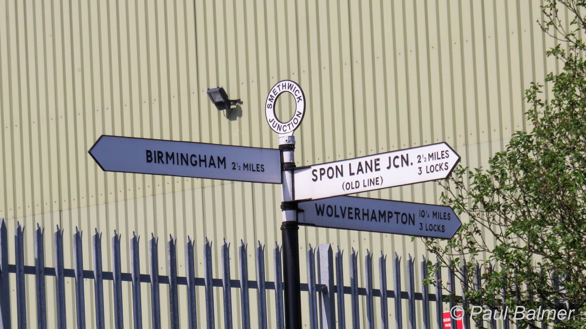
The signpost at Smethwick Junction marks the three way junction.
To the left is the main line to Birmingham. Straight on is the New Main Line to Wolverhampton and diverging is the Old Main Line of the Birmingham Canal Navigations (BCN).
The signpost at Smethwick Junction marks the three way junction.
To the left is the main line to Birmingham. Straight on is the New Main Line to Wolverhampton and diverging is the Old Main Line of the Birmingham Canal Navigations (BCN).
The signpost at Smethwick Junction marks the three way junction.

The finger sign at Winson Green Junction identifies the Birmingham Canal Navigations (BCN) Main Line between Birmingham and Wolverhampton.
The finger sign at Winson Green Junction identifies the Birmingham Canal Navigations (BCN) Main Line between Birmingham and Wolverhampton.
At Winson Green Junction the Soho Loop, part of the original route of canal, leaves and rejoins at Rotton Park Junction.
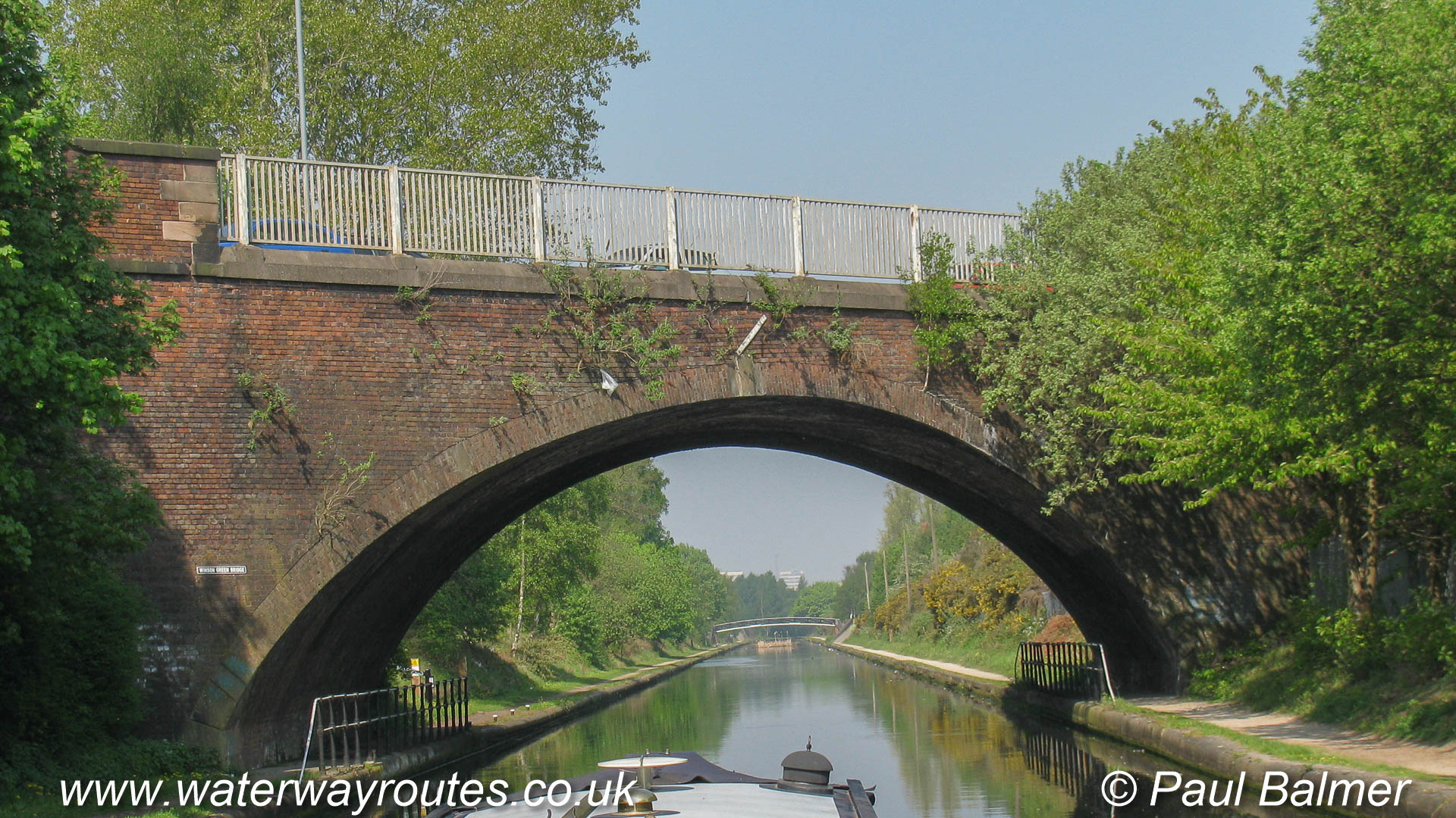
Winson Green Bridge strides across the wide route of the Birmingham Canal Navigations (BCN) Main Line, which includes towpaths along both sides.
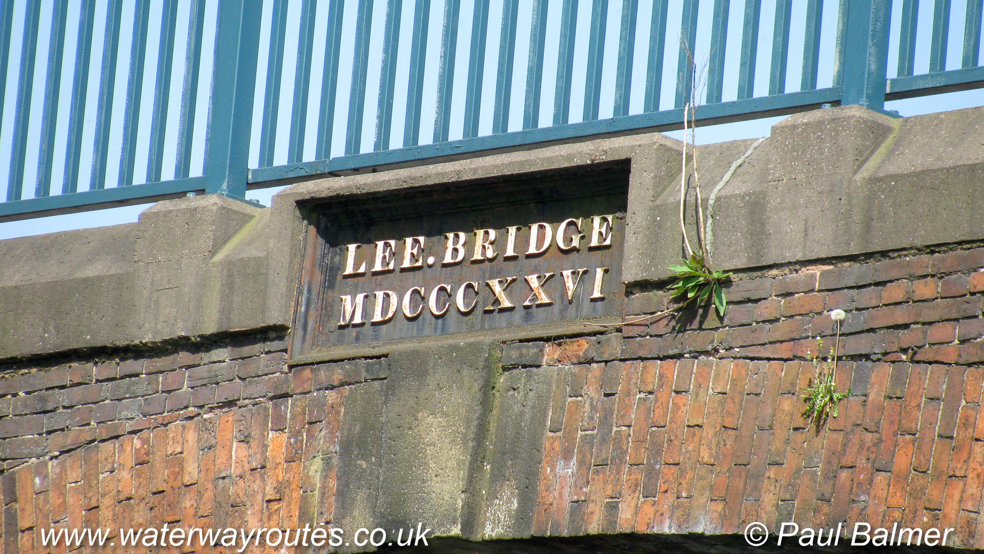
The name plate on Lee Bridge also shows the date MSDDDXXVI, which is 1826.
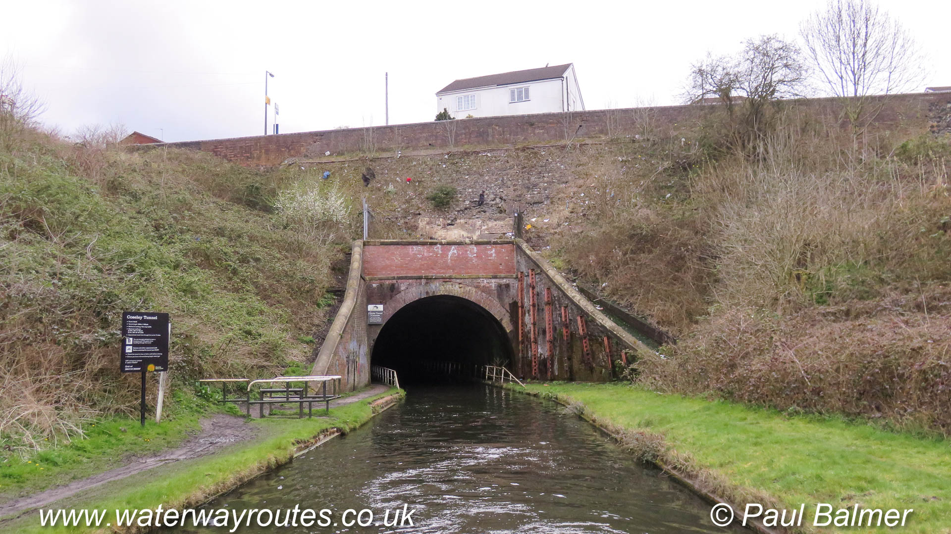
The north portal of Coseley Tunnel looks rather bare after clearance of the vegetation shortly before this photo was taken, but it will soon regrown.
Coseley Tunnel is 329m (360 yards) long, with passage taking around four minutes.
Looking along the New Main Line of the Birmingham Canal Navigations towards Birmingham. Emerging from under the bridge on the left is the Wednesbury Old Canal at
The short Soho Branch runs from its junction with the Soho Loop to the terminus at Hockley Port.
Once much longer and serving wharves and warehouses there are still two arms branching off to the right of the Soho Branch.
There are visitor moorings part way along the Soho Branch but there is no external access from these moorings. It’s impossible to leave the boat to go shopping or out to the pub, for example.
The Soho Branch is mostly used for permanent moorings these days, with a narrow channel still available for the occasional visiting boats.

Farmers Bridge Junction is immediately above Farmers Bridge Lock 1. The section of canal from Deep Cutting Junction (behind the camera) to the basin on the right was originally constructed as …
< Next Nutbrook Canal Next > < End of Navigation Erewash Canal Jn > Near Limekiln Lock 9 there are a few very short sections of the Nutbrook Canal in water if you look carefully through...
The Old Main Line of the Birmingham Canal Navigations passes Oldbury Junction on its route from Birmingham to Wolverhampton.
Ladywood Junction is on the Birmingham Canal Navigations (BCN). We are looking along the BCN Main Line towards Old Turn Junction, with Wolverhampton behind the camera.
The Oozells Street Loop, the original route for the canal, leaves under the bridge to the the right and takes a longer route to Old Turn Junction, passing through Sherborne Wharf on its way there.
Looking along the Oozells Street Loop towards Old Turn Junction which is immediately beyond the turquoise coloured bridge. Deep Cutting Junction is immediately beyond that.
Beyond that bridge the Birmingham Canal Navigations (BCN) Main Line leads to Gas Street Basin and Worcester Bar on the right, and Wolverhampton on the left.
Sheepcote Street Bridge leads to Sherborne Wharf Marina, and through that along the Oozells Street Loop to Ladywood Junction.
The red panels in the bridge are doors which can be opened by the Fire Service to put their hoses through to take water from the canal. They are present on many bridges in the Birmingham Area.
Ladywood Junction is on the Birmingham Canal Navigations (BCN). We are looking along the BCN Main Line towards Old Turn Junction, with Wolverhampton behind the camera.
The Oozells Street Loop, the original route for the canal, leaves under the bridge to the the right and takes a longer route to Old Turn Junction, passing through Sherborne Wharf on its way there.
Looking along the New Main Line of the Birmingham Canal Navigations (BCN) towards Birmingham. The almost invisible Smethwick Junction is just before the nearest bridge where the Old Main Line merges from the left.
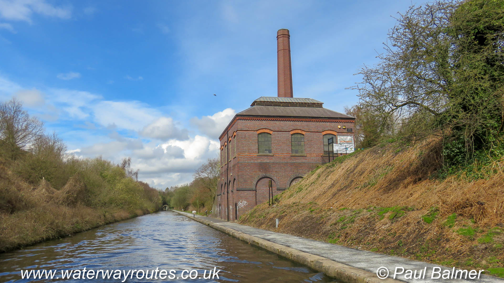
A bright April day shows Brasshouse Lane Pumping station in a great light. The Old Main Line runs to the right of the building after climbing through three locks from Smethwick Junction so it is 6.10m (20 feet) higher.
At Bromford Junction, looking along the New Main Line towards Birmingham.
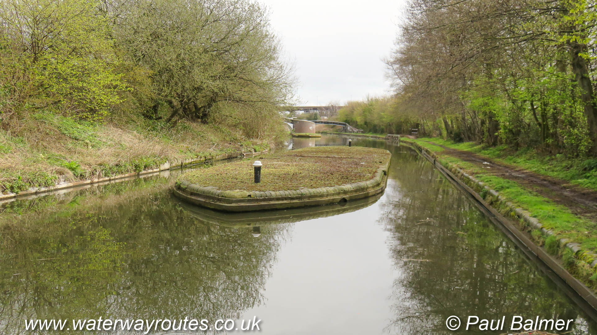
It’s rather unusual to see the toll island, and the left hand bank, clear of vegetation. They are frequently covered with overgrown vegetation. Bromford Junction is just
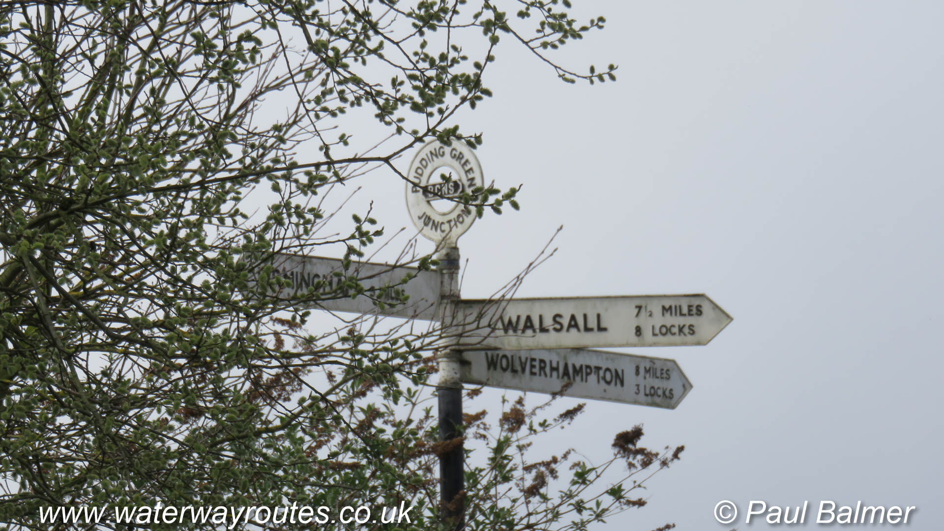
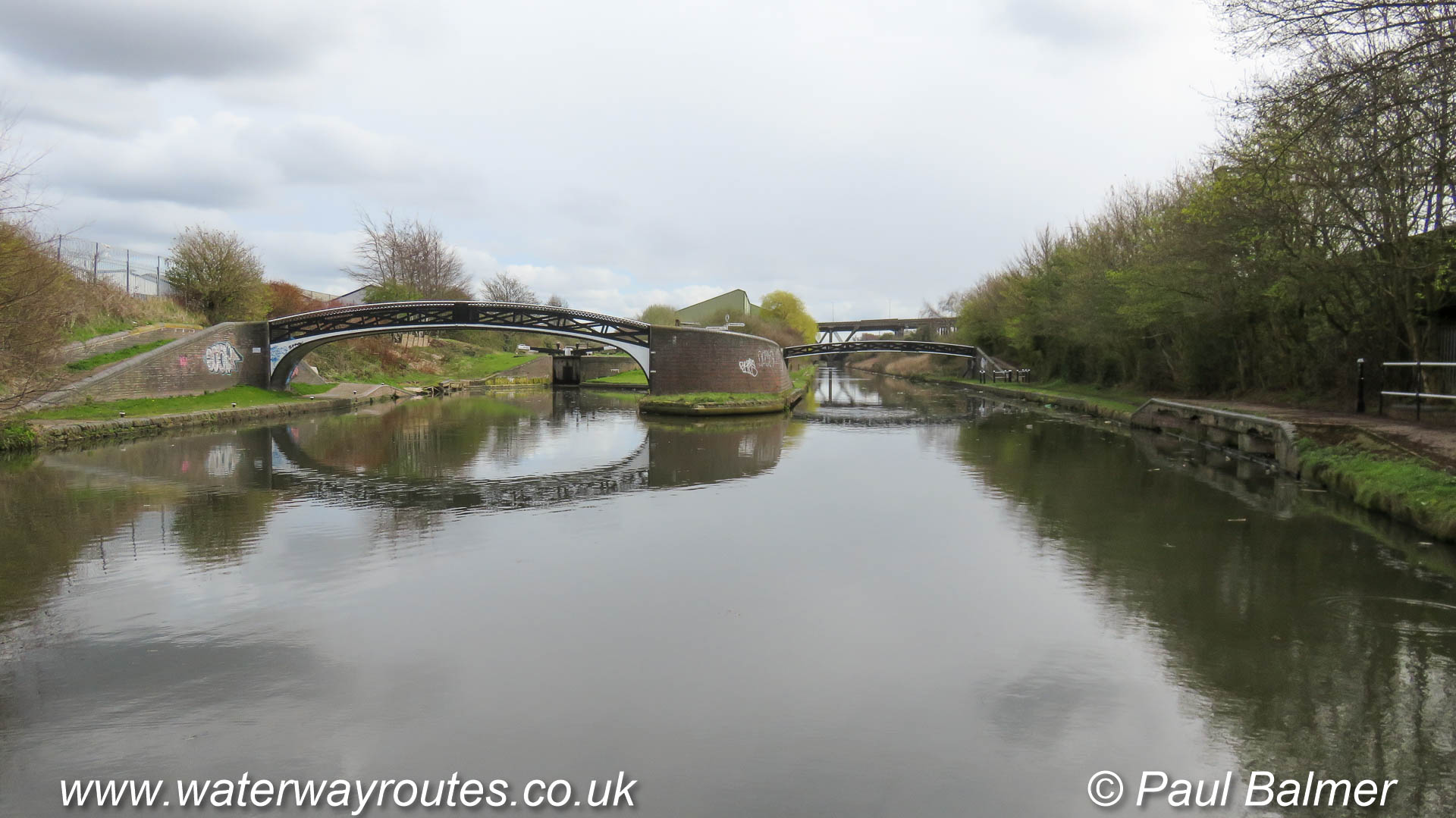
Pudding Green Junction lies on the New Main Line of the Birmingham Canal Navigations between Birmingham and Wolverhampton.
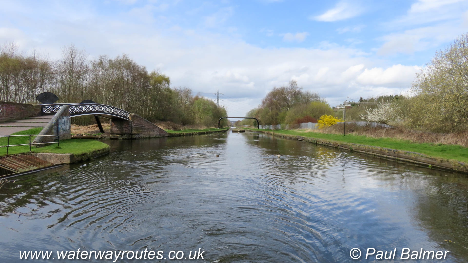
The New Main Line of the Birmingham Canal Navigations (BCN) is wide and straight. At this point it is generally at the natural ground level. Further ahead
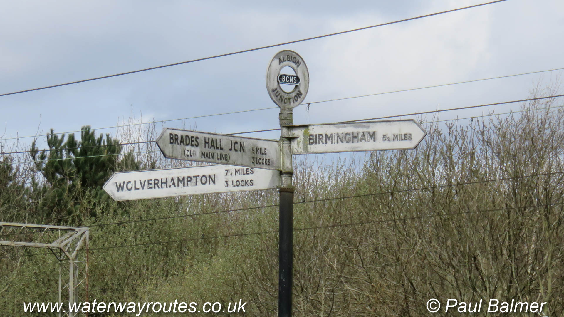
The New Main Line of the Birmingham Canal Navigations passes Albion Junction between Birmingham and Wolverhampton.
Looking towards Wolverhampton along the New Main Line of the Birmingham Canal Navigations (BCN) at Albion Junction. Turning left under the towpath bridge on the left at
The New Main Line of the Birmingham Canal Navigations passes Albion Junction between Birmingham and Wolverhampton.
Tividale Aqueduct, where the canal narrows a little, is where the Old Main Line crosses over the Netherton Tunnel Branch of the Birmingham Canal Navigations.
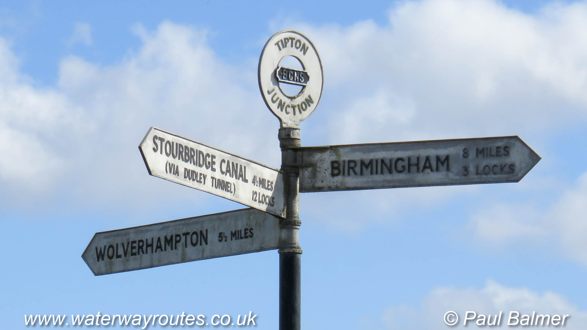
The Old Main Line of the Birmingham Canal Navigations passes Tipton Junction between Birmingham and Wolverhampton.
The Old Main Line towards Factory Junction curves to the right where a sharp turn to the left puts boaters onto the Dudley No 1 Canal.
Looking back from our boat as it is entering Factory Top Lock we see Factory Junction between the two bridges. Joining from the left between the bridges
The dark coloured edge to the towpath on the outside of the curve marks the site of the former Bloomfield Junction. A large loop once diverged to the right and wandered for more than eight kilometers (five miles) around the landscape before rejoining the current route just over two kilometers (one and a quarter miles) further on at Deepfields Junction.
Emerging from Coseley Tunnel on a bright day the straightened route disappears into the distance, cutting over six kilometers (four miles) from the original route along the Wednesbury Oak Loop.
Approaching Deepfields Junction, looking along the Birmingham Canal Navigations (BCN) Main Line towards Wolverhampton, with Birmingham behind the camera.
Leaving under the towpath bridge on the right is the Bradley Arm, which is the name usually given to the remaining open length of the Wednesbury Oak Loop.
Horseley Fields Junction is where the Wyrley & Essington Canal diverges to the right under the towpath and railway bridge.
The Birmingham Canal Navigations (BCN) Main Line continues straight ahead through Wolverhampton to Aldersley Junction, with Birmingham behind the camera.
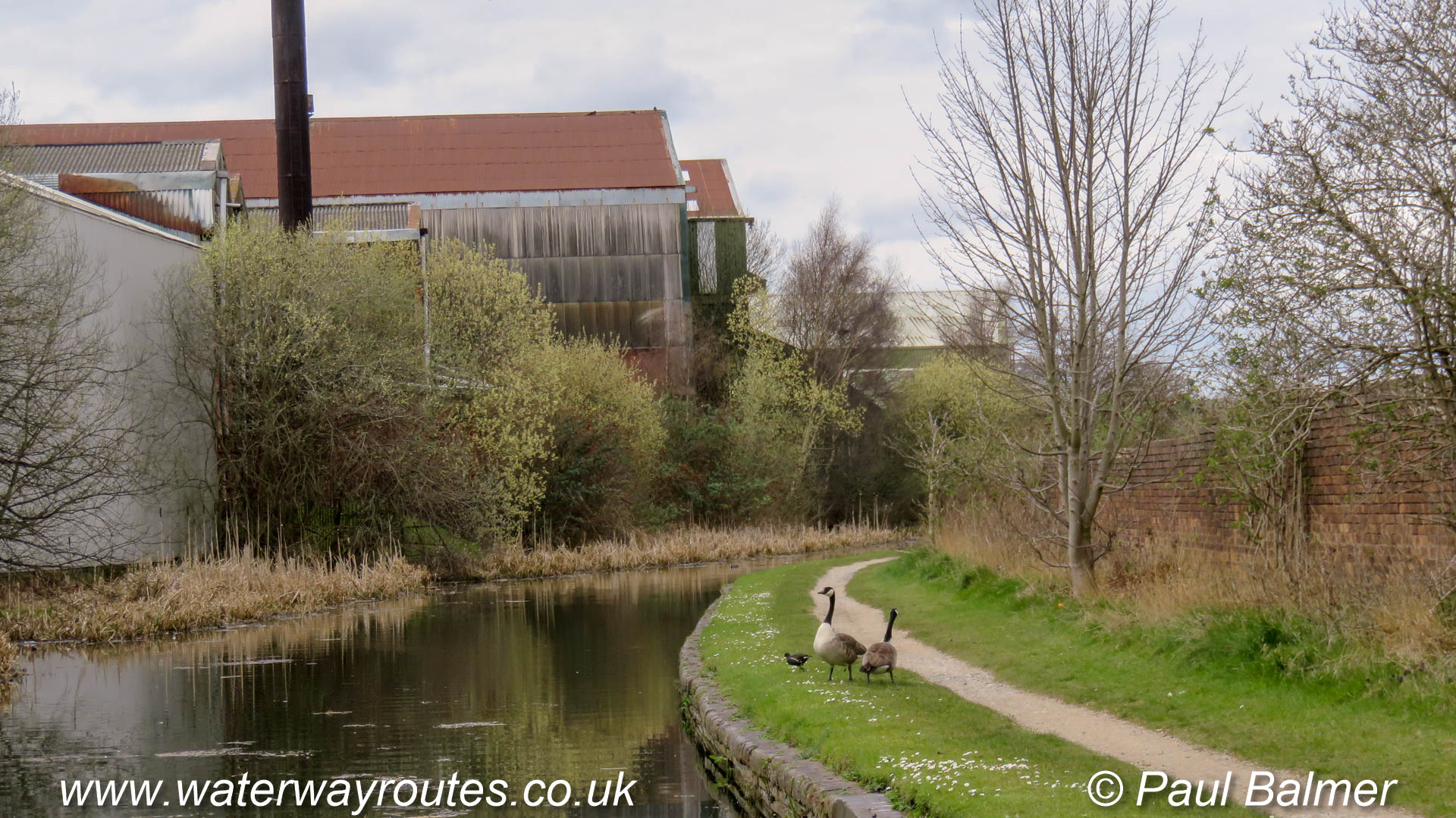
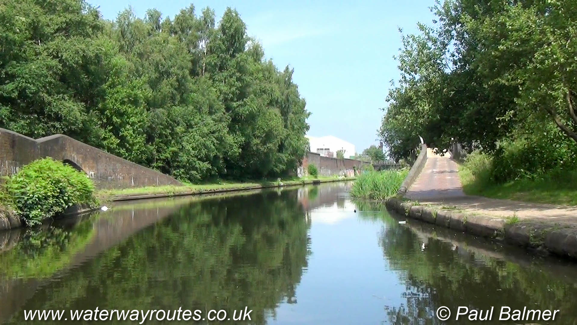
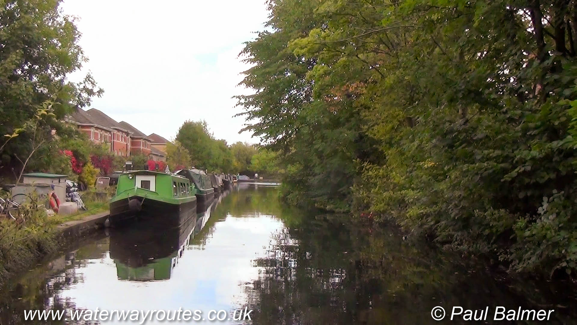
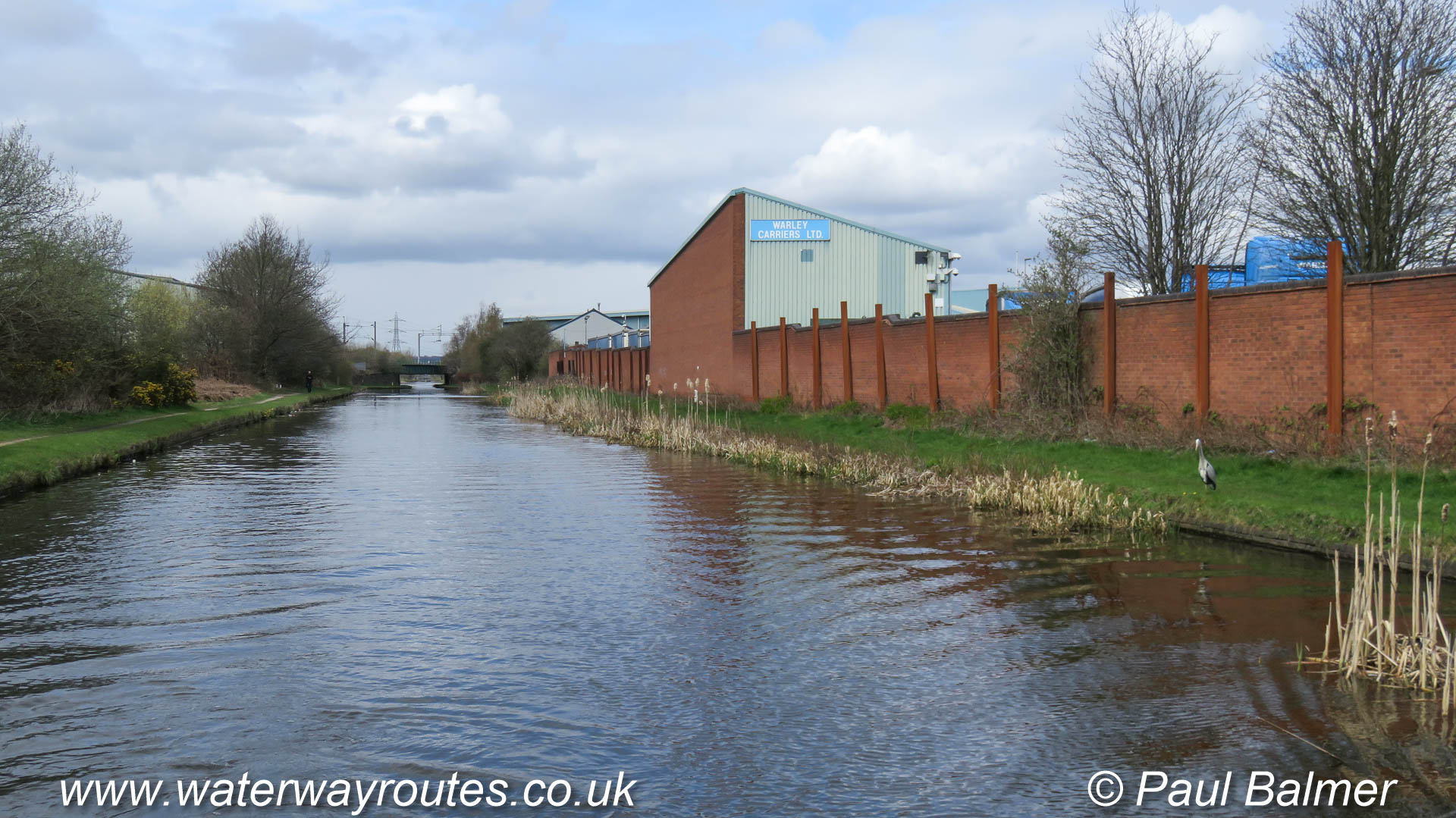
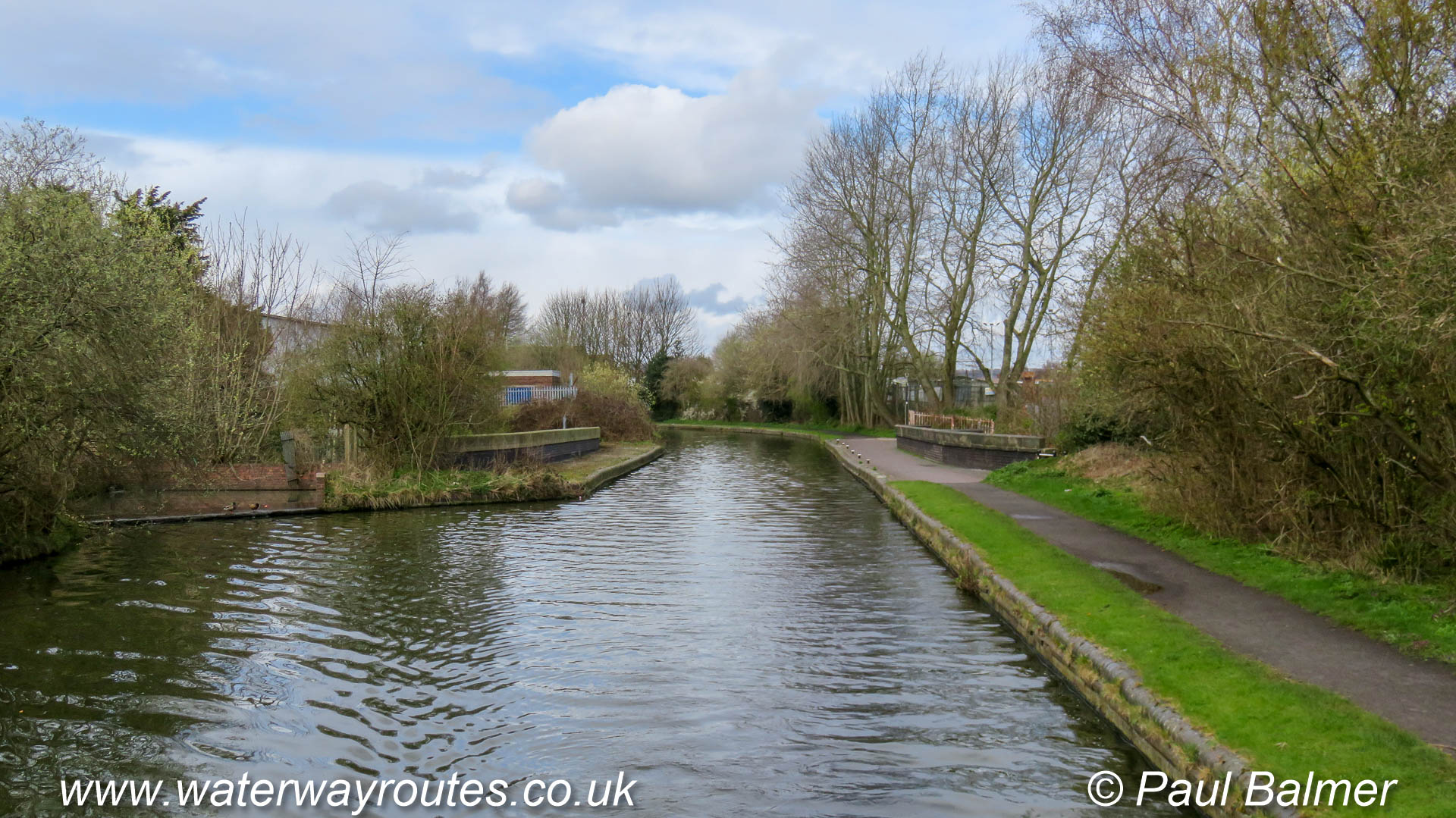
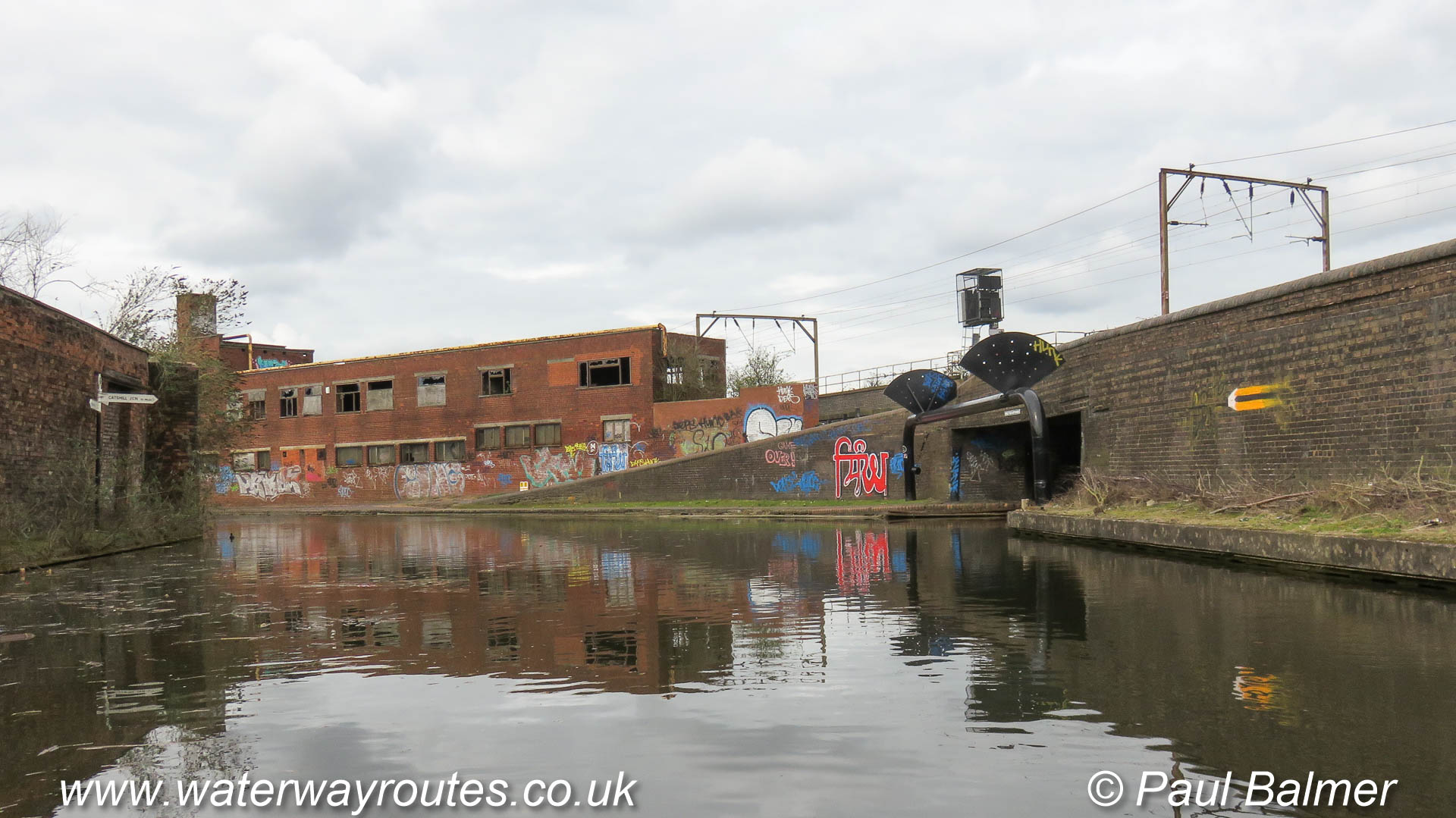
There are several sections of route then there are more industrial than residential buildings but they are frequently surrounded by established natural vegetation and rarely impose on the canal.
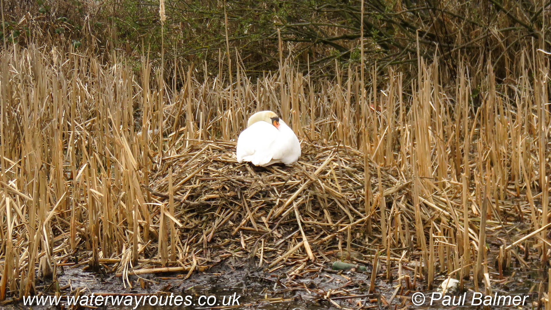
Nesting time in the spring when the two swan parents take it in turns to sit on the nest. They are on the offside of the canal and din’t seem bothered in any way by passing boats.
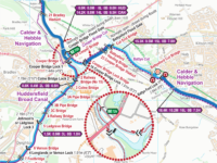
 England & Wales Waterway Map for Download
by Mike Fielding
England & Wales Waterway Map for Download
by Mike Fielding
 South Pennine Ring Map for Download
by Mark Adley
England & Wales Waterway Map for Download
by John DiDonato
England & Wales Waterway Map for Download
by John Charnock
South Pennine Ring Map for Download
by Mark Adley
England & Wales Waterway Map for Download
by John DiDonato
England & Wales Waterway Map for Download
by John Charnock
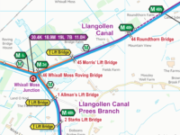 Llangollen Canal Map for Download
by Mike Moreau
Llangollen Canal Map for Download
by Mike Moreau
 RSS Blog Feed
Recent Comments